Category:Attinghausen
Jump to navigation
Jump to search
municipality in Switzerland    | |||||
| Upload media | |||||
| Instance of | |||||
|---|---|---|---|---|---|
| Location | Uri, Switzerland | ||||
| Located in or next to body of water | |||||
| Official language | |||||
| Population |
| ||||
| Area |
| ||||
| Elevation above sea level |
| ||||
| official website | |||||
 | |||||
 | |||||


Subcategories
This category has the following 8 subcategories, out of 8 total.
Media in category "Attinghausen"
The following 31 files are in this category, out of 31 total.
-
 Alpenstrassenbrücke Stierenbach Attinghausen-Stäuber UR 20180912-jag9889.jpg 4,608 × 3,456; 14.48 MB
-
 AttinghauseBrüsti.JPG 4,592 × 2,576; 4.07 MB
-
 Attinghausen UR-Wappen.JPG 159 × 176; 8 KB
-
 Attinghausen UR.png 254 × 254; 17 KB
-
 Attinghausen, Switzerland - panoramio (1).jpg 3,000 × 4,000; 3.01 MB
-
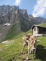 Attinghausen, Switzerland - panoramio - Rolenc.jpg 3,000 × 4,000; 2.63 MB
-
 Attinghausen, Switzerland - panoramio.jpg 4,000 × 3,000; 2.86 MB
-
 Attinghausen-coat of arms.svg 600 × 674; 8 KB
-
 Attinghausen-Reuss.jpg 1,200 × 800; 957 KB
-
 Attinghausen-UR.jpg 1,200 × 800; 1.06 MB
-
 AttinghausenBrüstiKabine.JPG 2,459 × 4,142; 2.52 MB
-
 Attinghauser Brücke Reuss Altdorf UR - Attinghausen UR 20160728-jag9889.jpg 4,320 × 3,456; 8.75 MB
-
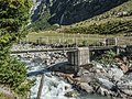 Auengebiet Alpenrösli-Herrenrüti, Attinghausen-Alpenrösli UR 20180912-jag9889.jpg 4,608 × 3,456; 9.8 MB
-
 Blackenalpkapelle.JPG 3,714 × 2,298; 1.65 MB
-
 BlackenalpkapelleAltar.JPG 4,592 × 2,576; 3.23 MB
-
 CH-NB-Album -Mit schweizerischen und ausländischen Ansichten--nbdig-18629-page181.tif 3,214 × 2,403; 5.4 MB
-
 Chappelibrüggli Stierenbach Attinghausen-Blackenalp UR 20180912-jag9889.jpg 4,608 × 3,456; 10.51 MB
-
 CHE Attinghausen Flag.svg 254 × 254; 7 KB
-
 CHE Attinghausen Logo.svg 512 × 121; 5 KB
-
 Engelberg - panoramio (1).jpg 4,000 × 3,000; 3.92 MB
-

-

-
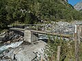 Fussgängersteg Stierenbach Attinghausen-Alpenrösli UR 20180912-jag9889.jpg 4,608 × 3,456; 11.61 MB
-
 Glatt Firn.jpg 3,764 × 2,823; 1.62 MB
-
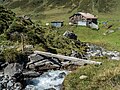 Holzsteg Stierenbach Attinghausen-Blackenalp UR 20180912-jag9889.jpg 4,608 × 3,456; 13.39 MB
-
 Karte Gemeinde Attinghausen 2007.png 1,476 × 1,533; 661 KB
-
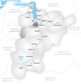 Karte Gemeinde Attinghausen.png 826 × 860; 224 KB
-
 Luftbild Reussebene Uri.jpg 1,296 × 972; 177 KB
-
 Palanggenbach-Mündung.jpg 3,648 × 2,736; 2.42 MB
-
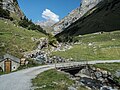 Spannorthütte Alpenstrassenbrücke Stierenbach Attinghausen-Stäfeli UR 20180912-jag9889.jpg 4,608 × 3,456; 11.44 MB
-
 Surenen.jpg 1,024 × 576; 157 KB


.jpg)


.jpg)


