Category:Auchinloch
Jump to navigation
Jump to search
English: Auchinloch ( Gaelic: Achadh an Locha) is a village in North Lanarkshire, near Lenzie in Scotland. The village's name - "Field of the Loch" - derives from its proximity to a small loch locally called the "Gadloch". Industrialization came in the 1880s, with the opening of the Lumloch Colliery, and then in the 1920s Wester Auchengeich Colliery. The latter closed in 1968.
village in North Lanarkshire, Scotland, UK .jpg) | |||||
| Upload media | |||||
| Instance of | |||||
|---|---|---|---|---|---|
| Location |
| ||||
| Population |
| ||||
 | |||||
Subcategories
This category has the following 2 subcategories, out of 2 total.
G
L
- Lenzie Golf Course (14 F)
Media in category "Auchinloch"
The following 35 files are in this category, out of 35 total.
-
 Approaching bend on Langmuirhead Road - geograph.org.uk - 1491899.jpg 640 × 480; 169 KB
-
 Auchinloch and Gadloch from the air (geograph 5681704).jpg 640 × 480; 168 KB
-
 Auchinloch from the air (geograph 5681698).jpg 640 × 480; 169 KB
-
 Auchinloch newsagents - geograph.org.uk - 1491888.jpg 640 × 480; 147 KB
-
 Auchinloch Primary School (geograph 2673913).jpg 640 × 480; 53 KB
-
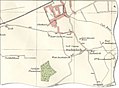 AuchinlochMap1923.jpg 918 × 677; 79 KB
-

-
 Bus stop in Auchinloch village - geograph.org.uk - 1491881.jpg 640 × 480; 112 KB
-
 Construction by the M80 - geograph.org.uk - 1491864.jpg 640 × 480; 141 KB
-

-
 Farm buildings at Auchingree - geograph.org.uk - 1491855.jpg 640 × 480; 116 KB
-
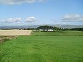
 Farmland north of Langmuirhead Road - geograph.org.uk - 1491897.jpg 640 × 480; 123 KB
-
 Fields by the B757 - geograph.org.uk - 1491865.jpg 640 × 480; 125 KB
-
 Flooding by the B757 - geograph.org.uk - 1491874.jpg 640 × 480; 117 KB
-
 Golden Pheasant - geograph.org.uk - 57764.jpg 640 × 480; 100 KB
-
 Houses in Auchinloch - geograph.org.uk - 1491878.jpg 640 × 480; 121 KB
-
 Kirkintilloch Cats Adoption Centre - geograph.org.uk - 1491896.jpg 640 × 480; 139 KB
-
 Langmuirhead Farm - geograph.org.uk - 1491858.jpg 640 × 480; 104 KB
-
 Langmuirhead Road - geograph.org.uk - 1491879.jpg 640 × 480; 115 KB
-
 Leaving Auchinloch on Langmuirhead Road - geograph.org.uk - 1491890.jpg 640 × 480; 142 KB
-
 Leaving Glasgow on Robroyston Road - geograph.org.uk - 1336433.jpg 640 × 480; 117 KB
-
 NS6469 harvest.jpg 640 × 480; 140 KB
-
 Parkhillhead Farm - geograph.org.uk - 57791.jpg 640 × 480; 113 KB
-
 Road to Eastbank Farm - geograph.org.uk - 1491869.jpg 640 × 480; 158 KB
-
 Robroyston Road - geograph.org.uk - 5888.jpg 640 × 480; 78 KB
-
 Rushyhill from Westerhill Road - geograph.org.uk - 1336456.jpg 640 × 480; 102 KB
-
 Small bridge over stream - geograph.org.uk - 1491904.jpg 640 × 480; 144 KB
-
 Snow, november 2010 001 (6538152755).jpg 500 × 375; 88 KB
-
 Snow, november 2010 018 (6538157003).jpg 500 × 375; 155 KB
-
 Snow, november 2010 019 (6538160439).jpg 375 × 500; 171 KB
-
 Snow, november 2010 020 (6538153467).jpg 500 × 375; 163 KB
-
 Snow, november 2010 029 (6538153907).jpg 360 × 480; 64 KB
-
 Snow, november 2010 030 (6538159383).jpg 500 × 375; 88 KB
-
 Snow, november 2010 031 (6538158211).jpg 500 × 375; 107 KB
-
 Uphill to houses by Langmuirhead Road - geograph.org.uk - 1491885.jpg 640 × 480; 126 KB

.jpg)

.jpg)


.jpg)
.jpg)
.jpg)
.jpg)
.jpg)
.jpg)
.jpg)
