Category:Auchterarder (civil parish)
Jump to navigation
Jump to search
Scottish parish in Perth and Kinross, Scotland, UK | |||||
| Upload media | |||||
| Instance of | |||||
|---|---|---|---|---|---|
| Part of |
| ||||
| Named after | |||||
| Location |
| ||||
| Population |
| ||||
| Area |
| ||||
 | |||||
Media in category "Auchterarder (civil parish)"
The following 200 files are in this category, out of 301 total.
(previous page) (next page)-

-
 A view of Craig Rossie - geograph.org.uk - 3434861.jpg 640 × 480; 261 KB
-
 A824 approaching the B8062 - geograph.org.uk - 5528188.jpg 640 × 481; 78 KB
-
 A824 in Auchterarder - geograph.org.uk - 5528171.jpg 640 × 505; 55 KB
-
 A9 near Aberuthven - geograph.org.uk - 5741636.jpg 640 × 480; 348 KB
-
 A9 south of Aberuthven - geograph.org.uk - 5741659.jpg 640 × 427; 339 KB
-
 A9 south parking area near Aberuthven - geograph.org.uk - 3473109.jpg 1,936 × 2,592; 1.74 MB
-
 A9 Southbound near Aberuthven - geograph.org.uk - 6134170.jpg 640 × 427; 341 KB
-
 A9 Trunk Road - geograph.org.uk - 1843953.jpg 2,272 × 1,704; 863 KB
-
 AA Roadside Phone - geograph.org.uk - 1843912.jpg 2,272 × 1,704; 890 KB
-
 Abandoned vehicle on Green Law - geograph.org.uk - 3231570.jpg 640 × 428; 107 KB
-
 Abbey Road, Milton - geograph.org.uk - 2852226.jpg 2,547 × 1,902; 1.66 MB
-
 Aberuthven cemetery, Perthshire - geograph.org.uk - 2667334.jpg 1,024 × 462; 88 KB
-
 Across Cloan Burn - geograph.org.uk - 3459993.jpg 2,592 × 1,944; 2.35 MB
-
 Agricultural land near Nether Fordun - geograph.org.uk - 3074929.jpg 640 × 480; 371 KB
-
 Anemometer mast, Steele's Knowe - geograph.org.uk - 2223436.jpg 640 × 480; 233 KB
-
 Approaching Craig Rossie - geograph.org.uk - 2626887.jpg 640 × 480; 71 KB
-
 Approaching the Auchterarder exit - geograph.org.uk - 3031502.jpg 800 × 637; 58 KB
-
 Aptly Named - geograph.org.uk - 2416811.jpg 1,600 × 1,384; 780 KB
-
 Arns near Aberuthven - geograph.org.uk - 2076007.jpg 640 × 480; 68 KB
-
 Attractive Cottage - geograph.org.uk - 2416782.jpg 1,600 × 1,200; 392 KB
-
 Auchterarder Cemetery - geograph.org.uk - 5663440.jpg 1,024 × 682; 183 KB
-
 Auchterarder Fire Station - geograph.org.uk - 2422558.jpg 1,600 × 1,067; 268 KB
-
 Auchterarder Golf Club - geograph.org.uk - 3428827.jpg 640 × 480; 348 KB
-
 Auchterarder High Street - geograph.org.uk - 2400222.jpg 1,600 × 1,067; 392 KB
-
 Auchterarder High Street - geograph.org.uk - 2400226.jpg 1,600 × 1,063; 487 KB
-
 Auchterarder High Street - geograph.org.uk - 5528168.jpg 640 × 464; 70 KB
-
 Auchterarder Motors - geograph.org.uk - 5290826.jpg 1,600 × 943; 307 KB
-
 Auchterarder Parish Church - geograph.org.uk - 3435369.jpg 640 × 480; 252 KB
-
 Auchterarder Parish Church - geograph.org.uk - 4234003.jpg 1,600 × 1,062; 501 KB
-
 Auchterarder Path - geograph.org.uk - 2327580.jpg 1,600 × 1,200; 560 KB
-
 Auchterarder Police Station - geograph.org.uk - 2422498.jpg 1,600 × 1,067; 400 KB
-
 Auchterarder Police Station - geograph.org.uk - 4234001.jpg 1,600 × 1,062; 541 KB
-
 Auchterarder Post Office - geograph.org.uk - 3428805.jpg 640 × 480; 267 KB
-
 Auchterarder to Butend path - geograph.org.uk - 5757323.jpg 1,024 × 683; 533 KB
-
 Autumn tree colours at Heuch of Coul - geograph.org.uk - 6301822.jpg 5,089 × 3,393; 4.08 MB
-
 Autumnal view of Craig Rossie - geograph.org.uk - 6301426.jpg 4,967 × 3,725; 4.16 MB
-
 Baker's Wynd - geograph.org.uk - 1189872.jpg 480 × 640; 43 KB
-
 Belhie Standing Stone from East - geograph.org.uk - 909989.jpg 640 × 480; 105 KB
-
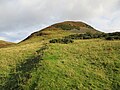
 Ben Effrey - geograph.org.uk - 2625917.jpg 640 × 480; 92 KB
-
 Ben Effrey - geograph.org.uk - 6301395.jpg 5,035 × 3,777; 3.89 MB
-
 Ben Effrey - geograph.org.uk - 6301778.jpg 5,152 × 3,864; 7.62 MB
-
 Ben Effrey from Beld Hill - geograph.org.uk - 3231605.jpg 640 × 425; 108 KB
-
 Ben Effrey hill fort - geograph.org.uk - 6301405.jpg 5,152 × 3,864; 5.6 MB
-
 Ben-Affray House, Auchterarder - geograph.org.uk - 4234019.jpg 1,600 × 1,062; 608 KB
-
 Black Hill - geograph.org.uk - 2236073.jpg 640 × 480; 239 KB
-
 Black Maller, with Corn Hill forest beyond - geograph.org.uk - 3459982.jpg 2,592 × 1,944; 1.42 MB
-
 Bog, Coul Burn - geograph.org.uk - 2236081.jpg 640 × 480; 241 KB
-
 Bridge over A9 near Auchterarder - geograph.org.uk - 5959120.jpg 1,024 × 576; 116 KB
-
 Bridge over the A9 near to Auchterarder - geograph.org.uk - 5741667.jpg 640 × 427; 360 KB
-
 Carlownie Burn - geograph.org.uk - 2420719.jpg 1,066 × 1,600; 1.03 MB
-
 Carlownie Burn - geograph.org.uk - 951153.jpg 640 × 359; 67 KB
-
 Castle Craig and Pairney Quarry - geograph.org.uk - 6301867.jpg 5,098 × 3,130; 3.73 MB
-
 Castleton Road - geograph.org.uk - 5740825.jpg 1,024 × 683; 303 KB
-
 Central Perk - geograph.org.uk - 2234563.jpg 640 × 480; 247 KB
-
 Cleared forest on Maller Hill - geograph.org.uk - 3459975.jpg 2,592 × 1,944; 2.08 MB
-
 Clearing, Corn Hill - geograph.org.uk - 955941.jpg 640 × 359; 89 KB
-
 Cloan house - geograph.org.uk - 1190182.jpg 640 × 442; 69 KB
-
 Corb Glen - geograph.org.uk - 2236084.jpg 640 × 480; 217 KB
-
 Corb Law - geograph.org.uk - 2234568.jpg 640 × 480; 220 KB
-
 Cornhill to Corn Hill track - geograph.org.uk - 951211.jpg 640 × 480; 98 KB
-
 Cottages at Townhead, Auchterarder - geograph.org.uk - 4234028.jpg 1,600 × 1,062; 644 KB
-
 Cottages near Aberuthven - geograph.org.uk - 4529346.jpg 800 × 480; 41 KB
-
 Coul Glen - geograph.org.uk - 2234579.jpg 640 × 480; 259 KB
-
 Coulshill to Corb Bridge road - geograph.org.uk - 2234587.jpg 640 × 480; 243 KB
-
 Craig Meed - geograph.org.uk - 2234591.jpg 640 × 480; 242 KB
-
 Craig Meed - geograph.org.uk - 5865171.jpg 1,600 × 1,066; 445 KB
-
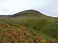
 Craig Rossie - geograph.org.uk - 1717075.jpg 640 × 480; 87 KB
-
 Craig Rossie - geograph.org.uk - 2625739.jpg 640 × 480; 98 KB
-
 Craig Rossie from Aberuthven - geograph.org.uk - 2667336.jpg 1,600 × 533; 153 KB
-
 Crossing the water - geograph.org.uk - 1189855.jpg 640 × 480; 79 KB
-
 Cultivating, East Fordun - geograph.org.uk - 3434840.jpg 640 × 480; 257 KB
-
 Descending off Ben Effrey - geograph.org.uk - 6301418.jpg 5,152 × 3,864; 6.39 MB
-
 Drummond Ave off Orchil Road, Auchterarder - geograph.org.uk - 4234037.jpg 1,600 × 1,052; 556 KB
-
 Drummond's Fold - geograph.org.uk - 2416823.jpg 1,600 × 1,200; 591 KB
-
 Drummonds Fold - geograph.org.uk - 2422445.jpg 1,600 × 1,067; 709 KB
-
 Duchally Road - geograph.org.uk - 2420738.jpg 1,600 × 1,067; 850 KB
-
 Duchally Road - geograph.org.uk - 2420856.jpg 1,600 × 1,067; 780 KB
-
 Dunlop Park, Auchterarder - geograph.org.uk - 5290139.jpg 1,600 × 1,067; 462 KB
-
 Earthworks on Ben Effrey - geograph.org.uk - 6301433.jpg 5,152 × 3,864; 6.09 MB
-
 East of Steele's Knowe - geograph.org.uk - 4329060.jpg 640 × 439; 371 KB
-
 Eastbow Hill from Carlownie Hill - geograph.org.uk - 955981.jpg 640 × 359; 65 KB
-

-
 Edge of Auchterarder - geograph.org.uk - 3508852.jpg 640 × 480; 289 KB
-
 Edge of Auchterarder - geograph.org.uk - 5741980.jpg 1,024 × 683; 349 KB
-
 Edward VII postbox, High Street, Auchterarder - geograph.org.uk - 5290860.jpg 1,067 × 1,600; 228 KB
-
 Eind farmhouse - geograph.org.uk - 1190192.jpg 640 × 480; 82 KB
-
 Entering Auchterarder on the A824 - geograph.org.uk - 4233997.jpg 1,600 × 1,062; 426 KB
-
 Entering Auchterarder on the A824 - geograph.org.uk - 5528153.jpg 640 × 461; 58 KB
-
 Farm road to Easter Coul - geograph.org.uk - 5774542.jpg 1,600 × 1,067; 645 KB
-
 Farmland at Damside - geograph.org.uk - 5336837.jpg 800 × 483; 225 KB
-
 Farmland at Strathy near Aberuthven - geograph.org.uk - 5008864.jpg 640 × 480; 72 KB
-
 Farmland at Thorn - geograph.org.uk - 5193437.jpg 4,896 × 3,672; 6.32 MB
-
 Farmland near Auchterarder - geograph.org.uk - 6229724.jpg 1,024 × 768; 167 KB
-
 Farmland near Coul - geograph.org.uk - 4696847.jpg 2,592 × 1,944; 1.33 MB
-
 Farmland near Nether Fordun - geograph.org.uk - 3074935.jpg 640 × 480; 356 KB
-
 Fence on Corb Law - geograph.org.uk - 2234542.jpg 640 × 480; 237 KB
-
 Feus from the junction with Abbey Road - geograph.org.uk - 2422490.jpg 1,600 × 1,067; 404 KB
-
 Field Boundary - geograph.org.uk - 5872487.jpg 1,600 × 1,070; 304 KB
-
 Field off Castleton Road - geograph.org.uk - 4595998.jpg 800 × 533; 313 KB
-
 Field, Auchterarder - geograph.org.uk - 4596001.jpg 800 × 533; 344 KB
-
 Field, Drummond's Fold - geograph.org.uk - 5757367.jpg 1,024 × 683; 444 KB
-
 Field, Woodside - geograph.org.uk - 5757361.jpg 1,024 × 683; 424 KB
-
 Fields and woods above Kincardine Glen - geograph.org.uk - 3458340.jpg 2,592 × 1,944; 1.85 MB
-
 Fields at Broadfold, east of Auchterarder - geograph.org.uk - 3098352.jpg 2,592 × 1,944; 1.47 MB
-
 Fields near Woodside - geograph.org.uk - 3458337.jpg 2,592 × 1,944; 1.69 MB
-
 Fields south of Auchterarder - geograph.org.uk - 3098346.jpg 2,592 × 1,944; 1.73 MB
-
 Follow The Police On Twitter - geograph.org.uk - 2422525.jpg 1,067 × 1,600; 290 KB
-
 Forest edge, Corn Hill - geograph.org.uk - 955949.jpg 640 × 480; 90 KB
-
 Forestry operations near Kincardine Castle - geograph.org.uk - 3098349.jpg 2,592 × 1,944; 1.33 MB
-
 Former Church in Auchterarder - geograph.org.uk - 4234008.jpg 1,600 × 1,062; 672 KB
-
 Foswell Loch - geograph.org.uk - 3459962.jpg 2,592 × 1,944; 1.87 MB
-
 Fruit and vegetable shop, Auchterarder - geograph.org.uk - 5290145.jpg 1,600 × 1,025; 256 KB
-
 Game crops above the Kincardine Glen - geograph.org.uk - 951208.jpg 640 × 480; 106 KB
-
 Gateway and War Memorial - geograph.org.uk - 2400237.jpg 1,067 × 1,600; 671 KB
-
 Glen of Coulshill - geograph.org.uk - 2234553.jpg 640 × 480; 229 KB
-
 Glencloch Burn - geograph.org.uk - 801834.jpg 640 × 480; 77 KB
-
 Glendevon Hotel - geograph.org.uk - 2422667.jpg 1,600 × 1,067; 355 KB
-
 Glenruthven Mill - boiler - geograph.org.uk - 3875212.jpg 430 × 640; 71 KB
-
 Glenruthven Mill - steam engine - geograph.org.uk - 3875015.jpg 640 × 414; 65 KB
-
 Glenruthven Mill - steam engine - geograph.org.uk - 3875030.jpg 640 × 431; 69 KB
-
 Gorse bloom on Thorney Hill - geograph.org.uk - 5774544.jpg 1,600 × 1,067; 314 KB
-
 Grand Entrance - geograph.org.uk - 2416744.jpg 1,600 × 1,200; 314 KB
-
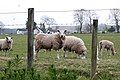 Grazing Sheep - geograph.org.uk - 2420730.jpg 1,600 × 1,070; 585 KB
-
 Green Hill from Craig Rossie - geograph.org.uk - 3231617.jpg 640 × 425; 76 KB
-
 Green Knowes power station - geograph.org.uk - 2228899.jpg 640 × 480; 67 KB
-
 Green Law - geograph.org.uk - 2327620.jpg 1,600 × 1,200; 379 KB
-
 Green Law - geograph.org.uk - 4996156.jpg 1,024 × 683; 304 KB
-
 High Street (A824) in Auchterarder - geograph.org.uk - 5564814.jpg 4,000 × 3,000; 2.65 MB
-
 High Street Auchterarder - geograph.org.uk - 2393574.jpg 427 × 640; 57 KB
-
 High Street, Auchterarder - geograph.org.uk - 1557383.jpg 640 × 481; 108 KB
-
 High Street, Auchterarder - geograph.org.uk - 3428275.jpg 640 × 480; 259 KB
-
 High Street, Auchterarder - geograph.org.uk - 4575536.jpg 800 × 533; 353 KB
-
 High Street, Auchterarder - geograph.org.uk - 4575538.jpg 800 × 533; 330 KB
-
 High Street, Auchterarder - geograph.org.uk - 5433197.jpg 480 × 640; 65 KB
-
 High Street, Auchterarder - geograph.org.uk - 5433199.jpg 480 × 640; 43 KB
-
 Hill Fort on Ben Effrey outlier - geograph.org.uk - 1717066.jpg 640 × 480; 75 KB
-
 Hoardings And Auchterarder Motors - geograph.org.uk - 2422565.jpg 1,600 × 1,034; 489 KB
-
 Home Farm, Auchterarder House - geograph.org.uk - 5929036.jpg 1,600 × 1,067; 555 KB
-
 Houses on Feus (road), Auchterarder - geograph.org.uk - 4233999.jpg 1,600 × 1,062; 521 KB
-
 Housing development, Main Road - geograph.org.uk - 5856563.jpg 1,600 × 1,067; 256 KB
-
 Housing on Aberuthven's main street - geograph.org.uk - 3573060.jpg 640 × 406; 57 KB
-
 John's Hill - Sim's Hill col - geograph.org.uk - 4996152.jpg 1,024 × 1,024; 546 KB
-
 Kirklands of Damside - geograph.org.uk - 5528186.jpg 640 × 448; 40 KB
-
 Landrovers, Main Road - geograph.org.uk - 5856558.jpg 1,600 × 1,067; 362 KB
-
 Layby on the A9 south of Aberuthven - geograph.org.uk - 5741664.jpg 640 × 427; 311 KB
-

-
 Leaving Aberuthven heading for Perth - geograph.org.uk - 5528183.jpg 640 × 481; 77 KB
-
 Leaving Auchterarder on the A824 - geograph.org.uk - 5528176.jpg 640 × 481; 49 KB
-
 Little Law - geograph.org.uk - 2234558.jpg 640 × 480; 240 KB
-
 Little Law - geograph.org.uk - 2234571.jpg 640 × 480; 243 KB
-
 Little Law - geograph.org.uk - 4996104.jpg 1,024 × 576; 198 KB
-
 Looking across to Auchterarder from the Eind road - geograph.org.uk - 3459998.jpg 2,592 × 1,944; 1.5 MB
-
 Looking along the A824 - geograph.org.uk - 3029339.jpg 640 × 556; 63 KB
-
 Looking down on Lochee - geograph.org.uk - 1190188.jpg 640 × 480; 70 KB
-
 Maidenplain, near Aberuthven - geograph.org.uk - 4524507.jpg 1,024 × 681; 130 KB
-
 Maller Hill - geograph.org.uk - 951149.jpg 640 × 348; 70 KB
-
 Minor road - geograph.org.uk - 3434841.jpg 640 × 480; 259 KB
-
 Minor road near Auchterarder - geograph.org.uk - 3289397.jpg 1,200 × 797; 638 KB
-

-
 Near Eind farm - geograph.org.uk - 1190196.jpg 640 × 480; 116 KB
-

-
 New Plantation - geograph.org.uk - 2420765.jpg 1,600 × 1,067; 737 KB
-
 Newly cultivated field - geograph.org.uk - 3434850.jpg 640 × 480; 259 KB
-
 North from Beld Hill - geograph.org.uk - 3231595.jpg 640 × 425; 113 KB
-
 North from Carlownie Hill - geograph.org.uk - 955974.jpg 640 × 359; 72 KB
-
 North of Steele's Knowe - geograph.org.uk - 2223451.jpg 640 × 480; 198 KB
-
 North Strathy - geograph.org.uk - 5741626.jpg 640 × 427; 354 KB
-
 Northbound A9 near to Aberuthven - geograph.org.uk - 5741631.jpg 640 × 480; 307 KB
-
 Oilseed rape, Auchterarder - geograph.org.uk - 3434846.jpg 640 × 480; 271 KB
-
 Old Church Tower and graveyard, Auchterarder - geograph.org.uk - 5435033.jpg 3,264 × 1,836; 2.06 MB
-

-
 Old parish church tower and graveyard, Auchterarder - geograph.org.uk - 5291024.jpg 1,067 × 1,600; 197 KB
-
 Old pathway, Carlownie Hill - geograph.org.uk - 955987.jpg 640 × 359; 79 KB
-
 On Steele's Knowe - geograph.org.uk - 801869.jpg 640 × 480; 62 KB
-
 On the edge of Auchterarder - geograph.org.uk - 3435361.jpg 640 × 480; 253 KB
-
 Orchil Road, Auchterarder - geograph.org.uk - 3428844.jpg 640 × 480; 283 KB
-
 Ordnance Survey Cut Mark - geograph.org.uk - 5575919.jpg 3,849 × 2,887; 3.17 MB
-
 Ordnance Survey Flush Bracket (G653) - geograph.org.uk - 4914867.jpg 480 × 640; 106 KB
-
 Over the A9 - geograph.org.uk - 2416763.jpg 1,600 × 1,200; 502 KB
-
 Pairney Farm - geograph.org.uk - 3098356.jpg 2,592 × 1,944; 1.12 MB
-
 Pairney Farm - geograph.org.uk - 4233877.jpg 1,600 × 1,062; 548 KB
-
 Pairney Farmsteading - geograph.org.uk - 2416705.jpg 1,600 × 738; 203 KB
-
 Pairney Quarry - geograph.org.uk - 2625751.jpg 640 × 465; 109 KB
-
 Park, Auchterarder - geograph.org.uk - 3428810.jpg 640 × 480; 301 KB
-
 Passing Woodend - geograph.org.uk - 5872504.jpg 1,600 × 1,066; 589 KB
-
 Path above Borland Glen - geograph.org.uk - 3215911.jpg 640 × 427; 310 KB
-
 Path sign, Auchterarder - geograph.org.uk - 5757313.jpg 1,024 × 683; 529 KB
-
 Path under the A9 - geograph.org.uk - 5757314.jpg 1,024 × 683; 541 KB
-
 Perth and Kinross , Grassy Field - geograph.org.uk - 5014288.jpg 6,000 × 4,000; 5.29 MB
-
 Perth and Kinross , The A9 - geograph.org.uk - 5014286.jpg 6,000 × 4,000; 4.61 MB
-
 Perth and Kinross , The A9 - geograph.org.uk - 5014290.jpg 6,000 × 4,000; 4.95 MB
-
 Perth and Kinross , The A9 - geograph.org.uk - 5014291.jpg 6,000 × 4,000; 5.16 MB
-
 Perth and Kinross , The A9 - geograph.org.uk - 5014293.jpg 6,000 × 4,000; 5.45 MB
-
 Perth and Kinross , The A9 - geograph.org.uk - 5014295.jpg 6,000 × 4,000; 5.13 MB
-
 Perth and Kinross , The A9 - geograph.org.uk - 5014297.jpg 6,000 × 4,000; 5.82 MB
-
 Perth and Kinross , The A9 - geograph.org.uk - 5014300.jpg 6,000 × 4,000; 6.94 MB
-
 Perth and Kinross , The A9 - geograph.org.uk - 5014309.jpg 6,000 × 4,000; 5.26 MB
-
 Perth and Kinross , The A9 - geograph.org.uk - 5014310.jpg 6,000 × 4,000; 5.28 MB
-
 Pinewood House, Blackburn - geograph.org.uk - 2692428.jpg 640 × 480; 97 KB


_in_Auchterarder_-_geograph.org.uk_-_5564814.jpg)


,_Auchterarder_-_geograph.org.uk_-_4233999.jpg)


_-_geograph.org.uk_-_4914867.jpg)


&filefrom=Plantation%2C+Corn+Hill+-+geograph.org.uk+-+951143.jpg#mw-category-media)