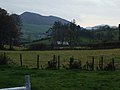
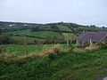
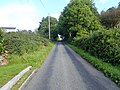
Category:Aughanduff
Jump to navigation
Jump to search
small hamlet and townland in the Parish of Forkhill, Barony of Upper Orior, and County of Armagh, Northern Ireland .JPG) | |||||
| Upload media | |||||
| Instance of | |||||
|---|---|---|---|---|---|
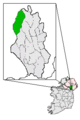
| Location | County Armagh, Northern Ireland | ||||
| Elevation above sea level |
| ||||
 | |||||
Media in category "Aughanduff"
The following 151 files are in this category, out of 151 total.
-
 AD. School Report.jpg 690 × 898; 147 KB
-
 ADSunrise.jpg 640 × 480; 116 KB
-
 AnnduffFromCarrick.jpg 640 × 480; 118 KB
-
 AnnduffinFHinAM.png 224 × 335; 9 KB
-
 AnnduffRoad.jpg 640 × 480; 116 KB
-

-
 Approaching the eastern end of Polkone Road - geograph.org.uk - 4310547.jpg 1,600 × 1,200; 465 KB
-
 Ascending along Glenmore Road - geograph.org.uk - 5907304.jpg 4,000 × 3,000; 2.91 MB
-
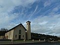
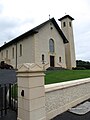
 Aughanduff Church(front).JPG 4,000 × 3,000; 4.61 MB
-
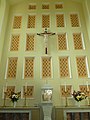
 Aughanduff Church(Interior-back).JPG 4,000 × 3,000; 4.77 MB
-
 Aughanduff Church(Interior-front).jpg 3,000 × 4,000; 2.97 MB
-
 Aughanduff Church(Side).JPG 4,000 × 3,000; 4.28 MB
-
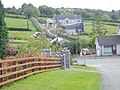
 Aughanduff Hamlet.JPG 4,000 × 3,000; 4.2 MB
-
 Aughanduff Lower Mountain from the Aughanduff Road - geograph.org.uk - 5910617.jpg 2,964 × 2,000; 3.86 MB
-
 Aughanduff Road ascending from the junction with the B30 - geograph.org.uk - 5905845.jpg 4,000 × 3,000; 2.76 MB
-
 Aughanduff Road at its junction with Tate Road - geograph.org.uk - 5911172.jpg 2,893 × 1,880; 2.98 MB
-
 Aughanduff Road at its junction with the B30 - geograph.org.uk - 4295825.jpg 1,600 × 1,179; 309 KB
-

-
 Aughanduff Road descending towards the junction with the B30 - geograph.org.uk - 5905861.jpg 2,614 × 1,834; 2.43 MB
-
 BackofAughanduff.JPG 2,272 × 1,704; 672 KB
-
 Bends and potholes on the Aughanduff Road - geograph.org.uk - 5916353.jpg 2,668 × 2,323; 4.22 MB
-
 Bends on the Aughanduff Road - geograph.org.uk - 5915708.jpg 4,000 × 3,000; 2.97 MB
-

-
 BT Telephone Box at McGeough's Crossroads, Aughanduff - geograph.org.uk - 5905564.jpg 1,780 × 1,334; 1.24 MB
-
 Bungalow under construction on Aughanduff Road - geograph.org.uk - 6173809.jpg 2,951 × 2,230; 2.94 MB
-
 Bungalows on the B30 opposite Aughanduff Chapel - geograph.org.uk - 6147272.jpg 3,437 × 1,959; 2.92 MB
-
 Bungalows on the East side of the B30 at Aughanduff - geograph.org.uk - 6255607.jpg 4,000 × 3,000; 4.99 MB
-

-

-

-
 Deciduous woodland on the east of the Glenmore Road - geograph.org.uk - 5913046.jpg 4,000 × 3,000; 2.72 MB
-
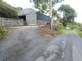
 Disused farm sheds at the southern end of Aughanduff Road - geograph.org.uk - 5905853.jpg 4,000 × 2,199; 4.05 MB
-
 Disused farm sheds on the west side of the Glenmore Road - geograph.org.uk - 5913053.jpg 3,827 × 2,288; 5.19 MB
-
 Disused stone quarry on Polkone Road - geograph.org.uk - 4310550.jpg 1,600 × 1,200; 560 KB
-
 Entrance drive leading from the Aughanduff Road - geograph.org.uk - 5916313.jpg 2,978 × 2,000; 3.77 MB
-

-
 Farm buildings on either side of Aughanduff Road - geograph.org.uk - 6173693.jpg 3,930 × 2,162; 5.15 MB
-
 Farm buildings on Glenmore Road, Aughanduff - geograph.org.uk - 5911796.jpg 3,987 × 2,478; 5.94 MB
-
 Farm shed on the lower section of Aughanduff Road - geograph.org.uk - 5916390.jpg 4,000 × 3,000; 2.89 MB
-
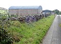 Farm sheds alongside the Aughanduff Road - geograph.org.uk - 5904368.jpg 3,828 × 2,754; 6.29 MB
-
 Farm sheds on the Aughanduff Road - geograph.org.uk - 5915688.jpg 2,938 × 2,000; 3.7 MB
-
 Farm sheds on the Aughanduff Road - geograph.org.uk - 6173640.jpg 3,323 × 2,004; 3.61 MB
-
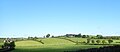
 Farmland on the lee side of Slievenacappal - geograph.org.uk - 6216688.jpg 1,869 × 1,175; 883 KB
-
 Field barn at the northern end of Aughanduff Road - geograph.org.uk - 5910561.jpg 3,748 × 2,562; 6.42 MB
-
 Field lane gate on the east side of Tate Road - geograph.org.uk - 6167768.jpg 4,000 × 3,000; 2.9 MB
-
 Glenmore Road at its junction with the B30 - geograph.org.uk - 4156663.jpg 1,024 × 768; 148 KB
-
 Glenmore Road at its junction with the B30 - geograph.org.uk - 5907255.jpg 1,780 × 1,334; 1.84 MB
-

-
 Glenmore Road, Aughanduff viewed from the B30 - geograph.org.uk - 4292325.jpg 1,600 × 1,178; 245 KB
-
 Glenmore Road, Aughanduff viewed from the B30 - geograph.org.uk - 4295834.jpg 1,600 × 1,200; 346 KB
-
 Grazing land on the east side of Aughanduff Road - geograph.org.uk - 5915537.jpg 4,000 × 3,000; 2.97 MB
-

-
 House under construction on Aughanduff Road - geograph.org.uk - 5915687.jpg 3,381 × 2,000; 3.48 MB
-

-
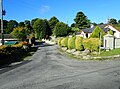
 Houses at McGeough's Cross Roads, Aughanduff - geograph.org.uk - 5905470.jpg 3,211 × 1,756; 2.53 MB
-

-
 Houses on the B30 (Silverbridge Road) at Aughanduff - geograph.org.uk - 6148856.jpg 4,000 × 3,000; 2.44 MB
-
 Large drumlin to the lee of Aughanduff Upper Mountain - geograph.org.uk - 5913885.jpg 3,172 × 1,385; 1.71 MB
-
 McGeough's Crossroads Aughanduff - geograph.org.uk - 4156425.jpg 1,024 × 768; 199 KB
-
 McGeough's Crossroads on the B30 (Silverbridge Road) - geograph.org.uk - 5905431.jpg 4,000 × 3,000; 2.19 MB
-
 Modern bungalows on Cashel Road - geograph.org.uk - 5905858.jpg 4,000 × 3,000; 2.36 MB
-
 Moorland above the B30 near Cashel Lough Lower - geograph.org.uk - 4295849.jpg 1,600 × 1,200; 296 KB
-
 Mountain land between Aughanduff Road and Glenmore Road - geograph.org.uk - 6174572.jpg 2,668 × 2,425; 4.89 MB
-
 New bungalow under construction on the Aughanduff Road - geograph.org.uk - 6173746.jpg 3,597 × 2,071; 4.63 MB
-
 New farm shed on the west side of Glenmore Road - geograph.org.uk - 5912638.jpg 2,228 × 1,334; 1.64 MB
-
 Oil storage tanks in an old quarry on Aughanduff Road - geograph.org.uk - 6173704.jpg 3,381 × 1,615; 3.22 MB
-
 Old well on the Aughanduff Road - geograph.org.uk - 5905869.jpg 4,000 × 3,000; 2.87 MB
-
 Our Lady Queen of Peace Catholic Chapel, Aughanduff - geograph.org.uk - 5905870.jpg 3,393 × 2,377; 3.84 MB
-
 Our Lady Queen of Peace Chapel, Aughanduff - geograph.org.uk - 4156036.jpg 768 × 1,024; 147 KB
-
 Our Lady Queen of Peace, Aughanduff - geograph.org.uk - 4156028.jpg 1,024 × 768; 185 KB
-
 Our Lady, Queen of Peace, Aughanduff, Co Armagh - geograph.org.uk - 4149502.jpg 768 × 1,024; 117 KB
-
 Pastureland and scrub on the east side of Polkone Road - geograph.org.uk - 4310234.jpg 1,600 × 1,200; 482 KB
-
 Phoenix Glass and Glazing Worskshop, Glenmore Road - geograph.org.uk - 5911372.jpg 3,894 × 2,000; 3.83 MB
-

-
 Polkone Road climbing south-eastwards to a col - geograph.org.uk - 4310536.jpg 1,200 × 1,600; 535 KB
-
 Polkone Road junction on the Glenmore Road - geograph.org.uk - 5907282.jpg 3,938 × 2,914; 7.97 MB
-
 Rear gate of Our Lady Queen of Peace, Aughanduff - geograph.org.uk - 4156014.jpg 742 × 1,024; 257 KB
-
 Rear view of derelict cottage on Aughanduff Road - geograph.org.uk - 5915696.jpg 4,000 × 3,000; 7.17 MB
-

-
 Refurbished traditional homestead on Aughanduff Road - geograph.org.uk - 6173732.jpg 3,405 × 2,282; 5.4 MB
-
 Ribbon development along Aughanduff Road - geograph.org.uk - 6173751.jpg 1,780 × 1,334; 1.66 MB
-
-
 Rock outcrops on the west side of Glenmore Road - geograph.org.uk - 5913013.jpg 4,000 × 3,000; 3.04 MB
-
 Roofless cottage off Aughanduff Road - geograph.org.uk - 5915704.jpg 4,000 × 3,000; 3 MB
-
 Roofless house on Aughanduff Road - geograph.org.uk - 6173726.jpg 2,668 × 2,000; 5 MB
-
 Rough grazing land on the north side of Polkone Road - geograph.org.uk - 4310533.jpg 1,600 × 1,200; 829 KB
-

-

-
 Rough pasturage East of Tate Road - geograph.org.uk - 6167813.jpg 4,000 × 3,000; 2.9 MB
-
 Rough pasture on the West side of Tate Road - geograph.org.uk - 6149957.jpg 3,912 × 2,880; 7.27 MB
-
 Ruined cottage on the edge of an upland bog - geograph.org.uk - 5915695.jpg 3,314 × 2,430; 6.87 MB
-
 Rural settlement on the slopes of Slievenacappel - geograph.org.uk - 6217636.jpg 1,182 × 876; 693 KB
-
 Scrub and rough grazing on the west side of Glenmore Road - geograph.org.uk - 5913839.jpg 2,441 × 1,320; 1.81 MB
-
 Scrubland on Aughanduff Lower Mountain - geograph.org.uk - 6173536.jpg 3,027 × 2,804; 3.64 MB
-
 Sheds on the Aughanduff Road - geograph.org.uk - 6173539.jpg 3,692 × 1,941; 2.79 MB
-
 Slieve Gullion.jpg 2,272 × 1,704; 706 KB
-
 Slievenacappel Mountain from the Tate Road - geograph.org.uk - 6173417.jpg 1,873 × 994; 739 KB
-

-
 Sweeping curve in the B30 west of McGeough's Crossroads - geograph.org.uk - 5905533.jpg 3,314 × 1,977; 2.9 MB
-
 Tate Road descending towards the Aughanduff Road junction - geograph.org.uk - 6167819.jpg 4,000 × 3,000; 2.71 MB
-

-

-
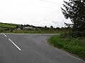
 The Aughanduff Road junction on the Tate Road - geograph.org.uk - 5904310.jpg 4,000 × 3,000; 2.9 MB
-

-
 The B30 between Aughanduff and Tullymacreeve - geograph.org.uk - 3772850.jpg 1,024 × 767; 94 KB
-
 The Ballina River north of Aughenduff Road bridge - geograph.org.uk - 5915532.jpg 3,924 × 2,896; 6.93 MB
-
 The Ballina Valley from the Aughanduff Road - geograph.org.uk - 5916366.jpg 4,000 × 3,000; 2.89 MB
-
 The belfry of Our Lady's Queen of Peace Church. Aughanduff - geograph.org.uk - 6273410.jpg 2,703 × 1,577; 1.46 MB
-
 The deteriorating surface of Aughanduff Road - geograph.org.uk - 5915690.jpg 2,606 × 1,916; 2.96 MB
-
 The entrance to Glen Avenue - geograph.org.uk - 5911663.jpg 4,000 × 3,000; 2.9 MB
-
 The flood plain of upper Forkhill River - geograph.org.uk - 4292335.jpg 1,600 × 1,136; 182 KB
-

-

-

-
 The mouth of Aughanduff Road - geograph.org.uk - 4156445.jpg 1,024 × 768; 202 KB
-
 The north-western sector of the Ring of Gullion - geograph.org.uk - 5910574.jpg 3,981 × 1,986; 3.25 MB
-
 The outcropping of igneous rocks in the Aughanduff hills - geograph.org.uk - 5913026.jpg 3,405 × 2,037; 3.29 MB
-
 The southern end of Glenmore Road - geograph.org.uk - 4156675.jpg 1,024 × 768; 187 KB
-

-
 Townland marker on Glenmore Road - geograph.org.uk - 5911799.jpg 4,000 × 3,000; 2.87 MB
-
 Track leading from Aughanduff Road to Aughanduff Mountain - geograph.org.uk - 6174560.jpg 4,000 × 3,000; 2.92 MB
-
 Traditional farm outbuildings on the west side of Tate Road - geograph.org.uk - 6149952.jpg 2,668 × 2,000; 2.73 MB
-

-
 Traditional style farmhouse below the Tate Road - geograph.org.uk - 5911140.jpg 3,640 × 2,005; 2.65 MB
-
 Tree arch on Aughanduff Road - geograph.org.uk - 5915701.jpg 1,780 × 1,335; 2.25 MB
-

-
 Ulsterbus Service 42 departing McGeough's Cross Roads - geograph.org.uk - 5907145.jpg 3,196 × 1,857; 3.46 MB
-

-
 View across rough grazing to Aughanduff Lower Mountain - geograph.org.uk - 6174587.jpg 4,000 × 3,000; 3.04 MB
-
 View East across the B30 at Aughanduff - geograph.org.uk - 5905875.jpg 3,442 × 2,469; 5.79 MB
-

-
 View ENE across Ballinn Valley towards Slievenacappel - geograph.org.uk - 6173824.jpg 3,195 × 2,000; 4.61 MB
-

-
 View NNE towards Glenmore Road from Polkone Road - geograph.org.uk - 4310552.jpg 1,600 × 1,200; 540 KB
-
 View NNW along Glenmore Road - geograph.org.uk - 4156694.jpg 1,024 × 632; 120 KB
-
 View North along a tree lined section of Glenmore Road - geograph.org.uk - 5913889.jpg 4,000 × 3,000; 2.89 MB
-
 View north along Aughanduff Road - geograph.org.uk - 4156041.jpg 768 × 1,024; 327 KB
-
 View North along the ascending Tate Road - geograph.org.uk - 6167816.jpg 2,668 × 2,000; 2.3 MB
-
 View North along the middle section of Aughanduff Road - geograph.org.uk - 6174403.jpg 1,780 × 1,335; 1.65 MB
-
 View over Slievenacappel towards Slieve Gullion - geograph.org.uk - 6167829.jpg 3,996 × 2,996; 5.63 MB
-
 View South along the Ballinn River Valley - geograph.org.uk - 6174304.jpg 1,548 × 993; 808 KB
-
 View South along the middle section of Tate Road - geograph.org.uk - 6172801.jpg 2,668 × 2,000; 3.09 MB
-
 View West along Aughanduff Road - geograph.org.uk - 5910580.jpg 4,000 × 3,000; 2.91 MB
-

-
 Wetland east of the Polkone Road-Glenmore Road junction - geograph.org.uk - 6169481.jpg 3,160 × 1,951; 3.66 MB
-
 Wetland on the eastern edge of Aughanduff Lower Mountain - geograph.org.uk - 5915698.jpg 4,000 × 3,000; 2.71 MB
-
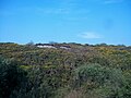
 Whins and scrub covered Aughanduff Upper Mountain - geograph.org.uk - 4309855.jpg 1,600 × 1,200; 350 KB
-
 Wind turbine below the Aughanduff Road - geograph.org.uk - 5910628.jpg 2,902 × 3,928; 4.99 MB
-

-

-
 Woodland on Aughanduff Upper Mountain - geograph.org.uk - 5913061.jpg 4,000 × 3,000; 2.87 MB


.JPG)
.JPG)
.jpg)


_-_geograph.org.uk_-_4156403.jpg)
_at_Aughanduff_-_geograph.org.uk_-_6148856.jpg)


_-_geograph.org.uk_-_5905431.jpg)


_-_geograph.org.uk_-_4295852.jpg)


_west_of_Aughanduff_Chapel_-_geograph.org.uk_-_4156435.jpg)


_-_geograph.org.uk_-_4156408.jpg)


_viewed_from_the_Aughanduff_Road_-_geograph.org.uk_-_5916399.jpg)


