Category:August 2003 in North Yorkshire
Jump to navigation
Jump to search
Ceremonial counties of England: Bedfordshire · Berkshire · Buckinghamshire · Cambridgeshire · Cheshire · Cornwall · Cumbria · Derbyshire · Devon · Dorset · Durham · East Riding of Yorkshire · East Sussex · Essex · Greater London · Greater Manchester · Hampshire · Herefordshire · Hertfordshire · Isle of Wight · Kent · Lancashire · Leicestershire · Lincolnshire · Merseyside · Norfolk · North Yorkshire · Northamptonshire · Northumberland · Nottinghamshire · Oxfordshire · Shropshire · Somerset · South Yorkshire · Staffordshire · Suffolk · Surrey · West Midlands · West Yorkshire · Wiltshire · Worcestershire
City-counties: Bristol ·
Former historic counties:
Other former counties:
City-counties: Bristol ·
Former historic counties:
Other former counties:
Deutsch: Bilder, die im August 2003 in North Yorkshire aufgenommen worden sind. Bitte beachten Sie, dass dies weder das Datum des Uploads noch das Datum des Scannens eines Fotos ist.
English: Images/pictures taken in North Yorkshire during August 2003. Note this is not the date of the upload, nor the date a photo was scanned.
Español: Fotografías o imágenes tomadas en North Yorkshire durante agosto 2003. No es la fecha de subida ni escaneo, sino la fecha en que las fotografías o imágenes se crearon.
Esperanto: Bildoj faritaj en North Yorkshire en aŭgusto 2003. Tio ne estas la dato, kiam la bildoj estis alŝutitaj aŭ skanitaj.
Français : Photographies ou images prises en North Yorkshire durant août 2003. Ce n'est pas la date du téléchargement ou du scan.
Galego: Fotografías ou imaxes tomadas en North Yorkshire durante agosto 2003. Non é a data de subida nin escaneamento, senón a data na que se crearon as fotografías ou imaxes.
Italiano: Fotografie o immagini scattate a North Yorkshire nel agosto 2003. Nota bene: la data non si riferisce né a quella di upload né a quella in cui la foto è stata digitalizzata.
Norsk bokmål: Bilder tatt i North Yorkshire i løpet av august 2003. Merk at dette ikke er datoen for opplasting, eller når et bilde har blitt skannet.
Norsk nynorsk: Bilete teke i North Yorkshire i løpet av august 2003. Merk at dette ikkje er datoen for opplasting, eller når eit bilete har vorte skanna.
Русский: Изображения, сделанные в North Yorkshire в течение август 2003 (не дата загрузки изображения).
Українська: Зображення, зроблені в North Yorkshire протягом серпень 2003. Зауважте, що це не дата завантаження чи дата сканування фотографії.
| August 2002 | ← | August 2003 | → | August 2004 | |||||||
| Jan | Feb | Mar | Apr | May | Jun | Jul | Aug | Sep | Oct | Nov | Dec |
| 6 | 25 | 7 | 95 | 7 | 37 | 14 | 92 | 13 | 7 | 31 | 27 |
|---|---|---|---|---|---|---|---|---|---|---|---|
Media in category "August 2003 in North Yorkshire"
The following 92 files are in this category, out of 92 total.
-
 Bolton Percy - geograph.org.uk - 663665.jpg 640 × 426; 84 KB
-
 Barden Bridge - geograph.org.uk - 144999.jpg 640 × 480; 102 KB
-
 Colton Junction - geograph.org.uk - 330509.jpg 640 × 426; 118 KB
-
 Yorkshire Dales - geograph.org.uk - 302791.jpg 480 × 640; 114 KB
-
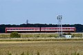
 56 072 passing Ulleskelf station - geograph.org.uk - 332304.jpg 640 × 426; 108 KB
-
 A speeding HST - geograph.org.uk - 330474.jpg 640 × 336; 78 KB
-
 Approaching Motorcar - geograph.org.uk - 496728.jpg 640 × 426; 112 KB
-
 Burton Salmon - geograph.org.uk - 330615.jpg 640 × 426; 133 KB
-
 Buttertubs Pass. - geograph.org.uk - 410387.jpg 640 × 427; 89 KB
-
 Cairn on the slopes of Gragareth - geograph.org.uk - 958283.jpg 640 × 409; 89 KB
-
 Cairn on Thwaite Scar above Norber - geograph.org.uk - 958456.jpg 640 × 427; 102 KB
-
 Cairn on Thwaite Scar above Norber - geograph.org.uk - 958461.jpg 640 × 412; 79 KB
-
-
 Captain Cooks Monument - geograph.org.uk - 1567146.jpg 640 × 480; 85 KB
-
 Careful with that axe, Sir Eugene... - geograph.org.uk - 1601164.jpg 512 × 640; 153 KB
-
 Climbing Gragareth - geograph.org.uk - 958308.jpg 440 × 640; 140 KB
-
 Colton Junction - geograph.org.uk - 330518.jpg 640 × 426; 147 KB
-

-
 Derelict barn near Gearstones - geograph.org.uk - 383981.jpg 640 × 458; 73 KB
-
 Diesel railcar at Embsay Station - geograph.org.uk - 331734.jpg 640 × 426; 116 KB
-
 Dmu South of Colton Junction - geograph.org.uk - 332889.jpg 640 × 426; 152 KB
-
 Eden Camp - geograph.org.uk - 406877.jpg 640 × 427; 123 KB
-
 Eden Camp - geograph.org.uk - 406880.jpg 640 × 427; 104 KB
-
 Eden Camp - geograph.org.uk - 406884.jpg 640 × 427; 107 KB
-
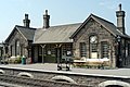 Embsay Station - geograph.org.uk - 331708.jpg 640 × 426; 133 KB
-
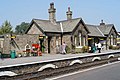 Embsay Station - geograph.org.uk - 331711.jpg 640 × 426; 133 KB
-
 Embsay Station - geograph.org.uk - 331726.jpg 640 × 426; 125 KB
-
 Engineer's Train - geograph.org.uk - 621749.jpg 640 × 426; 97 KB
-
 Filey Brigg - geograph.org.uk - 1041998.jpg 640 × 374; 276 KB
-
 Filey Sailing Club - geograph.org.uk - 1041993.jpg 640 × 480; 418 KB
-
 Filey Sea Front - geograph.org.uk - 1310012.jpg 640 × 480; 61 KB
-
 Footbridge at Embsay Station - geograph.org.uk - 331718.jpg 640 × 401; 137 KB
-
 Fountains Abbey. - geograph.org.uk - 410489.jpg 640 × 427; 120 KB
-
 Fountains Abbey. - geograph.org.uk - 410490.jpg 640 × 427; 116 KB
-
 Fountains Abbey. - geograph.org.uk - 410499.jpg 640 × 427; 111 KB
-
 Gate along the Turbary road - geograph.org.uk - 958288.jpg 452 × 640; 104 KB
-
 Going Under - geograph.org.uk - 628459.jpg 640 × 426; 82 KB
-
 Harvesting the Crop - geograph.org.uk - 496739.jpg 640 × 426; 160 KB
-
 Ingleby Manor, Rear View - geograph.org.uk - 1567118.jpg 640 × 480; 85 KB
-

-

-
 Local train - geograph.org.uk - 332883.jpg 640 × 426; 99 KB
-
 Looking North into Whitby - geograph.org.uk - 583941.jpg 640 × 425; 67 KB
-
 Low Bradley, near Skipton - geograph.org.uk - 3245.jpg 640 × 363; 45 KB
-
 Main Street, Grassington, Yorkshire - geograph.org.uk - 133592.jpg 427 × 640; 95 KB
-
 Malham Cove, Information Board - geograph.org.uk - 641826.jpg 640 × 386; 95 KB
-
 Marmion Tower - geograph.org.uk - 220715.jpg 640 × 480; 82 KB
-
 Middlewood Lane - geograph.org.uk - 1340148.jpg 640 × 480; 136 KB
-
 Oil Train at Burton Salmon - geograph.org.uk - 330620.jpg 640 × 426; 125 KB
-
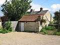 Old Wash House, Ryemoor, Nunnington - geograph.org.uk - 1142437.jpg 640 × 480; 133 KB
-
 Pecca Falls - geograph.org.uk - 42334.jpg 640 × 427; 216 KB
-
 Red Lion, Skipton.jpg 640 × 480; 90 KB
-
 Rendezvous Hotel, Skipton - geograph.org.uk - 642763.jpg 640 × 480; 75 KB
-
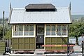
 Ribblehead Station Lantern - geograph.org.uk - 358304.jpg 640 × 480; 50 KB
-
 Ripon Cathedral (Summer) - geograph.org.uk - 118962.jpg 481 × 640; 71 KB
-
 Selby Railway Station - geograph.org.uk - 328920.jpg 640 × 426; 126 KB
-
 Selby Railway Station - geograph.org.uk - 328936.jpg 640 × 426; 131 KB
-
 Edward of Middleham (geograph).jpg 320 × 240; 10 KB
-
 Small pool on summit of Gragareth - geograph.org.uk - 958322.jpg 640 × 399; 88 KB
-
 South Milford Junction - geograph.org.uk - 496767.jpg 640 × 414; 139 KB
-
 Studley Water Gardens. - geograph.org.uk - 410493.jpg 640 × 427; 125 KB
-
 Sutton Bank - geograph.org.uk - 406891.jpg 640 × 427; 85 KB
-
 Swinden Quarry - geograph.org.uk - 330605.jpg 640 × 426; 187 KB
-
-
 The North Yorkshire Coast - geograph.org.uk - 583947.jpg 640 × 425; 56 KB
-
 The path to Sulber gate - geograph.org.uk - 958443.jpg 640 × 441; 71 KB
-
 Valley Gardens, Harrogate. - geograph.org.uk - 404785.jpg 640 × 427; 162 KB
-
 Valley Gardens, Harrogate. - geograph.org.uk - 404788.jpg 640 × 427; 133 KB
-
 Walking the Turbary Road - geograph.org.uk - 958277.jpg 640 × 409; 87 KB
-
 Water Dale - geograph.org.uk - 139086.jpg 640 × 480; 102 KB
-
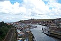
 Whitby Harbour - geograph.org.uk - 583925.jpg 640 × 434; 92 KB
-
 Whitby Rock - geograph.org.uk - 583932.jpg 640 × 425; 89 KB
-
 Whitley Lock - geograph.org.uk - 358315.jpg 640 × 426; 149 KB
-
 Whitley Lock - geograph.org.uk - 628378.jpg 426 × 640; 66 KB
-
 Yarm railway station 1.jpg 640 × 480; 79 KB
-
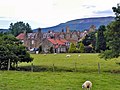
 Austwick village from Oxenber - geograph.org.uk - 18597.jpg 640 × 480; 140 KB
-
 Bare House from the North East - geograph.org.uk - 440816.jpg 640 × 480; 34 KB
-
 Beamsley Beacon and Pendle Hill - geograph.org.uk - 51266.jpg 640 × 448; 119 KB
-
 Boltby - geograph.org.uk - 84426.jpg 300 × 151; 18 KB
-
 Bridge over the River Skirfare. - geograph.org.uk - 335549.jpg 640 × 480; 129 KB
-
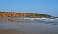
 Fyling Park from Low Farm - geograph.org.uk - 367398.jpg 640 × 427; 66 KB
-
 Grassington Moor - geograph.org.uk - 310475.jpg 640 × 480; 84 KB
-
 Hunmanby Gap Car Park - geograph.org.uk - 221181.jpg 640 × 480; 61 KB
-
 Jervaulx Park - geograph.org.uk - 270709.jpg 640 × 480; 51 KB
-
 Larpool Hall - geograph.org.uk - 128952.jpg 640 × 480; 95 KB
-
 Little Beck - geograph.org.uk - 399450.jpg 640 × 480; 164 KB
-
 Nutwith Lane - geograph.org.uk - 114297.jpg 640 × 480; 125 KB
-
 Porret Lane - geograph.org.uk - 217389.jpg 640 × 398; 84 KB
-
 Ryemoor, Nunnington - geograph.org.uk - 673462.jpg 640 × 480; 102 KB
-
 Scalby Beck - geograph.org.uk - 220164.jpg 640 × 480; 120 KB
-
 View from Marmion Tower - geograph.org.uk - 220720.jpg 640 × 480; 92 KB
-
 View from Sutton Bank. - geograph.org.uk - 58227.jpg 640 × 480; 113 KB


_-_geograph.org.uk_-_118962.jpg)


.jpg)


