Category:August 2006 in County Tyrone
Jump to navigation
Jump to search
English: Images taken in County Tyrone, Northern Ireland in this month of 2006 (not the date of the upload).
| Jan | Feb | Mar | Apr | May | Jun | Jul | Aug | Sep | Oct | Nov | Dec | ||
| ← | 301 | 291 | 688 | 258 | 324 | 109 | 276 | 154 | 243 | 330 | 180 | 92 | → |
|---|
Media in category "August 2006 in County Tyrone"
The following 154 files are in this category, out of 154 total.
-
 Abandoned Cottage - geograph.org.uk - 216263.jpg 640 × 479; 87 KB
-
 Abandoned Cottage - geograph.org.uk - 216266.jpg 640 × 479; 70 KB
-
 Abandoned cottage at Teebane East - geograph.org.uk - 229722.jpg 640 × 479; 78 KB
-
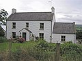
 Abandoned House - geograph.org.uk - 229675.jpg 640 × 479; 66 KB
-
 Aghaboy - geograph.org.uk - 229599.jpg 640 × 479; 57 KB
-
 Aghaboy Road - geograph.org.uk - 229600.jpg 640 × 479; 75 KB
-
 Aghaboy Townland - geograph.org.uk - 229598.jpg 640 × 479; 54 KB
-
 Allagh Townland - geograph.org.uk - 229631.jpg 640 × 479; 50 KB
-
 Alwories Townland - geograph.org.uk - 229602.jpg 640 × 479; 56 KB
-
 Alwories Townland - geograph.org.uk - 229603.jpg 640 × 479; 56 KB
-
 An Bosca Ceoil, Gortin - geograph.org.uk - 216665.jpg 640 × 539; 49 KB
-
 Approaching Omagh - geograph.org.uk - 218281.jpg 640 × 479; 49 KB
-
-
 Ballyfatten Barley Field Guards - geograph.org.uk - 306267.jpg 640 × 480; 148 KB
-
 Ballyforlea Picnic Area - geograph.org.uk - 222282.jpg 640 × 479; 51 KB
-
 Ballymenagh, Cookstown - geograph.org.uk - 222275.jpg 640 × 479; 53 KB
-
 Ballymenagh, County Tyrone - geograph.org.uk - 222277.jpg 640 × 479; 40 KB
-
 Bassetts, Omagh - geograph.org.uk - 218276.jpg 640 × 427; 38 KB
-
 Cannonhill, Omagh - geograph.org.uk - 214264.jpg 640 × 479; 78 KB
-
 Caravan site in Dungannon Park - geograph.org.uk - 1216431.jpg 640 × 480; 67 KB
-
 Carpet Right, Omagh - geograph.org.uk - 218275.jpg 640 × 479; 47 KB
-
 Carrickatane - geograph.org.uk - 224834.jpg 640 × 479; 61 KB
-
 Cashel Townland, Greencastle - geograph.org.uk - 216248.jpg 640 × 479; 52 KB
-
 Casorna Townland - geograph.org.uk - 216276.jpg 640 × 479; 60 KB
-
 Coneyglen Burn - geograph.org.uk - 229703.jpg 640 × 479; 80 KB
-
 Cookstown Methodist Church - geograph.org.uk - 217785.jpg 378 × 480; 36 KB
-
 Coolnagard Drive, Omagh - geograph.org.uk - 214266.jpg 640 × 479; 81 KB
-
 Coolnagard Village, Omagh - geograph.org.uk - 214246.jpg 640 × 281; 27 KB
-
 Cottage at Carrickatane - geograph.org.uk - 224826.jpg 640 × 284; 28 KB
-
 Cottage at Greencastle - geograph.org.uk - 216252.jpg 640 × 479; 49 KB
-
 Crock Primary School - geograph.org.uk - 229734.jpg 640 × 479; 55 KB
-
 Crockanboy Hill, Greencastle - geograph.org.uk - 216255.jpg 640 × 479; 53 KB
-
 Crockanboy Road, Gortin - geograph.org.uk - 216305.jpg 640 × 270; 35 KB
-
 Crockanboy Townland - geograph.org.uk - 216253.jpg 640 × 479; 58 KB
-
 Crockanboy Townland, Greencastle - geograph.org.uk - 216260.jpg 640 × 479; 57 KB
-
 Crockatanty Townland - geograph.org.uk - 229694.jpg 640 × 479; 65 KB
-
 Crooked Bridge, Gortin - geograph.org.uk - 216669.jpg 640 × 479; 75 KB
-
 Cul-de-sac at Knockgreenan Park - geograph.org.uk - 226616.jpg 640 × 183; 21 KB
-
 Culmore Diner, Omagh - geograph.org.uk - 218274.jpg 640 × 479; 48 KB
-
 Culmore Park, Omagh - geograph.org.uk - 218260.jpg 640 × 479; 42 KB
-
 Culmore Service Station, Omagh - geograph.org.uk - 218270.jpg 640 × 479; 48 KB
-
 David Prentice, Omagh - geograph.org.uk - 218277.jpg 640 × 479; 43 KB
-
 Dergmoney Court, Omagh - geograph.org.uk - 214221.jpg 640 × 286; 33 KB
-
 Dergmoney Heights, Omagh - geograph.org.uk - 214238.jpg 640 × 285; 35 KB
-
 Dergmoney Lane, Omagh - geograph.org.uk - 214231.jpg 640 × 297; 35 KB
-
 Dergmoney View, Omagh - geograph.org.uk - 214230.jpg 640 × 479; 62 KB
-
 Drumragh Care Home, Omagh - geograph.org.uk - 214225.jpg 640 × 313; 26 KB
-
 Dublin Road, Omagh - geograph.org.uk - 214222.jpg 640 × 479; 51 KB
-
 Fallagh Lower - geograph.org.uk - 216291.jpg 640 × 479; 62 KB
-
 Fallagh Lower Townland - geograph.org.uk - 216292.jpg 640 × 479; 57 KB
-
 Fallagh Lower Townland - geograph.org.uk - 216293.jpg 640 × 286; 26 KB
-
 Fallagh Middle - geograph.org.uk - 216299.jpg 640 × 479; 49 KB
-
 Fallagh Middle Townland - geograph.org.uk - 216294.jpg 640 × 285; 30 KB
-
 Formil - geograph.org.uk - 229747.jpg 640 × 479; 61 KB
-
 Fungus Plant - geograph.org.uk - 229614.jpg 640 × 479; 74 KB
-
 Garvagh Townland - geograph.org.uk - 216713.jpg 640 × 246; 25 KB
-
 Garvagh Townland - geograph.org.uk - 216714.jpg 640 × 235; 20 KB
-
 Garvagh, County Tryrone - geograph.org.uk - 216710.jpg 640 × 479; 52 KB
-
 Garvagh, County Tryrone - geograph.org.uk - 216711.jpg 640 × 479; 46 KB
-
 Glenark River - geograph.org.uk - 229678.jpg 640 × 479; 72 KB
-
 Glencullin Road - geograph.org.uk - 229659.jpg 640 × 479; 77 KB
-
 Glenlark Townland - geograph.org.uk - 229676.jpg 640 × 479; 51 KB
-
 Glenmacoffer Townland - geograph.org.uk - 216302.jpg 640 × 479; 49 KB
-
 Golan Bridge - geograph.org.uk - 216719.jpg 640 × 479; 65 KB
-
 Gormleys, Omagh - geograph.org.uk - 218267.jpg 640 × 479; 45 KB
-
 Gorticashel Lower - geograph.org.uk - 229637.jpg 640 × 479; 59 KB
-
 Gorticashel Lower - geograph.org.uk - 229643.jpg 640 × 479; 64 KB
-
 Gorticashel Lower - geograph.org.uk - 229654.jpg 640 × 479; 39 KB
-
 Gorticashel Upper - geograph.org.uk - 229666.jpg 640 × 479; 58 KB
-

-

-
 High Street, Omagh - geograph.org.uk - 218284.jpg 640 × 479; 70 KB
-
 Holiday homes - geograph.org.uk - 216689.jpg 640 × 479; 54 KB
-
 House at Meenadoo - geograph.org.uk - 216688.jpg 640 × 479; 54 KB
-
 Houses at Rousky - geograph.org.uk - 216280.jpg 640 × 277; 42 KB
-
 Industrial Estate, Coalisland - geograph.org.uk - 144039.jpg 640 × 412; 55 KB
-
 Jim McGreneghan, Omagh - geograph.org.uk - 218268.jpg 640 × 479; 43 KB
-
 Kevlin Gardens, Omagh - geograph.org.uk - 214262.jpg 640 × 479; 57 KB
-
 Kevlin Glen, Omagh - geograph.org.uk - 214269.jpg 640 × 479; 42 KB
-
 Kevlin Heights, Omagh - geograph.org.uk - 214241.jpg 640 × 479; 44 KB
-

-
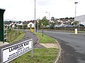 Lambrook Road, Omagh - geograph.org.uk - 218263.jpg 640 × 479; 62 KB
-
 Leaghan Townland - geograph.org.uk - 216244.jpg 640 × 479; 52 KB
-
 Leaghan Townland - geograph.org.uk - 216245.jpg 640 × 479; 57 KB
-
 Lenamore Townland - geograph.org.uk - 216306.jpg 640 × 290; 29 KB
-
 Lenamore Townland, Gortin - geograph.org.uk - 216307.jpg 640 × 288; 28 KB
-
 Lenamore, Gortin - geograph.org.uk - 216308.jpg 640 × 251; 31 KB
-
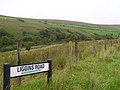 Liggins Road - geograph.org.uk - 229698.jpg 640 × 479; 60 KB
-
 Liggins Townland - geograph.org.uk - 229710.jpg 640 × 479; 71 KB
-
 Lissan View, Omagh - geograph.org.uk - 214226.jpg 640 × 479; 46 KB
-
 Lough Muck Road, Omagh - geograph.org.uk - 218261.jpg 640 × 479; 61 KB
-
 Magheraliss Road - geograph.org.uk - 216301.jpg 640 × 479; 67 KB
-
 Maghereaboy Townland - geograph.org.uk - 216300.jpg 640 × 479; 56 KB
-
 Masonic Hall, Gortin - geograph.org.uk - 216668.jpg 324 × 480; 24 KB
-
 McKenna's Bar - geograph.org.uk - 229663.jpg 640 × 279; 28 KB
-
 Meenadoo Townland, Gortin - geograph.org.uk - 216672.jpg 640 × 479; 52 KB
-
 Meenadoo Townland, Gortin - geograph.org.uk - 216673.jpg 640 × 479; 52 KB
-
 Meenadoo Townland, Gortin - geograph.org.uk - 216674.jpg 640 × 479; 63 KB
-
 Meenadoo Townland, Gortin - geograph.org.uk - 216721.jpg 640 × 479; 54 KB
-
 Meenadoo Townland, Gortin - geograph.org.uk - 216722.jpg 640 × 479; 53 KB
-
 Milking time at Rousky - geograph.org.uk - 216277.jpg 640 × 479; 55 KB
-
 Monanameal Townland - geograph.org.uk - 229601.jpg 640 × 479; 48 KB
-
 Mullaghbolig - geograph.org.uk - 229669.jpg 640 × 479; 44 KB
-
 Mullaghbolig - geograph.org.uk - 229672.jpg 640 × 479; 59 KB
-
 New Arts Centre, Omagh - geograph.org.uk - 213759.jpg 640 × 289; 28 KB
-
 New DPP Office site, Omagh - geograph.org.uk - 213758.jpg 640 × 288; 45 KB
-

-
 O'Kane Park, Omagh - geograph.org.uk - 218259.jpg 640 × 479; 39 KB
-
 Old farmhouse at Fallagh Middle - geograph.org.uk - 216297.jpg 640 × 479; 84 KB
-
 Omagh Integrated Primary School - geograph.org.uk - 214233.jpg 640 × 282; 27 KB
-
 Omagh Throughpass - geograph.org.uk - 225575.jpg 640 × 479; 54 KB
-
 Petfood Superstore, Omagh - geograph.org.uk - 218271.jpg 640 × 479; 41 KB
-
 Road at Casorna - geograph.org.uk - 216273.jpg 640 × 479; 62 KB
-
 Road at Crockanboy - geograph.org.uk - 216258.jpg 640 × 273; 25 KB
-
 Road at Fallagh Lower - geograph.org.uk - 216290.jpg 640 × 281; 34 KB
-
 Road at Formil - geograph.org.uk - 229742.jpg 640 × 479; 59 KB
-
 Road at Glenmacoffer - geograph.org.uk - 216303.jpg 640 × 479; 61 KB
-
 Road at Gorticashel Lower - geograph.org.uk - 229642.jpg 640 × 479; 47 KB
-
 Road at Meenadoo - geograph.org.uk - 216691.jpg 640 × 281; 25 KB
-
 Road at Teebane East - geograph.org.uk - 229720.jpg 640 × 479; 56 KB
-
 Road at Teebane East - geograph.org.uk - 229723.jpg 640 × 479; 46 KB
-
 Road at Teebane East - geograph.org.uk - 229729.jpg 640 × 479; 53 KB
-
 Road at Trinamadan - geograph.org.uk - 216678.jpg 640 × 272; 28 KB
-
 Roadworks at Hospital Road, Omagh - geograph.org.uk - 218290.jpg 640 × 279; 37 KB
-
 Rock Road - geograph.org.uk - 229744.jpg 640 × 479; 61 KB
-
 Rouskey - geograph.org.uk - 229633.jpg 640 × 479; 66 KB
-
 Rouskey Community Centre - geograph.org.uk - 216281.jpg 640 × 479; 66 KB
-
 Ruin at Fallagh Middle - geograph.org.uk - 216295.jpg 640 × 292; 53 KB
-
 Ruin at Liggins - geograph.org.uk - 229712.jpg 640 × 479; 78 KB
-
 Ruin at Mullaghbolig - geograph.org.uk - 229671.jpg 640 × 479; 56 KB
-
 Ruined house at Fallagh Lower - geograph.org.uk - 216288.jpg 640 × 479; 87 KB
-
 St Mary's RC Church, Rousky - geograph.org.uk - 216284.jpg 640 × 479; 44 KB
-
 Standing Stones at Meenadoo - geograph.org.uk - 216724.jpg 640 × 479; 58 KB
-
 Suburban Builders, Omagh - geograph.org.uk - 218265.jpg 640 × 479; 54 KB
-
 Teebane East - geograph.org.uk - 229728.jpg 640 × 479; 45 KB
-
 Teebane East - geograph.org.uk - 229731.jpg 640 × 479; 59 KB
-
 Teebane West - geograph.org.uk - 216261.jpg 640 × 479; 57 KB
-
 Teebane West Townland - geograph.org.uk - 216268.jpg 640 × 302; 33 KB
-

-
 The Bothy, Rousky - geograph.org.uk - 216279.jpg 640 × 274; 36 KB
-
 The Clock Bar, Omagh - geograph.org.uk - 213760.jpg 640 × 479; 55 KB
-
 The Derry Road, Omagh - geograph.org.uk - 226836.jpg 640 × 480; 81 KB
-
 The Gateway Restaurant, Gortnagarn - geograph.org.uk - 216310.jpg 640 × 479; 51 KB
-
 The Pedlar's Rest, Gortin - geograph.org.uk - 216666.jpg 640 × 479; 61 KB
-
 The Ulster Way - geograph.org.uk - 216675.jpg 640 × 479; 64 KB
-
 Tile Market, Omagh - geograph.org.uk - 218280.jpg 640 × 479; 42 KB
-
 Trinamadan Old School - geograph.org.uk - 216686.jpg 640 × 479; 85 KB
-
 Trinamadan Townland - geograph.org.uk - 216676.jpg 640 × 479; 43 KB
-
 Trinamadan Townland - geograph.org.uk - 216677.jpg 640 × 479; 63 KB
-
 Turning Point, Omagh - geograph.org.uk - 213756.jpg 359 × 480; 37 KB
-
 Upper Magheraliss Townland - geograph.org.uk - 216304.jpg 640 × 275; 37 KB
-
 View from Rousky - geograph.org.uk - 216286.jpg 640 × 479; 46 KB
-
 WalCour.jpg 1,800 × 1,095; 823 KB
-
 Wee Robin - geograph.org.uk - 217338.jpg 640 × 479; 49 KB


_-_geograph.org.uk_-_216667.jpg)


