Category:August 2009 in County Down
Jump to navigation
Jump to search
English: Images taken in County Down, Northern Ireland in this month of 2009 (not the date of the upload).
| Jan | Feb | Mar | Apr | May | Jun | Jul | Aug | Sep | Oct | Nov | Dec | ||
| ← | 59 | 46 | 48 | 61 | 33 | 30 | 72 | 224 | 115 | 109 | 34 | 154 | → |
|---|
Subcategories
This category has the following 6 subcategories, out of 6 total.
B
- August 2009 in Banbridge (8 F)
D
- August 2009 in Down (district) (175 F)
- August 2009 in Downpatrick (34 F)
N
Media in category "August 2009 in County Down"
The following 200 files are in this category, out of 218 total.
(previous page) (next page)-
 "Lagan Street", Dromore - geograph.org.uk - 1456974.jpg 640 × 480; 85 KB
-
 "No Dumping", Listullycurran - geograph.org.uk - 1451074.jpg 640 × 480; 64 KB
-
 'Mackerel Rocks', Bangor - geograph.org.uk - 1451408.jpg 640 × 428; 378 KB
-
-

-
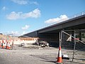 A flyover on the new Newry Bypass - geograph.org.uk - 1479630.jpg 640 × 480; 60 KB
-
-

-

-

-

-

-
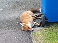 An expired fox on the side of the A50 - geograph.org.uk - 1470387.jpg 640 × 480; 103 KB
-

-
 Annaghanoon Road, Donaghcloney - geograph.org.uk - 1453098.jpg 640 × 480; 75 KB
-

-

-
 Ards peninsula field, August 2009.JPG 4,272 × 2,848; 4.02 MB
-
 Ardtanagh Townland - geograph.org.uk - 1444331.jpg 640 × 480; 119 KB
-

-
 Assumption Church (02), August 2009.JPG 4,272 × 2,848; 3.99 MB
-
 Assumption Church (03), August 2009.JPG 2,848 × 4,272; 5.1 MB
-
 Assumption Church (06), August 2009.JPG 4,272 × 2,848; 4.34 MB
-
 Assumption Church (07), August 2009.JPG 4,272 × 2,848; 3.23 MB
-
 Assumption Church (08), August 2009.JPG 4,272 × 2,848; 3.28 MB
-
 Assumption Church (09), August 2009.JPG 4,272 × 2,848; 3.31 MB
-
 Assumption Church (10), August 2009.JPG 4,272 × 2,848; 3.54 MB
-
 Assumption Church (11), August 2009.JPG 2,848 × 4,272; 2.97 MB
-
 Assumption Church (12), August 2009.JPG 4,272 × 2,848; 2.89 MB
-
 Assumption Church (13), August 2009.JPG 2,848 × 4,272; 2.99 MB
-
 Assumption Church (15), August 2009.JPG 2,848 × 4,272; 4.27 MB
-
 Assumption Church (16), August 2009.JPG 2,848 × 4,272; 4.35 MB
-
 Assumption Church (18), August 2009.JPG 2,848 × 4,272; 3.95 MB
-
 Assumption Church (19), August 2009.JPG 2,848 × 4,272; 4.36 MB
-
 Assumption Church (20), August 2009.JPG 2,848 × 4,272; 3.57 MB
-
 Audley's Castle (01), August 2009.JPG 2,848 × 4,272; 4.65 MB
-
 Audley's Castle (02), August 2009.JPG 2,848 × 4,272; 4.45 MB
-
 Audley's Castle (03), August 2009.JPG 2,848 × 4,272; 5.29 MB
-
 Audley's Castle (04), August 2009.JPG 2,848 × 4,272; 6.91 MB
-
 Audley's Castle (05), August 2009.JPG 4,272 × 2,848; 5.71 MB
-
 Audley's Castle (06), August 2009.JPG 2,848 × 4,272; 7.75 MB
-
 Audley's Castle (07), August 2009.JPG 4,272 × 2,848; 7 MB
-
 Audley's Castle (10), August 2009.JPG 4,272 × 2,848; 2.92 MB
-
 Audley's Castle (11), August 2009.JPG 4,272 × 2,848; 5.15 MB
-
 Audley's Castle (12), August 2009.JPG 2,848 × 4,272; 6.27 MB
-
 Audley's Castle (13), August 2009.JPG 2,848 × 4,272; 4.92 MB
-
 Audleystown Court Cairn (02).JPG 2,848 × 4,272; 5.58 MB
-
 Audleystown Court Cairn (03).JPG 2,848 × 4,272; 6.02 MB
-
 Audleystown Court Cairn (04).JPG 2,848 × 4,272; 5.93 MB
-
 Audleystown Court Cairn (05).JPG 2,848 × 4,272; 5.25 MB
-
 Audleystown Court Cairn (06).JPG 2,848 × 4,272; 4.29 MB
-
 Audleystown Court Cairn (07).JPG 4,272 × 2,848; 5.6 MB
-
 Audleystown Court Cairn (08).JPG 4,272 × 2,848; 2.11 MB
-
 Audleystown Court Cairn.JPG 4,272 × 2,848; 3.76 MB
-
 Audleystown gate, August 2009.JPG 4,272 × 2,848; 5.88 MB
-
 Ballyhornan Bay - geograph.org.uk - 1532439.jpg 640 × 364; 38 KB
-
 Ballynaris Townland - geograph.org.uk - 1456904.jpg 640 × 480; 94 KB
-
 Ballynaris Townland - geograph.org.uk - 1457246.jpg 640 × 480; 64 KB
-
 Ballynaris Townland - geograph.org.uk - 1457269.jpg 640 × 480; 82 KB
-
 Ballynaris Townland - geograph.org.uk - 1457312.jpg 640 × 480; 70 KB
-
 Ballynaris Townland - geograph.org.uk - 1457342.jpg 640 × 480; 66 KB
-
 Ballyrenan Townland - geograph.org.uk - 1467631.jpg 640 × 480; 70 KB
-
 Bangor railway station, County Down, 2009 (geograph 7101192).jpg 1,600 × 1,200; 450 KB
-

-

-

-

-
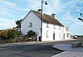
 Bow Street, Donaghadee - geograph.org.uk - 1445719.jpg 640 × 480; 70 KB
-
 Brennans, Loughinisland - geograph.org.uk - 1444406.jpg 640 × 480; 49 KB
-

-
-
 Bus stop, Dromore - geograph.org.uk - 1431063.jpg 640 × 405; 100 KB
-
 Bus, Rathfriland - geograph.org.uk - 1439504.jpg 640 × 386; 79 KB
-
 Cablebarballyhornan.jpg 604 × 453; 51 KB
-
 Canoe Trail sign, August 2009.JPG 4,272 × 2,848; 4.16 MB
-
 Carryduff gospel hall - geograph.org.uk - 1441323.jpg 640 × 476; 95 KB
-

-
 Castle Ward (01), August 2009.JPG 2,848 × 4,272; 4.26 MB
-
 Castle Ward Castle, August 2009.JPG 2,848 × 4,272; 3.69 MB
-
 Castlenavan Townland - geograph.org.uk - 1444358.jpg 640 × 480; 93 KB
-
 Cattle, Ballynaris Townland - geograph.org.uk - 1457171.jpg 640 × 480; 92 KB
-
 Church Lane, Warrenpoint - geograph.org.uk - 1438330.jpg 640 × 484; 95 KB
-

-
 Church of Ireland, Warrenpoint - geograph.org.uk - 1438312.jpg 640 × 472; 72 KB
-
 Church Street, Dromore - geograph.org.uk - 1456837.jpg 640 × 480; 87 KB
-
 Church View, Dromore - geograph.org.uk - 1456828.jpg 640 × 480; 120 KB
-
 Circle shop, August 2009.JPG 4,272 × 2,848; 3.82 MB
-
 Clipper Panorama.jpg 640 × 335; 36 KB
-
 Clock, Former Down Shoes Factory - geograph.org.uk - 1446635.jpg 640 × 480; 66 KB
-
 Clock, Hilltown - geograph.org.uk - 1438575.jpg 640 × 442; 69 KB
-
 Clough Castle - geograph.org.uk - 1551617.jpg 640 × 362; 34 KB
-
 Comber Street, Saintfield - geograph.org.uk - 1441096.jpg 640 × 403; 72 KB
-

-
 Corry Woods Park, Annsborough - geograph.org.uk - 1467317.jpg 640 × 480; 42 KB
-

-

-

-
 County Down (27), August 2009.JPG 4,272 × 2,848; 3.34 MB
-
 Denvirs Hotel (03), August 2009.JPG 4,272 × 2,848; 3.21 MB
-
 Derelict House, Kilntown Road, Dromore - geograph.org.uk - 1457231.jpg 640 × 480; 164 KB
-
 Donard Forest from the Harbour - geograph.org.uk - 1474092.jpg 640 × 480; 61 KB
-
 Donard Hotel (01), August 2009.JPG 2,848 × 4,272; 5.48 MB
-
 Doomed tree, Drumkeeragh forest - geograph.org.uk - 1463631.jpg 640 × 428; 91 KB
-
 Down Arts Centre (05), August 2009.JPG 4,272 × 2,848; 5.14 MB
-
 Down Cathedral (03), August 2009.JPG 4,272 × 2,848; 5.23 MB
-
 Down Cathedral (04), August 2009.JPG 2,848 × 4,272; 5.15 MB
-
 Down Cathedral (05), August 2009.JPG 4,272 × 2,848; 3.37 MB
-
 Down Cathedral (06), August 2009.JPG 2,848 × 4,272; 4.43 MB
-
 Down Cathedral (07), August 2009.JPG 4,272 × 2,848; 4.22 MB
-
 Down Cathedral (08), August 2009.JPG 4,272 × 2,848; 5.15 MB
-
 Down Cathedral (09), August 2009.JPG 2,848 × 4,272; 3.96 MB
-
 Down Cathedral (11), August 2009.JPG 2,848 × 4,272; 5.15 MB
-
 Down Cathedral (12), August 2009.JPG 2,848 × 4,272; 4.72 MB
-
 Down Cathedral (13), August 2009.JPG 2,848 × 4,272; 5.45 MB
-
 Down Cathedral (14), August 2009.JPG 2,848 × 4,272; 3.45 MB
-
 Down Cathedral (15), August 2009.JPG 2,848 × 4,272; 4.25 MB
-
 Down Cathedral (17), August 2009.JPG 2,848 × 4,272; 4.05 MB
-
 Down Cathedral (19), August 2009.JPG 4,272 × 2,848; 2.73 MB
-
 Down County Museum (01), August 2009.JPG 2,848 × 4,272; 4.49 MB
-
 Down County Museum (04), August 2009.JPG 4,272 × 2,848; 3.46 MB
-
 Down County Museum (05), August 2009.JPG 4,272 × 2,848; 2.79 MB
-
 Down County Museum (07), August 2009.JPG 4,272 × 2,848; 3.65 MB
-
 Down County Museum (08), August 2009.JPG 4,272 × 2,848; 3.29 MB
-
 Down County Museum (09), August 2009.JPG 2,848 × 4,272; 6.76 MB
-
 Down County Museum (10), August 2009.JPG 2,848 × 4,272; 4.14 MB
-
 Down High School (02), August 2009.JPG 4,272 × 2,848; 3.95 MB
-
 Down High School (03), August 2009.JPG 4,272 × 2,848; 4.39 MB
-
 Down Recorder, August 2009.JPG 4,272 × 2,848; 4.81 MB
-
 Downpatrick Courthouse (01), August 2009.JPG 2,848 × 4,272; 5.93 MB
-
 Downpatrick Courthouse (02), August 2009.JPG 4,272 × 2,848; 3.72 MB
-
 Downpatrick Courthouse (04), August 2009.JPG 4,272 × 2,848; 3.53 MB
-
 Downpatrick Courthouse (05), August 2009.JPG 2,848 × 4,272; 6.23 MB
-
 Downpatrick doors (01), August 2009.JPG 2,848 × 4,272; 3.92 MB
-
 Downpatrick doors (02), August 2009.JPG 2,848 × 4,272; 5.92 MB
-
 Downpatrick doors (03), August 2009.JPG 2,848 × 4,272; 3.98 MB
-
 Downpatrick doors (04), August 2009.JPG 2,848 × 4,272; 5.35 MB
-
 Downpatrick doors (05), August 2009.JPG 4,272 × 2,848; 3.35 MB
-
 Downpatrick doors (06), August 2009.JPG 2,848 × 4,272; 4.7 MB
-
 Downpatrick Flags (01), August 2009.JPG 4,272 × 2,848; 2.91 MB
-
 Downpatrick Flags (02), August 2009.JPG 4,272 × 2,848; 3.13 MB
-
 Downpatrick Graffiti, August 2009.JPG 2,848 × 4,272; 6.57 MB
-
 Downpatrick mailbox, August 2009.JPG 2,848 × 4,272; 3.66 MB
-
 Downpatrick signs (01), August 2009.JPG 2,848 × 4,272; 4.81 MB
-
 Downpatrick signs (02), August 2009.JPG 2,848 × 4,272; 3.52 MB
-
 Downpatrick signs (06), August 2009.JPG 2,848 × 4,272; 5.29 MB
-
 Downpatrick signs (07), August 2009.JPG 2,848 × 4,272; 4.08 MB
-
 Downpatrick signs (10), August 2009.JPG 2,848 × 4,272; 2.63 MB
-
 Drumlin country (29) - geograph.org.uk - 1462700.jpg 640 × 368; 81 KB
-
 Drumsnade Townland - geograph.org.uk - 1444296.jpg 640 × 480; 77 KB
-
 Drystone wall near Dromara - geograph.org.uk - 1463573.jpg 623 × 382; 102 KB
-
 Drystone walls near Dromara - geograph.org.uk - 1463549.jpg 640 × 376; 91 KB
-
 Edenderry gospel hall near Belfast - geograph.org.uk - 1452068.jpg 640 × 413; 88 KB
-
 Fungus, Drumkeeragh forest (7) - geograph.org.uk - 1463885.jpg 538 × 364; 106 KB
-
 Fungus, Drumkeeragh forest (8) - geograph.org.uk - 1463909.jpg 572 × 369; 108 KB
-
 Fungus, Drumkeeragh forest (9) - geograph.org.uk - 1463941.jpg 640 × 526; 104 KB
-
-

-

-
 Kilntown Road, Ballynaris - geograph.org.uk - 1457211.jpg 640 × 480; 124 KB
-
 Kilntown Road, Ballynaris - geograph.org.uk - 1457224.jpg 640 × 480; 135 KB
-
 Listullycurran Orange Hall - geograph.org.uk - 1451014.jpg 640 × 480; 53 KB
-
 Listullycurran Railway Bridge - geograph.org.uk - 1451094.jpg 640 × 480; 102 KB
-
 Listullycurran Road, Dromore - geograph.org.uk - 1451064.jpg 640 × 480; 65 KB
-

-
 McAnulty's, Warrenpoint - geograph.org.uk - 1438348.jpg 640 × 412; 69 KB
-
 Meadow Lane, Ballynaris - geograph.org.uk - 1457331.jpg 640 × 480; 131 KB
-
 Modern house south of Chapeltown - geograph.org.uk - 1532138.jpg 640 × 330; 36 KB
-
 Moira - the main street - geograph.org.uk - 1432404.jpg 640 × 387; 91 KB
-
 Mussel dredgers, Warrenpoint - geograph.org.uk - 1438210.jpg 640 × 429; 101 KB
-

-
 New Street, Donaghadee - geograph.org.uk - 1445724.jpg 640 × 480; 76 KB
-

-
 Old billets belonging to Ringawaddy - geograph.org.uk - 1532424.jpg 640 × 480; 46 KB
-
 Old railway bridge near Crossgar - geograph.org.uk - 1441150.jpg 640 × 377; 93 KB
-
 Old Railway Line at Listullycurran - geograph.org.uk - 1451052.jpg 640 × 480; 117 KB
-
 Overgrown Bridge at Listullycurran - geograph.org.uk - 1451088.jpg 640 × 480; 130 KB
-

-
 Path, Drumkeeragh forest - geograph.org.uk - 1463858.jpg 623 × 383; 96 KB
-
 Picnic Table, Shore Street - geograph.org.uk - 1445710.jpg 640 × 480; 51 KB
-
 Portaferry (01), August 2009.JPG 4,272 × 2,848; 4.08 MB
-
 Portaferry (02), August 2009.JPG 4,272 × 2,848; 3.41 MB
-
 Remains of Railway Bridge, Ballyrenan - geograph.org.uk - 1467622.jpg 640 × 480; 112 KB
-
 School Road, Ballymartin - geograph.org.uk - 1465856.jpg 640 × 373; 28 KB
-
 Sign, Annaghanoon - geograph.org.uk - 1453108.jpg 640 × 480; 128 KB
-
 Sign, Meadow Lane, Ballynaris - geograph.org.uk - 1457338.jpg 640 × 480; 95 KB
-
 Silage Tanks, Ballynaris - geograph.org.uk - 1457267.jpg 640 × 480; 135 KB
-
-
 St Patrick's Well, Ardtole - geograph.org.uk - 1535138.jpg 640 × 389; 33 KB
-

-
 Stile, County Down (01).JPG 2,848 × 4,272; 6.16 MB
-
 Stile, County Down (02).JPG 2,848 × 4,272; 7.26 MB
-
 Strangford (25), August 2009.JPG 4,272 × 2,848; 3.2 MB
-
 Strangford (29), August 2009.JPG 4,272 × 2,848; 3.66 MB
-
 Strangford (37), August 2009.JPG 4,272 × 2,848; 3.95 MB
-
 Strangford Lough (02), August 2009.JPG 4,272 × 2,848; 5.03 MB
-
 Tannaghmore Road near Loughinisland - geograph.org.uk - 1444335.jpg 640 × 480; 116 KB
-
 Tannaghmore Road, Ardtanagh - geograph.org.uk - 1444325.jpg 640 × 480; 116 KB
-
 Telecommunications Masts, Ballynaris - geograph.org.uk - 1457343.jpg 640 × 480; 70 KB
-

-
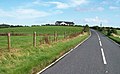
 The A2 Coney Island to Killough road - geograph.org.uk - 1639275.jpg 640 × 480; 70 KB


,_August_2009.JPG)
,_August_2009.JPG)
,_August_2009.JPG)
,_August_2009.JPG)
,_August_2009.JPG)
,_August_2009.JPG)
,_August_2009.JPG)
,_August_2009.JPG)
,_August_2009.JPG)
,_August_2009.JPG)
,_August_2009.JPG)
,_August_2009.JPG)
,_August_2009.JPG)
,_August_2009.JPG)
,_August_2009.JPG)
,_August_2009.JPG)
,_August_2009.JPG)
,_August_2009.JPG)
,_August_2009.JPG)
,_August_2009.JPG)
,_August_2009.JPG)
,_August_2009.JPG)
,_August_2009.JPG)
,_August_2009.JPG)
,_August_2009.JPG)
,_August_2009.JPG)
.JPG)
.JPG)
.JPG)
.JPG)
.JPG)
.JPG)
.JPG)


.jpg)


,_August_2009.JPG)


,_Drumaness_-_geograph.org.uk_-_1444286.jpg)


_at_Coney_Island_-_geograph.org.uk_-_1534964.jpg)


,_August_2009.JPG)
,_August_2009.JPG)


,_August_2009.JPG)

,_August_2009.JPG)
,_August_2009.JPG)
,_August_2009.JPG)
,_August_2009.JPG)
,_August_2009.JPG)
,_August_2009.JPG)
,_August_2009.JPG)
,_August_2009.JPG)
,_August_2009.JPG)
,_August_2009.JPG)
,_August_2009.JPG)
,_August_2009.JPG)
,_August_2009.JPG)
,_August_2009.JPG)
,_August_2009.JPG)
,_August_2009.JPG)
,_August_2009.JPG)
,_August_2009.JPG)
,_August_2009.JPG)
,_August_2009.JPG)
,_August_2009.JPG)
,_August_2009.JPG)
,_August_2009.JPG)
,_August_2009.JPG)

,_August_2009.JPG)
,_August_2009.JPG)
,_August_2009.JPG)
,_August_2009.JPG)
,_August_2009.JPG)
,_August_2009.JPG)
,_August_2009.JPG)
,_August_2009.JPG)
,_August_2009.JPG)
,_August_2009.JPG)
,_August_2009.JPG)
,_August_2009.JPG)


,_August_2009.JPG)
,_August_2009.JPG)
,_August_2009.JPG)
,_August_2009.JPG)
,_August_2009.JPG)
_-_geograph.org.uk_-_1462700.jpg)


_-_geograph.org.uk_-_1463885.jpg)
_-_geograph.org.uk_-_1463909.jpg)
_-_geograph.org.uk_-_1463941.jpg)


,_August_2009.JPG)
,_August_2009.JPG)


.JPG)
.JPG)
,_August_2009.JPG)
,_August_2009.JPG)
,_August_2009.JPG)
,_August_2009.JPG)


