Category:Avenues in Ruhland
Jump to navigation
Jump to search
| Object location | | View all coordinates using: OpenStreetMap |
|---|
Alleen in Ruhland
[edit]Media in category "Avenues in Ruhland"
The following 83 files are in this category, out of 83 total.
-
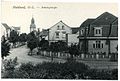 20922-Ruhland-1918-Bahnhofstraße-Brück & Sohn Kunstverlag.jpg 1,481 × 1,000; 570 KB
-
 Geschwister-Scholl-Weg Ruhland, Birkenweg westwärts 2.jpg 1,704 × 2,272; 739 KB
-
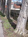
 Ruhland, Alte Hermsdorfer Str., Westsüdwestansicht von der Kreuzung Kamenzer Str.jpg 2,272 × 1,704; 427 KB
-

-
 Ruhland, Am Bach (Straße) nordwärts bei Hausnr. 1, Frühling, 01.jpg 2,736 × 3,316; 1.42 MB
-
 Ruhland, Am Bach (Straße) nordwärts on Gutshof (Straße), Frühling, 02.jpg 2,736 × 3,648; 4.9 MB
-

-
 Ruhland, Am Bach (Straße) nordwärts von Gutshof (Straße), Frühling, 01.jpg 3,648 × 2,736; 4.36 MB
-
 Ruhland, Am Bach (Straße) nordwärts zwischen Hausnr. 1–2, Frühling, 01.jpg 3,194 × 2,647; 1.11 MB
-
 Ruhland, Am Bach (Straße) nordwärts zwischen Hausnr. 1–2, Frühling, 02.jpg 3,648 × 2,736; 3.43 MB
-
 Ruhland, Am Bach (Straße) nordwärts zwischen Hausnr. 1–2, Frühling, 03.jpg 3,648 × 2,736; 3.85 MB
-
 Ruhland, Am Bach (Straße), Blick von Nr. 2 nach Süden.jpg 1,704 × 2,272; 679 KB
-
 Ruhland, Am Bach bei Hausnr. 2, Schwarzwasser, Nordansicht, Winter.jpg 2,272 × 1,704; 602 KB
-
 Ruhland, Am Bach, bei Hausnr. 2 südwärts, Winter.jpg 2,272 × 1,704; 515 KB
-
 Ruhland, Am Dreistein, Nordostende 01.jpg 1,200 × 1,068; 201 KB
-
 Ruhland, Am Dreistein, Nordostende 02.jpg 1,600 × 1,200; 999 KB
-
 Ruhland, Am Dreistein, Nordwestende 01.jpg 1,462 × 1,200; 317 KB
-
 Ruhland, Am Dreistein, Nordwestende 02.jpg 1,447 × 985; 210 KB
-
 Ruhland, Am Lug nordwärts bei Hausnr. 1, Sommer, 01.jpg 2,736 × 3,648; 3.91 MB
-
 Ruhland, Am Wiesengrund nordwärts bei Am Lug 3, Sommer, 01.jpg 3,648 × 2,736; 3.57 MB
-
 Ruhland, Am Wiesengrund nordwärts bei Hausnr. 11, Spätfrühling, 01.jpg 3,648 × 2,736; 2.28 MB
-
 Ruhland, Am Wiesengrund nordwärts bei Hausnr. 2, Sommer, 01.jpg 3,648 × 2,736; 7.12 MB
-
 Ruhland, Am Wiesengrund südwärts bei Hausnr. 10, Spätfrühling, 01.jpg 3,648 × 2,736; 4.88 MB
-
 Ruhland, Badeanstalt (Straße) bei der dreistämmigen Eiche, Blick ostwärts.jpg 2,272 × 1,704; 742 KB
-
 Ruhland, Badeanstalt (Straße) bei Nr. 7, Blick westwärts.jpg 2,272 × 1,704; 429 KB
-
 Ruhland, Bahnhof (Straße), Nordnordostansicht; Lindenreihe und Baustelle.jpg 2,272 × 1,704; 542 KB
-
 Ruhland, Bahnhofstr. ostsüdostwärts bei Hausnr. 18, 01.jpg 2,272 × 1,704; 450 KB
-
 Ruhland, Bahnhofstr. ostwärts bei Ernst-Thälmann-Str. 1, Winter.jpg 2,272 × 1,704; 404 KB
-
 Ruhland, Berliner Str. stadtauswärts, Willkommensschild, 01.jpg 4,000 × 3,000; 4.64 MB
-
 Ruhland, Berliner Str. stadteinwärts, Willkommensschild, 01.jpg 3,000 × 4,000; 1.45 MB
-
 Ruhland, Berliner Str. stadteinwärts, Willkommensschild, 02.jpg 4,000 × 3,000; 3.8 MB
-
 Ruhland, Bernsdorfer Str. ostwärts bei Hausnr. 3, Vorwinter, 01.jpg 2,736 × 3,648; 6.01 MB
-
 Ruhland, Dresdener Str. bei Hausnr. 31, Platanenallee, Vorfrühling, 01.jpg 2,736 × 3,648; 2.03 MB
-

-
 Ruhland, Dresdener Str., (Platanen-Allee) 01.jpg 1,704 × 2,272; 671 KB
-
 Ruhland, Dresdener Str., (Platanen-Allee) 02.jpg 1,704 × 2,272; 679 KB
-
 Ruhland, Dresdener Str., Linde beim sowjetischen Ehrenmal, Anfahrschaden Januar 2022, 01.jpg 3,000 × 4,000; 6.39 MB
-
 Ruhland, Dresdener Str., Linde beim sowjetischen Ehrenmal, Anfahrschaden Januar 2022, 02.jpg 3,000 × 4,000; 5.38 MB
-
 Ruhland, Dresdener Str., Linde beim sowjetischen Ehrenmal, Anfahrschaden Januar 2022, 03.jpg 3,000 × 4,000; 6.44 MB
-
 Ruhland, Dresdener Str., von der Bahnunterführung.jpg 2,272 × 1,704; 716 KB
-

-

-
 Ruhland, Elsterbogen, Silberahorn am FRISTO-Parkplatz.jpg 2,272 × 1,704; 738 KB
-
 Ruhland, Friedhof, Hauptweg, Blick nach Süden.jpg 1,704 × 2,272; 745 KB
-
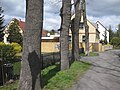
 Ruhland, Glashüttenstr., Blick von Kreuzung Karl-Marx-Str. nach Ostsüdost 02.jpg 1,200 × 1,600; 1.32 MB
-
 Ruhland, Glashüttenstr., Blick von Kreuzung Karl-Marx-Str. nach Ostsüdost.jpg 1,600 × 1,200; 1.45 MB
-
 Ruhland, Goethestr., Lindenreihe 02.jpg 1,704 × 2,272; 513 KB
-
 Ruhland, Hartwigstr. nordwärts von Kreuzung Glashüttenstr., Vorfrühling, 01.jpg 2,736 × 3,648; 2.04 MB
-
 Ruhland, Hartwigstr., Blick von Glashüttenstr.nach Norden 02.jpg 1,600 × 1,200; 1.36 MB
-
 Ruhland, Heinrich-Heine-Str., Eichendoppelreihe auf dem Sportplatz, Südansicht 01.jpg 1,600 × 1,200; 1.37 MB
-
 Ruhland, Heinrich-Heine-Str., Eichendoppelreihe auf dem Sportplatz, Südansicht 02.jpg 1,200 × 1,600; 1.46 MB
-
 Ruhland, Heinrich-Heine-Str., Eichendoppelreihe auf dem Sportplatz, Südansicht 03.jpg 1,600 × 1,200; 1.33 MB
-
 Ruhland, Heinrich-Heine-Str., Eichendoppelreihe auf dem Sportplatz, Südansicht 04.jpg 1,600 × 1,200; 1.36 MB
-
 Ruhland, Kamenzer Str. stadtauswärts, Linden-Doppelreihe, Winter.jpg 2,272 × 1,704; 424 KB
-
 Ruhland, Kamenzer Str., am Ortsausgang.jpg 1,704 × 2,272; 479 KB
-
 Ruhland, Kamenzer Straße ostsüdostwärts beim alten Grenzstein, Sommer, 01.jpg 4,000 × 3,000; 6.99 MB
-
 Ruhland, Kamenzer Straße westnordwestwärts beim alten Grenzstein, Sommer, 01.jpg 3,000 × 4,000; 6.13 MB
-
 Ruhland, Karl-Marx-Str., Blick nach Nordnordost zur Hartwigstr.jpg 1,600 × 1,200; 1.38 MB
-
 Ruhland, Marienstr. ostwärts bei Wallstr. 22, geschnittener Spitzahorn, Winter, 01.jpg 3,000 × 4,000; 5.47 MB
-
 Ruhland, Marienstr. ostwärts bei Wallstr. 22, geschnittener Spitzahorn, Winter, 02.jpg 4,000 × 3,000; 5.37 MB
-
 Ruhland, Marienstr. westwärts bei Hausnr. 10a, Spätsommer, 01.jpg 2,272 × 1,704; 520 KB
-
 Ruhland, Marienstr. westwärts bei Wallstr. 22, geschnittene Robinie, Winter, 01.jpg 3,000 × 4,000; 4.17 MB
-
 Ruhland, Marienstr. westwärts bei Wallstr. 23, geschnittene Robinie, Winter, 01.jpg 3,000 × 4,000; 3.77 MB
-
 Ruhland, Ortrander Str. bei Hausnr. 12. Westansicht, Herbst.jpg 2,272 × 1,704; 791 KB
-
 Ruhland, Ortrander Str. westwärts vor Hausnr. 5, mit Schild Karneval 2020.jpg 3,648 × 2,736; 5.67 MB
-
-
 Ruhland, Ortrander Str., Roteichen-Allee 01.jpg 1,704 × 2,272; 817 KB
-
 Ruhland, Ortrander Str., Roteichen-Allee 02.jpg 1,704 × 2,272; 622 KB
-
 Ruhland, Ortrander Str..6a, Häuserfront Blick nach Westen, Winter.jpg 1,704 × 2,272; 738 KB
-
 Ruhland, Ortrander Str..6a, Straße Blick nach Westen, Winter.jpg 1,704 × 2,272; 800 KB
-
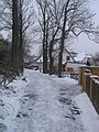
 Ruhland, Pflaumenweg, Blick ostwärts, Winter.jpg 2,272 × 1,704; 569 KB
-
 Ruhland, Querstraße, vom Knick bei Nr. 2 westnordwestwärts.jpg 2,272 × 1,704; 572 KB
-
 Ruhland, Stadtmühle (Straße), Blick von der Stahlbrücke nach Nordnordwest, Winter 01.jpg 1,704 × 2,272; 743 KB
-
 Ruhland, Stadtmühle (Straße), Blick von der Stahlbrücke nach Nordnordwest, Winter 02.jpg 1,704 × 2,272; 851 KB
-
 Ruhland, Stadtmühle (Straße), Blick von der Stahlbrücke nach Nordnordwest, Winter 03.jpg 1,704 × 2,272; 792 KB
-
 Ruhland, Stadtmühle (Straße), Blick von der Stahlbrücke nach Nordnordwest, Winter 04.jpg 2,272 × 1,704; 715 KB
-
 Ruhland, Theodor-Schmidt-Str. bei Nr. 50 ostnordostwärts.jpg 2,272 × 1,704; 588 KB
-
 Ruhland, Theodor-Schmidt-Str. Ecke Neulandweg, Linden-Doppelreihe, Winter.jpg 2,272 × 1,704; 616 KB
-
 Ruhland, Waldesruh, Feld nördlich Hausnr. 2, Grenzstein an der K 6603, Frühsommer, 01.jpg 5,328 × 4,000; 9.52 MB
-
 Ruhland,Lindendoppelreihe auf dem Elsterdamm am Zollhaus, Winter 01.jpg 2,272 × 1,704; 957 KB
-
 Ruhland,Lindendoppelreihe auf dem Elsterdamm am Zollhaus, Winter 02.jpg 1,704 × 2,272; 1,012 KB
-
 Ruhland,Lindendoppelreihe auf dem Elsterdamm zwischen Bahnlinie und Zollhaus, Winter 01.jpg 2,272 × 1,704; 1,001 KB
-
 Ruhland,Lindendoppelreihe auf dem Elsterdamm zwischen Bahnlinie und Zollhaus, Winter 02.jpg 1,704 × 2,272; 1,019 KB


_nordnordostw%C3%A4rts_hinter_Wallstr._2,_Baumreihe_Gew%C3%B6hnliche_Esche_(Fraxinus_excelsior),_Fr%C3%BChling,_01.jpg)
_nordw%C3%A4rts_bei_Hausnr._1,_Fr%C3%BChling,_01.jpg)
_nordw%C3%A4rts_on_Gutshof_(Stra%C3%9Fe),_Fr%C3%BChling,_02.jpg)
_nordw%C3%A4rts_von_der_Schwarzwasser-Br%C3%BCcke_Gutshof%E2%80%93-Lindenplatz,_Fr%C3%BChling,_01.jpg)
_nordw%C3%A4rts_von_Gutshof_(Stra%C3%9Fe),_Fr%C3%BChling,_01.jpg)
_nordw%C3%A4rts_zwischen_Hausnr._1%E2%80%932,_Fr%C3%BChling,_01.jpg)
_nordw%C3%A4rts_zwischen_Hausnr._1%E2%80%932,_Fr%C3%BChling,_02.jpg)
_nordw%C3%A4rts_zwischen_Hausnr._1%E2%80%932,_Fr%C3%BChling,_03.jpg)
,_Blick_von_Nr._2_nach_S%C3%BCden.jpg)


_bei_der_dreist%C3%A4mmigen_Eiche,_Blick_ostw%C3%A4rts.jpg)
_bei_Nr._7,_Blick_westw%C3%A4rts.jpg)
,_Nordnordostansicht;_Lindenreihe_und_Baustelle.jpg)


_01.jpg)
_02.jpg)


,_Blick_von_der_Stahlbr%C3%BCcke_nach_Nordnordwest,_Winter_01.jpg)
,_Blick_von_der_Stahlbr%C3%BCcke_nach_Nordnordwest,_Winter_02.jpg)
,_Blick_von_der_Stahlbr%C3%BCcke_nach_Nordnordwest,_Winter_03.jpg)
,_Blick_von_der_Stahlbr%C3%BCcke_nach_Nordnordwest,_Winter_04.jpg)


