Category:Aviation in the United States
Jump to navigation
Jump to search
Countries of the Americas: Antigua and Barbuda · Argentina · The Bahamas · Barbados · Belize · Bolivia · Brazil · Canada · Chile · Colombia · Costa Rica · Cuba · Dominica · Dominican Republic · Ecuador · El Salvador · Grenada · Guatemala · Guyana · Haiti · Honduras · Jamaica · Mexico · Nicaragua · Panama · Paraguay · Peru · Saint Kitts and Nevis · Saint Lucia · Saint Vincent and the Grenadines · Suriname · Trinidad and Tobago · United States of America · Uruguay · Venezuela
Other areas: Anguilla · Aruba · Bermuda · British Virgin Islands · Cayman Islands · Curaçao · Dutch Caribbean · Falkland Islands · French Guiana · Greenland · Guadeloupe · Martinique · Puerto Rico · Saint Barthélemy · Sint Maarten · Turks and Caicos Islands · United States Virgin Islands
Other areas: Anguilla · Aruba · Bermuda · British Virgin Islands · Cayman Islands · Curaçao · Dutch Caribbean · Falkland Islands · French Guiana · Greenland · Guadeloupe · Martinique · Puerto Rico · Saint Barthélemy · Sint Maarten · Turks and Caicos Islands · United States Virgin Islands
Aviation conducted by, located within, or otherwise associated with the United States of America
Español: Aviación en los Estados Unidos
Wikimedia category | |||||
| Upload media | |||||
| Instance of | |||||
|---|---|---|---|---|---|
| Category combines topics | |||||
 | |||||
Subcategories
This category has the following 47 subcategories, out of 47 total.
+
A
B
C
- Contrails in the United States (44 F)
D
- Mortimer Delano (1 F)
F
G
H
M
O
P
S
T
- Triumph Group (5 F)
W
- Willauer Box (15 F)
- Wing Scouts (2 F)
Media in category "Aviation in the United States"
The following 36 files are in this category, out of 36 total.
-

-
20160802 The White House OSTP Workshop on Drone and the Future of Aviation HD.webm 59 min 31 s, 1,280 × 720; 500.41 MB
-
 Air line distances map United States - btv1b531895340.jpg 12,088 × 8,642; 12.18 MB
-
 Air transport demand distribution in the USA.jpg 3,066 × 1,791; 261 KB
-
 AirlineDeregulationAct.png 589 × 400; 695 KB
-
 Align Aerospace Logo 1.jpg 800 × 519; 75 KB
-
 Aviation Survival Technician rating badge.png 122 × 76; 16 KB
-
 Blackcat-thirteen-lrg.png 75 × 75; 4 KB
-
 Boeing 727 Trijet (1968).jpg 2,200 × 1,401; 399 KB
-
 Congressional Research Service Report R42781 - Federal Civil Aviation Programs - In Brief.pdf 1,275 × 1,650, 14 pages; 1.04 MB
-
 EAS chart.png 764 × 353; 54 KB
-
 Frances E. Lee.jpg 546 × 1,026; 125 KB
-
 EXPANSION OF AIRPORT CAPACITY IN THE CHICAGO, ILLINOIS AREA (IA gov.gpo.fdsys.CHRG-107shrg89638).pdf 1,275 × 1,650, 87 pages; 1.04 MB
-
 FUTURE OF THE AIRLINE INDUSTRY (IA gov.gpo.fdsys.CHRG-108shrg95697).pdf 1,275 × 1,650, 96 pages; 2.31 MB
-
 MEETING FUTURE AVIATION CAPACITY NEEDS IN SOUTHERN CALIFORNIA (IA gov.gpo.fdsys.CHRG-109hhrg28273).pdf 1,275 × 1,650, 117 pages; 3.8 MB
-
 AVIATION CAPACITY AND CONGESTION CHALLENGES (IA gov.gpo.fdsys.CHRG-109shrg27295).pdf 1,275 × 1,650, 64 pages; 2.82 MB
-
 IMPROVING AIR SERVICES TO SMALL AND RURAL COMMUNITIES (IA gov.gpo.fdsys.CHRG-110shrg75608).pdf 1,275 × 1,650, 52 pages; 1.18 MB
-
 CONGESTION AND DELAYS- THE IMPACT ON PASSENGERS AND POSSIBLE SOLUTIONS (IA gov.gpo.fdsys.CHRG-110shrg75971).pdf 1,275 × 1,650, 96 pages; 1,020 KB
-
 OUTLOOK FOR SUMMER AIR TRAVEL- ADDRESSING CONGESTION AND DELAY (IA gov.gpo.fdsys.CHRG-110shrg80048).pdf 1,275 × 1,650, 71 pages; 796 KB
-
 HITRON Patch Logo Medium (MH65C 06-2011).png 411 × 577; 148 KB
-
 Image as alt and caption vector.png 10 × 10; 936 bytes
-
 Jwise airmail.jpg 431 × 321; 116 KB
-
 L.H. Thomson Logo.jpg 186 × 50; 5 KB
-
 LosAngelesAFB-31may1994.jpg 980 × 626; 193 KB
-
 NAI2O Logo.png 526 × 526; 573 KB
-
 NSA museum.jpg 3,000 × 2,376; 4.77 MB
-
 Pratt & Whitney Rocketdyne Division.JPG 3,052 × 2,028; 1.29 MB
-
 Rovirosa+Limb.jpg 1,280 × 720; 220 KB
-
 SAI takes to the skies (4690099).jpeg 2,920 × 5,184; 3.59 MB
-
 SAI takes to the skies (4690102).jpeg 5,184 × 2,920; 4.09 MB
-
 Six Student Naval Aviator training pipelines.jpg 1,379 × 653; 312 KB
-
 Unisonindustrieslogo.png 3,264 × 1,004; 227 KB
-
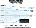 US Navy helo master plan.gif 528 × 409; 12 KB
-
 US Navy Helo Master Plan.jpg 800 × 598; 64 KB
-
 US pilots certificate back.jpg 640 × 419; 202 KB
-
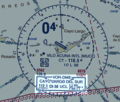 VFR Chart Cayo Largo Del Sur VOR-DME.png 789 × 668; 300 KB


.jpg)


.jpeg)
.jpeg)


.png)