Category:Awaji Island
Bước tới điều hướng
Bước tới tìm kiếm
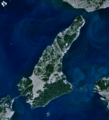
Hòn đảo thuộc tỉnh Hyōgo, Nhật Bản  Satelitní fotografie z prosince 2010  | |||||
| Tải lên phương tiện | |||||
| Là một | |||||
|---|---|---|---|---|---|
| Vị trí | biển nội địa Seto, Tỉnh Ōsaka, Nhật Bản | ||||
| Tọa lạc trong hoặc bên cạnh thủy vực | |||||
| Trung tâm hành chính | |||||
| Chiều rộng |
| ||||
| Chiều dài |
| ||||
| Điểm cao nhất |
| ||||
| Dân số |
| ||||
| Diện tích |
| ||||
 | |||||

العربية: أواجي (جزيرة)
Dansk: Avaji
Esperanto: Aŭaĝi
日本語: 淡路島
한국어: 아와지 섬
Lietuvių: Avadžis
Русский: Авадзи (остров)
ไทย: เกาะอะวะจิ
Українська: Авадзі
中文:淡路島
Thể loại con
Thể loại này có 12 thể loại con sau, trên tổng số 12 thể loại con.
A
- Awaji Onions (22 F)
- Awaji Roof Tiles (7 F)
C
M
- Maps of Awaji Island (10 F)
S
V
Y
- Yuzuruha Mountains (9 F)
Tập tin trong thể loại “Awaji Island”
48 tập tin sau nằm trong thể loại này, trong tổng số 48 tập tin.
-
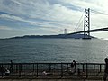
 Akashi Strait Bridge and Awajishima Island 20190202-1.jpg 3.989×2.992; 3,67 MB
-
 Akashi Strait Bridge and Awajishima Island 20190202-2.jpg 3.981×2.986; 3,42 MB
-
 Akashi Strait Bridge and Awajishima Island 20190202-3.jpg 3.981×2.986; 3,51 MB
-
 Apollon AAAL.jpg 2.400×1.636; 812 kB
-
 Awaji chicken Bajiru Sand.jpg 3.264×2.448; 3,21 MB
-
 Awaji Island milk.JPG 1.536×2.304; 1,49 MB
-
 Awaji island.jpg 639×639; 140 kB
-
 Awaji Onion.JPG 3.264×2.448; 3,56 MB
-
 Awaji, Japan.jpg 2.048×1.280; 948 kB
-
 Awaji-island 1.png 903×995; 372 kB
-
 Awajishima Island and Akashi Strait Bridge 1.JPG 3.227×2.421; 2,74 MB
-
 Awajishima Island and Akashi Strait Bridge 3.JPG 3.208×2.406; 1,7 MB
-
 Awajishima Island and Akashi Strait Bridge 5.JPG 3.228×2.421; 2,68 MB
-
 Awajishima Island and Akashi Strait Bridge 9.JPG 3.264×2.448; 2,45 MB
-
 Customers to gather Bussan facility during Golden Week.JPG 2.304×1.728; 1,86 MB
-
 Ferrysouthern nal.jpg 3.872×2.592; 3,55 MB
-
 Fuki2 3 Nishiawajiline.jpg 3.008×2.000; 1,1 MB
-
 Fuki5 8 Nishiawajiline.jpg 2.483×1.627; 817 kB
-
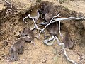 Geophagy and five Japanese monkeys.jpg 640×480; 159 kB
-
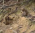 Geophagy and two Japanese monkeys.jpg 510×481; 149 kB
-
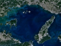 Harima-Nada 1.png 1.203×921; 755 kB
-
 Hikari2 Fukekaiun.jpg 1.600×1.061; 344 kB
-
 Infinity pool - villa-mon-temps,Awaji.jpg 2.946×1.810; 1,22 MB
-
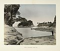
 Kusakabe Kimbei 1218 Awaji-Shima.JPG 820×643; 264 kB
-
 Narugashima 1.jpg 2.861×1.956; 2,8 MB
-
 Narugashima 2.jpg 3.488×2.616; 4,34 MB
-
 Narugashima 3.jpg 1.200×900; 637 kB
-
 Narugashima Island (9730222677).jpg 5.472×3.648; 5,75 MB
-
 Narugashima, Sumoto (16743407703).jpg 2.448×3.264; 1,14 MB
-
 Naruto Strait NASA WorldWind Outflow.jpg 1.024×658; 89 kB
-
 Nushima gyokou.jpg 1.600×1.064; 770 kB
-
 Oge Coast 20160505-2.JPG 3.145×2.359; 2,41 MB
-
 Oge Coast 20160505.JPG 3.221×2.416; 2,04 MB
-
 Oishinohana.jpg 5.058×3.372; 2,15 MB
-
 Oishiyamahorui 1.jpg 3.284×2.436; 5,59 MB
-
 Shizukiport.jpg 4.928×3.264; 6,06 MB
-
 Suzuranmaru Bantanrenrakukisen.jpg 2.400×1.624; 1,01 MB
-
 Tomoya2011-ProfileLogo.png 1.108×1.107; 455 kB
-
 Tsunaferrycenterbild.jpg 4.928×3.264; 6,58 MB
-
 Tsunaport koshienferry.jpg 4.928×3.264; 6,73 MB
-
 Typhoon Talas – The way home.jpg 1.024×680; 189 kB
-
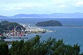
 View of Awaji-shima, Inland Sea (3110695678).jpg 760×647; 61 kB
-
 Wakatsurumaru Awajiferryboat.jpg 2.400×1.647; 1,05 MB
-
 WUL-he02 08100 0096 淡路島.pdf 4.033 × 2.683, 10 trang; 2,36 MB
-
 Yura district and Yura bay lagoon Aerial photograph.2020.jpg 5.518×7.593; 21,57 MB
-
 Yura port 1.jpg 2.687×1.771; 2,34 MB
-
 成ヶ島img357.jpg 1.280×778; 248 kB
-
 高い低い 深い浅い 厚い薄い 強い弱い 多い少ない (4812049927).jpg 1.600×1.200; 704 kB


.jpg)
.jpg)
.jpg)
.jpg)