Category:Axmouth to Lyme Regis Undercliffs
Jump to navigation
Jump to search
landslip induced landscape on the English south coast  | |||||
| Upload media | |||||
| Instance of | |||||
|---|---|---|---|---|---|
| Location |
| ||||
 | |||||
Media in category "Axmouth to Lyme Regis Undercliffs"
The following 56 files are in this category, out of 56 total.
-
 "Chimney rock" - geograph.org.uk - 278695.jpg 480 × 640; 86 KB
-
-
 Beach at Charton Bay - geograph.org.uk - 1355930.jpg 640 × 480; 106 KB
-
 Beach below Bindon Cliffs - geograph.org.uk - 1355953.jpg 640 × 480; 95 KB
-
 Beach below Haven Cliff, Seaton - geograph.org.uk - 1637557.jpg 640 × 427; 91 KB
-
 Bindon Cliffs - geograph.org.uk - 1086644.jpg 640 × 427; 102 KB
-
 Bindon Cliffs - geograph.org.uk - 47076.jpg 640 × 480; 141 KB
-
 Bindon Cliffs - geograph.org.uk - 771372.jpg 480 × 640; 106 KB
-
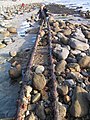
 Cement works steelwork, westward view - geograph.org.uk - 1988890.jpg 1,547 × 2,000; 1.28 MB
-
 Chalk Clff, Undercliff - geograph.org.uk - 1184327.jpg 640 × 480; 104 KB
-
 Chalk cliff - geograph.org.uk - 2009361.jpg 3,072 × 2,304; 1.2 MB
-
 Charton Bay, Humble Pt - geograph.org.uk - 697115.jpg 640 × 480; 112 KB
-
 Cliffs in the Undercliff - geograph.org.uk - 771368.jpg 640 × 480; 92 KB
-
 Dowlands Cliffs and Beach - geograph.org.uk - 1355945.jpg 640 × 480; 122 KB
-
 Former habitation on the Undercliff - geograph.org.uk - 1086665.jpg 640 × 427; 120 KB
-
 Former habitation on the Undercliff - geograph.org.uk - 1086671.jpg 427 × 640; 129 KB
-
 Former habitation on the Undercliff - geograph.org.uk - 1086693.jpg 640 × 427; 119 KB
-
 Goldencap from undercliff 06.05.JPG 2,560 × 1,920; 2.43 MB
-

-
 Humble point - geograph.org.uk - 277987.jpg 640 × 480; 151 KB
-

-
 Landslip at Culverhole Point - geograph.org.uk - 2009326.jpg 3,072 × 2,304; 1.02 MB
-
 Landslip at Haven Cliff - geograph.org.uk - 2009312.jpg 3,072 × 2,304; 1.04 MB
-
 Lias Cliff, West of Lyme Regis - geograph.org.uk - 771487.jpg 640 × 480; 115 KB
-
 Looking up at Goat Island - geograph.org.uk - 47078.jpg 640 × 400; 100 KB
-
 Lyme Regis Undercliff - geograph.org.uk - 47304.jpg 640 × 480; 172 KB
-

-
 Monmouth Beach, Lyme - geograph.org.uk - 1988808.jpg 2,000 × 1,495; 1.14 MB
-

-
 Path through Dowlands Landslip - geograph.org.uk - 47092.jpg 480 × 640; 165 KB
-
 Pinhay Cliff - geograph.org.uk - 216474.jpg 480 × 640; 312 KB
-
 Remains of the dam - geograph.org.uk - 1086677.jpg 640 × 426; 126 KB
-
 Remains of the pumping station - geograph.org.uk - 1086683.jpg 427 × 640; 108 KB
-
 Ruin dwarfed by trees - geograph.org.uk - 277998.jpg 640 × 480; 151 KB
-
 Ruins in the Undercliff - geograph.org.uk - 771360.jpg 480 × 640; 130 KB
-
 Seashore near Pinhay Bay - geograph.org.uk - 2009395.jpg 3,072 × 2,304; 1.24 MB
-
 Seven Rock Point - geograph.org.uk - 1355923.jpg 640 × 480; 85 KB
-
 Spring in the Great Chasm - geograph.org.uk - 1120318.jpg 640 × 428; 135 KB
-
 Steelwork, Monmouth Beach, Lyme - geograph.org.uk - 1988884.jpg 1,523 × 2,000; 1.26 MB
-
 The coast at Pinhay Bay - geograph.org.uk - 217266.jpg 640 × 480; 162 KB
-
 The remains of Allhallows Pumping Station - geograph.org.uk - 47099.jpg 640 × 619; 205 KB
-
 The remains of the engineers house - geograph.org.uk - 47100.jpg 640 × 480; 161 KB
-
 The sea from the Undercliff - geograph.org.uk - 1086637.jpg 640 × 427; 58 KB
-
 The Undercliff - geograph.org.uk - 1086629.jpg 640 × 427; 100 KB
-
 The Undercliff - geograph.org.uk - 1086633.jpg 427 × 640; 100 KB
-
 The Undercliff - geograph.org.uk - 1086649.jpg 427 × 640; 109 KB
-
 The Undercliff - geograph.org.uk - 1086655.jpg 640 × 427; 126 KB
-
 The Undercliff - geograph.org.uk - 1086658.jpg 427 × 640; 89 KB
-
 The Undercliff - geograph.org.uk - 1086699.jpg 427 × 640; 96 KB
-
 The undercliff above Pinhay bay - geograph.org.uk - 278004.jpg 640 × 480; 148 KB
-
 The Undercliff Path near Pinhay - geograph.org.uk - 334331.jpg 480 × 640; 157 KB
-
 Undercliff - geograph.org.uk - 278005.jpg 640 × 480; 158 KB
-
 Wave Cut Platform, west of Lyme Regis - geograph.org.uk - 771482.jpg 640 × 480; 91 KB
-
 Whitlands Cliff - geograph.org.uk - 47302.jpg 640 × 480; 152 KB
-
 Whitlands Cliff - geograph.org.uk - 771366.jpg 640 × 480; 115 KB
-
 Woodlands in the Undercliff - geograph.org.uk - 69634.jpg 480 × 640; 171 KB


