Category:Ay River (inflow of Ufa)
Jump to navigation
Jump to search
| Parent categories were assigned using the {{Category Russia}} template. In general, new categories should not be added by hand. The tree of categories is maintained automatically, any human edits may be overridden by bot. |
| This is the category of the protected area of Russia number 7410258 | |
| This template and pages using it are maintained by the Russian WLE team. Please read the guidelines before making any changes that can affect the database! |
river in Bashkiria and Chelyabinsk Oblast, Russia  | |||||
| Upload media | |||||
| Instance of | |||||
|---|---|---|---|---|---|
| Location | |||||
| Length |
| ||||
| Elevation above sea level |
| ||||
| Mouth of the watercourse | |||||
| Drainage basin | |||||
| Tributary |
| ||||
| Different from | |||||
 | |||||
Subcategories
This category has the following 4 subcategories, out of 4 total.
- Ay River, Kiginsky District (30 F)
- Ay River, Salavatsky District (14 F)
B
- Bol'shoy Ik (inflow of Ay) (3 F)
Media in category "Ay River (inflow of Ufa)"
The following 55 files are in this category, out of 55 total.
-
 "Айские" притесы.jpg 5,156 × 3,408; 10.55 MB
-
 Bridge on the Ay River.jpg 3,648 × 2,736; 5.77 MB
-
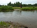
 Ford across Ai river.jpg 3,968 × 2,232; 5.15 MB
-
 Ford the across Ay river.jpg 3,648 × 2,736; 5.7 MB
-
 Ай в "Притесах".jpg 5,472 × 3,648; 14.72 MB
-
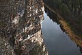
 Айские утёсы.jpg 3,832 × 2,555; 5.52 MB
-
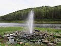 Айский фонтан.jpg 4,000 × 3,000; 1.33 MB
-
 Большие Притёсы.jpg 2,000 × 1,500; 485 KB
-
 Большие Притесы на реке Ай.jpg 4,500 × 3,000; 9.18 MB
-
 Вечер на воде.jpg 864 × 1,152; 63 KB
-
 Вид на Ай с Больших Притёсов 2.jpg 1,920 × 2,560; 722 KB
-
 Вид на Ай с Больших Притёсов.jpg 2,816 × 2,112; 2.16 MB
-
 Вид на реку Ай с Больших Айских притёсов.jpg 4,368 × 2,912; 11.35 MB
-
 Вид на реку Ай с Больших притёсов.jpg 2,912 × 4,368; 11.77 MB
-
 Висячий мост через реку Ай в деревне Верхне-Айская.jpg 2,272 × 1,704; 1.55 MB
-
 Грот "Юношеский" (Караташ (Черный Камень); Каракуаши (Черная Дыра)). Пещера.jpg 1,920 × 2,560; 728 KB
-
 Дачный поселок Горняк - 2.jpg 6,000 × 3,690; 14.43 MB
-
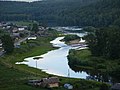
 Долина реки Ай (деревня Верхне-Айская).jpg 2,272 × 1,704; 1.53 MB
-
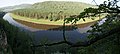
 Долина реки Ай (посёлок Межевой).jpg 3,880 × 2,608; 5.56 MB
-
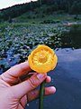 Желтый лотос.jpg 3,000 × 4,000; 6.72 MB
-
 Занозинская излучина (Большая Кривуля) на реке Ай 2.jpg 4,912 × 3,264; 12.05 MB
-
 Занозинская излучина (Большая Кривуля) на реке Ай.jpg 4,912 × 3,264; 11.33 MB
-
 Изгибы притесов.jpg 3,528 × 5,292; 11.07 MB
-
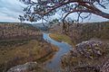
 Лес на берегу р. Ай.jpg 4,431 × 1,999; 1.23 MB
-
 Майские "Притесы".jpg 3,473 × 5,210; 9.76 MB
-
 Майский Ай.jpg 5,437 × 3,625; 12.61 MB
-
 Над рекой Ай.jpg 3,024 × 4,032; 3.97 MB
-
 Небо без фильтров.jpg 1,152 × 864; 91 KB
-
 Небо, притёсы, река.jpg 3,000 × 4,000; 6.15 MB
-
 Осенние "Приетсы".jpg 1,280 × 853; 902 KB
-
 Остановка у расщелины.jpg 3,000 × 4,000; 10.6 MB
-
 Панорама, вид на деревню Сикияз-Тамак.jpg 5,675 × 2,805; 12.66 MB
-
 Первый лёд на реке Ай (посёлок Межевой").jpg 3,880 × 2,608; 7.21 MB
-
 Перепад высоты.jpg 1,280 × 853; 1.34 MB
-
 Пещера в Занозинской излучине, на реке Ай 2.jpg 4,320 × 3,240; 13.83 MB
-
 Пещера в Занозинской излучине, на реке Ай 3.jpg 4,320 × 3,240; 12.78 MB
-
 Пещера в Занозинской излучине, на реке Ай 4.jpg 4,320 × 3,240; 14.81 MB
-
 Пещера в Занозинской излучине, на реке Ай.jpg 4,320 × 3,240; 18.33 MB
-
 Пещера Сикияз-Тамакская сквозная (им. Сысоева).jpg 2,816 × 2,112; 7.29 MB
-
 Подъём на Большие Притёсы.jpg 1,920 × 2,560; 1.27 MB
-
 Поперечный гребень.jpg 1,920 × 1,280; 1,010 KB
-
 Р.Ай, рядом с Скияз-тамакским пещерным комплексом.jpg 1,280 × 853; 263 KB
-
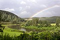 Радуга на реке Ай.jpg 4,500 × 3,000; 10.81 MB
-
 Река Ай (вид со скалы).jpg 3,872 × 2,592; 1.3 MB
-
 Река Ай (Саткинский район).jpg 1,920 × 1,393; 1.22 MB
-
 Река Ай в районе Сикияз-Тамака.JPG 2,048 × 1,536; 1.33 MB
-
 Река Ай. Большеустьикинское, Башкортостан - panoramio.jpg 2,048 × 2,046; 855 KB
-
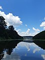
 Река Ай.jpg 2,560 × 1,920; 1.61 MB
-
 Река Ай2.jpg 7,374 × 2,252; 1.94 MB
-
 Синее небо.jpg 1,152 × 864; 75 KB
-
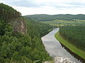
 Скалы на берегу реки Ай.jpg 3,872 × 2,592; 1.57 MB
-
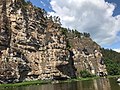 Скалы реки Ай.jpg 1,280 × 960; 288 KB
-
 Фонтан на берегу реки Ай (Кигинский р-н, Респ. Башкортостан).jpg 3,872 × 2,592; 1.72 MB
-
 Цапля на реке Ай.jpg 4,257 × 2,972; 2.71 MB
-
 Шулёмкинская пещера (расположена в месте в падения р. Шулёмка в р. Ай).jpg 4,320 × 3,240; 18.68 MB


;_%D0%9A%D0%B0%D1%80%D0%B0%D0%BA%D1%83%D0%B0%D1%88%D0%B8_(%D0%A7%D0%B5%D1%80%D0%BD%D0%B0%D1%8F_%D0%94%D1%8B%D1%80%D0%B0))._%D0%9F%D0%B5%D1%89%D0%B5%D1%80%D0%B0.jpg)

.jpg)
.jpg)

_%D0%BD%D0%B0_%D1%80%D0%B5%D0%BA%D0%B5_%D0%90%D0%B9_2.jpg)
_%D0%BD%D0%B0_%D1%80%D0%B5%D0%BA%D0%B5_%D0%90%D0%B9.jpg)


.jpg)


.jpg)


.jpg)
.jpg)


.jpg)

.jpg)