Category:Bílá (Liberec District)
Jump to navigation
Jump to search
village in Liberec District of Liberec region .jpg) _Flag.jpg) _CoA.png) | |||||
| Upload media | |||||
| Instance of | |||||
|---|---|---|---|---|---|
| Location |
| ||||
| Population |
| ||||
| Area |
| ||||
| Elevation above sea level |
| ||||
| official website | |||||
 | |||||
Subcategories
This category has the following 16 subcategories, out of 16 total.
Media in category "Bílá (Liberec District)"
The following 6 files are in this category, out of 6 total.
-
 Bílá (1).jpg 5,021 × 3,347; 7.24 MB
-
 Bílá (Liberec District) CoA.jpg 437 × 500; 37 KB
-
 Bílá (Liberec District) CoA.png 437 × 500; 284 KB
-
 Bílá (Liberec District) Flag.jpg 741 × 500; 40 KB
-
 Bílá - okolí (pohled do údolí Oharky před Hodkovicemi).JPG 2,288 × 1,712; 743 KB
-
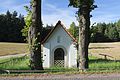 Kaplička, Bílá (1).JPG 4,789 × 3,193; 5.38 MB
_CoA.jpg)
.JPG)
.JPG)