Category:B1057 road (England)
Jump to navigation
Jump to search

road in England | |||||
| Upload media | |||||
| Instance of |
| ||||
|---|---|---|---|---|---|
| Location | England | ||||
| Transport network |
| ||||
| |||||
Media in category "B1057 road (England)"
The following 15 files are in this category, out of 15 total.
-
 Bran End, Essex - geograph.org.uk - 159713.jpg 640 × 480; 59 KB
-
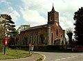
 Church End, Great Dunmow, Essex - geograph.org.uk - 242467.jpg 640 × 352; 44 KB
-
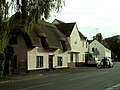
 Cottages on the B.1057 - geograph.org.uk - 289661.jpg 640 × 480; 81 KB
-

-
 Finchingfield, Village Pond and Sign. - geograph.org.uk - 138018.jpg 640 × 442; 104 KB
-
-
 Oxen End - geograph.org.uk - 289592.jpg 640 × 464; 108 KB
-
-
 Steeple Bumpstead, Essex - geograph.org.uk - 69824.jpg 632 × 640; 58 KB
-

-
 The old Mill on the B.1057 - geograph.org.uk - 289052.jpg 640 × 480; 88 KB
-

-
 Main Street, Great Bardfield - geograph.org.uk - 24922.jpg 640 × 427; 67 KB
-
 The B1057 heading towards Haverhill - geograph.org.uk - 312864.jpg 640 × 436; 57 KB
-
 The B1057 near Church End - geograph.org.uk - 312812.jpg 640 × 375; 61 KB


_near_Steeple_Bumpstead_-_geograph.org.uk_-_222187.jpg)


