Category:Bad Nenndorf
Jump to navigation
Jump to search
| Object location | | View all coordinates using: OpenStreetMap |
|---|

Landkreis Schaumburg  Ahnsen · Apelern · Auetal · Auhagen · Bad Eilsen · Bad Nenndorf · Beckedorf · Buchholz · Bückeburg · Hagenburg · Haste · Heeßen · Helpsen · Hespe · Heuerßen · Hohnhorst · Hülsede · Lauenau · Lauenhagen · Lindhorst · Lüdersfeld · Luhden · Meerbeck · Messenkamp · Niedernwöhren · Nienstädt · Nordsehl · Obernkirchen · Pohle · Pollhagen · Rinteln · Rodenberg · Sachsenhagen · Seggebruch · Stadthagen · Suthfeld · Wiedensahl · Wölpinghausen ·
municipality of Germany    | |||||
| Upload media | |||||
| Instance of |
| ||||
|---|---|---|---|---|---|
| Location | Nenndorf, Schaumburg, Lower Saxony, Germany | ||||
| Population |
| ||||
| Area |
| ||||
| Elevation above sea level |
| ||||
| official website | |||||
 | |||||
Subcategories
This category has the following 25 subcategories, out of 25 total.
B
- Bahnhof Bad Nenndorf (6 F)
- Bus stops in Bad Nenndorf (21 F)
- Bückeberge-Weg (4 F)
C
- Calenberger Weg (1 F)
D
F
H
- Haster Bach (Südaue) (2 F)
K
M
- Mooshüttestollen (5 F)
N
- NABU-Oase (Bad Nenndorf) (4 F)
R
S
V
- Vogelpark am Krater (2 F)
W
- Waltringhausen (Bad Nenndorf) (13 F)
Media in category "Bad Nenndorf"
The following 45 files are in this category, out of 45 total.
-
 Wappen Bad Nenndorf.png 181 × 196; 9 KB
-
-

-
 Bach, 1, Bad Nenndorf, Landkreis Schaumburg.jpg 3,456 × 2,592; 5.67 MB
-
 Bach, 2, Bad Nenndorf, Landkreis Schaumburg.jpg 3,456 × 2,592; 6.05 MB
-
 Bach, 3, Bad Nenndorf, Landkreis Schaumburg.jpg 3,456 × 2,592; 4.39 MB
-
 Bach, 4, Bad Nenndorf, Landkreis Schaumburg.jpg 3,456 × 2,592; 5.19 MB
-
 Bach, 5, Bad Nenndorf, Landkreis Schaumburg.jpg 3,456 × 2,592; 5.22 MB
-
 Bach, 6, Bad Nenndorf, Landkreis Schaumburg.jpg 3,456 × 2,592; 5.8 MB
-
 Bach, 7, Bad Nenndorf, Landkreis Schaumburg.jpg 3,456 × 2,592; 6.27 MB
-
LL-Q188 (deu)-PetiteTrolline-Bad Nenndorf.wav 1.8 s; 155 KB
-
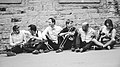 Bad Nenndorf Boys Press Foto.jpg 2,048 × 1,152; 345 KB
-
 Bad Nenndorf in SHG.svg 1,308 × 1,317; 728 KB
-
 Bad Nenndorf, Germany - panoramio (1).jpg 4,896 × 3,672; 499 KB
-
 Bad Nenndorf, Germany - panoramio (2).jpg 4,051 × 1,699; 540 KB
-
 Bad Nenndorf, Germany - panoramio (3).jpg 4,610 × 1,685; 741 KB
-
 Bad Nenndorf, Germany - panoramio.jpg 3,963 × 2,095; 718 KB
-
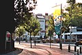 Bad Nenndorf, im Zentrum.jpg 2,551 × 1,701; 1.11 MB
-
 BadNenndorf.jpg 1,478 × 1,046; 263 KB
-
 Badnenndorfboy.JPG 800 × 578; 110 KB
-
 Beechforest062005.jpg 2,048 × 1,536; 780 KB
-
 Berliner Straße 3 + 1, 1, Bad Nenndorf, Landkreis Schaumburg.jpg 3,456 × 2,592; 4.11 MB
-
 Bubikopfallee (Bad Nenndorf) (1).jpg 3,024 × 4,032; 7.49 MB
-
 Bubikopfallee (Bad Nenndorf) (2).jpg 3,024 × 4,032; 6.83 MB
-
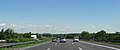
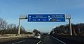
 Bundesautobahn 2, 1, Bad Nenndorf, Landkreis Schaumburg.jpg 3,456 × 2,592; 4.32 MB
-
De-Bad Nenndorf.ogg 2.3 s; 23 KB
-
 Die Gartenlaube (1896) b 0469.jpg 1,500 × 1,527; 390 KB
-
 Dinosaurierspuren Bad Nenndorf 1.JPG 3,648 × 2,736; 4.15 MB
-
 Dinosaurierspuren Bad Nenndorf 2.JPG 3,648 × 2,736; 3.65 MB
-
 Ehemalige Forstwartei Bückethaler Landwehr.jpg 1,500 × 1,150; 2.12 MB
-
 FagusPendula052005.jpg 1,657 × 1,184; 522 KB
-
 FagusPurpureaZlatia052005.jpg 1,350 × 1,873; 777 KB
-
 FagusSylvNuts.jpg 906 × 1,224; 200 KB
-
 FagusSylvPurpurea052005.jpg 2,038 × 1,517; 737 KB
-
 Grenzstein Am Galenberg (Bad Nenndorf) (1).jpg 3,024 × 4,032; 5.7 MB
-
 Grenzstein Am Galenberg (Bad Nenndorf) (2).jpg 3,024 × 4,032; 7.94 MB
-
 KretzschmariaDeusta052005.jpg 2,042 × 1,526; 796 KB
-
 KretzschmariaDeusta112004.jpg 2,029 × 1,511; 955 KB
-
 Landgrafenklinik, Bad Nenndorf.jpg 4,000 × 3,000; 3.34 MB
-
 Lichterfest in Bad Nenndorf.jpg 1,396 × 1,828; 359 KB
-
 Ostpreußenweg, 1, Bad Nenndorf, Landkreis Schaumburg.jpg 3,456 × 2,592; 4.73 MB
-
 PendulaNenndorf042004.jpg 1,490 × 2,019; 989 KB
-
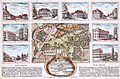 Plan der Anlagen des Schwefel-Bades Nendorf (1816).jpg 1,752 × 1,148; 3.43 MB
-
 Plan vom Schwefelbade Nenndorf (1840).jpg 815 × 641; 166 KB
-
 Tortuosa.jpg 1,774 × 1,257; 409 KB
,_Adressseite.jpg)
,_Bildseite.jpg)


.jpg)
.jpg)


_(1).jpg)
_(2).jpg)

_b_0469.jpg)


_(1).jpg)
_(2).jpg)


.jpg)
.jpg)

.jpg)