Category:Bahnstromfreileitungskreuzung Mannheim-Alteichwald
Jump to navigation
Jump to search
| Object location | | View all coordinates using: OpenStreetMap |
|---|
Media in category "Bahnstromfreileitungskreuzung Mannheim-Alteichwald"
The following 2 files are in this category, out of 2 total.
-
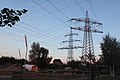 Bahnstrom Freileitungskreuzung Alteichwald07072017 1.JPG 4,980 × 3,320; 10.22 MB
-
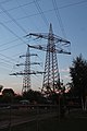 Bahnstrom Freileitungskreuzung Alteichwald07072017 2.JPG 3,372 × 5,058; 9.75 MB

