Category:Baiselsberg (Stromberg)
Jump to navigation
Jump to search
mountain in Germany  | |||||
| Upload media | |||||
| Instance of | |||||
|---|---|---|---|---|---|
| Location | Sachsenheim, Ludwigsburg District, Stuttgart Government Region, Baden-Württemberg, Germany | ||||
| Mountain range |
| ||||
| Elevation above sea level |
| ||||
 | |||||
Der Baiselsberg ist ein Bergrücken zwischen Kirbach- und Mettertal im Landkreis Ludwigsburg. Mit einer Höhe von 476,6 Metern ist er der höchste Punkt des Strombergs.
Media in category "Baiselsberg (Stromberg)"
The following 22 files are in this category, out of 22 total.
-
 1590 Burg Bromberg im Stromberger Forst Gadner Aus.jpg 862 × 643; 886 KB
-
 1684 Forstlager Herrschaftl Geißbühl und Bromberg.jpg 2,523 × 1,312; 1.21 MB
-
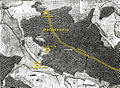 1684 Kiesersche Forstkarte 98 Spilberg beschriftet.jpg 1,123 × 826; 881 KB
-
 1700 Gegend um Kirbach HStA Stuttgart N7 Nr 63 Ausschnitt.jpg 1,006 × 794; 740 KB
-
 1808 Bromberg Charte von Schwaben Tafel 04 LB.jpg 846 × 643; 1,020 KB
-
 Ausblick Richtung Enz - panoramio.jpg 4,608 × 2,304; 3.75 MB
-
 Aussichtsturm Klosterruine Baiselsberg.jpg 3,024 × 4,032; 3.61 MB
-
 Baiselsberg Gipfel.jpg 2,391 × 1,920; 5.52 MB
-
 Baiselsberg Ostabdachung 1250W.jpg 1,854 × 794; 1.17 MB
-
 Baiselsberg Südabdachung über Horrheim 1248W.jpg 1,865 × 794; 1.16 MB
-
 Bildstock Ochsenbach nahe Kirchbachhof.jpg 3,024 × 4,032; 6.03 MB
-
 Bromberger Wald Nordabdachung Baiselsberg 1240W.jpg 1,265 × 715; 1.03 MB
-
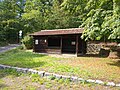
 Bromberghütte.jpg 4,032 × 3,024; 4.25 MB
-
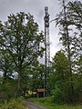 Funkmast Spielberg.jpg 3,024 × 4,032; 3 MB
-
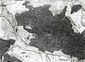 Kiesersche Forstkarte Nr. 98 Spilberg (Spielberg).jpg 1,024 × 753; 321 KB
-
 Klosterberg-Schutzhütte.jpg 4,032 × 3,024; 4.4 MB
-
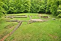 KlosterruineBaiselsberg.jpg 4,288 × 2,848; 8.61 MB
-
 Marker TAL Pipeline Baiselsberg km 204.650.jpg 3,024 × 4,032; 6.83 MB
-

-
 Schutzhütte Baiselsberg an der Kreuzung Pfarrsitzweg und Krummes Steigle.jpg 4,032 × 3,024; 3.49 MB
-
 Schutzhütte Laubsteigle.jpg 2,720 × 2,040; 1.3 MB
-
 Schutzhütte Nonnensessel.jpg 4,032 × 3,024; 3.42 MB


.jpg)


