Category:Balkans
Jump to navigation
Jump to search
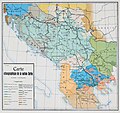
geopolitical and cultural region of Southeast Europe    Topologisk karta enligt definition av Jovan Cvijića 1918, definierad efter Donau-Sava-Kupa-linjen och med kontaktytan mellan Dinariska och Julianska Alperna som nordgräns.  | |||||
| Upload media | |||||
| Instance of | |||||
|---|---|---|---|---|---|
| Location |
| ||||
| Located in or next to body of water | |||||
| Highest point | |||||
| Area |
| ||||
| Different from | |||||
 | |||||
Subcategories
This category has the following 14 subcategories, out of 14 total.
Pages in category "Balkans"
The following 2 pages are in this category, out of 2 total.
Media in category "Balkans"
The following 88 files are in this category, out of 88 total.
-

-
 Adria region.png 562 × 357; 27 KB
-
 Air photograph balkan 09-21-2003.jpg 389 × 289; 22 KB
-
 Ancient Macedonia, Peonia and part of Thrace.jpg 1,315 × 758; 540 KB
-
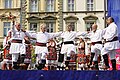
 Antoni Piotrowski. Dziewczyny z Bałkanów.jpg 564 × 457; 62 KB
-
 Balkan1.jpg 353 × 557; 66 KB
-
 Balkans (definitions).png 6,460 × 3,403; 952 KB
-
 Balkans culture collage.jpg 998 × 1,400; 1.39 MB
-
 Balkans year 925.png 472 × 605; 288 KB
-
 Beautiful etno ladies.jpg 2,726 × 4,088; 8.32 MB
-
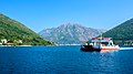 Boka Kotorska (26335314163).jpg 4,608 × 2,592; 13.09 MB
-
 Cheshma-Popov kladenets.jpg 4,000 × 2,250; 5.22 MB
-
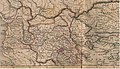
 Cvijic map 1909.jpg 1,200 × 1,127; 233 KB
-
 Dotation Carnegie pour la paix internationale Enquête dans les Balkans.djvu 4,666 × 3,333, 612 pages; 42.11 MB
-
 East Europe Blank Map.png 720 × 540; 78 KB
-
 Folklore feel.jpg 4,088 × 2,726; 9.71 MB
-

-
 Gotse Delchev Panorama.jpg 4,032 × 1,816; 586 KB
-
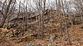 Gradište-Leskovdol-skala.jpg 4,000 × 2,250; 5.73 MB
-
 Gradište-Leskovdol.jpg 3,728 × 2,288; 5.31 MB
-
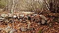 Gradište-zid.jpg 4,000 × 2,250; 5.95 MB
-
 Gradište.jpg 4,000 × 3,000; 3.37 MB
-
 Historic Dobruja.png 175 × 138; 5 KB
-
 Inyova niva-Leskovdol.jpg 3,000 × 4,000; 5.36 MB
-
 Izdremets-Leskovdol.jpg 4,000 × 3,000; 3.03 MB
-
 Izdremets-Lilyaka-Osičeno bardo.jpg 4,000 × 2,250; 4.14 MB
-
 Izdremets-Lilyaka.jpg 3,648 × 2,736; 791 KB
-
 Izgled-Dabeto.jpg 3,000 × 4,000; 2.33 MB
-
 Izgled-Inyova niva.jpg 4,000 × 3,000; 4.23 MB
-
 Izgled-Lafčov tok.jpg 4,000 × 3,000; 2.49 MB
-
 Izgled-Popov kladenets.jpg 4,000 × 2,250; 3.54 MB
-
Jer-Balkans.ogg 1.0 s; 12 KB
-
 Kamenna-reka-2.jpg 4,000 × 2,250; 5.13 MB
-
 Kamenna-reka.jpg 4,000 × 3,000; 7.53 MB
-
 Kashti-Leskovdol.jpg 4,000 × 3,000; 4.03 MB
-
 Kooperativen-dom-Leskovdol.jpg 4,000 × 2,250; 3.04 MB
-
 Kristian Kreković - Zmaj od Bosne Huseinbeg Gradaščević.jpg 480 × 692; 80 KB
-
 Lakatnik.jpg 4,000 × 2,250; 3.22 MB
-
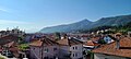
 Lake (20502180388).jpg 4,608 × 3,072; 17.43 MB
-
 Landscape (19681643933).jpg 4,572 × 3,048; 10.48 MB
-
 Landscape (20294614762).jpg 4,608 × 2,592; 8.52 MB
-
 Landscape (20638519869).jpg 4,608 × 2,592; 9.29 MB
-
 Les Roumains de la Macédoine - 1913.djvu 3,397 × 4,875, 47 pages; 2.66 MB
-
 Leskovdol-Džidovets.jpg 4,000 × 2,250; 3.5 MB
-
 Leskovdol-izgled-Maznotil.jpg 4,000 × 2,250; 3.18 MB
-
 Leskovdol-izgled.jpg 4,000 × 3,000; 3.63 MB
-
 Leskovdol-Kotlene.jpg 4,000 × 2,250; 4.58 MB
-
 Leskovdol-lampa.jpg 2,240 × 4,000; 5.13 MB
-
 Leskovdol-panorama.jpg 3,997 × 1,543; 731 KB
-
 Leskovdol-Preslapa.jpg 4,000 × 2,250; 2.29 MB
-
 Leskovdol-star-most.jpg 3,072 × 2,304; 1.69 MB
-
 Leskovdol-staro-shosse.jpg 1,920 × 1,440; 4.01 MB
-
 Leskovdol-tabela.jpg 1,472 × 1,011; 173 KB
-
 Let them feel.jpg 2,726 × 4,088; 8.07 MB
-
 Lilyaka-Osičeno bardo.jpg 4,000 × 3,000; 4.69 MB
-
 Lilyaka.jpg 3,072 × 2,304; 2.13 MB
-
 Lokvata.jpg 4,000 × 3,000; 3.78 MB
-
 Macedonian dolly.jpg 2,726 × 4,088; 8.15 MB
-
 Magazin-Popov kladenets.jpg 4,000 × 3,000; 6.95 MB
-
 Mali Korab and Korabska Vrata.jpg 4,928 × 3,264; 12.13 MB
-
 Northern Dalmatia (20312046136).jpg 4,608 × 2,592; 7.03 MB
-
 Northern Dalmatia (20344336511).jpg 4,596 × 3,064; 12.45 MB
-
 Nov-most-Leskovdol.jpg 1,920 × 1,440; 4.35 MB
-
 Ochryda.jpg 1,600 × 900; 1.49 MB
-
 Osičeno-bardo.jpg 3,072 × 2,304; 2.22 MB
-
 Pametnik-Leskovdol-2020.jpg 3,000 × 4,000; 3.7 MB
-
 Pametnik-Leskovdol-2021.jpg 4,000 × 3,000; 4.71 MB
-
 Parlenka.webp 1,200 × 800; 76 KB
-
 Popov kladenets.jpg 4,000 × 2,250; 3.72 MB
-
 Radova-livada.jpg 3,072 × 2,304; 3.46 MB
-
 Reka-Selska-Leskovdol.jpg 2,250 × 4,000; 6 MB
-
 Rijeka Janja.jpg 1,032 × 825; 337 KB
-
 Rijeka Janja2.jpg 1,206 × 859; 265 KB
-
 Road-Leskovdol.jpg 4,000 × 3,000; 4.58 MB
-
 Sredno bardo-Leskovdol.jpg 4,000 × 3,000; 3.68 MB
-
 Star-most-Leskovdol-izgled.jpg 2,304 × 3,072; 1.65 MB
-
 Star-most-Leskovdol.jpg 3,072 × 2,304; 1.68 MB
-
 Staro-shosse-Leskovdol.jpg 3,072 × 2,304; 1.56 MB
-
 Stars and a mountain (20279988926).jpg 4,608 × 2,592; 10.79 MB
-
 Strange plant (20703394479).jpg 3,072 × 4,608; 15.65 MB
-
 Them main character.jpg 2,726 × 4,088; 7.83 MB
-
 Vetren.jpg 3,072 × 2,304; 1.5 MB
-
 You-Are-Heard.org logo.png 500 × 167; 25 KB
-

-

-
 Основа за блъгарскѫ грамматикѫ.pdf 706 × 1,118, 76 pages; 5.18 MB
-
 Основа за българска граматика, корица (четвърто издание).png 690 × 1,091; 1,000 KB
-
 Религиска карта на Европска Турција, во границите од 1912 година, но со население од 2023.jpg 15,171 × 9,990; 5.16 MB


.png)


.jpg)


.jpg)
.jpg)
.jpg)
.jpg)


.jpg)
.jpg)


.jpg)
.jpg)


.jpg)

.png)
