Category:Balnamore
Jump to navigation
Jump to search
village in the United Kingdom | |||||
| Upload media | |||||
| Instance of | |||||
|---|---|---|---|---|---|
| Location | County Antrim, Northern Ireland | ||||
 | |||||
English: Balnamore (from the ) is a small village in County Antrim, Northern Ireland. Ballymoney is 3 kilometres to the east, and Coleraine is 10 kilometres to the north west. It had a population of 661 people in the 2001 Census. It is within the Ballymoney Borough Council area.
Nederlands: Balnamore ( Iers: Baile án Monaidh) is een plaats in het Noord-Ierse County Antrim. Balnamore telt 696 inwoners. Van de bevolking is 90,9% protestant en 5,6% katholiek.
Media in category "Balnamore"
The following 30 files are in this category, out of 30 total.
-
 Agivey Bann Bridge - geograph.org.uk - 164860.jpg 640 × 426; 118 KB
-
 Agivey Bridge - geograph.org.uk - 176579.jpg 640 × 479; 69 KB
-
 Balnamore Mill - geograph.org.uk - 2394631.jpg 640 × 480; 107 KB
-
 Balnamore village - geograph-5328247.jpg 3,200 × 2,400; 4.95 MB
-
 Balnamore village - geograph.org.uk - 5342383.jpg 3,200 × 2,400; 4.54 MB
-
 Caravan site at Drumaheglis marina - geograph.org.uk - 325506.jpg 640 × 480; 89 KB
-
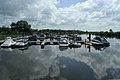 Drumaheglis Marina - geograph.org.uk - 497931.jpg 640 × 426; 93 KB
-
 Drumaheglis Marina and Caravansite - geograph.org.uk - 1656982.jpg 640 × 417; 63 KB
-
 Drumaheglis Marina and Caravansite - geograph.org.uk - 1656989.jpg 640 × 393; 67 KB
-
 Drumahiskey Road - geograph.org.uk - 2394606.jpg 640 × 480; 143 KB
-
 Drumnahiskey Road - geograph.org.uk - 5328242.jpg 3,200 × 2,400; 4.95 MB
-
 Glasgort Bridge, Agivey River - geograph.org.uk - 583087.jpg 640 × 480; 97 KB
-
 Glasgort Bridge, Agivey River - geograph.org.uk - 583105.jpg 640 × 480; 102 KB
-

-

-
 Level crossing on Balnamore Road - geograph.org.uk - 2394641.jpg 640 × 480; 105 KB
-
 Lodge at the entrance to Harmony Hill - geograph.org.uk - 2394660.jpg 640 × 480; 115 KB
-
 Near Balnamore - geograph.org.uk - 847981.jpg 640 × 479; 66 KB
-
 Near Balnamore - geograph.org.uk - 847983.jpg 640 × 479; 69 KB
-
 Near Balnamore - geograph.org.uk - 847984.jpg 640 × 479; 48 KB
-
 Outskirts of Ballymoney - geograph.org.uk - 5328250.jpg 2,992 × 2,160; 3.87 MB
-
 Rebuilding the Agivey Bann Bridge - geograph.org.uk - 503737.jpg 635 × 419; 54 KB
-
 Sheep grazing - geograph.org.uk - 4666653.jpg 4,000 × 2,286; 3.85 MB
-
 The Agivey River at Glasgort - geograph.org.uk - 374114.jpg 640 × 426; 123 KB
-
 The Glasgort Bridge near Ballymoney - geograph.org.uk - 374101.jpg 640 × 426; 137 KB
-
 The river at Balnamore - geograph.org.uk - 2394593.jpg 640 × 480; 134 KB
-
 Bendooragh Townland - geograph.org.uk - 848309.jpg 640 × 479; 54 KB
-
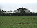
 Currysiskan House - geograph.org.uk - 721380.jpg 640 × 360; 95 KB
-
 Lovell and Christmas Bacon Factory - geograph.org.uk - 177571.jpg 640 × 479; 57 KB
-
 The Tower, Mullaghmore - geograph.org.uk - 583075.jpg 640 × 480; 57 KB


