Category:Banningham
Jump to navigation
Jump to search
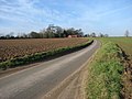
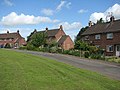
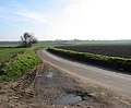
English: Banningham is a village within the civil parish of Colby in the English county of Norfolk .The village is 2.9 miles north east of Aylsham, 14.7 miles west north of Norwich and 129 miles north east of London. The nearest railway station is at North Walsham Railway station where the Bittern Line from Cromer to Norwich can be accessed and the national rail network beyond. The nearest airport is Norwich International Airport. The village lies a small distance east from the A140 Cromer to Norwich road.
village in Colby, Norfolk, England, UK | |||||
| Upload media | |||||
| Instance of | |||||
|---|---|---|---|---|---|
| Location | Colby, North Norfolk, Norfolk, East of England, England | ||||
 | |||||
Subcategories
This category has the following 5 subcategories, out of 5 total.
Media in category "Banningham"
The following 15 files are in this category, out of 15 total.
-
 Approaching Banningham - geograph.org.uk - 1140958.jpg 640 × 480; 79 KB
-
 Bowling green - geograph.org.uk - 860882.jpg 640 × 480; 130 KB
-
 Church Close - geograph.org.uk - 860879.jpg 640 × 480; 127 KB
-
 Highbury Farm - geograph.org.uk - 860843.jpg 640 × 480; 146 KB
-
 Road past St Botolph's church - geograph.org.uk - 860870.jpg 480 × 640; 153 KB
-
 Rush hour in Banningham - geograph.org.uk - 5352041.jpg 640 × 480; 98 KB
-
 Skirting a field's edge - geograph.org.uk - 1140962.jpg 640 × 480; 90 KB
-
 The village green - geograph.org.uk - 860872.jpg 640 × 480; 143 KB
-
 The village of Banningham - geograph.org.uk - 1140916.jpg 640 × 397; 73 KB
-
 Victorian postbox - geograph.org.uk - 860858.jpg 480 × 640; 189 KB
-
 View across a field - geograph.org.uk - 1140918.jpg 640 × 396; 75 KB
-
 View southeast along Banningham Road - geograph.org.uk - 1140956.jpg 640 × 528; 75 KB
-
 View southwest along Church Road - geograph.org.uk - 860841.jpg 480 × 640; 142 KB
-
 View west along path - geograph.org.uk - 1140924.jpg 640 × 480; 106 KB
-
 Village green at Banningham - geograph.org.uk - 5971724.jpg 1,600 × 1,064; 934 KB


