Category:Bannock County, Idaho
Jump to navigation
Jump to search
Counties of Idaho: Ada · Adams · Bannock · Bear Lake · Benewah · Bingham · Blaine · Boise · Bonner · Bonneville · Boundary · Butte · Camas · Canyon · Caribou · Cassia · Clark · Clearwater · Custer · Elmore · Franklin · Fremont · Gem · Gooding · Idaho · Jefferson · Jerome · Kootenai · Latah · Lemhi · Lewis · Lincoln · Madison · Minidoka · Nez Perce · Oneida · Owyhee · Payette · Power · Shoshone · Teton · Twin Falls · Valley · Washington
county in Idaho, United States    | |||||
| Upload media | |||||
| Instance of | |||||
|---|---|---|---|---|---|
| Named after | |||||
| Location | Idaho, Estados Unidos | ||||
| Capital | |||||
| Inception |
| ||||
| Population |
| ||||
| Area |
| ||||
| official website | |||||
 | |||||
English: Media related to Bannock County, Idaho, a county in southeastern Idaho, United States.
Mga ubos-nga-kaarangay
Ini nga kaarangay mayda han mga nasunod nga 11 nga mga ubos-nga-kaarangay, tikang hin 11 nga kabug-osan.
B
F
G
M
P
T
Media ha kaarangay nga "Bannock County, Idaho"
An mga nasunod nga 95 ka mga fayl aada han hini nga kaarangay, tikang hin 95 nga kabug-osan.
-
 A City Creek Parking Area - panoramio.jpg 3,488 × 2,616; 4.57 nga MB
-
 A Gulley - panoramio.jpg 3,488 × 2,616; 4.28 nga MB
-
 A Pool on the Portneuf - panoramio.jpg 3,444 × 2,523; 4.39 nga MB
-
 A Very Old Cabin - panoramio.jpg 2,172 × 1,504; 2.58 nga MB
-
 Across the Bottoms - panoramio.jpg 3,420 × 1,532; 1.71 nga MB
-
 Aggregate Left By the Bonneville Flood Is One of Our Greatest Assets - panoramio.jpg 3,432 × 2,331; 4.74 nga MB
-
 Back of the Mountain - panoramio.jpg 1,600 × 1,200; 1.37 nga MB
-
 Bannock County Courthouse.jpg 2,000 × 818; 527 nga KB
-
 Between the Portnuef River and Marsh Creek is the Basalt of Portnuef Valley - panoramio.jpg 3,488 × 2,616; 4.45 nga MB
-
 Bonneville Mountain - panoramio.jpg 2,576 × 1,932; 2.39 nga MB
-
 Bridge Across the Portneuf - panoramio.jpg 3,488 × 2,616; 3.52 nga MB
-
 Camp, 25 miles south of Fort Hall, at Three Springs. Bannock County, Idaho. - NARA - 516728.jpg 3,000 × 1,959; 1.12 nga MB
-
 Canyon Maples - panoramio.jpg 1,600 × 1,200; 1.78 nga MB
-
 Rapid Creek flood hazard analyses Bannock County, Idaho; including Inman Creek and West Fork Creek tributaries (IA CAT74425837).pdf 1,133 × 1,500, 86 mga pakli; 4.07 nga MB
-
 Cliffs - panoramio (1).jpg 3,488 × 2,616; 5.01 nga MB
-
 Creek Crossing - panoramio.jpg 3,488 × 2,616; 6.51 nga MB
-
 DSCN6277 portneufriver e.jpg 600 × 476; 95 nga KB
-
 Early in the Spring - panoramio.jpg 3,488 × 2,616; 3.86 nga MB
-
 East Face - panoramio.jpg 2,592 × 1,944; 2.61 nga MB
-
 East Fork Mink Creek - panoramio.jpg 800 × 600; 462 nga KB
-
 East to North Putnam Mountain - panoramio.jpg 3,488 × 2,616; 3.68 nga MB
-

-
 Fallow Fields - panoramio.jpg 1,600 × 1,200; 1.22 nga MB
-
 Fort Hall Monument - panoramio.jpg 3,488 × 2,616; 4.6 nga MB
-
 From Scout Mountain to Old Tom Mountain - panoramio.jpg 2,592 × 1,944; 2.46 nga MB
-
 Garden Creek Gap - panoramio.jpg 3,352 × 2,524; 5.54 nga MB
-
 Gas Pipeline - panoramio (1).jpg 1,600 × 1,200; 1.6 nga MB
-
 Goodenough Creek - panoramio.jpg 2,592 × 1,944; 2.79 nga MB
-
 Graffiti on the North End of the Bridge - panoramio.jpg 3,488 × 2,616; 5.24 nga MB
-
 I15 Passes Through a Large Road Cut - panoramio.jpg 3,488 × 2,616; 4.62 nga MB
-
 Idaho 40 eastern terminus sign.jpg 1,024 × 768; 151 nga KB
-
 Idaho 40 eastern terminus.jpg 1,024 × 768; 136 nga KB
-
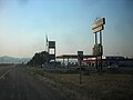 Idaho 40 gas station.jpg 1,024 × 768; 145 nga KB
-
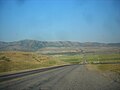 Idaho 40 rural.jpg 1,024 × 768; 160 nga KB
-
 Idaho 40 western terminus.jpg 1,024 × 768; 158 nga KB
-
 Idaho, rolls of hay - panoramio.jpg 2,304 × 1,536; 916 nga KB
-
 Interstate 15 - panoramio.jpg 3,488 × 2,616; 4.47 nga MB
-
 Mink Creek - panoramio (1).jpg 3,488 × 2,616; 5.49 nga MB
-
 Mink Creek - panoramio.jpg 3,488 × 2,616; 6.24 nga MB
-
 Mountain Mist - panoramio.jpg 3,488 × 2,616; 3.99 nga MB
-
 North and South Putnam Mountains - panoramio.jpg 3,488 × 2,616; 4.19 nga MB
-
 North Fork - panoramio.jpg 3,000 × 2,172; 4.56 nga MB
-
 North Putnam Mountain - panoramio.jpg 1,600 × 1,200; 1.63 nga MB
-
 On Fish Creek Pass - panoramio.jpg 3,488 × 2,616; 3.51 nga MB
-
 On the Frozen Lake - panoramio.jpg 3,449 × 2,537; 4.4 nga MB
-
 On the Old Road - panoramio.jpg 3,488 × 2,616; 3.65 nga MB
-
 Osl1.jpg 600 × 359; 40 nga KB
-
 Parking Area - panoramio.jpg 3,488 × 2,616; 5.11 nga MB
-
 Pebble Creek Top Lift - panoramio.jpg 9,412 × 1,624; 10.44 nga MB
-
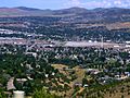
 Pocatello from Wildhorse Mountain. - panoramio.jpg 1,600 × 1,157; 1.2 nga MB
-
-
 Portneuf Drinks - panoramio.jpg 3,392 × 2,395; 4.87 nga MB
-
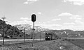
 Rail Signal - panoramio.jpg 3,408 × 2,439; 4.31 nga MB
-
 Rock Climber Paradise - panoramio.jpg 3,488 × 2,616; 3.63 nga MB
-
 Ross Fork - panoramio.jpg 3,380 × 2,435; 4.4 nga MB
-
 Roundabout - panoramio (1).jpg 3,488 × 2,616; 3.83 nga MB
-
 Scout Mountain - panoramio (1).jpg 1,600 × 1,200; 1.47 nga MB
-
 Scout Mountain - panoramio.jpg 800 × 600; 463 nga KB
-
 Scout Mountain from the Last Gate - panoramio.jpg 3,488 × 2,616; 2.79 nga MB
-
 Scout Mountain Scenic Overlook - panoramio.jpg 800 × 600; 374 nga KB
-
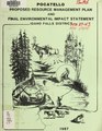
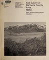 Soil survey of Bannock County area, Idaho - parts of Bannock and Power counties (IA soilsurveyofbann00mcgr).pdf 1,768 × 2,141, 424 mga pakli; 46.32 nga MB
-
 South End of the Pocatello Basin - panoramio.jpg 3,488 × 2,616; 3.97 nga MB
-
 South to Marsh Valley - panoramio.jpg 1,600 × 1,200; 1.41 nga MB
-
 South to the Mountains above Pocatello - panoramio.jpg 3,000 × 1,460; 1.78 nga MB
-
 Southern Bannock County, Idaho 1909.png 964 × 499; 1.45 nga MB
-
 Stormcloud Sunset near Blackfoot River (23903096696).jpg 1,844 × 2,582; 2.24 nga MB
-
 The Blackrock Area - panoramio.jpg 3,488 × 2,616; 3.73 nga MB
-
 The Buckskin Area - panoramio.jpg 3,488 × 2,616; 4.13 nga MB
-
 The City - panoramio (1).jpg 1,600 × 1,200; 1.31 nga MB
-
 The City - panoramio (2).jpg 3,488 × 2,616; 4.35 nga MB
-
 The City Creek Trail - panoramio.jpg 3,488 × 2,616; 4.62 nga MB
-
 The Gap - panoramio (1).jpg 2,748 × 1,376; 1.64 nga MB
-
 The Hills - panoramio.jpg 3,420 × 2,495; 7.06 nga MB
-
 The Horses that Once Lived Here - panoramio.jpg 1,600 × 1,200; 1.09 nga MB
-
 The Interior of Wildhorse Mountain - panoramio.jpg 2,592 × 1,944; 2.25 nga MB
-
 The Local Authorities Dislike and Discourage Campers So There's No Campground Here Now - panoramio.jpg 3,488 × 2,616; 5.75 nga MB
-
 The Peak - panoramio (1).jpg 3,488 × 2,616; 3.89 nga MB
-
 The Peak Above the Mine - panoramio.jpg 3,488 × 2,616; 3.77 nga MB
-
 The Portneuf River Bottoms - panoramio.jpg 3,488 × 2,616; 4.19 nga MB
-
 The Road that Goes Up to the Top of the Mountain - panoramio.jpg 3,488 × 2,616; 4.55 nga MB
-
 The Road to Goodenough Creek - panoramio.jpg 2,503 × 1,779; 2.96 nga MB
-
 The Skeleton of the Old Narrow Bridge - panoramio.jpg 3,488 × 2,616; 5.1 nga MB
-
 The Steepest Point - panoramio.jpg 3,488 × 2,616; 4.54 nga MB
-
 The Top of the West Bench - panoramio.jpg 3,428 × 1,824; 3.32 nga MB
-
 The Trees Along the River - panoramio.jpg 3,488 × 2,616; 4.01 nga MB
-
 The West Bench. - panoramio.jpg 1,600 × 1,200; 1.88 nga MB
-
 There Once Was a Mummy in This Hole - panoramio.jpg 3,488 × 2,616; 6.67 nga MB
-
 Trail - panoramio (3).jpg 3,448 × 2,471; 8.39 nga MB
-
 Trail Creek - panoramio (1).jpg 3,488 × 2,616; 3.82 nga MB
-
 Trail Creek Road - panoramio.jpg 2,048 × 1,536; 1.36 nga MB
-
 Up Blackrock - panoramio.jpg 1,600 × 1,200; 1.26 nga MB
-
 Uphill - panoramio (2).jpg 3,488 × 2,616; 4.1 nga MB
-
 Upper East Fork Mink Creek Drainage - panoramio.jpg 2,576 × 1,932; 2.93 nga MB
-
 USA Bannock County, Idaho age pyramid.svg 520 × 600; 9 nga KB
-
 Waterfall on the Portneuf - panoramio.jpg 3,488 × 2,616; 4.97 nga MB


.jpg)


.jpg)


.jpg)


.jpg)
.jpg)


.jpg)


.jpg)
.jpg)

.jpg)


.jpg)


.jpg)
.jpg)


.jpg)


