Category:Pocatello, Idaho
Jump to navigation
Jump to search
city in Bannock and Power counties in Idaho, United States, that is the county seat of Bannock County    | |||||
| Upload media | |||||
| Instance of | |||||
|---|---|---|---|---|---|
| Named after |
| ||||
| Location | Bannock County, Idaho | ||||
| Head of government |
| ||||
| Inception |
| ||||
| Population |
| ||||
| Area |
| ||||
| Elevation above sea level |
| ||||
| official website | |||||
 | |||||
English: Media related to Pocatello, Idaho, a city in Bannock and Power counties (as well as the county seat of Bannock County) in southeastern Idaho, United States.
Subcategories
This category has the following 11 subcategories, out of 11 total.
Media in category "Pocatello, Idaho"
The following 128 files are in this category, out of 128 total.
-
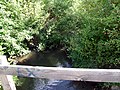
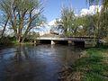
 A Bridge on the River Portneuf - panoramio.jpg 3,488 × 2,616; 3.71 MB
-
 A Draw in the North Side of Howard Mountain - panoramio.jpg 2,592 × 1,944; 2.71 MB
-
 A Popular Climbing Place - panoramio.jpg 3,488 × 2,616; 2.84 MB
-
 A Spring Feeding the River - panoramio.jpg 3,488 × 2,616; 5.94 MB
-
 Amphitheater - panoramio (1).jpg 3,488 × 2,616; 5.1 MB
-
 An Old Aggregate Mine - panoramio.jpg 3,432 × 2,455; 5.19 MB
-
-
 Antenna on Howard Mountain - panoramio.jpg 2,142 × 1,692; 1.98 MB
-
 Aspen Grove - panoramio.jpg 1,600 × 1,200; 1.8 MB
-
 At One of the Lookouts on the Road - panoramio.jpg 3,488 × 2,616; 3.78 MB
-
 At the Gate - panoramio.jpg 1,985 × 1,465; 1.19 MB
-
 At the Very Top of the Mountain - panoramio.jpg 1,600 × 1,200; 939 KB
-
 Batiste Spring - panoramio.jpg 3,488 × 2,616; 3.83 MB
-
 Blackrock Canyon - panoramio.jpg 3,488 × 2,616; 4.68 MB
-
 Blackrock Slopes - panoramio.jpg 3,488 × 2,616; 5.1 MB
-
 Bottomland - panoramio.jpg 2,482 × 1,578; 2.51 MB
-
 Bottoms - panoramio.jpg 3,488 × 2,616; 4.49 MB
-
 Boulders - panoramio (1).jpg 3,488 × 2,616; 5.77 MB
-
 Bridge - panoramio (16).jpg 3,488 × 2,616; 4.55 MB
-
 Bridge - panoramio (20).jpg 3,488 × 2,616; 4.66 MB
-
 Bridge - panoramio (23).jpg 3,488 × 2,616; 5.24 MB
-
 Bridge - panoramio (51).jpg 3,488 × 2,616; 5.97 MB
-
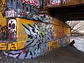 Bridge Graffiti - panoramio.jpg 3,488 × 2,616; 4.9 MB
-
 Bridge Over Bannock Creek - panoramio.jpg 3,488 × 2,616; 4.57 MB
-
 Bridges - panoramio (4).jpg 3,488 × 2,616; 6.08 MB
-
 Canyon Maples - panoramio (1).jpg 3,488 × 2,616; 7.21 MB
-
 Cattle - panoramio (3).jpg 3,488 × 2,616; 4.45 MB
-
 Chilled Grasslands - panoramio.jpg 1,599 × 1,095; 830 KB
-
 China and Scout Mountain - panoramio.jpg 3,488 × 2,616; 4.86 MB
-
 Downhill - panoramio (1).jpg 3,488 × 2,616; 4.76 MB
-
 Downtown Pocatello Idaho 2004.jpg 600 × 431; 92 KB
-
 Draw - panoramio.jpg 3,351 × 2,409; 4.38 MB
-
 Dry Creekbed - panoramio (1).jpg 3,392 × 2,451; 8.73 MB
-
 Emergency Stabilization and Rehabilitation after wildfire (9397).jpg 1,024 × 768; 354 KB
-
 Eroded Ramparts - panoramio.jpg 3,488 × 2,616; 3.34 MB
-
 Fence Posts - panoramio.jpg 3,380 × 2,439; 4.83 MB
-
 Field - panoramio (1).jpg 3,488 × 2,616; 6 MB
-
 Fishing Hole - panoramio.jpg 1,600 × 1,200; 1.19 MB
-
 Flag of Pocatello, Idaho.svg 300 × 180; 894 bytes
-
 Flat Top - panoramio.jpg 3,488 × 2,616; 5.31 MB
-
-
 For No Good Reason Mountain Lion Kittens are Shot Dead Here - panoramio.jpg 3,488 × 2,616; 5.5 MB
-
 Frozen River - panoramio (1).jpg 1,600 × 1,200; 1.47 MB
-
 Grain is Staged Here During the Harvest - panoramio.jpg 3,348 × 2,259; 3.65 MB
-
 Grass, Sage and Junipers - panoramio.jpg 3,488 × 2,616; 5.14 MB
-
 Gravel Pit - panoramio.jpg 3,488 × 2,616; 5.75 MB
-
 Gravel Pit Pond - panoramio.jpg 3,488 × 2,616; 2.87 MB
-
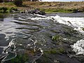
 High Water - panoramio.jpg 2,592 × 1,944; 2.02 MB
-
 Highland Blvd - panoramio.jpg 2,032 × 1,124; 1.14 MB
-
 Hillside - panoramio.jpg 3,488 × 2,616; 4.31 MB
-
 Hoku Under Construction - panoramio.jpg 2,048 × 1,536; 1.48 MB
-
 Howard Mountain - panoramio (1).jpg 3,488 × 2,616; 4.07 MB
-
 Howard Mountain - panoramio (2).jpg 3,392 × 2,439; 3.35 MB
-
 Howard Mountain - panoramio.jpg 1,600 × 1,200; 1.3 MB
-
 Idaho - Pocatello - NARA - 23939461 (cropped).jpg 3,485 × 2,663; 2.08 MB
-
 Idaho - Pocatello - NARA - 23939461.jpg 4,367 × 3,388; 2.69 MB
-
 Idaho - Pocatello - NARA - 23939463.jpg 4,367 × 3,388; 3.46 MB
-
 Idaho - Pocatello - NARA - 23939465.jpg 4,367 × 3,388; 2.95 MB
-
 Idaho - Pocatello - NARA - 23939467.jpg 4,367 × 3,388; 3.12 MB
-
 Idaho - Pocatello - NARA - 23939469 (cropped).jpg 3,518 × 2,682; 2.45 MB
-
 Idaho - Pocatello - NARA - 23939469.jpg 4,367 × 3,388; 2.91 MB
-
 Idaho - Pocatello - NARA - 23939471.jpg 3,388 × 4,367; 1.73 MB
-
 In the Brush - panoramio.jpg 3,488 × 2,616; 5.35 MB
-
 In the Distance is Ferry Butte - panoramio.jpg 2,592 × 1,944; 2.17 MB
-
 In the Junipers - panoramio.jpg 3,488 × 2,616; 6.75 MB
-
 Indian Graves - panoramio.jpg 3,488 × 2,616; 4.47 MB
-
 Indian Graveyard - panoramio.jpg 3,488 × 2,616; 4.23 MB
-
 Kinport - panoramio.jpg 1,600 × 1,200; 1.07 MB
-
 Kinport from City Creek Road - panoramio.jpg 3,488 × 2,616; 4.75 MB
-
 Kinport Looking Towards Pocatello - panoramio.jpg 16,304 × 2,056; 8.76 MB
-
 Kinport Peak looking towards American Falls - panoramio.jpg 11,496 × 2,791; 20.14 MB
-
 Lagoon - panoramio.jpg 3,436 × 2,483; 4.05 MB
-
 Land of Carcasses - panoramio.jpg 1,696 × 1,332; 1.47 MB
-
 Locals Are Not Welcome - panoramio.jpg 3,488 × 2,616; 5.55 MB
-
 Lone Waterfowl - panoramio.jpg 2,460 × 1,788; 4.04 MB
-
 Looking over Wildhorse Mountain to Mink Creek - panoramio.jpg 3,488 × 2,616; 4.29 MB
-
 Looking South East towards Inkom from Black Rock - panoramio.jpg 10,934 × 2,530; 19.61 MB
-
 Looking South to Wildhorse Mountain - panoramio.jpg 800 × 600; 503 KB
-
 Looking West to Michaud Creek - panoramio.jpg 800 × 600; 513 KB
-
 Lorna Doone (1922) - 8.jpg 787 × 554; 127 KB
-
 Molinelli Jewelers street clock, neon, Main Street, Pocatello, Idaho LCCN2017706283.tif 3,629 × 5,262; 109.32 MB
-
 No Trespassing on the "I" - panoramio.jpg 512 × 384; 63 KB
-
 Northwest View from Red Hill - panoramio.jpg 512 × 384; 25 KB
-
 NPS craters-of-the-moon-regional-map.pdf 370 × 393; 752 KB
-
 Official PRT Logo.png 1,068 × 412; 20 KB
-
 Old Gravel Pits - panoramio.jpg 3,488 × 2,616; 5.89 MB
-
 On the North Face of China Mountain - panoramio.jpg 3,488 × 2,616; 3.99 MB
-
 On the Pedestrian Bridge - panoramio (1).jpg 3,488 × 2,616; 4.26 MB
-
 On Wildhorse Mountain above Michaud Creek - panoramio.jpg 3,488 × 2,616; 3.4 MB
-
 Chief pocatello 2011.jpg 247 × 330; 17 KB
-
 Pocatello Banner.jpg 3,264 × 466; 1.31 MB
-
 Pocatello Flag.jpg 879 × 495; 30 KB
-
 Pocatello Trap Club - panoramio.jpg 1,661 × 1,054; 883 KB
-
 Pocatello, from the N.W., C.R. Savage, photo..jpg 2,962 × 2,464; 1.03 MB
-
 Pocatello, Idaho - panoramio (3).jpg 4,000 × 3,000; 2.73 MB
-
 Pocatello, Idaho from the N.W. C.R. Savage, Photo..jpg 3,436 × 2,844; 1.35 MB
-
 Pocatello, Idaho LCCN2007662265.tif 4,096 × 3,271; 12.78 MB
-

-
-
 Pool of Oil - panoramio.jpg 3,488 × 2,616; 4.69 MB
-
 Portneuf - panoramio.jpg 3,488 × 2,616; 4.93 MB
-
 Portneuf River - panoramio.jpg 3,488 × 2,616; 3.46 MB
-
 Racetrack - panoramio.jpg 2,792 × 1,696; 2.26 MB
-
 Railroad - panoramio (2).jpg 1,600 × 1,200; 1.12 MB
-
 Remote Control Modelers' Airfield - panoramio.jpg 3,488 × 2,616; 3.66 MB
-
 Rice-Packard House Pocatello ID.jpg 5,184 × 3,456; 10.51 MB
-
 Scout Mountain from the Performing Arts Center - panoramio.jpg 3,360 × 2,312; 2.6 MB
-
 Simplot, Pocatello's Only Major Polluter - panoramio.jpg 2,592 × 1,944; 3.13 MB
-
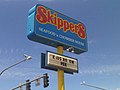 Skippers sign, Pocatello, Idaho.jpg 1,376 × 1,032; 217 KB
-
 Sun Rise at Pocatello, Idaho.jpg 1,024 × 261; 36 KB
-

-
 The Channelized Portneuf River - panoramio.jpg 3,488 × 2,616; 4.44 MB
-
 The Fake Ruins of ISU - panoramio.jpg 408 × 246; 15 KB
-
 The ISU "I" - panoramio.jpg 422 × 258; 35 KB
-
 The Kraft Road Bridge Over the Portneuf - panoramio.jpg 3,488 × 2,616; 5.06 MB
-
 The Mounted F101 Voodoo - panoramio.jpg 2,153 × 1,179; 1.24 MB
-
 The Once Beautiful Swiegart Park is Now a Neglected Empty Lot - panoramio.jpg 3,488 × 2,616; 4.78 MB
-
 Three Trains - panoramio.jpg 3,392 × 2,119; 3.23 MB
-
 Underpass - panoramio - JF Hobbs.jpg 3,275 × 2,257; 2.03 MB
-
 Union Pacific Smokestack - panoramio.jpg 3,252 × 2,328; 3.3 MB
-
 UP 931 the Portland Rose in Pocatello, ID in April 1971 (27390094811).jpg 2,000 × 1,378; 1.41 MB
-
 Up the Bench - panoramio.jpg 3,488 × 2,616; 3.52 MB
-
 West to Portland - panoramio.jpg 2,576 × 1,932; 2.12 MB
-
 Where this Creek Meets the Portneuf is Where the Old Indian Camp Was - panoramio.jpg 3,488 × 2,616; 3.58 MB
-
 Wier - panoramio.jpg 1,600 × 1,200; 1.38 MB
-
 Windless - panoramio.jpg 2,535 × 1,851; 2.31 MB
-
 Winter Wheat Fields - panoramio.jpg 3,380 × 2,415; 3.68 MB
-
 Wrensted Pocatello Parade.jpg 336 × 242; 18 KB


.jpg)


.jpg)
.jpg)
.jpg)
.jpg)
.jpg)


.jpg)
.jpg)
.jpg)


.jpg)

.jpg)
.jpg)


.jpg)


.jpg)


.jpg)
.jpg)

.jpg)


.jpg)


_-_8.jpg)


.jpg)


.jpg)


.jpg)


.jpg)


