Category:Barbarakerk (Tungelroy)
Jump to navigation
Jump to search
| Object location | | View all coordinates using: OpenStreetMap |
|---|
church in Tungelroy, Netherlands  | |||||
| Upload media | |||||
| Instance of | |||||
|---|---|---|---|---|---|
| Dedicated to | |||||
| Location | Tungelroy, Weert, Limburg, Netherlands | ||||
| Street address |
| ||||
| Located on street |
| ||||
| Diocese | |||||
| Heritage designation |
| ||||
| Inception |
| ||||
| Religion or worldview | |||||
 | |||||
Nederlands: Barbarakerk (Tungelroy) - anno 1793
|
This is a category about rijksmonument number 38470
|
| Address |
|
Media in category "Barbarakerk (Tungelroy)"
The following 15 files are in this category, out of 15 total.
-
 Aanzicht - Tungelroy - 20210112 - RCE.jpg 806 × 1,200; 142 KB
-
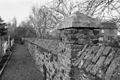
 Exterieur GEDEELTE KERKHOFMUUR - Tungelroy - 20295717 - RCE.jpg 1,200 × 800; 296 KB
-
 Exterieur KAPEL MET KRUISBEELD - Tungelroy - 20295719 - RCE.jpg 800 × 1,200; 179 KB
-
 Exterieur OVERZICHT - Tungelroy - 20295714 - RCE.jpg 800 × 1,200; 165 KB
-
 Exterieur OVERZICHT KAPEL - Tungelroy - 20295718 - RCE.jpg 800 × 1,200; 171 KB
-
 Exterieur OVERZICHT KERKHOFMUUR - Tungelroy - 20295715 - RCE.jpg 1,200 × 800; 211 KB
-
 Exterieur OVERZICHT KERKHOFMUUR - Tungelroy - 20295716 - RCE.jpg 1,200 × 800; 296 KB
-
 INTERIEUR, KAPEL, SCHILDERINGEN - Tungelroy - 20295720 - RCE.jpg 800 × 1,200; 270 KB
-
 INTERIEUR, KAPEL, SCHILDERINGEN - Tungelroy - 20295721 - RCE.jpg 800 × 1,200; 237 KB
-
 INTERIEUR, KAPEL, SCHILDERINGEN - Tungelroy - 20295722 - RCE.jpg 789 × 1,200; 237 KB
-
 Tungelroy, kerk foto8 2011-03-20 15.14 B.jpg 2,976 × 3,968; 9.8 MB
-
 Tungelroy, kerk foto8 2011-03-20 15.14.JPG 3,312 × 4,686; 8.86 MB
-
 Tungelroy-Sint-Barbarakerk (1).jpg 4,000 × 3,000; 4.96 MB
-
 Tungelroy-Sint-Barbarakerk (2).jpg 4,000 × 3,000; 4.66 MB
-
 Tungelroy-Sint-Barbarakerk (3).jpg 3,000 × 4,000; 4.74 MB


.jpg)
.jpg)
.jpg)