Category:Barbican, Bratislava
Jump to navigation
Jump to search
| This category shows the protected monument with the number 101-120/2 (other) in the Slovak Republic. |
| Object location | | View all coordinates using: OpenStreetMap |
|---|
 | |||||
| Upload media | |||||
| Instance of | |||||
|---|---|---|---|---|---|
| Location | Bratislava, Bratislava Region, Slovakia | ||||
| Architectural style | |||||
| Heritage designation |
| ||||
| Inception |
| ||||
 | |||||
Subcategories
This category has only the following subcategory.
M
- Museum of Pharmacy, Bratislava (12 F)
Media in category "Barbican, Bratislava"
The following 13 files are in this category, out of 13 total.
-
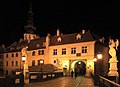
 Bratislava - Michalská - View West.jpg 4,604 × 3,799; 22.23 MB
-
 Bratislava - Michalská - View WSW.jpg 2,592 × 3,915; 9.62 MB
-
 Bratislava Michaels Gate Barbican.JPG 1,600 × 1,200; 279 KB
-
 Bratislava Michalská barbakan 01.jpg 1,536 × 2,048; 601 KB
-
 Bratislava Michalská barbakan 02.jpg 1,536 × 2,048; 706 KB
-
 Bratislava Michalská barbakan 03.jpg 2,048 × 1,536; 758 KB
-
 Bratislava Michalská barbakan 04.jpg 2,048 × 1,536; 1.11 MB
-
 Bratislava Michalský most 06.jpg 2,048 × 1,536; 825 KB
-
 Bratislava Michalský most 10.jpg 2,048 × 1,536; 819 KB
-
 BRÁNA OPEVNENIA.jpg 6,000 × 4,000; 12.79 MB
-
 I10 348 Barbakan.jpg 3,560 × 2,582; 1.44 MB
-
 I10 355 Zwinger vor dem Michaelertor.jpg 2,996 × 4,494; 3.16 MB
-
 Pozsony-2014-3-26- (5).jpg 2,560 × 1,920; 1.16 MB


.jpg)