Category:Barry, Vale of Glamorgan
Jump to navigation
Jump to search
town and community in the Vale of Glamorgan, Wales, UK   | |||||
| Upload media | |||||
| Instance of | |||||
|---|---|---|---|---|---|
| Location | Vale of Glamorgan, Wales | ||||
| Inception |
| ||||
| Population |
| ||||
| Area |
| ||||
| Elevation above sea level |
| ||||
 | |||||
English: Barry (south-southwest of Cardiff, the capital city of Wales, Barry is a seaside resort, with attractions including several beaches and the Barry Island Pleasure Park. Once a small village, Barry has absorbed its larger neighbouring villages of Cadoxton and Barry Island.
Subcategories
This category has the following 20 subcategories, out of 20 total.
- Merthyr Dyfan (15 F)
B
- Barry Waterfront (22 F)
C
- Cold Knap (17 F)
E
J
- Jenner Park (6 F)
M
P
- Porthkerry Country Park (30 F)
S
T
- The Bendricks (16 F)
Pages in category "Barry, Vale of Glamorgan"
This category contains only the following page.
Media in category "Barry, Vale of Glamorgan"
The following 200 files are in this category, out of 1,442 total.
(previous page) (next page)-
 'Stavros S Niarchos' at Barry docks - geograph.org.uk - 2590906.jpg 768 × 1,024; 156 KB
-

-
 20mph zone, College Road, Barry - geograph.org.uk - 3296378.jpg 640 × 524; 95 KB
-

-

-
-
 A customer at Quasar - geograph.org.uk - 5425629.jpg 2,270 × 1,960; 855 KB
-
-
 A pebble beach, Barry - geograph.org.uk - 3965962.jpg 800 × 557; 152 KB
-

-
 A row of houses, Cardiff Road, Barry - geograph.org.uk - 3246877.jpg 640 × 424; 66 KB
-
 A Sainsbury's Local in Barry - geograph.org.uk - 3368851.jpg 640 × 413; 77 KB
-
 A shrunken postbox, Barry - geograph.org.uk - 3356064.jpg 640 × 603; 129 KB
-
 A view across the Bristol Channel from Barry Island - geograph.org.uk - 5902644.jpg 1,024 × 683; 1.09 MB
-
 A view from Dock View Road, Barry - geograph.org.uk - 3359016.jpg 640 × 415; 78 KB
-
 A warrior in the leisure park - geograph.org.uk - 5425635.jpg 5,202 × 3,465; 3.39 MB
-
 A.B.Car Sales, Barry - geograph.org.uk - 3255363.jpg 640 × 454; 77 KB
-
 A4050 Colcot Road - geograph.org.uk - 5888165.jpg 1,024 × 755; 142 KB
-
 A4055 Cardiff Road - geograph.org.uk - 5249188.jpg 640 × 513; 55 KB
-
 A4056 nears The Parade junction - geograph.org.uk - 5754243.jpg 640 × 480; 52 KB
-
 A4226 near Walters Farm - geograph.org.uk - 5888148.jpg 1,024 × 761; 169 KB
-
 A4231 Barry Docks Link Road - geograph.org.uk - 5754273.jpg 640 × 480; 55 KB
-
 A4231 Barry Docks Link Road - geograph.org.uk - 5754297.jpg 640 × 481; 64 KB
-

-
 Abandoned building on Little Island, Barry - geograph.org.uk - 2583712.jpg 2,816 × 2,112; 1.89 MB
-
 Abbeyfield, Barry - geograph.org.uk - 3361728.jpg 640 × 497; 90 KB
-

-
 Accountants at 68 High Street, Barry - geograph.org.uk - 6261969.jpg 1,600 × 1,240; 484 KB
-

-
 AEC Mercury-Merryweather Fire Engine - geograph.org.uk - 1932071.jpg 1,024 × 768; 205 KB
-
 Albert Street, Barry - geograph.org.uk - 5394442.jpg 800 × 746; 143 KB
-
 Alisa and a derelict boat in Barry Harbour - geograph.org.uk - 6692822.jpg 5,184 × 3,888; 5.47 MB
-
 All Saints' Church information board, Park Road, Barry - geograph.org.uk - 6264487.jpg 1,600 × 1,325; 571 KB
-

-

-
 Allotment Sheds, Barry Island - geograph.org.uk - 3845290.jpg 2,400 × 1,491; 4.36 MB
-

-
 Allsta Motors, Barry - geograph.org.uk - 6260089.jpg 1,600 × 1,371; 514 KB
-
 Along a jetty into Barry Dock - geograph.org.uk - 3966476.jpg 800 × 600; 120 KB
-
 Along College Road, Barry - geograph.org.uk - 6272220.jpg 1,600 × 1,208; 414 KB
-

-
 Ammonite water feature, promenade, Barry Island - geograph.org.uk - 5566546.jpg 5,184 × 3,456; 7.42 MB
-

-
 An Inconvenience - geograph.org.uk - 5305445.jpg 2,787 × 2,069; 1.16 MB
-

-

-
 Approaching sunset at Barry Docks station - geograph.org.uk - 2764800.jpg 1,024 × 683; 91 KB
-

-
 Arthur Street traffic calming, Barry - geograph.org.uk - 5393972.jpg 800 × 699; 139 KB
-
 Artificial island in Barry Dock - geograph.org.uk - 3966548.jpg 800 × 725; 178 KB
-
 Atlantic Trading Estate, Sully - geograph.org.uk - 5453171.jpg 3,264 × 2,448; 1.89 MB
-
 Atlantic Trading Estate, Sully.jpg 640 × 402; 56 KB
-
 Automasters, Barry - geograph.org.uk - 5084520.jpg 800 × 596; 112 KB
-
 B.W.Autos in Barry - geograph.org.uk - 5079893.jpg 685 × 800; 114 KB
-
 B4266 Pontypridd Road, Barry - geograph.org.uk - 5754214.jpg 640 × 480; 73 KB
-
 B4267 at Ty Verion roundabout - geograph.org.uk - 5249187.jpg 640 × 480; 67 KB
-
 Babs Baps, Barry - geograph.org.uk - 5080199.jpg 694 × 800; 142 KB
-
 Back Street Barry - geograph.org.uk - 3873451.jpg 2,400 × 814; 2.2 MB
-
 Bandstand - geograph.org.uk - 6892449.jpg 640 × 478; 54 KB
-
 Barbershop on Wyndham Street - geograph.org.uk - 5335737.jpg 1,024 × 779; 169 KB
-
 Barclays Bank, Barry - geograph.org.uk - 3379423.jpg 640 × 566; 101 KB
-
 Barrier across Knap Car Terrace, Barry - geograph.org.uk - 3966004.jpg 800 × 600; 162 KB
-
 Barry , Colcot Road A4050 - geograph.org.uk - 6115665.jpg 6,000 × 4,000; 5.8 MB
-
 Barry , Houses - geograph.org.uk - 6115662.jpg 6,000 × 4,000; 7.89 MB
-
 Barry , Port Road East A4050 - geograph.org.uk - 6115663.jpg 6,000 × 4,000; 6.63 MB
-
 Barry , Port Road East A4050 - geograph.org.uk - 6115664.jpg 6,000 × 4,000; 7.44 MB
-
 Barry , Port Road West A4226 - geograph.org.uk - 6115667.jpg 6,000 × 4,000; 5.48 MB
-
 Barry , Port Road West A4226 - geograph.org.uk - 6115669.jpg 6,000 × 4,000; 5.51 MB
-
 Barry , Port Road West A4226 - geograph.org.uk - 6115670.jpg 6,000 × 4,000; 7.14 MB
-
 Barry , Texaco - geograph.org.uk - 6115671.jpg 6,000 × 4,000; 7.24 MB
-
 Barry , Toby Carvery - geograph.org.uk - 6115672.jpg 6,000 × 4,000; 5.27 MB
-
 Barry Animal Health Centre - geograph.org.uk - 3356107.jpg 640 × 494; 80 KB
-
 Barry Arts Centre, Colcot, Barry - geograph.org.uk - 3286205.jpg 640 × 495; 78 KB
-
 Barry Athletic Cricket Club - geograph.org.uk - 2590980.jpg 1,024 × 762; 119 KB
-
 Barry back lane - geograph.org.uk - 5393961.jpg 655 × 800; 127 KB
-
 Barry breakwater - geograph.org.uk - 1888072.jpg 640 × 480; 115 KB
-
-
 Barry Crematorium - geograph.org.uk - 5198274.jpg 3,264 × 2,448; 2.05 MB
-
 Barry Dock Conservative Club - geograph.org.uk - 1897294.jpg 3,296 × 2,472; 1.86 MB
-

-
 Barry Dock from Dock View Road - geograph.org.uk - 2818104.jpg 2,200 × 640; 1.75 MB
-
 Barry Dock RNLI Lifeboat Station - geograph.org.uk - 3636952.jpg 800 × 519; 113 KB
-
 Barry Dockers Sports and Social Club - geograph.org.uk - 1917447.jpg 640 × 484; 67 KB
-
 Barry Docks - geograph.org.uk - 1971869.jpg 1,500 × 990; 154 KB
-
 Barry Docks - geograph.org.uk - 2352824.jpg 640 × 491; 51 KB
-
 Barry Docks - geograph.org.uk - 5305442.jpg 3,264 × 2,448; 1.28 MB
-
 Barry Docks branch - geograph.org.uk - 2006622.jpg 640 × 480; 106 KB
-
 Barry Docks Link Road A4231.jpg 640 × 480; 66 KB
-
 Barry East sewage pumping station - geograph.org.uk - 3248779.jpg 640 × 573; 80 KB
-
 Barry Gorsedd Stones.JPG 2,272 × 1,704; 1.99 MB
-
 Barry Grid Substation - geograph.org.uk - 5198271.jpg 3,264 × 2,448; 2.75 MB
-
 Barry Island (Vale of Glamorgan) - geograph.org.uk - 6922360.jpg 600 × 800; 113 KB
-

-
 Barry Island - Watch house bay taken March 2008 - geograph.org.uk - 2758155.jpg 1,024 × 683; 153 KB
-
 Barry Island Beach view, Cardiff 01.jpg 1,440 × 1,081; 206 KB
-
 Barry Island Beach view, Cardiff 03.jpg 1,440 × 1,083; 471 KB
-
 Barry Island Beach view, Cardiff 04.jpg 4,032 × 3,024; 3.33 MB
-
 Barry Island Beach view, Cardiff 05.jpg 4,032 × 3,024; 2.07 MB
-
 Barry Island by Night - geograph.org.uk - 3845275.jpg 2,400 × 1,594; 3.38 MB
-
 Barry Island Coastguard Rescue Station - geograph.org.uk - 3743602.jpg 800 × 617; 125 KB
-
 Barry Island eastern promenade - geograph.org.uk - 5425410.jpg 5,202 × 3,465; 3.1 MB
-
 Barry Island football pitch - geograph.org.uk - 3834994.jpg 800 × 547; 120 KB
-
 Barry Island Harbour - geograph.org.uk - 6892389.jpg 640 × 478; 68 KB
-
 Barry Island in January - geograph.org.uk - 3304533.jpg 1,024 × 768; 196 KB
-
 Barry Island post office - geograph.org.uk - 3278199.jpg 639 × 640; 110 KB
-

-

-

-

-
 Barry Island sign, Harbour Road - geograph.org.uk - 1909380.jpg 640 × 480; 47 KB
-
 Barry Island station looking east from footbridge - geograph.org.uk - 5425371.jpg 5,202 × 3,465; 3.94 MB
-
 Barry Island station looking west. - geograph.org.uk - 5425365.jpg 5,202 × 3,465; 3.05 MB
-
 Barry Masonic Hall - geograph.org.uk - 5079889.jpg 800 × 789; 175 KB
-
 Barry Masonic Hall, Broad Street, Barry - geograph.org.uk - 6261950.jpg 1,541 × 1,600; 472 KB
-
 Barry Mencap Social Centre, Barry - geograph.org.uk - 3351765.jpg 640 × 487; 84 KB
-
 Barry mosque - geograph.org.uk - 1917344.jpg 640 × 480; 81 KB
-
 Barry mosque, Holton Rd, Barry - geograph.org.uk - 2294179.jpg 4,000 × 3,000; 1.7 MB
-
 Barry Old Harbour - geograph.org.uk - 6302748.jpg 2,852 × 1,770; 1.33 MB
-
 Barry panorama.jpg 413 × 640; 84 KB
-
 Barry Pilot Station - geograph.org.uk - 3636865.jpg 800 × 500; 118 KB
-
 Barry railway station bilingual name sign - geograph.org.uk - 6260025.jpg 1,264 × 1,391; 630 KB
-
 Barry Road near St Fagans Avenue - geograph.org.uk - 5888173.jpg 1,024 × 742; 186 KB
-
 Barry Road, Barry - geograph.org.uk - 3296351.jpg 640 × 387; 66 KB
-
 Barry Security Centre, Barry - geograph.org.uk - 3368813.jpg 640 × 605; 95 KB
-
 Barry Station Car Park - geograph.org.uk - 6260070.jpg 1,600 × 821; 333 KB
-
 Barry Station Car Park, Barry - geograph.org.uk - 5079430.jpg 800 × 605; 142 KB
-
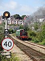
 Barry Tourist Railway - geograph.org.uk - 1932066.jpg 1,024 × 768; 164 KB
-
 Barry Tourist Railway - geograph.org.uk - 3629338.jpg 4,000 × 3,000; 3.48 MB
-
 Barry Tourist Railway - geograph.org.uk - 4145543.jpg 3,416 × 2,562; 2.16 MB
-
 Barry Tourist Railway - geograph.org.uk - 4145553.jpg 3,908 × 2,931; 2.69 MB
-
 Barry Tourist Railway - geograph.org.uk - 4145620.jpg 3,000 × 4,000; 4.18 MB
-
 Barry Tourist Railway at the Island - geograph.org.uk - 1932074.jpg 1,024 × 768; 237 KB
-
 Barry Town Hall and new Library - geograph.org.uk - 272848.jpg 640 × 437; 129 KB
-
 Barry Tyre Centre, Barry - geograph.org.uk - 3374891.jpg 640 × 595; 102 KB
-
 Barry Wartime Weekend - geograph.org.uk - 3629335.jpg 4,000 × 3,000; 3.66 MB
-
 Barry Wartime Weekend display - geograph.org.uk - 4145540.jpg 3,936 × 2,952; 3.39 MB
-
 Barry Waterfront - geograph.org.uk - 1971863.jpg 1,500 × 988; 173 KB
-
 Barry Waterfront - geograph.org.uk - 6704636.jpg 1,200 × 802; 1,012 KB
-
 Barry Waterfront Festival - geograph.org.uk - 2583693.jpg 2,816 × 2,112; 1.41 MB
-
 Barry West End Club, Barry - geograph.org.uk - 3361682.jpg 640 × 409; 65 KB
-
 Barry, south Wales from the air (22186906576).jpg 3,888 × 2,592; 6.03 MB
-
 Barry, Vale of Glamorgan from the air (22207794531).jpg 3,538 × 2,359; 4.35 MB
-
 Barryfestivaltheautomatic2.jpg 744 × 884; 388 KB
-
 Bassett Park, Barry - geograph.org.uk - 3374855.jpg 640 × 500; 95 KB
-
 Beach and Harbour Wall - geograph.org.uk - 2061993.jpg 600 × 800; 95 KB
-
 Beach and promenade, Whitmore Bay, Barry Island - geograph.org.uk - 5565479.jpg 5,179 × 3,451; 4.25 MB
-
 Beach at Jackson's Bay, Barry Island - geograph.org.uk - 5564126.jpg 5,179 × 3,451; 5.29 MB
-
 Beach huts at the edge of Whitmore Bay - geograph.org.uk - 5425391.jpg 4,502 × 3,421; 3.97 MB
-
 Beach steps '6', Whitmore Bay - geograph.org.uk - 5903083.jpg 5,184 × 3,456; 6.51 MB
-
 Beach, The Knapp, at low tide - geograph.org.uk - 5567140.jpg 5,179 × 3,451; 4.27 MB
-
 Beacon, Cold Knapp Point - geograph.org.uk - 5567172.jpg 5,179 × 3,451; 5.1 MB
-
 BeeSpoke Cycles, Barry - geograph.org.uk - 3247044.jpg 640 × 507; 64 KB
-
 Belle Vue Terrace, Cadoxton, Barry - geograph.org.uk - 3351037.jpg 640 × 578; 132 KB
-
 Belvedere Crescent, Barry - geograph.org.uk - 3373490.jpg 640 × 517; 93 KB
-

-
 Bench with a view, Dock View Road, Barry - geograph.org.uk - 5373263.jpg 800 × 611; 109 KB
-

-

-
 Bend from Romilly Park Road to Lakeside, Barry - geograph.org.uk - 6265933.jpg 1,600 × 1,167; 436 KB
-
 Bend in Main Street, Cadoxton, Barry - geograph.org.uk - 5187121.jpg 800 × 570; 96 KB
-
 Bend in St Nicholas Road, Barry - geograph.org.uk - 6264058.jpg 1,367 × 1,600; 389 KB
-
 Bendrick Rock - geograph.org.uk - 5453177.jpg 3,264 × 2,448; 3.18 MB
-
 Bespoke Jewellery Workshop, 4 Island Road, Barry - geograph.org.uk - 6262011.jpg 1,513 × 1,600; 651 KB
-
 Best-one corner shop, Barry - geograph.org.uk - 3353344.jpg 640 × 457; 73 KB
-
 Between green railings, Barry Island - geograph.org.uk - 3832623.jpg 800 × 548; 142 KB
-
 Beverley Street, Cadoxton, Barry - geograph.org.uk - 3351667.jpg 634 × 640; 113 KB
-
 Big Dave's, Barry Island - geograph.org.uk - 3360507.jpg 593 × 640; 101 KB
-
 Bikers Gear, Cadoxton, Barry - geograph.org.uk - 5181677.jpg 800 × 637; 92 KB
-
 Birch Grove, The Knap, Barry - geograph.org.uk - 3966296.jpg 800 × 468; 85 KB
-
 Bite Me, Barry - geograph.org.uk - 3373962.jpg 640 × 553; 103 KB
-
 Black gates facing Hill Street, Barry - geograph.org.uk - 5367835.jpg 800 × 750; 171 KB
-

-
 Bladez Barbershop, Broad Street, Barry - geograph.org.uk - 5106786.jpg 800 × 766; 121 KB
-
 Block of flats on Holton Road, Barry - geograph.org.uk - 5335734.jpg 1,024 × 807; 143 KB
-

-

-
 Blocks installation on promenade by Whitmore Bay - geograph.org.uk - 5425384.jpg 4,507 × 2,885; 2.7 MB
-

-

-
 Bonmarche Barry - geograph.org.uk - 3379399.jpg 478 × 640; 89 KB
-
 Boots Pharmacy, Holton Road, Barry - geograph.org.uk - 3358027.jpg 640 × 464; 75 KB
-
-
 Boulders on a roundabout, Barry - geograph.org.uk - 3385144.jpg 640 × 358; 53 KB
-

-
 Brake van ride on the Barry Tourist Railway - geograph.org.uk - 6834215.jpg 5,184 × 3,888; 4.51 MB
-
 Breaksea Court, Barry Island - geograph.org.uk - 3743870.jpg 800 × 515; 87 KB
-
 Breaksea Drive, Barry - geograph.org.uk - 5754251.jpg 640 × 481; 55 KB
-
 Brewers Fayre and Premier Inn, Barry - geograph.org.uk - 3761331.jpg 800 × 517; 106 KB
-
 Brick houses, Canon Street, Barry - geograph.org.uk - 6265087.jpg 1,600 × 1,200; 514 KB
-
 Bristol Channel , South Wales - geograph.org.uk - 6258946.jpg 6,000 × 4,000; 7.22 MB
-
 Broad Street Garden Centre, Barry - geograph.org.uk - 3368889.jpg 640 × 407; 78 KB
-
 Broad Street gas installation, Barry - geograph.org.uk - 6260839.jpg 1,600 × 1,095; 515 KB
-

-
 Broad Street houses and trees, Barry - geograph.org.uk - 6273435.jpg 1,600 × 1,372; 582 KB
-

-
 Bromfield Road, Barry Island - geograph.org.uk - 3276545.jpg 640 × 523; 73 KB
-
 Brush electricity equipment below Harbour Road, Barry - geograph.org.uk - 6263986.jpg 1,600 × 1,417; 631 KB
-
 Brynhill Golf Club, Barry - geograph.org.uk - 3285927.jpg 640 × 408; 73 KB
-
 Brynhill vale course.jpg 2,048 × 1,536; 706 KB
-


_-_geograph.org.uk_-_6922360.jpg)


.jpg)
.jpg)


