Category:Barsham, Norfolk
Jump to navigation
Jump to search
English: Barsham is a civil parish in the English county of Norfolk, and includes the villages of East Barsham, North Barsham, West Barsham and Houghton St Giles. The villages are all situated with 3 km of each other, about 5 km north of the town of Fakenham and 45 km north-west of the city of Norwich. The headwaters of the River Stiffkey flow through both East and North Barsham and Houghton St Giles.
civil parish in Norfolk, UK | |||||
| Upload media | |||||
| Instance of | |||||
|---|---|---|---|---|---|
| Location | North Norfolk, Norfolk, East of England, England | ||||
| Area |
| ||||
 | |||||
Subcategories
This category has the following 4 subcategories, out of 4 total.
E
H
N
W
Media in category "Barsham, Norfolk"
The following 176 files are in this category, out of 176 total.
-
 A carpet of fallen leaves - geograph.org.uk - 5616175.jpg 3,456 × 2,592; 3.99 MB
-
 A cluster of bluebells beside Brake Lane - geograph.org.uk - 4937723.jpg 640 × 360; 374 KB
-

-
 Approaching the B1105 road on Brake Lane - geograph.org.uk - 4937695.jpg 640 × 360; 353 KB
-
 B1105, West Barsham - geograph.org.uk - 5850669.jpg 1,600 × 939; 260 KB
-
 Barley crop field beside the B1105 road - geograph.org.uk - 4937707.jpg 640 × 360; 249 KB
-

-

-
 Barley crop in early May - geograph.org.uk - 4937712.jpg 640 × 360; 276 KB
-
 Barn beside the B1105 road - geograph.org.uk - 2122319.jpg 640 × 480; 78 KB
-
 Bus Stop - geograph.org.uk - 264058.jpg 640 × 480; 97 KB
-
 Bust of Cardinal Bourne - geograph.org.uk - 5380263.jpg 640 × 480; 98 KB
-
 Chimneys and Turrets, Manor House East Barsham - geograph.org.uk - 6323669.jpg 5,184 × 3,888; 495 KB
-

-
 Concealed entrance sign on Fakenham Road, Houghton - geograph.org.uk - 5950675.jpg 2,592 × 1,944; 2.74 MB
-
 Cottage on Fakenham Road - geograph.org.uk - 5557848.jpg 640 × 480; 95 KB
-

-
 Council houses on Fakenham Road - geograph.org.uk - 5557837.jpg 640 × 480; 80 KB
-
 Crop field and hedgerow - geograph.org.uk - 5557838.jpg 640 × 480; 53 KB
-
 Crop field off Fakenham Road - geograph.org.uk - 5557839.jpg 640 × 480; 81 KB
-
-
 Crossing Cottage in Fakenham Road - geograph.org.uk - 2122077.jpg 640 × 480; 78 KB
-
 Crossroads, Houghton St Giles - geograph.org.uk - 5557854.jpg 640 × 480; 71 KB
-
 Deck Removed - geograph.org.uk - 1934396.jpg 800 × 531; 196 KB
-
 Deep Cutting - geograph.org.uk - 1934603.jpg 800 × 531; 150 KB
-
 Deep Railway Cutting - geograph.org.uk - 1934268.jpg 800 × 531; 164 KB
-
 Dismantled Level Crossing - geograph.org.uk - 1934082.jpg 800 × 531; 81 KB
-
 Dismantled Railway - geograph.org.uk - 1934049.jpg 800 × 531; 106 KB
-
 Dismantled Railway - geograph.org.uk - 1934227.jpg 800 × 531; 177 KB
-
 Dismantled Railway - geograph.org.uk - 1934639.jpg 800 × 531; 117 KB
-
 Dismantled Railway Bridge - geograph.org.uk - 1934285.jpg 800 × 531; 214 KB
-
 Dismantled Railway Bridge - geograph.org.uk - 1934313.jpg 800 × 531; 239 KB
-
 Dismantled Railway Bridge - geograph.org.uk - 1934664.jpg 800 × 531; 168 KB
-
 Domesticated Water Buffalo (Bubalus bubalis) - geograph.org.uk - 6026478.jpg 3,264 × 2,448; 1.81 MB
-
 Domesticated Water Buffalo calf (Bubalus bubalis) (junior) - geograph.org.uk - 6026483.jpg 3,264 × 2,448; 1.74 MB
-
 Drive to Dale Cottage - geograph.org.uk - 5557851.jpg 640 × 480; 113 KB
-

-
 Elizabeth II postbox on Fakenham Road, Houghton St. Giles - geograph.org.uk - 5579799.jpg 2,136 × 2,848; 1.44 MB
-
 Entering East Barsham - geograph.org.uk - 5557840.jpg 640 × 480; 49 KB
-
 Fakenham Road in Houghton St Giles - geograph.org.uk - 4845871.jpg 4,320 × 3,240; 5.6 MB
-
 Fakenham Road towards East Barsham - geograph.org.uk - 5557836.jpg 640 × 480; 75 KB
-

-

-
 Farm Accommodation Bridge - geograph.org.uk - 1934615.jpg 800 × 531; 205 KB
-
 Farm Accommodation Bridge - geograph.org.uk - 1934670.jpg 800 × 450; 181 KB
-
 Farm buildings at Lodge Farm - geograph.org.uk - 6391676.jpg 800 × 533; 139 KB
-
 Farm shed west of the B1105 road - geograph.org.uk - 2122297.jpg 640 × 480; 139 KB
-

-
 Farmland near Little Walsingham - geograph.org.uk - 5557861.jpg 640 × 480; 54 KB
-
 Farmland west of Fakenham Road - geograph.org.uk - 5557834.jpg 640 × 480; 64 KB
-
 Field boundary hedge near Lodge Farm - geograph.org.uk - 2313360.jpg 2,848 × 2,136; 2.95 MB
-
 Field east of the B1105 road - geograph.org.uk - 2122466.jpg 640 × 480; 157 KB
-
 Field gates, West Barsham - geograph.org.uk - 5850667.jpg 1,600 × 1,067; 384 KB
-
 Field south of Hand Lane - geograph.org.uk - 2122367.jpg 640 × 480; 134 KB
-
 Fields beside Brake Lane - geograph.org.uk - 4937683.jpg 640 × 360; 273 KB
-
 Fields east of the B1105 road - geograph.org.uk - 2122470.jpg 640 × 480; 155 KB
-
 Fields north of Green Way - geograph.org.uk - 2122513.jpg 640 × 480; 79 KB
-
 Fields north-west of North Barsham - geograph.org.uk - 2122547.jpg 640 × 480; 75 KB
-
 Footbridge on Pilgrims Way - geograph.org.uk - 1934632.jpg 800 × 531; 187 KB
-
 Footpath to Waterden in Norfolk - geograph.org.uk - 2935200.jpg 4,320 × 3,240; 6.1 MB
-
 Ford but for Tractors only - geograph.org.uk - 1934166.jpg 800 × 531; 188 KB
-
 Gateway to Manor House, East Barsham - geograph.org.uk - 6323672.jpg 640 × 480; 68 KB
-
 Germination on the higher ground - geograph.org.uk - 2935376.jpg 4,320 × 3,240; 5.74 MB
-
 Grain Dryer - geograph.org.uk - 1934065.jpg 800 × 531; 103 KB
-
 Grain dryer next to the dismantled railway - geograph.org.uk - 2313432.jpg 2,848 × 2,136; 3.08 MB
-
 Grain dryer north of Fakenham - geograph.org.uk - 5557832.jpg 640 × 374; 58 KB
-
 Green Way past North Barsham Farm - geograph.org.uk - 2122502.jpg 640 × 480; 96 KB
-
 Hand Lane - geograph.org.uk - 2122143.jpg 640 × 480; 145 KB
-
 Hand Lane - geograph.org.uk - 2122345.jpg 640 × 480; 107 KB
-
 Hedgerows flanking the B1105 road - geograph.org.uk - 4937718.jpg 640 × 360; 285 KB
-
 Hedges at road junction with B1105 - geograph.org.uk - 6391858.jpg 800 × 533; 141 KB
-

-
 Hillside crop field, East Barsham - geograph.org.uk - 5557845.jpg 640 × 480; 80 KB
-
 Houghton-in-the-Dale War Memorial - geograph.org.uk - 4885617.jpg 2,592 × 3,456; 3.2 MB
-

-
 House on Fakenham Road, Houghton St. Giles - geograph.org.uk - 5579801.jpg 2,848 × 2,136; 1.41 MB
-
 I shot a pheasant (with a camera) - geograph.org.uk - 2856880.jpg 4,320 × 3,240; 5.39 MB
-

-

-

-

-

-

-

-

-

-

-

-

-

-

-

-

-
 Lane to Cranmer Hall - geograph.org.uk - 2122295.jpg 640 × 480; 172 KB
-
 Lane to Waterden - geograph.org.uk - 2122305.jpg 480 × 640; 125 KB
-
 Large cultivated field by Lodge Farm - geograph.org.uk - 4937690.jpg 640 × 360; 375 KB
-
 Large Cutting - geograph.org.uk - 1934612.jpg 800 × 501; 122 KB
-
 List of Rectors of North Barsham church - geograph.org.uk - 6026532.jpg 2,448 × 3,264; 1.69 MB
-
 Little Walsingham pumping station - geograph.org.uk - 5616172.jpg 3,456 × 2,592; 3.91 MB
-
 Manor House, East Barsham - geograph.org.uk - 6323665.jpg 5,184 × 3,888; 647 KB
-
 Manor House, East Barsham - geograph.org.uk - 6323666.jpg 5,184 × 3,888; 868 KB
-
-
 Old crossing-keeper's house - geograph.org.uk - 1934035.jpg 800 × 531; 98 KB
-
 Old Footbridge - geograph.org.uk - 1934352.jpg 800 × 531; 199 KB
-
 Old Mile Marker - geograph.org.uk - 1934606.jpg 800 × 531; 251 KB
-
 Old Railway Cutting - geograph.org.uk - 1934249.jpg 800 × 531; 186 KB
-
 Old Railway Cutting - geograph.org.uk - 1934624.jpg 800 × 531; 152 KB
-

-

-

-

-

-

-

-

-

-

-

-

-

-

-
 Overgrown Trackbed - geograph.org.uk - 1934101.jpg 800 × 531; 163 KB
-
 Peter Capaldi (Dr. Who) working as a security guard - geograph.org.uk - 5616168.jpg 3,456 × 2,592; 3.75 MB
-
 Pilgrims Way - geograph.org.uk - 1934649.jpg 800 × 531; 120 KB
-
 Pilgrims Way Footbridge - geograph.org.uk - 1934658.jpg 800 × 531; 182 KB
-

-

-

-
 Private road to Waterhouse Cottages - geograph.org.uk - 5950706.jpg 2,592 × 1,944; 2.99 MB
-
 Railway Bridge (Deck Removed) - geograph.org.uk - 1934384.jpg 800 × 531; 196 KB
-
 Rape and railings in Norfolk - geograph.org.uk - 2935316.jpg 4,320 × 3,240; 5.7 MB
-
 RC National Shrine - geograph.org.uk - 4670325.jpg 1,600 × 1,064; 508 KB
-
 Refuge on the Line - geograph.org.uk - 1934278.jpg 800 × 531; 198 KB
-
 Remains of a Railway Bridge - geograph.org.uk - 1934114.jpg 800 × 531; 244 KB
-
 Remains of old railway bridge - geograph.org.uk - 2935324.jpg 4,320 × 3,240; 5.99 MB
-
 River Stiffkey at Houghton St. Giles - geograph.org.uk - 3853439.jpg 1,600 × 1,230; 551 KB
-

-
-
 Single track road to Cannister Hall Farm - geograph.org.uk - 5950825.jpg 2,592 × 1,944; 2.87 MB
-
 Site of Dismantled Railway Bridge - geograph.org.uk - 1934133.jpg 800 × 531; 154 KB
-
 Small bridge over the river Stiffkey - geograph.org.uk - 2296604.jpg 2,127 × 1,371; 726 KB
-
 Spring Lane - geograph.org.uk - 2122352.jpg 640 × 480; 131 KB
-
-

-
 Stubble field beside the B1105 road - geograph.org.uk - 2122301.jpg 640 × 480; 86 KB
-
 The 3 Rs.....Rotting - Rubble - Rusting - geograph.org.uk - 2810195.jpg 4,320 × 3,240; 5.89 MB
-
 The B1105 road as seen from Brake Lane - geograph.org.uk - 4937713.jpg 640 × 360; 305 KB
-

-
 The B1355 - geograph.org.uk - 2077129.jpg 800 × 531; 162 KB
-
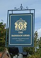
 The Barsham Arms, East Barsham - geograph.org.uk - 5557843.jpg 640 × 480; 75 KB
-
 The lane to West Barsham - geograph.org.uk - 2122141.jpg 480 × 640; 116 KB
-
 To North Barsham on Green Way - geograph.org.uk - 2122532.jpg 640 × 480; 147 KB
-

-
 Track past The Lodge - geograph.org.uk - 6069966.jpg 4,032 × 3,024; 7.06 MB
-
 Track to Hook's Moor near Great Snoring - geograph.org.uk - 2810203.jpg 4,320 × 3,240; 5.77 MB
-
 Track to pumping station - geograph.org.uk - 5557858.jpg 640 × 480; 80 KB
-
 Track to Three Cornered Plantation - geograph.org.uk - 2313340.jpg 2,848 × 2,136; 3.16 MB
-
 Trackbed to Fakenham - geograph.org.uk - 1934645.jpg 800 × 531; 131 KB
-
 Trackbed to Walsingham - geograph.org.uk - 1934421.jpg 800 × 531; 202 KB
-
 Tractor Ford - geograph.org.uk - 1934180.jpg 800 × 531; 169 KB
-
 Vatican Flag - geograph.org.uk - 3700378.jpg 600 × 800; 98 KB
-
 View along Brake Lane - geograph.org.uk - 4937703.jpg 640 × 360; 337 KB
-
 View along the B1105 road - geograph.org.uk - 4937717.jpg 640 × 360; 269 KB
-
 View down track towards Old Covert - geograph.org.uk - 481510.jpg 640 × 480; 143 KB
-
 View north along Fakenham Road - geograph.org.uk - 2122088.jpg 640 × 480; 83 KB
-
 View north along the B1105 road - geograph.org.uk - 2122463.jpg 640 × 480; 89 KB
-
 Waterden Farm - geograph.org.uk - 612416.jpg 640 × 480; 75 KB
-
 West Barsham War Memorial - geograph.org.uk - 5801016.jpg 2,592 × 3,456; 3.21 MB
-
 White field gate beside the B1105 road - geograph.org.uk - 2122459.jpg 640 × 480; 102 KB
-
 Who is that up at the window^ - geograph.org.uk - 5616170.jpg 3,456 × 2,592; 3.97 MB
-
 Wooded Embankment - geograph.org.uk - 1934365.jpg 800 × 531; 144 KB
-
 Wooded Trackbed - geograph.org.uk - 1934144.jpg 800 × 531; 157 KB
-
 WW1 memorial to four men from North Barsham - geograph.org.uk - 6026517.jpg 3,264 × 2,448; 1.84 MB
-
 WW2 memorial on Houghton St. Giles church - geograph.org.uk - 5950685.jpg 1,944 × 2,592; 2.3 MB
-

-
 Rural landscape - geograph.org.uk - 261736.jpg 640 × 480; 108 KB


_-_geograph.org.uk_-_6026478.jpg)
_(junior)_-_geograph.org.uk_-_6026483.jpg)


_-_geograph.org.uk_-_2856880.jpg)
_-_geograph.org.uk_-_5380503.jpg)
_-_geograph.org.uk_-_5380504.jpg)


_working_as_a_security_guard_-_geograph.org.uk_-_5616168.jpg)


_-_geograph.org.uk_-_1934384.jpg)


