Category:Bassett Green, Southampton
Jump to navigation
Jump to search
suburb of Southampton, Hampshire, England, UK  | |||||
| Upload media | |||||
| Instance of | |||||
|---|---|---|---|---|---|
| Part of | |||||
| Location | City of Southampton, Hampshire, South East England, England | ||||
 | |||||
Media in category "Bassett Green, Southampton"
The following 48 files are in this category, out of 48 total.
-
 A27 - geograph.org.uk - 5185047.jpg 640 × 427; 104 KB
-
 Along Burgess Road - geograph.org.uk - 5185389.jpg 640 × 427; 105 KB
-
 An attractive part of Bassett Green Road - geograph.org.uk - 3357894.jpg 800 × 524; 116 KB
-
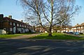
 Bassett Green - geograph.org.uk - 5185045.jpg 640 × 427; 120 KB
-
 Bassett Green Close, Bassett Green - geograph.org.uk - 2597348.jpg 640 × 480; 93 KB
-
 Bassett Green Road - geograph.org.uk - 5185210.jpg 640 × 427; 115 KB
-
 Bassett Green, Bencraft Court - geograph.org.uk - 1967894.jpg 1,024 × 768; 264 KB
-
 Bassett Green, crematorium - geograph.org.uk - 1967756.jpg 1,024 × 768; 184 KB
-
 Bassett Green, milestone - geograph.org.uk - 1967881.jpg 1,024 × 768; 280 KB
-
 Bencraft Court, Bassett Green Road - geograph.org.uk - 1324491.jpg 416 × 640; 89 KB
-
 Binstead Close, Bassett Green - geograph.org.uk - 2597383.jpg 640 × 480; 65 KB
-
 Bonchurch Close - geograph.org.uk - 2597372.jpg 640 × 480; 76 KB
-
 Building 58 - geograph.org.uk - 5172276.jpg 640 × 427; 139 KB
-
 Bungalows in The Parkway - geograph.org.uk - 2264748.jpg 640 × 480; 71 KB
-
 Bungalows, Bassett Green Road A27 - geograph.org.uk - 2439536.jpg 640 × 427; 98 KB
-
 Burgess Road - geograph.org.uk - 5185387.jpg 640 × 427; 137 KB
-

-
-
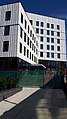 Centenary Building nearing completion - geograph.org.uk - 6245448.jpg 576 × 1,024; 142 KB
-
 Chemistry Buildings - geograph.org.uk - 5172270.jpg 640 × 427; 116 KB
-
 Concrete progress being made - geograph.org.uk - 5694732.jpg 640 × 360; 65 KB
-

-
 Down Kitchener Road - geograph.org.uk - 5172265.jpg 640 × 427; 103 KB
-
 Footbridge east of junction 4 - geograph.org.uk - 4727306.jpg 640 × 392; 50 KB
-
 Foundations of learning - geograph.org.uk - 5600295.jpg 640 × 360; 60 KB
-
 Glen Eyre Drive - geograph.org.uk - 5184765.jpg 427 × 640; 101 KB
-
 Glen Eyre Road - geograph.org.uk - 5185397.jpg 640 × 427; 105 KB
-
 Glenwood Avenue - geograph.org.uk - 5185038.jpg 640 × 427; 129 KB
-
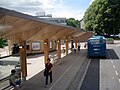
 Highfield Bus Interchange - geograph.org.uk - 5172274.jpg 640 × 427; 97 KB
-
 Houses and trees in Burgess Road - geograph.org.uk - 6171735.jpg 1,024 × 576; 274 KB
-
 Kitchener Road - geograph.org.uk - 5172264.jpg 640 × 427; 107 KB
-
 Lobelia Road - geograph.org.uk - 6265158.jpg 1,024 × 576; 204 KB
-

-
 Mid section of The Parkway - geograph.org.uk - 2264783.jpg 640 × 480; 81 KB
-
 Path in Bassett Wood - geograph.org.uk - 5185042.jpg 640 × 427; 174 KB
-
 Pavement in Coppefield Road - geograph.org.uk - 2264679.jpg 640 × 480; 83 KB
-
 Pre-term calm, University of Southampton - geograph.org.uk - 6265157.jpg 1,024 × 576; 228 KB
-
 Preparing the ground - geograph.org.uk - 5544054.jpg 360 × 640; 48 KB
-
 Ready for the first floor - geograph.org.uk - 5706992.jpg 640 × 360; 65 KB
-
 Shadows in The Parkway - geograph.org.uk - 2264721.jpg 640 × 480; 93 KB
-
 Southampton Crematorium - geograph.org.uk - 499363.jpg 640 × 480; 81 KB
-
 Stormy skies over Hampton Park - geograph.org.uk - 4955645.jpg 640 × 360; 79 KB
-
 The Parkway - geograph.org.uk - 5185040.jpg 427 × 640; 98 KB
-
 The Stile - geograph.org.uk - 5185394.jpg 640 × 427; 120 KB
-
 Trees in Copperfield Road - geograph.org.uk - 2264680.jpg 640 × 480; 89 KB
-
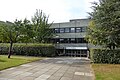
 University of Southampton buildings - geograph.org.uk - 5172268.jpg 640 × 427; 102 KB
-

-
 View from the top of Building 100 - geograph.org.uk - 6287464.jpg 1,024 × 576; 182 KB


