Category:Bastion Turfpoort (Vestingwerken Naarden)
Jump to navigation
Jump to search
| Object location | | View all coordinates using: OpenStreetMap |
|---|
 | |||||
| Upload media | |||||
| Instance of | |||||
|---|---|---|---|---|---|
| Part of | |||||
| Location | Naarden, Gooise Meren, North Holland, Netherlands | ||||
| Street address |
| ||||
| Heritage designation |
| ||||
 | |||||
|
This is a category about rijksmonument number 338811
|
| Address |
|
Media in category "Bastion Turfpoort (Vestingwerken Naarden)"
The following 18 files are in this category, out of 18 total.
-
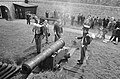
 Kazemat X op bastion Turfpoort - Naarden - 20161750 - RCE.jpg 1,189 × 1,200; 322 KB
-
 Luchtfototurfpoort.jpg 4,000 × 3,000; 12.58 MB
-
 Naarden Vesting Bastion Turfpoort Poterne V.jpg 3,386 × 2,663; 4.67 MB
-
 Overzicht bastion Turfpoort bij kazemat W - Naarden - 20161752 - RCE.jpg 1,191 × 1,200; 309 KB
-
 Overzicht bij bastion Turfpoort vanuit het westen - Naarden - 20161757 - RCE.jpg 1,187 × 1,200; 249 KB
-
 Overzicht oost bastion Turfpoort bij kazemat V. - Naarden - 20161751 - RCE.jpg 1,191 × 1,200; 426 KB
-
 Overzicht op bastion Turfpoort ter hoogte van kazemat W - Naarden - 20161755 - RCE.jpg 1,191 × 1,200; 354 KB
-
 Overzicht vanuit het zuiden bij bastion Turfpoort - Naarden - 20161756 - RCE.jpg 1,193 × 1,200; 391 KB
-

-
 Overzicht west-zijde bastion Turfpoort vanuit het zuiden - Naarden - 20161753 - RCE.jpg 1,193 × 1,200; 329 KB
-
 RM338811 Naarden Bastion Turfpoort.JPG 2,399 × 1,811; 1.8 MB
-
 Toegang west kazemat A op bastion Turfpoort - Naarden - 20161748 - RCE.jpg 1,193 × 1,200; 396 KB
-
 Voorgevel kazemat IJ op bastion Turfpoort - Naarden - 20161749 - RCE.jpg 1,193 × 1,200; 356 KB
-
-

-
-

-


