Category:Bastion de Saint-Léger (Geneva)
Jump to navigation
Jump to search
| Object location | | View all coordinates using: OpenStreetMap |
|---|
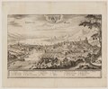
Français : Aussi nommé « bastion Cavalier ». Partiellement détruit en 1852. La moitié ouest est conservée, à l'angle de l'actuel parc des Bastions, sa terrasse se trouve au long du Pont de Saint-Léger.
Subcategories
This category has the following 2 subcategories, out of 2 total.
T
Media in category "Bastion de Saint-Léger (Geneva)"
The following 20 files are in this category, out of 20 total.
-
 1902-Saint-Léger-Mégard-BGE 25P St Le 11.jpg 1,175 × 761; 1.4 MB
-
 Bastion Saint-Léger 2024-a.jpg 5,472 × 3,648; 4.26 MB
-
 Bastion Saint-Léger 2024-b.jpg 5,178 × 3,585; 4.7 MB
-
 Bastion Saint-Léger 2024-c.jpg 5,472 × 3,648; 7.06 MB
-
 Bastion Saint-Léger 2024-d.jpg 5,445 × 3,176; 4.15 MB
-
 Bastion Saint-Léger 2024-e.jpg 3,906 × 3,447; 3.03 MB
-
 Bastion Saint-Léger 2024-f.jpg 3,648 × 5,472; 4.91 MB
-
 Bastion Saint-Léger 2024-g.jpg 3,648 × 5,472; 6.53 MB
-
 Bastion Saint-Léger 2024-h.jpg 4,882 × 2,297; 3.67 MB
-
 Bastion Saint-Léger 2024-plaque.jpg 1,717 × 1,123; 562 KB
-
 Bastion Saint-Léger.JPG 3,648 × 2,736; 6.27 MB
-
 CH-NB - Grafiken Orts- und Landschaftsansichten - GS-GRAF-ANSI-GE-209.tif 6,500 × 4,365; 69.65 MB
-
 CH-NB - Grafiken Orts- und Landschaftsansichten - GS-GRAF-ANSI-GE-29.tif 7,221 × 4,572, 2 pages; 94.51 MB
-
 CH-NB - Grafiken Orts- und Landschaftsansichten - GS-GRAF-ANSI-GE-42.tif 6,560 × 5,375, 2 pages; 100.95 MB
-
 CH-NB - Grafiken Orts- und Landschaftsansichten - GS-GRAF-ANSI-GE-44.tif 8,296 × 3,386, 2 pages; 80.41 MB
-
 Geneve... - btv1b8459098z.jpg 9,154 × 6,970; 11.26 MB
-
 Zentralbibliothek Zürich - Geneue - 991011184589705501.jpg 5,644 × 4,830; 4.93 MB
-
 Zentralbibliothek Zürich - Geneve Genff - 991011018929705501.jpg 6,585 × 3,475; 3.77 MB
-
 Zentralbibliothek Zürich - Vue de Geneve du coté du Couchant - 991081642359705501.jpg 6,927 × 3,917; 4.09 MB
-
 Topographia Helvetiae, Rhaetiae et Valesiae 1654 (1127074).jpg 4,055 × 2,775; 4.45 MB


.jpg)