Category:Batherton
Jump to navigation
Jump to search
English: Batherton is a hamlet and former civil parish in the unitary authority area of Cheshire East and the ceremonial county of Cheshire, England. It is just south of Nantwich, and according to the 2001 census had a population of 36.
hamlet and former civil parish in Cheshire East, England, UK  | |||||
| Upload media | |||||
| Instance of |
| ||||
|---|---|---|---|---|---|
| Location |
| ||||
 | |||||
Media in category "Batherton"
The following 24 files are in this category, out of 24 total.
-
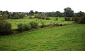 Austerson fields by Weaver.jpg 640 × 389; 116 KB
-
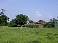 Batherton - Farm Buildings.jpg 640 × 480; 69 KB
-

-

-

-
 Entrance to Brookside Farm, Stapeley - geograph.org.uk - 5236161.jpg 800 × 600; 177 KB
-
 Farewell Nantwich, Floral Market Town - geograph.org.uk - 5154051.jpg 800 × 600; 147 KB
-
 Fields seen from Footpath - geograph.org.uk - 562891.jpg 640 × 480; 58 KB
-
 First Dig Lane - geograph.org.uk - 3881944.jpg 4,608 × 2,827; 4.75 MB
-
 Kill Your Speed in Stapeley - geograph.org.uk - 5235891.jpg 800 × 559; 115 KB
-
 Lane towards two farms, Stapeley - geograph.org.uk - 5236176.jpg 800 × 706; 134 KB
-

-
 Maylands Farm near Stapeley - geograph.org.uk - 5235858.jpg 800 × 607; 99 KB
-
 Mill Lane, Stapeley - geograph.org.uk - 5236173.jpg 753 × 800; 162 KB
-

-
 Oak Cottage, Stapeley - geograph.org.uk - 5236667.jpg 800 × 455; 84 KB
-

-
 Roadside houses, Stapeley - geograph.org.uk - 5236198.jpg 800 × 718; 147 KB
-
 Row of bungalows, Stapeley - geograph.org.uk - 5236155.jpg 800 × 450; 82 KB
-

-

-

-
 Warning sign - school, Stapeley - geograph.org.uk - 5236159.jpg 800 × 690; 156 KB
-
 Welcome to Nantwich, Floral Market Town - geograph.org.uk - 5154063.jpg 800 × 699; 156 KB


