Category:Bay of Mont-Saint-Michel
Jump to navigation
Jump to search
Français : Baie du Mont Saint-Michel
bay located between Brittany and the Normandy peninsula of Cotentin  | |||||
| Upload media | |||||
| Instance of | |||||
|---|---|---|---|---|---|
| Part of |
| ||||
| Located in protected area |
| ||||
| Location | |||||
| Area |
| ||||
| Different from | |||||
 | |||||
Subcategories
This category has the following 7 subcategories, out of 7 total.
Media in category "Bay of Mont-Saint-Michel"
The following 161 files are in this category, out of 161 total.
-
 2017-04 Mont Saint-Michel 01.jpg 5,992 × 3,995; 8.8 MB
-
 2017-04 Mont Saint-Michel Bay 01.jpg 4,585 × 2,579; 3.97 MB
-
 2017-04 Mont Saint-Michel Bay 02.jpg 6,000 × 4,000; 8.51 MB
-
 2017-04 Mont Saint-Michel Bay 03.jpg 6,000 × 4,000; 13.27 MB
-
 3689 - Frankreichtour 2016 - Mont Saint Michel (24124080688).jpg 10,537 × 3,512; 9.13 MB
-
 50170 Mont Saint-Michel, France - panoramio (6).jpg 3,888 × 2,592; 4.92 MB
-
 Abbey - Mont Saint Michel (32882396606).jpg 7,360 × 4,912; 9.6 MB
-
 Agon - Mont-Saint-Michel - btv1b53012830g (1 of 2).jpg 12,245 × 15,760; 14.55 MB
-
 Agon - Mont-Saint-Michel - btv1b53012830g (2 of 2).jpg 9,744 × 15,680; 15 MB
-
 Au Mont-saint-Michel (France).jpg 4,231 × 3,129; 6.18 MB
-
 Avranches and Mont Saint Michel from air.jpg 480 × 640; 43 KB
-
 Baie du Mont Saint Michel.JPG 3,872 × 2,592; 4.41 MB
-
 Baie Mont Saint-Michel, marée montante (2015).JPG 3,072 × 2,304; 2.03 MB
-
 Bay of Mont Saint-Michel (1).jpg 4,608 × 3,456; 3.51 MB
-
 Bay of Mont Saint-Michel - low tide - walking on the mud 01.JPG 4,896 × 3,672; 3.07 MB
-
 Bay of Mont Saint-Michel - low tide - walking on the mud 02.JPG 4,896 × 3,672; 5.58 MB
-
 Bay of Mont Saint-Michel - low tide - walking on the mud 03.JPG 4,896 × 3,672; 7.07 MB
-
 Bay of Mont Saint-Michel - low tide - walking on the mud 04.JPG 4,896 × 3,672; 6.05 MB
-
 Bay of Mont Saint-Michel - low tide - walking on the mud 05.JPG 4,896 × 3,672; 4.63 MB
-
 Bay of Mont Saint-Michel and small island.JPG 4,896 × 3,672; 3.85 MB
-
 Bay of Mont Saint-Michel.jpg 4,608 × 3,456; 3.76 MB
-
 Blick vom Kreuzgang in die Bucht.JPG 4,288 × 3,216; 1.61 MB
-
 Borne d'un sentier littoral.JPG 2,000 × 3,008; 3.53 MB
-
 Bretagne (253769973).jpeg 2,048 × 1,365; 981 KB
-
 Bretagne 2023-07-15 (53920769678).jpg 6,064 × 4,040; 14.88 MB
-
 Bretagne 2023-07-15 (53920867654).jpg 6,064 × 4,040; 13.7 MB
-
 Carte des costes maritimes de Bretagne, première feuille - btv1b8591894x.jpg 8,042 × 10,399; 11.28 MB
-
 Couesnon mud.jpg 2,848 × 2,136; 3.51 MB
-
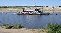 Drague sur le Couesnon DSC 0320.JPG 4,556 × 2,465; 4.06 MB
-
 ETH-BIB-Baie du Mont Saint-Michel, Ebbe-Flut Karte-Dia 247-12335.tif 3,696 × 2,555; 27.11 MB
-

-

-
 FMIB 43897 Bay of St Michel.jpeg 1,046 × 1,605; 340 KB
-
 Fortifications - Mont Saint Michel Abbey (32081514824).jpg 7,360 × 4,912; 9.81 MB
-
 FR Saint Michel 9805 006 (17044053507).jpg 800 × 541; 64 KB
-
 France - Mt. St. Michel - panoramio (5).jpg 5,312 × 2,988; 3.72 MB
-
 France - Mt. St. Michel - panoramio (6).jpg 5,312 × 2,988; 5.08 MB
-
 France - Mt. St. Michel - panoramio (7).jpg 2,121 × 3,771; 6 MB
-
 France - Mt. St. Michel - panoramio (8).jpg 2,988 × 5,312; 3.7 MB
-
 FranceNormandieMortainCouchantBaieDuMont.jpg 1,267 × 1,056; 625 KB
-
 La baia di Mont-Saint-Michel.jpg 4,517 × 3,011; 4.94 MB
-
 La baie du Mont Saint-Michel à Cherrueix - Mai 2014.jpg 3,400 × 2,600; 3.53 MB
-
 Le lever du soleil au Mont St-Michel 2.jpg 2,592 × 1,944; 1.14 MB
-
 Le Mont Saint Michel et sa baie 15.jpg 4,000 × 3,000; 1.81 MB
-
 Le Mont Saint-Michel en 1948 (17).jpg 2,554 × 1,724; 768 KB
-
 Le Mont Saint-Michel en 1948 (18).jpg 2,548 × 1,672; 496 KB
-
 Le Mont-Saint-Michel (3223358734).jpg 1,023 × 768; 142 KB
-
 Le Mont-Saint-Michel (Vue sur la baie à marée basse 2 ).JPG 3,840 × 2,160; 599 KB
-
 Le Mont-Saint-Michel (Vue sur la baie à marée basse).JPG 3,840 × 2,160; 814 KB
-
 Le Mont-Saint-Michel (Vue sur la baie).JPG 3,840 × 2,160; 824 KB
-
 Le Mont-Saint-Michel (Vue sur le parking).JPG 3,840 × 2,160; 766 KB
-
 Le Mont-Saint-Michel 20171015 03.jpg 4,128 × 3,096; 3.36 MB
-
 Le Mont-Saint-Michel 20171015 06.jpg 4,128 × 3,096; 3.54 MB
-
 Le Mont-Saint-Michel 20171015 41.jpg 4,128 × 3,096; 3.2 MB
-
 Le Mont-Saint-Michel 20171015 42.jpg 4,128 × 3,096; 3.39 MB
-
 Le Mont-Saint-Michel 20171015 62.jpg 4,128 × 3,096; 3.04 MB
-
 Le Mont-Saint-Michel 20171015 73.jpg 4,128 × 3,096; 3.22 MB
-
 Le Mont-Saint-Michel 20171015 81.jpg 4,128 × 3,096; 3.63 MB
-
 Le Mont-Saint-Michel et sa baie vus de Cancale 01.jpg 6,000 × 4,000; 7.02 MB
-
 Le Mont-Saint-Michel et sa baie vus de Cancale 02.jpg 6,000 × 4,000; 5.34 MB
-
 Le Mont-Saint-Michel France Salt-Meadow-Sheeps-01.jpg 3,717 × 3,717; 8.8 MB
-
 Le Mont-Saint-Michel France Salt-Meadow-Sheeps-02.jpg 4,880 × 3,235; 7.94 MB
-
 Le Mont-Saint-Michel,nature.jpg 3,216 × 2,136; 778 KB
-
 Le Mont-Saint-Michel,people.jpg 3,216 × 2,136; 1.19 MB
-
 Le rempart est (Mont Saint-Michel) (7198149560).jpg 1,365 × 1,024; 686 KB
-
 LH-0920-41.jpg 4,752 × 3,168; 5.97 MB
-
 LH-0920-42.jpg 4,752 × 3,168; 9.25 MB
-
 Long way1.jpg 3,789 × 2,526; 1.79 MB
-
 Love Stone (61510375).jpeg 2,048 × 1,152; 230 KB
-
 Maringotte.jpg 997 × 615; 378 KB
-
 Marins pélerins.jpg 4,000 × 3,000; 2.18 MB
-
 Mont Saint Michel (133399089).jpeg 2,000 × 1,331; 1,001 KB
-
 Mont Saint Michel (177066033).jpeg 2,048 × 740; 437 KB
-
 Mont Saint Michel 2019 02.jpg 5,184 × 3,888; 5.02 MB
-
 Mont Saint Michel 2019 03.jpg 5,184 × 3,888; 5.32 MB
-
 Mont Saint Michel panorama.jpg 7,172 × 1,999; 17.89 MB
-
 Mont Saint-Michel (top).jpg 3,264 × 2,448; 1.22 MB
-
 Mont Saint-Michel - KMB - 16001000210924.jpg 780 × 505; 68 KB
-
 Mont Saint-Michel - KMB - 16001000210928.jpg 780 × 505; 59 KB
-
 Mont Saint-Michel 4 - panoramio.jpg 2,048 × 1,536; 1.34 MB
-
 Mont Saint-Michel 5 - panoramio.jpg 2,048 × 1,536; 1,005 KB
-
 Mont Saint-Michel 6 - panoramio.jpg 1,536 × 2,048; 691 KB
-
 Mont Saint-Michel 7 - panoramio.jpg 2,048 × 1,536; 1.2 MB
-
 Mont Saint-Michel depuis la Cabane Vauban.JPG 4,288 × 3,216; 3.14 MB
-
 Mont Saint-Michel garden A.JPG 4,000 × 3,000; 2.86 MB
-
 Mont Saint-Michel garden B.JPG 3,000 × 4,000; 2.84 MB
-
 Mont Saint-Michel tidal plane.JPG 3,000 × 4,000; 2.57 MB
-
 Mont St Michel (12099638305).jpg 2,000 × 1,125; 573 KB
-
 Mont st Michel - Flickr - morosphinx.jpg 4,573 × 3,080; 1.17 MB
-
 Mont st michel vue baie tombelaine.jpg 7,424 × 2,400; 20.69 MB
-
 Mont St Michel – ramparts (1).jpg 6,000 × 4,000; 15.45 MB
-
 Mont St Michel – ramparts (3).jpg 6,000 × 4,000; 20.09 MB
-
 Mont St-Michel (July 2011).JPG 4,000 × 2,672; 3.53 MB
-
 Mont St. Michel Slow Shutter.jpg 4,288 × 2,848; 2.55 MB
-
 Mont St. Michel Sunset HDR.jpg 4,288 × 2,848; 7.16 MB
-
 Mont-dol panorama.jpg 17,408 × 1,494; 10.75 MB
-
 Mont-saint-Michel (France).jpg 4,416 × 3,312; 5.83 MB
-
 Mont-Saint-Michel - Novembre 2011 (13).jpg 1,600 × 1,200; 315 KB
-
 Mont-Saint-Michel - Novembre 2011 (14).jpg 1,200 × 1,600; 319 KB
-
 Mont-Saint-Michel - Novembre 2011 (15).jpg 1,600 × 1,200; 171 KB
-
 Mont-Saint-Michel - Novembre 2011 (21).jpg 1,600 × 1,200; 146 KB
-
 Mont-Saint-Michel - Novembre 2011 (23).jpg 1,600 × 1,200; 446 KB
-
 Mont-Saint-Michel - Novembre 2011 (7).jpg 1,600 × 1,200; 483 KB
-
 Mont-Saint-Michel Blick über die Gebäude.jpg 4,000 × 3,000; 4.11 MB
-
 Mont-Saint-Michel La Marée basse.jpg 4,416 × 3,312; 9.34 MB
-
 Mont-Saint-Michel Panoramique (3840958378).jpg 5,198 × 1,926; 6.34 MB
-
 Mont-Saint-Michel, France.jpg 3,752 × 2,501; 1.36 MB
-
 Mont-Saint-Michel, Manche, France - 53386472514.jpg 3,648 × 3,648; 6.62 MB
-
 MONT-ST-MICHEL (235) 06.jpg 4,176 × 2,784; 15.59 MB
-
 MontSaintMichelCostaBassaMarea.jpg 1,045 × 671; 689 KB
-
 Mudflat hiking near Mont Saint-Michel.jpg 5,124 × 3,407; 945 KB
-
 Normandie2009 (25).jpg 2,832 × 2,128; 2.63 MB
-
 Normandie2009 (26).jpg 2,832 × 2,128; 2.58 MB
-
 Normandie2009 (28).jpg 2,832 × 2,128; 2.46 MB
-
 Ombre de l'abbatiale du Mont Saint-Michel sur la grève.jpg 800 × 559; 81 KB
-
 Ombre du Mont St Michel sur la baie (44041983942).jpg 5,472 × 2,535; 5.63 MB
-
 Panorama de la baie du Mont Saint-Michel.jpg 5,355 × 1,803; 1.1 MB
-
 Panoramic view of the bay of Mont Saint-Michel.JPG 4,912 × 1,080; 1.59 MB
-
 Plan général de la baie du Mont Saint-Michel - 1868.jpg 12,348 × 8,266; 17.96 MB
-
 Přílivová laguna kolem Mont Saint Michel. - panoramio.jpg 5,659 × 3,789; 2.86 MB
-
 Récif d'Hermelles de la baie du Mont-Saint-Michel.png 377 × 185; 89 KB
-
 Récifs d'hermelles en baie du Mont-Saint-Michel.jpg 8,256 × 5,504; 36.16 MB
-

-
 Saut-parachute-Côte-des-Havres.jpg 768 × 1,152; 99 KB
-
 Seabed at ebb - Mont Saint-Michel, France - panoramio.jpg 2,092 × 1,394; 1.15 MB
-
 Situé aux confins de Normandie et de Bretagne, gravure aquarellée, 1705.jpg 1,024 × 744; 186 KB
-
 SUBIENDO LA MAREA - panoramio.jpg 4,288 × 2,848; 5.38 MB
-
 The mud flats at Mont St. Michel (48200702566).jpg 5,420 × 3,049; 5.8 MB
-
 Tidal wave is approaching - Mont Saint-Michel, France - panoramio.jpg 1,886 × 1,257; 513 KB
-
 Touristes sur la Tour du Nord (Le Mont-Saint-Michel, Manche, France).jpg 5,181 × 3,454; 5.95 MB
-
 TravauxMontSaintMichel-Pieu.JPG 3,000 × 4,000; 5.85 MB
-
 TravauxMontStMichel.jpg 6,541 × 1,352; 3.9 MB
-
 Traversée Baie du Mont-Saint-Michel.jpg 2,036 × 443; 883 KB
-
 Traversée de la baie du Mont Saint Michel, vue de la tour nord.JPG 3,264 × 2,448; 1.22 MB
-
 Traversée de la baie.jpg 1,024 × 552; 45 KB
-
 Vaches sur les polders.jpg 1,024 × 542; 57 KB
-
 View from Mont Saint-Michel.jpg 3,652 × 5,492; 1,000 KB
-
 View of Buildings in Mont Saint-Michel 26.jpg 4,272 × 2,848; 1.75 MB
-
 View of the bay from above Tour du Nord, Mont Saint-Michel, 2024.jpg 6,016 × 4,000; 9.36 MB
-
 Vue depuis le Mont-Saint-Michel (01).jpg 4,288 × 3,216; 556 KB
-
 Vue depuis le Mont-Saint-Michel (02).jpg 4,288 × 3,216; 646 KB
-
 Vue depuis le Mont-Saint-Michel (03).jpg 3,216 × 4,288; 378 KB
-
 Vue depuis le Mont-Saint-Michel (04).jpg 3,216 × 4,288; 484 KB
-
 Vue depuis le Mont-Saint-Michel (05).jpg 4,288 × 3,216; 443 KB
-
 Vue depuis le Mont-Saint-Michel (06).jpg 4,288 × 3,216; 530 KB
-
 Vue depuis le Mont-Saint-Michel (07).jpg 4,288 × 3,216; 826 KB
-
 Vue depuis le Mont-Saint-Michel (08).jpg 4,288 × 3,216; 464 KB
-
 Vue depuis le Mont-Saint-Michel (09).jpg 4,288 × 3,216; 1.02 MB
-
 Vue depuis le Mont-Saint-Michel (10).jpg 4,288 × 3,216; 653 KB
-
 Vue depuis le Mont-Saint-Michel (11).jpg 4,288 × 3,216; 494 KB
-
 Vue depuis le Mont-Saint-Michel (12).jpg 4,288 × 3,216; 478 KB
-
 Vue depuis le Mont-Saint-Michel (13).jpg 4,288 × 3,216; 570 KB
-
 Wasserwellen.jpg 4,000 × 3,000; 4.94 MB
-
 Water and sand streak.jpg 4,000 × 3,000; 5.09 MB
-
 Ле Мон-Сен-Мишель - panoramio (12).jpg 4,000 × 3,000; 2.31 MB
-
 Ле Мон-Сен-Мишель - panoramio (16).jpg 4,000 × 3,000; 2.7 MB
-
 Ле Мон-Сен-Мишель - panoramio (38).jpg 3,000 × 4,000; 3.1 MB
-
 Мон-сен-Мишель.Остров Томблен и бухта.jpg 3,648 × 2,736; 8.95 MB
-
 Оздоровительные прогулки по глиняному дну залива вокруг Мон-Сен-Мишеля - panoramio.jpg 5,184 × 3,456; 5.56 MB
-
 Песчано-глиняные моря вокруг Мон-Сен-Мишеля - panoramio.jpg 5,184 × 3,456; 4.22 MB
-
 モン・サン=ミシェルを背に - panoramio.jpg 2,592 × 1,944; 1.79 MB


.jpg)
.jpg)
.jpg)
.jpg)
.jpg)


.JPG)
.jpg)


.jpeg)
.jpg)
.jpg)


.jpg)
.jpg)
.jpg)
.jpg)
.jpg)
.jpg)


.jpg)
.jpg)
.jpg)
.JPG)
.JPG)
.JPG)
.JPG)


_(7198149560).jpg)


.jpeg)


.jpeg)


.jpg)


.jpg)

.jpg)
.jpg)
.JPG)


.jpg)
.jpg)
.jpg)
.jpg)
.jpg)
.jpg)
.jpg)


_06.jpg)


.jpg)
.jpg)
.jpg)

.jpg)


.jpg)

.jpg)


.jpg)
.jpg)
.jpg)
.jpg)
.jpg)
.jpg)
.jpg)
.jpg)
.jpg)
.jpg)
.jpg)
.jpg)
.jpg)


.jpg)
.jpg)
.jpg)


.jpg)
.jpeg)
.jpg)