Category:Bearsden
Jump to navigation
Jump to search
town in East Dunbartonshire, Scotland, UK   | |||||
| Upload media | |||||
| Instance of |
| ||||
|---|---|---|---|---|---|
| Location |
| ||||
| Population |
| ||||
| Different from | |||||
 | |||||
English: Bearsden is town in East Dunbartonshire and effectively a suburb of Glasgow, with housing development coinciding with the introduction of a railway line in 1863, from where the town gets its name (Bearsden station was named after a nearby cottage).
Gàidhlig: 'S e baile ann an Alba meadhanach a tha ann am Cille Phàdraig Ùr (Beurla: Bearsden). Tha e faisg air Glaschu agus Muileann Dhàibhidh ann an Dùn Bhreatainn an Ear. 'S e seo na co-chomharran aige: 55° 56′ 27.6″ Tuath agus 4° 19′ 8.4″ Iar.
Nederlands: Bearsden ( Schots-Gaelisch: Cille Phàdraig Ùr) is een dorp in de Schotse council East Dunbartonshire in het historisch graafschap Dunbartonshire. Bearsden ligt ongeveer 10 kilometer van Glasgow.
Scots: Bearsden is a toun in East Dunbartonshire, Scotland. A suburb on the northwastern fringe ay Glesga, aboot sex myle (9.7 km) frae the ceety centur, wi mony o the hooses bildit efter 1863.
Subcategories
This category has the following 16 subcategories, out of 16 total.
B
- Bearsden railway station (3 F)
- Bearsden Roman Bath House (8 F)
- Bearsden War Memorial (4 F)
- Boclair Academy (7 F)
- Boclair House (3 F)
C
- Castle Hill, Bearsden (5 F)
G
- Garscadden Wood (2 F)
- Glasgow golf club (3 F)
H
- Hillfoot railway station (4 F)
N
- New Kilpatrick cemetery (3 F)
- New Kilpatrick parish church (4 F)
P
T
- The Burnbrae (2 F)
W
Media in category "Bearsden"
The following 72 files are in this category, out of 72 total.
-
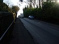
 A 739 (Switchback Road) at Canniesburn Toll (geograph 5337963).jpg 1,600 × 1,135; 408 KB
-
 Aerial view of Renfrew 04.jpg 4,032 × 3,024; 1.92 MB
-
 Aerial view of Renfrew 05.jpg 4,032 × 3,024; 2.33 MB
-
 Aerial view of Renfrew 06.jpg 4,032 × 3,024; 2.26 MB
-
 Aerial view of Renfrew 07.jpg 4,032 × 3,024; 2.37 MB
-
 Antonine Wall - geograph.org.uk - 49196.jpg 640 × 480; 148 KB
-
 Approaching the golf club - geograph.org.uk - 714662.jpg 640 × 480; 359 KB
-
 Ardoch Road - geograph.org.uk - 1220499.jpg 640 × 480; 143 KB
-
 Bearsden Academy from the air (geograph 5599775).jpg 640 × 480; 187 KB
-
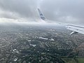
 Bearsden and Hillfoot from the air (geograph 2988025).jpg 640 × 480; 178 KB
-
 Bearsden Coat of Arms.png 271 × 364; 187 KB
-
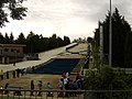 Bearsden dry ski slope - geograph.org.uk - 514536.jpg 640 × 480; 85 KB
-
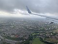
 Bearsden from the air (geograph 5186835).jpg 562 × 640; 176 KB
-
 Bearsden from the air (geograph 5310285).jpg 640 × 480; 173 KB
-
 Bearsden Golf Club - geograph.org.uk - 48133.jpg 640 × 426; 39 KB
-
 Bearsden Hall - geograph.org.uk - 514551.jpg 640 × 480; 85 KB
-
Bearsden.ogg 1.2 s; 31 KB
-
 BearsdenExpansion.svg 1,990 × 1,696; 187 KB
-
 BearsdenMap1923.jpg 808 × 677; 113 KB
-
 Beginning of Stockiemuir Road - geograph.org.uk - 514542.jpg 640 × 480; 84 KB
-
 BP station, Milngavie Road - geograph.org.uk - 1220473.jpg 640 × 480; 133 KB
-
 Burn in Hillfoot - geograph.org.uk - 1220481.jpg 640 × 480; 202 KB
-
 Canniesburn Drive (geograph 4517510).jpg 3,504 × 2,336; 3.76 MB
-
 Canniesburn from the air (geograph 4665738).jpg 640 × 480; 243 KB
-
 Canniesburn Toll Roundabout (geograph 5794788).jpg 1,600 × 1,091; 323 KB
-
 Coat of Arms of the Burgh of Bearsden, 1959-1975.svg 600 × 660; 304 KB
-
 Colquhoun (GarscaddenKillermont) arms.svg 600 × 660; 24 KB
-
 Country meets town at Kessington - geograph.org.uk - 1220614.jpg 640 × 480; 149 KB
-

-
 Drymen Road (geograph 7771904).jpg 1,600 × 1,067; 365 KB
-
 Estate Agents on Roman Road - geograph.org.uk - 515032.jpg 640 × 480; 83 KB
-
 Footpath along boundary of Bearsden - geograph.org.uk - 49088.jpg 640 × 480; 156 KB
-
 Garscube Mill - geograph.org.uk - 1220647.jpg 640 × 480; 159 KB
-
 Gruffalo Sculpture, Kilmardinny Loch, Bearsden.JPG 2,848 × 4,288; 6.38 MB
-
 Hill behind Kessington - geograph.org.uk - 1220505.jpg 640 × 480; 128 KB
-
 Houses on Canniesburn Road, Bearsden - geograph.org.uk - 515060.jpg 640 × 480; 92 KB
-
 Junction of Switchback Road and Braemar Crescent (geograph 4910098).jpg 3,436 × 2,293; 3.25 MB
-
 Junction of Switchback Road and Wardlaw Road (geograph 5376816).jpg 1,600 × 1,200; 470 KB
-
 Kessington Square - geograph.org.uk - 1220598.jpg 640 × 480; 127 KB
-
 Kilmardinny House (geograph 3130624).jpg 576 × 432; 53 KB
-
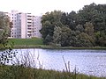
 Kilmardinny Loch - geograph.org.uk - 511466.jpg 640 × 480; 78 KB
-
 Looking downhill on Pendicle Road - geograph.org.uk - 515042.jpg 640 × 480; 116 KB
-
 Looking to Boclair Road - geograph.org.uk - 1220511.jpg 640 × 480; 145 KB
-
 Methven Avenue - geograph.org.uk - 1220502.jpg 640 × 480; 108 KB
-
 Mini roundabout, Rannoch Drive - geograph.org.uk - 1220579.jpg 640 × 480; 141 KB
-
 Mosshead Primary School, Bearsden - geograph.org.uk - 49084.jpg 640 × 463; 63 KB
-
 Muddy stream at foot of hill - geograph.org.uk - 1220513.jpg 640 × 480; 143 KB
-
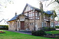 NewKilpatrickParishChambers1907.JPG 3,872 × 2,592; 2.34 MB
-
 Oddbins, Hillfoot - geograph.org.uk - 1220483.jpg 480 × 640; 129 KB
-
 Ordnance Survey One-inch Sheet 60 Glasgow, Published 1957.jpg 8,171 × 9,912; 12.02 MB
-
 Ordnance Survey One-Inch Sheet 60 Glasgow, Published 1965.jpg 8,238 × 9,844; 13.58 MB
-
 Peel Glen Road - geograph.org.uk - 502120.jpg 640 × 480; 96 KB
-
 Pendicle Road, Bearsden - geograph.org.uk - 515037.jpg 640 × 480; 106 KB
-
 Roman Road, Bearsden - geograph.org.uk - 1657489.jpg 640 × 480; 129 KB
-
 Row of shops, Drymen Road, Bearsden - geograph.org.uk - 514609.jpg 640 × 480; 83 KB
-
 SchawHomeBearsden.JPG 2,592 × 3,872; 2.32 MB
-
 Scotus College, Bearsden.jpg 800 × 600; 65 KB
-
 Shops on Switchback Road (geograph 5376858).jpg 1,600 × 1,161; 306 KB
-
 St Germains Loch - geograph.org.uk - 56816.jpg 640 × 480; 150 KB
-
 Stirling Drive, Bearsden - geograph.org.uk - 48110.jpg 640 × 477; 104 KB
-
 Suburban scene - geograph.org.uk - 714657.jpg 640 × 480; 275 KB
-
 Sunset at Hillfoot Cemetery, Bearsden - geograph.org.uk - 49197.jpg 640 × 464; 50 KB
-
 Switchback Road, Bearsden (geograph 4910068).jpg 3,504 × 2,288; 3.4 MB
-
 Templehill and surrounding farmland - geograph.org.uk - 1220620.jpg 640 × 480; 128 KB
-
 Templehill Wood - geograph.org.uk - 58526.jpg 640 × 480; 117 KB
-
 The High School of Glasgow - Junior School - geograph.org.uk - 5747413.jpg 1,600 × 848; 277 KB
-
 The High School of Glasgow - Junior School - geograph.org.uk - 5747422.jpg 1,600 × 1,145; 384 KB
-
 The Inn, Bearsden - geograph.org.uk - 515036.jpg 640 × 480; 108 KB
-
 The Road into Drumchapel - geograph.org.uk - 48136.jpg 640 × 441; 89 KB
-
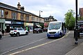
 Traffic in Bearsden - geograph.org.uk - 444194.jpg 640 × 582; 107 KB
-
 Uphill view on Boclair Road - geograph.org.uk - 1220491.jpg 640 × 480; 115 KB
-
 Woodvale Avenue at Albert Drive - geograph.org.uk - 1220632.jpg 640 × 480; 132 KB
_at_Canniesburn_Toll_(geograph_5337963).jpg)


.jpg)
.jpg)


.jpg)
.jpg)


.jpg)
.jpg)
.jpg)
_arms.svg)


.jpg)


.jpg)
.jpg)

.jpg)


.jpg)


.jpg)


