Category:Beaver Lake (Arkansas)
Jump to navigation
Jump to search
reservoir in Arkansas, United States  | |||||
| Upload media | |||||
| Instance of | |||||
|---|---|---|---|---|---|
| Location | Arkansas | ||||
| Mountain range | |||||
| Outflows | |||||
| Drainage basin | |||||
| Basin country | |||||
| Dam | |||||
 | |||||
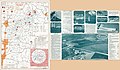
Beaver Lake is a man-made reservoir in the Ozark Mountains of Northwest Arkansas and is formed by a dam across the White River. Beaver Lake has some 487 miles (784 km) of natural shoreline. With towering limestone bluffs, natural caves, and a wide variety of trees and flowering shrubs, it is a popular tourist destination.
Media in category "Beaver Lake (Arkansas)"
The following 14 files are in this category, out of 14 total.
-
 20180504-Monte Ne.jpg 2,040 × 1,275; 643 KB
-
 Beaver Lake approaching Highway 12 Bridge.jpg 1,960 × 1,024; 378 KB
-
 Beaver Lake from Prairie Creek, Arkansas.jpg 3,788 × 2,134; 3.69 MB
-
 Beaver Lake in Arkansas.jpg 3,072 × 2,048; 2.02 MB
-
 Beaver Lake underneath Highway 12 Bridge.jpg 1,974 × 982; 294 KB
-
 Beaver Lake with changing leaves.jpg 1,980 × 1,106; 445 KB
-
 Beaver Lake with high lake levels.jpg 900 × 598; 403 KB
-
 Beaver Lake, Arkansas. LOC 77695704.jpg 12,377 × 7,255; 12.04 MB
-
 Beaver Lake, Arkansas.jpeg 3,264 × 2,448; 3.01 MB
-
 Boat on Beaver Lake in Arkansas.jpg 2,000 × 1,333; 2.75 MB
-
 Cloudy Beaver Lake at Lost Bridge Marina.jpg 4,128 × 2,322; 2.63 MB
-
 Flag on rock outcropping at Beaver Lake.jpg 1,904 × 1,040; 438 KB
-
 Monte Ne Amphitheater during low lake levels.jpg 872 × 655; 204 KB
-
 Operation River Assault a success (9417663419).jpg 2,048 × 1,356; 278 KB


.jpg)