Category:Beechwood, Newport
Jump to navigation
Jump to search
community in Newport  | |||||
| Upload media | |||||
| Instance of | |||||
|---|---|---|---|---|---|
| Location | Newport, Wales | ||||
| Population |
| ||||
| Area |
| ||||
 | |||||
Media in category "Beechwood, Newport"
The following 200 files are in this category, out of 297 total.
(previous page) (next page)-
 173 Chepstow Road, Newport - geograph.org.uk - 2133014.jpg 640 × 418; 94 KB
-

-

-

-
 A view over Newport from Beechwood Park - geograph.org.uk - 5314162.jpg 640 × 480; 183 KB
-

-
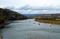 Afon Wysg (River Usk) northeast of Newport - geograph.org.uk - 4938475.jpg 1,540 × 1,000; 1.11 MB
-
 An entrance to Beechwood Park, Newport - geograph.org.uk - 5992125.jpg 1,024 × 683; 1.32 MB
-

-
 Archibald Street, Newport - geograph.org.uk - 1561229.jpg 640 × 361; 46 KB
-
 Arundel Road, Newport - geograph.org.uk - 1562182.jpg 640 × 439; 64 KB
-
 Arundel Road, Newport - geograph.org.uk - 3283375.jpg 640 × 542; 77 KB
-
 Augustus John Close, Newport - geograph.org.uk - 2357248.jpg 640 × 398; 48 KB
-
 Badminton Road, Newport - geograph.org.uk - 1556787.jpg 640 × 362; 59 KB
-
 Badminton Road, Newport - geograph.org.uk - 1640604.jpg 640 × 472; 77 KB
-
 Baptist Church, St Julians - geograph.org.uk - 2029900.jpg 1,496 × 1,122; 717 KB
-

-
 Beaufort Place, Newport - geograph.org.uk - 4874704.jpg 800 × 537; 89 KB
-
 Beaufort Place, St Julians, Newport - geograph.org.uk - 1640623.jpg 640 × 457; 65 KB
-

-
 Beaufort Road flats, Newport - geograph.org.uk - 2357256.jpg 640 × 480; 65 KB
-
 Beaufort Road, Newport - geograph.org.uk - 1556826.jpg 640 × 361; 69 KB
-
 Beaufort Road, Newport - geograph.org.uk - 1590643.jpg 640 × 311; 53 KB
-
 Beaufort Road, Newport - geograph.org.uk - 1640600.jpg 640 × 413; 60 KB
-
 Beechwood Electronics, 369 Chepstow Road, Newport - geograph.org.uk - 6188650.jpg 1,600 × 1,297; 388 KB
-
 Beechwood Electronics, Newport - geograph.org.uk - 4771867.jpg 800 × 544; 104 KB
-
 Beechwood Electronics,Newport - geograph.org.uk - 1481456.jpg 640 × 473; 190 KB
-
 Beechwood Park - geograph.org.uk - 1061792.jpg 640 × 478; 176 KB
-
 Beechwood Park - geograph.org.uk - 6432716.jpg 1,200 × 806; 1.33 MB
-
-
 Beechwood Park in Autumn - geograph.org.uk - 1552930.jpg 640 × 480; 142 KB
-
 Beechwood Park, Newport - geograph.org.uk - 2039362.jpg 480 × 640; 138 KB
-
 Beechwood Park, Newport - geograph.org.uk - 2940663.jpg 4,320 × 3,240; 2.95 MB
-
 Beechwood Presbyterian Church - geograph.org.uk - 1552923.jpg 640 × 480; 86 KB
-
 Beechwood Road speed bumps, Newport - geograph.org.uk - 6188259.jpg 1,600 × 1,200; 614 KB
-
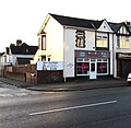
 Beechwood Stores, Newport - geograph.org.uk - 4992039.jpg 800 × 783; 114 KB
-
 Behind Woodland Park ^ Clevedon Roads, Beechwood - geograph.org.uk - 6273247.jpg 5,184 × 3,456; 6.76 MB
-

-
 Blue Fanta, Beechwood, Newport - geograph.org.uk - 6188269.jpg 1,461 × 1,600; 460 KB
-
 Blue plaque, Cambrian House, Newport - geograph.org.uk - 2986984.jpg 453 × 640; 63 KB
-
 Bridge over the M4 - geograph.org.uk - 3671938.jpg 640 × 430; 47 KB
-
 BT phonebox, Eveswell, Newport - geograph.org.uk - 4773488.jpg 800 × 680; 90 KB
-
 Buckingham Crescent, Newport - geograph.org.uk - 4991998.jpg 800 × 600; 142 KB
-
 Burton Road, Newport - geograph.org.uk - 1556791.jpg 640 × 439; 71 KB
-
 Burton Road, Newport - geograph.org.uk - 1997015.jpg 640 × 415; 51 KB
-
 B^J Newsagents and Gwent Cycles, Newport - geograph.org.uk - 4772752.jpg 800 × 725; 134 KB
-

-

-

-

-
 Caerleon Road, Newport - geograph.org.uk - 1590615.jpg 640 × 321; 52 KB
-
 Carisbrooke Road, Newport - geograph.org.uk - 1562189.jpg 640 × 437; 74 KB
-
 Carisbrooke Road, Newport - geograph.org.uk - 3283388.jpg 640 × 529; 83 KB
-
 Carisbrooke Road, Newport - geograph.org.uk - 4772983.jpg 800 × 562; 89 KB
-
 Cats Whiskers, Newport - geograph.org.uk - 1561636.jpg 548 × 640; 76 KB
-
 Celtic Car Company(1), Newport - geograph.org.uk - 1885167.jpg 640 × 418; 63 KB
-
 Celtic Car Company(2), Newport - geograph.org.uk - 1885171.jpg 640 × 455; 73 KB
-

-
-
 Chaucer Road houses, Newport - geograph.org.uk - 2985479.jpg 640 × 392; 48 KB
-

-
 Chepstow Road, Newport - geograph.org.uk - 6307299.jpg 800 × 600; 106 KB
-
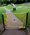
 Children's play area in Beechwood Park, Newport - geograph.org.uk - 6188244.jpg 1,600 × 1,038; 491 KB
-

-

-
 Christchurch Road houses, Newport - geograph.org.uk - 4991882.jpg 800 × 582; 100 KB
-
 Christchurch Road speed bumps, Newport - geograph.org.uk - 4991955.jpg 800 × 645; 115 KB
-

-
 Church of St John the Evangelist, Maindee, Newport - geograph.org.uk - 2940610.jpg 4,320 × 3,240; 3.09 MB
-
 Church of St John the Evangelist, Maindee, Newport - geograph.org.uk - 2940614.jpg 3,240 × 4,320; 3.89 MB
-

-
 Constable Drive houses, Newport - geograph.org.uk - 2357280.jpg 640 × 512; 62 KB
-

-

-

-
 Crown's Coffee Corner, Newport - geograph.org.uk - 6188842.jpg 1,565 × 1,600; 439 KB
-
 Daffodils in Beechwood Park, Newport - geograph.org.uk - 5314154.jpg 640 × 480; 244 KB
-
 Dark green cabinet on a Maindee corner, Newport - geograph.org.uk - 6500104.jpg 845 × 1,000; 153 KB
-
 Dark green cabinets on a Beechwood corner, Newport - geograph.org.uk - 6188248.jpg 1,600 × 1,300; 460 KB
-

-

-

-
 Dragon and Christchurch Road - geograph.org.uk - 2096763.jpg 1,024 × 768; 175 KB
-
 East side of Kensington Grove, Newport - geograph.org.uk - 4773569.jpg 800 × 571; 110 KB
-

-

-

-
 Entrance to Eveswell Court, Newport - geograph.org.uk - 1561246.jpg 640 × 480; 58 KB
-
 Entrance to GJ Auto Service, Maindee, Newport - geograph.org.uk - 6499747.jpg 1,230 × 1,600; 520 KB
-
 Eveswell Community Centre, Newport - geograph.org.uk - 1561658.jpg 640 × 379; 70 KB
-
 Eveswell Court, Newport - geograph.org.uk - 1561241.jpg 640 × 403; 72 KB
-
 Eveswell Primary School, Newport - geograph.org.uk - 1579479.jpg 640 × 298; 53 KB
-
 Fatima Lodge, Maindee, Newport - geograph.org.uk - 3702985.jpg 798 × 800; 186 KB
-
 Fatima Lodge, Newport - geograph.org.uk - 2987555.jpg 640 × 510; 74 KB
-
 Firbank Avenue Bridge, M4 - geograph.org.uk - 3671942.jpg 640 × 409; 44 KB
-

-
-
 Former Kensington Court Day Centre - geograph.org.uk - 5657853.jpg 800 × 533; 130 KB
-

-
 Furry Babies Boutique, Newport - geograph.org.uk - 4772855.jpg 800 × 798; 134 KB
-
 Gita Stores, Chepstow Road, Newport - geograph.org.uk - 1880554.jpg 640 × 524; 85 KB
-
-

-
 Hogarth Close, Newport - geograph.org.uk - 2357323.jpg 640 × 428; 70 KB
-
 Hospice, St John's Rd, Maindee, Newport - geograph.org.uk - 2940624.jpg 4,320 × 3,240; 3.02 MB
-
 House Clearance ^ Shop, Newport - geograph.org.uk - 2987567.jpg 640 × 450; 62 KB
-
 Houses above Tennyson Road, Newport - geograph.org.uk - 4773016.jpg 800 × 735; 113 KB
-

-
 Houses at the top of Victoria Avenue, Newport - geograph.org.uk - 5866052.jpg 1,024 × 826; 167 KB
-
 Houses on Chepstow Road, Newport - geograph.org.uk - 6307297.jpg 800 × 600; 130 KB
-

-

-
 Information board, Beechwood Park, Newport - geograph.org.uk - 5990767.jpg 1,024 × 768; 1.49 MB
-

-

-

-
 JP's Cuts, Chepstow Road, Newport - geograph.org.uk - 4773436.jpg 800 × 682; 134 KB
-

-

-
-

-

-
 Junction of Windsor Rd ^ Conway Rd, Newport - geograph.org.uk - 2940646.jpg 4,320 × 3,240; 3.08 MB
-
 Kelly Road, Newport - geograph.org.uk - 2357307.jpg 640 × 476; 68 KB
-
 Kensington Gardens, Newport - geograph.org.uk - 1880589.jpg 640 × 480; 85 KB
-
 Kensington Grove, Newport - geograph.org.uk - 3703056.jpg 792 × 800; 158 KB
-

-
 Kensington Place houses, Newport - geograph.org.uk - 2987151.jpg 640 × 480; 67 KB
-
 Kensington Place, Newport - geograph.org.uk - 1880579.jpg 640 × 534; 82 KB
-
-
 Late autumn in Beechwood Park, Newport - geograph.org.uk - 5990423.jpg 768 × 1,024; 1.63 MB
-

-
 Looking across Beechwood Park, Newport - geograph.org.uk - 5992124.jpg 1,024 × 512; 915 KB
-

-
 M4 eastbound - geograph.org.uk - 2449139.jpg 640 × 480; 44 KB
-

-

-

-
 M4 motorway, St Julians - geograph.org.uk - 1558663.jpg 640 × 413; 98 KB
-
 M4 motorway, St Julians - geograph.org.uk - 1558677.jpg 640 × 346; 57 KB
-
 M4, westbound - geograph.org.uk - 3671946.jpg 640 × 430; 47 KB
-
 Maindee Bargains, Newport - geograph.org.uk - 4773688.jpg 800 × 574; 107 KB
-
 Maindee Fire Station - geograph.org.uk - 467337.jpg 640 × 427; 184 KB
-
 Maindee fire station - geograph.org.uk - 6163200.jpg 3,485 × 2,325; 2.1 MB
-

-
 Milton Road houses, Newport - geograph.org.uk - 2985035.jpg 640 × 607; 87 KB
-

-
 Monet Crescent, St Julians, Newport - geograph.org.uk - 1558625.jpg 640 × 334; 58 KB
-
 Monmouth Drive,Newport - geograph.org.uk - 1557268.jpg 640 × 385; 70 KB
-

-

-
 NE side of Constable Drive, Newport - geograph.org.uk - 2357295.jpg 640 × 474; 60 KB
-
-

-

-
 Newport , The M4 Motorway - geograph.org.uk - 3926485.jpg 4,288 × 2,848; 4.74 MB
-
 Newport , The M4 Motorway - geograph.org.uk - 3926490.jpg 4,144 × 2,614; 5.01 MB
-
 Newport Bike Life, Rochester Road, Newport - geograph.org.uk - 6188851.jpg 1,600 × 1,107; 263 KB
-
 Newport City Signs - geograph.org.uk - 2984856.jpg 640 × 516; 75 KB
-
 Newport Seventh-Day Adventist Church - geograph.org.uk - 6307296.jpg 800 × 548; 53 KB
-

-

-
 Northern end of Beaufort Road, Newport - geograph.org.uk - 4874667.jpg 800 × 541; 103 KB
-

-
 Northumberland Road, Newport - geograph.org.uk - 4991961.jpg 800 × 648; 102 KB
-
-
 Oaklands Road, Newport - geograph.org.uk - 1880611.jpg 640 × 453; 97 KB
-

-

-
 One Stop, Caerleon Road, Newport - geograph.org.uk - 4874652.jpg 800 × 687; 119 KB
-
 One Stop, Caerleon Road, Newport - geograph.org.uk - 5030939.jpg 800 × 706; 127 KB
-
 Ordnance Survey Cut Mark - geograph.org.uk - 5802483.jpg 640 × 352; 81 KB
-
 Ordnance Survey Cut Mark - geograph.org.uk - 5802484.jpg 640 × 399; 111 KB
-
 Ordnance Survey Cut Mark - geograph.org.uk - 5802485.jpg 640 × 415; 94 KB
-
 Ordnance Survey Cut Mark - geograph.org.uk - 5802486.jpg 640 × 476; 138 KB
-
 Ordnance Survey Cut Mark - geograph.org.uk - 5802487.jpg 525 × 640; 122 KB
-
 Ordnance Survey Cut Mark - geograph.org.uk - 5802489.jpg 640 × 458; 104 KB
-
 Ordnance Survey Cut Mark - geograph.org.uk - 5802490.jpg 640 × 468; 100 KB
-
 Ordnance Survey Cut Mark - geograph.org.uk - 5802491.jpg 640 × 550; 88 KB
-
 Oriental Garden, Chepstow Road, Newport - geograph.org.uk - 4772832.jpg 800 × 782; 147 KB
-

-
 Oxford Street, Newport - geograph.org.uk - 1561263.jpg 640 × 429; 65 KB
-
 Part of the bowling green in Beechwood Park, Newport - geograph.org.uk - 5990770.jpg 1,024 × 768; 1.59 MB
-

-
 Path in Beechwood Park - geograph.org.uk - 2128594.jpg 1,200 × 1,600; 634 KB
-

-
 Perfect, Chepstow Road, Newport - geograph.org.uk - 4772844.jpg 800 × 779; 128 KB
-
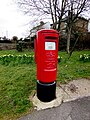
 Pillarbox on a Beechwood corner, Newport - geograph.org.uk - 4773415.jpg 800 × 608; 134 KB
-

-
 Pioneer Club, Newport - geograph.org.uk - 1562174.jpg 640 × 427; 55 KB
-
-
 Rear of house, Clevedon Road, Beechwood - geograph.org.uk - 6273261.jpg 5,184 × 3,456; 6.69 MB
-
 Rear of houses in Archibald Street - geograph.org.uk - 5452652.jpg 640 × 360; 68 KB
-
 Red Royal Mail drop box, Windsor Road, Newport - geograph.org.uk - 6188747.jpg 1,024 × 741; 162 KB
-
 Rembrandt Way bridge over M4 - geograph.org.uk - 5849112.jpg 1,600 × 1,201; 612 KB
-
 Rochester Road, Newport - geograph.org.uk - 1562171.jpg 640 × 374; 56 KB
-
 Rochester Road, Newport - geograph.org.uk - 2984890.jpg 640 × 512; 79 KB
-
 Rochester Road, Newport - geograph.org.uk - 3283349.jpg 640 × 424; 59 KB
-
 Rosendale Court, Newport - geograph.org.uk - 2985956.jpg 640 × 431; 62 KB
-
 Rosslyn Road, Maindee, Newport - geograph.org.uk - 3283335.jpg 640 × 429; 61 KB


_northeast_of_Newport_-_geograph.org.uk_-_4938475.jpg)


,_Newport_-_geograph.org.uk_-_1885167.jpg)
,_Newport_-_geograph.org.uk_-_1885171.jpg)


