Category:Beinn Mhòr, North Uist
Jump to navigation
Jump to search
Beinn Mhòr is a mountain on the island of North Uist in the Outer Hebrides of Scotland. The name is from the Gaelic for "big mountain". It is 190 metres high, and listed as a Marilyn.
Media in category "Beinn Mhòr, North Uist"
The following 15 files are in this category, out of 15 total.
-
 Baile Mhic' Phàil - geograph.org.uk - 927356.jpg 640 × 384; 42 KB
-
 Beinn Mhòr - geograph.org.uk - 927336.jpg 640 × 480; 72 KB
-
 Dun an Sticir Aerial Pan360.jpg 13,452 × 6,726; 28.99 MB
-
 Eilean na Cloiche - geograph.org.uk - 1485287.jpg 640 × 480; 54 KB
-
 Faoghail Bhàlaig - geograph.org.uk - 1340930.jpg 640 × 480; 286 KB
-
 Near Blashaval - geograph.org.uk - 1343348.jpg 640 × 359; 171 KB
-
 On Beinn Mhor. - geograph.org.uk - 15398.jpg 640 × 397; 59 KB
-
 Rickle o'Stanes - geograph.org.uk - 1340989.jpg 640 × 480; 309 KB
-
 Rubha an Daimh - geograph.org.uk - 1343362.jpg 640 × 408; 243 KB
-
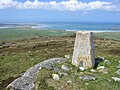
 Summit Beinn Mhòr - geograph.org.uk - 911650.jpg 640 × 480; 73 KB
-
 Summit, Beinn Mhòr - geograph.org.uk - 927340.jpg 640 × 480; 86 KB
-
 Traigh Ear - geograph.org.uk - 15076.jpg 640 × 395; 21 KB
-
 Tràigh Bhalaigh - geograph.org.uk - 857764.jpg 640 × 480; 75 KB
-
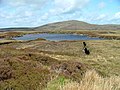 Cama Lochan - geograph.org.uk - 443461.jpg 640 × 480; 87 KB
-
 Loch an Sticer - geograph.org.uk - 15356.jpg 640 × 409; 62 KB


