Category:Benedeneind ZZ 279, Benschop
Jump to navigation
Jump to search
| Object location | | View all coordinates using: OpenStreetMap |
|---|
farmhouse in Lopik, Netherlands  | |||||
| Upload media | |||||
| Instance of | |||||
|---|---|---|---|---|---|
| Location | Benschop, Lopik, Utrecht, Netherlands | ||||
| Street address |
| ||||
| Located on street |
| ||||
| Heritage designation |
| ||||
 | |||||
|
This is a category about rijksmonument number 8961
|
| Address |
|
Media in category "Benedeneind ZZ 279, Benschop"
The following 19 files are in this category, out of 19 total.
-
 Benedeneind.ZZ279.Benschop.jpg 4,000 × 3,000; 7.25 MB
-
 Benschop Benedeneind ZZ 279.jpg 4,420 × 2,821; 4.36 MB
-
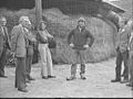
 Deelnemers op het erf - Benschop - 20472218 - RCE.jpg 1,200 × 900; 209 KB
-
 Detail voorgevel - Benschop - 20472219 - RCE.jpg 1,200 × 900; 217 KB
-
 Deurklink voordeur - Benschop - 20472229 - RCE.jpg 1,200 × 900; 71 KB
-
 Deurklopper op de voordeur - Benschop - 20472230 - RCE.jpg 1,200 × 900; 67 KB
-
 Deurklopper op de voordeur - Benschop - 20472231 - RCE.jpg 1,200 × 900; 85 KB
-
 Excursiegezelschap naast de hooiberg - Benschop - 20472221 - RCE.jpg 1,200 × 900; 158 KB
-
 Exterieur ACHTERGEVEL, RECHTER ZIJGEVEL - Benschop - 20314026 - RCE.jpg 1,183 × 1,200; 323 KB
-
 Exterieur VOORGEVEL, RECHTER ZIJGEVEL - Benschop - 20314024 - RCE.jpg 1,176 × 1,200; 325 KB
-
 Portret van Kees Rosenboom - Benschop - 20472225 - RCE.jpg 1,200 × 900; 108 KB
-
 Raampje in zijgevel - Benschop - 20472226 - RCE.jpg 1,200 × 900; 148 KB
-
 Rechter zijgevel - Benschop - 20030743 - RCE.jpg 1,200 × 812; 295 KB
-
 Spoelhok - Benschop - 20472223 - RCE.jpg 1,200 × 900; 147 KB
-
 Voor- en zijgevel - Benschop - 20472222 - RCE.jpg 1,200 × 900; 206 KB
-
 Voordeur - Benschop - 20472228 - RCE.jpg 1,200 × 900; 130 KB
-
 Voorgevel - Benschop - 20030742 - RCE.jpg 1,200 × 813; 284 KB
-
 Voorgevel - Benschop - 20472220 - RCE.jpg 1,200 × 900; 129 KB
-
 Voorgevel - Benschop - 20472227 - RCE.jpg 1,200 × 900; 232 KB


