Category:Beni Department
Jump to navigation
Jump to search
- Departments of Bolivia
- Beni
- Chuquisaca
- Cochabamba
- La Paz
- Oruro
- Pando
- Potosí
- Santa Cruz
- Tarija
department of Bolivia     | |||||
| Upload media | |||||
| Instance of | |||||
|---|---|---|---|---|---|
| Part of |
| ||||
| Location | Bolivia | ||||
| Capital | |||||
| Founded by | |||||
| Inception |
| ||||
| Population |
| ||||
| Area |
| ||||
| Elevation above sea level |
| ||||
| official website | |||||
 | |||||
Subcategories
This category has the following 9 subcategories, out of 9 total.
Media in category "Beni Department"
The following 47 files are in this category, out of 47 total.
-
 Bandera de Beni.svg 1,063 × 638; 164 bytes
-
 Flag of Beni.svg 1,100 × 750; 266 bytes
-
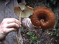 2008-02-04 Amauroderma Murrill 16590.jpg 640 × 480; 124 KB
-
 2008-02-04 Phillipsia Berk 16584.jpg 640 × 480; 127 KB
-
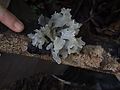 2008-02-04 Tremella fuciformis Berk 16592.jpg 640 × 480; 105 KB
-
 2008-02-04 Trichaptum fumosoavellaneum 16589.jpg 640 × 480; 136 KB
-
 Aquicuana.jpg 2,667 × 1,897; 1.47 MB
-
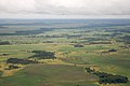 Beni Department aérea 25.jpg 3,445 × 2,297; 2.15 MB
-
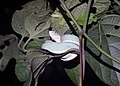 Bothrops bilineatus 256043197.jpg 2,048 × 1,467; 648 KB
-
 Capybara Bolivie.jpg 640 × 480; 96 KB
-
 Construccion-Carretera Villa Tunari - San Ignacio de Moxos.jpg 1,024 × 685; 587 KB
-
 Danza de JUDAS.jpg 5,472 × 3,648; 2.13 MB
-
 Erythrolamprus dorsocorallinus 118709866.jpg 1,536 × 2,048; 1.1 MB
-
 Erythrolamprus dorsocorallinus 118709895.jpg 1,536 × 2,048; 1,007 KB
-
 Erythrolamprus dorsocorallinus 118709896.jpg 1,536 × 2,048; 868 KB
-
 Escuela Nueva Galilea - panoramio.jpg 2,816 × 1,872; 2.38 MB
-

-

-
 Flag of Beni Department, Bolivia.svg 512 × 349; 1 KB
-

-
 Kapybara2.jpg 1,536 × 1,024; 559 KB
-
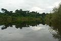
 Llanos del Beni, Bolivia.jpg 3,008 × 2,000; 1.11 MB
-
 Machetero de la Ichapekene Piesta.jpg 5,472 × 3,072; 3.25 MB
-
 Macheteros 10 11 20.jpg 5,472 × 3,648; 5.26 MB
-
 Man made island in llanos de moxos.jpg 926 × 648; 184 KB
-
 Pampas del Beni Bolivia.jpg 2,048 × 1,536; 923 KB
-
 Pre-Columbian man-made causeway in Llanos de Moxos.jpg 362 × 499; 62 KB
-

-

-
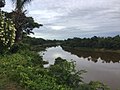 Rio Blanco Beni.jpg 1,280 × 960; 198 KB
-
 Rio Ibare.jpg 2,040 × 1,368; 1.43 MB
-
 Rio Mamore - panoramio.jpg 2,560 × 1,920; 1.9 MB
-
 Rurrenabaque Bolivia - The Amazon.jpg 1,607 × 1,242; 405 KB
-
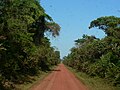 Ruta 13, Bolivia.jpg 2,048 × 1,536; 1.52 MB
-
 Ruta 8, Bolivia1.JPG 2,048 × 1,536; 1.27 MB
-
 Réserve aquicuana le lac.jpg 5,312 × 2,988; 4.83 MB
-
 Río Ibare and Puerto Almacén, Bolivia.jpg 2,031 × 1,119; 1.49 MB
-
 Río Maniqui - Bolivia.jpg 4,288 × 2,848; 4.41 MB
-
 Río Yata.jpg 1,956 × 1,401; 1.61 MB
-
 Sabana del Beni - Bolivia.jpg 4,288 × 2,848; 4.39 MB
-
 Serrania de San Simón Beni Bolivia satellite map62.16122W 13.png 1,278 × 942; 1.44 MB
-
 Squirrel monkey 2.JPG 2,048 × 1,536; 887 KB
-

-
 To cave at Galeshwor temple - panoramio.jpg 1,024 × 768; 295 KB
-
 Tumi Chucua 2013 small.jpg 240 × 164; 22 KB
-
 Una tarde cualquiera en Cachuela Esperanza.jpg 640 × 428; 105 KB
-


