Category:Bergh Apton
Jump to navigation
Jump to search
English: Bergh Apton is a village and civil parish in the South Norfolk district of Norfolk, England, 7 miles (11 km) south-east of Norwich just south of the A146 between Yelverton and Thurton. According to the 2001 census it had a population of 428 in 186 households.
village in the United Kingdom  | |||||
| Upload media | |||||
| Instance of | |||||
|---|---|---|---|---|---|
| Location | South Norfolk, Norfolk, East of England, England | ||||
| Population |
| ||||
| Area |
| ||||
 | |||||
Subcategories
This category has the following 3 subcategories, out of 3 total.
B
- Bergh Apton Village Sign (4 F)
- Bergh Apton War Memorial (7 F)
P
Media in category "Bergh Apton"
The following 200 files are in this category, out of 255 total.
(previous page) (next page)-
 18 Church Road Postbox - geograph.org.uk - 3876891.jpg 3,072 × 2,304; 1.72 MB
-
 18 Church Road Postbox - geograph.org.uk - 3876970.jpg 2,304 × 3,072; 2.04 MB
-
 18 Church Road Postbox - geograph.org.uk - 3876972.jpg 2,304 × 3,072; 1.88 MB
-
 18 Church Road Postbox - geograph.org.uk - 3877004.jpg 3,072 × 2,304; 2.06 MB
-
 18 Church Road Postbox - geograph.org.uk - 3877026.jpg 2,304 × 3,072; 1.92 MB
-
 A dried out pond - geograph.org.uk - 4237879.jpg 640 × 480; 261 KB
-
 A Farmhouse in Berghapton - geograph.org.uk - 2265683.jpg 640 × 480; 136 KB
-
 A footpath junction - geograph.org.uk - 1536784.jpg 640 × 459; 73 KB
-
 A glimpse of Bergh Aphton Manor - geograph.org.uk - 1536904.jpg 600 × 565; 111 KB
-
 A junction of paths - geograph.org.uk - 1536873.jpg 640 × 448; 87 KB
-
 A private track - geograph.org.uk - 1536817.jpg 640 × 445; 124 KB
-
 A sunny day in mid-October - geograph.org.uk - 1536802.jpg 640 × 480; 93 KB
-
 A terrace of houses in Church Road - geograph.org.uk - 6074488.jpg 800 × 574; 159 KB
-
 A terrace of houses in Church Road - geograph.org.uk - 6074509.jpg 800 × 582; 149 KB
-
 A tree-lined path - geograph.org.uk - 1536796.jpg 640 × 480; 89 KB
-
 Access road to Bergh Apton Manor - geograph.org.uk - 4332119.jpg 640 × 480; 238 KB
-
 Access road to Hillside Farm - geograph.org.uk - 6074431.jpg 800 × 588; 108 KB
-
 Approach to Bergh Aphton on Cooke's Road - geograph.org.uk - 1536516.jpg 640 × 457; 124 KB
-
 Approaching the A146 road - geograph.org.uk - 5892704.jpg 800 × 600; 142 KB
-

-
 Autumn colours in hedge - geograph.org.uk - 1570789.jpg 640 × 500; 146 KB
-
 Barn conversion at Hillside Farm - geograph.org.uk - 6074422.jpg 800 × 560; 122 KB
-
 Barn conversion on School Road - geograph.org.uk - 5892594.jpg 800 × 595; 113 KB
-
 Barns at Valley Farm - geograph.org.uk - 6074475.jpg 800 × 568; 167 KB
-
 Bergh Apton - WW1 commemoration - geograph.org.uk - 5953170.jpg 800 × 588; 206 KB
-
 Bergh Apton - WW1 commemoration - geograph.org.uk - 5953174.jpg 800 × 552; 168 KB
-
 Bergh Apton - WW1 commemoration - geograph.org.uk - 5953177.jpg 800 × 555; 176 KB
-
 Bergh Apton - WW1 commemoration - geograph.org.uk - 5953178.jpg 800 × 559; 124 KB
-
 Bergh Apton nature reserve - pond in restored wetland - geograph.org.uk - 6521094.jpg 2,576 × 1,932; 1.32 MB
-
 Bergh Apton Nature reserve - pond in restored wetland - geograph.org.uk - 6521103.jpg 4,608 × 3,456; 5.55 MB
-
 Bergh Apton Nature Reserve - woodland area - geograph.org.uk - 6521125.jpg 4,608 × 3,456; 4.39 MB
-
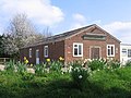 Bergh Apton Village Hall - geograph.org.uk - 156605.jpg 640 × 480; 107 KB
-
 Bergh Apton Village Hall - geograph.org.uk - 5998734.jpg 3,456 × 2,592; 3.94 MB
-
 Bergh Apton village sign - geograph.org.uk - 6074481.jpg 800 × 590; 135 KB
-
 Bergh Apton village sign - geograph.org.uk - 6632221.jpg 4,608 × 3,072; 5.61 MB
-
 Bergh Apton village sign - geograph.org.uk - 6632227.jpg 4,608 × 3,072; 6.22 MB
-
 Bergh Apton, Church of St. Peter and St. Paul - geograph.org.uk - 6507014.jpg 5,801 × 3,867; 7.4 MB
-

-

-

-
 Bergh Apton, Church of St. Peter and St. Paul, South porch - geograph.org.uk - 6507005.jpg 3,946 × 5,918; 7.31 MB
-

-

-

-
 Bergh Apton, Church of St. Peter and St. Paul, Tower - geograph.org.uk - 6506996.jpg 6,641 × 4,426; 7.63 MB
-
 Bergh Apton, Church of St. Peter and St. Paul, Tower - geograph.org.uk - 6507010.jpg 6,714 × 4,476; 6.36 MB
-
 Book exchange in School Road - geograph.org.uk - 5892601.jpg 800 × 600; 155 KB
-

-
 Brambles beside the path - geograph.org.uk - 1536849.jpg 640 × 480; 121 KB
-

-
 Bridleway to Cooke's Road - geograph.org.uk - 1536794.jpg 640 × 453; 97 KB
-
 Bridleway to Cooke's Road - geograph.org.uk - 1536824.jpg 640 × 480; 83 KB
-

-
 Bridleway to Wellbeck Road - geograph.org.uk - 3877024.jpg 3,072 × 2,304; 1.88 MB
-
 Bridleway to Wellbeck Road - geograph.org.uk - 3877071.jpg 3,072 × 2,304; 2.02 MB
-
 Brown leaves in a hedge - geograph.org.uk - 1536828.jpg 640 × 522; 125 KB
-

-
 Bungalow in Church Road - geograph.org.uk - 6074503.jpg 800 × 594; 166 KB
-
 Bungalow in Church Road - geograph.org.uk - 6074505.jpg 800 × 595; 167 KB
-
 Busseybridge Farm, Mundham - geograph.org.uk - 3374359.jpg 640 × 480; 211 KB
-
 Cattle pasture south of Bergh Aphton - geograph.org.uk - 1570733.jpg 640 × 480; 142 KB
-
 Chimneys at Bergh Aphton Manor - geograph.org.uk - 1536902.jpg 486 × 640; 96 KB
-
 Church Farm - the farmhouse - geograph.org.uk - 1536894.jpg 640 × 480; 98 KB
-
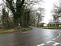 Church Road junction - geograph.org.uk - 3877073.jpg 3,072 × 2,304; 1.86 MB
-
 Church Road sign - geograph.org.uk - 3876684.jpg 3,072 × 2,304; 2.23 MB
-
 Church Road with Lower Kiln Lane on the left - geograph.org.uk - 5998725.jpg 3,456 × 2,592; 3.8 MB
-
 Church Road, Bergh Apton - geograph.org.uk - 3876860.jpg 3,072 × 2,304; 1.09 MB
-
 Church Road, Bergh Apton - geograph.org.uk - 3876992.jpg 3,072 × 2,304; 2 MB
-
 Church Road, Bergh Apton - geograph.org.uk - 3877930.jpg 3,072 × 2,304; 1.51 MB
-
 Church Road, Bergh Apton - geograph.org.uk - 3877932.jpg 3,072 × 2,304; 1.76 MB
-
 Church Road, Bergh Apton - geograph.org.uk - 6268694.jpg 4,032 × 2,268; 5.44 MB
-
 Copse surrounded by fields - geograph.org.uk - 1536742.jpg 640 × 447; 88 KB
-
 Corner Cottage - geograph.org.uk - 1536869.jpg 640 × 463; 99 KB
-
-
 Crop field north of Wellbeck Road - geograph.org.uk - 6074447.jpg 800 × 580; 144 KB
-
 Crop fields by Bergh Apton - geograph.org.uk - 4332135.jpg 640 × 480; 176 KB
-
 Crop fields by Mere Farm - geograph.org.uk - 4237887.jpg 640 × 480; 236 KB
-
 Disused K6 telephone box in School Road - geograph.org.uk - 5892597.jpg 800 × 594; 138 KB
-
 Dodgers Lane past Church Farm - geograph.org.uk - 1536709.jpg 640 × 480; 111 KB
-
 Dodgers Lane past Corner Cottage - geograph.org.uk - 1536881.jpg 640 × 458; 104 KB
-

-
 Electricity pylon in crop field - geograph.org.uk - 5892701.jpg 800 × 600; 127 KB
-
 Entrance to a household waste depot - geograph.org.uk - 6074478.jpg 800 × 579; 111 KB
-
 Entrance to Bergh Aphton Manor - geograph.org.uk - 1536895.jpg 640 × 480; 112 KB
-
 Farm bridge over Well Beck - geograph.org.uk - 6074444.jpg 800 × 587; 172 KB
-
 Farm land off White Heath Road, Thurton - geograph.org.uk - 5998740.jpg 3,456 × 2,592; 3.91 MB
-

-
 Farm track through fields - geograph.org.uk - 1536806.jpg 640 × 455; 95 KB
-
 Farm track to Cooke's Road - geograph.org.uk - 1536815.jpg 640 × 454; 85 KB
-
 Field entrance off Church Road at Bergh Apton - geograph.org.uk - 5998735.jpg 3,456 × 2,592; 3.9 MB
-
 Field west of Lion Lane, Thurton - geograph.org.uk - 3374421.jpg 640 × 480; 197 KB
-
 Fields beside the footpath - geograph.org.uk - 4237882.jpg 640 × 480; 206 KB
-
 Fields by Bergh Apton - geograph.org.uk - 4237878.jpg 640 × 480; 171 KB
-
 Fields by Mere Farm - geograph.org.uk - 4237867.jpg 640 × 480; 155 KB
-
 Fields east of Bergh Apton House - geograph.org.uk - 3374392.jpg 640 × 480; 189 KB
-

-

-
 Fields south of Cooke's Road - geograph.org.uk - 4237873.jpg 640 × 480; 189 KB
-
 Fields south of Cooke's Road - geograph.org.uk - 4237880.jpg 640 × 615; 209 KB
-
 Fields south of Thurton - geograph.org.uk - 5892573.jpg 800 × 490; 83 KB
-
 Fields south of White Heath House - geograph.org.uk - 4237877.jpg 640 × 447; 183 KB
-

-

-

-
 Footpath through Bergh Apton Nature Reserve - geograph.org.uk - 6521117.jpg 4,608 × 3,456; 4.48 MB
-
 Footpath to Bergh Apton - geograph.org.uk - 4237876.jpg 640 × 480; 176 KB
-
 Footpath to Cooke's Road - geograph.org.uk - 4237886.jpg 640 × 480; 177 KB
-
 Footpath to Lower Kiln Lane - geograph.org.uk - 3876646.jpg 3,072 × 2,304; 1.38 MB
-

-
 Gate into a works site - geograph.org.uk - 6074538.jpg 800 × 567; 161 KB
-

-
 George VI postbox in Threadneedle Street - geograph.org.uk - 4332138.jpg 640 × 509; 295 KB
-

-

-
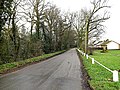
 Hall Road, Bergh Apton - geograph.org.uk - 3878063.jpg 3,072 × 2,304; 914 KB
-
 Hedge beside Threadneedle Street - geograph.org.uk - 4332145.jpg 640 × 480; 215 KB
-
 Hillside Farm (farmhouse) - geograph.org.uk - 6074420.jpg 800 × 572; 112 KB
-
 Hillside Farm (farmhouse) - geograph.org.uk - 6074425.jpg 800 × 597; 120 KB
-
 Hillside Farm (farmhouse) - geograph.org.uk - 6074427.jpg 800 × 587; 159 KB
-

-
 House in Bergh Apton - geograph.org.uk - 4332107.jpg 640 × 440; 122 KB
-
 House in Threadneedle Street - geograph.org.uk - 4332148.jpg 640 × 480; 182 KB
-

-

-
 Houses on Church Meadow Lane from Upper Kiln Lane - geograph.org.uk - 5998721.jpg 3,456 × 2,592; 3.86 MB
-
 Houses on Wellbeck Road - geograph.org.uk - 6074465.jpg 800 × 567; 139 KB
-
 Ivy-clad trees casting their shadows - geograph.org.uk - 1536842.jpg 500 × 640; 138 KB
-
-
 Junction of Wellback Road and School Road - geograph.org.uk - 6268693.jpg 4,032 × 2,268; 4.98 MB
-
 K6 telephone box in Threadneedle Street - geograph.org.uk - 4332111.jpg 640 × 480; 249 KB
-
 K6 telephone box in Threadneedle Street - geograph.org.uk - 4332116.jpg 640 × 480; 284 KB
-
 Loddon Road past Bergh Apton House - geograph.org.uk - 5892564.jpg 800 × 600; 173 KB
-
 Loddon Road past Hollylodge Farm - geograph.org.uk - 5892569.jpg 800 × 587; 100 KB
-
 Lower Kiln Lane sign - geograph.org.uk - 3876675.jpg 3,072 × 2,304; 2.07 MB
-
 Lower Kiln Lane, Bergh Apton - geograph.org.uk - 3876678.jpg 3,072 × 2,304; 711 KB
-
 Lower Kiln Lane, Bergh Apton - geograph.org.uk - 3878176.jpg 3,072 × 2,304; 1.59 MB
-
 Manor House, Bergh Apton - geograph.org.uk - 5998729.jpg 3,456 × 2,592; 3.88 MB
-
 May Cottage, Bussey Bridge, Bergh Apton - geograph.org.uk - 160604.jpg 640 × 471; 107 KB
-

-
 Minor road past Bergh Apton House - geograph.org.uk - 3374404.jpg 640 × 480; 165 KB
-

-
 Muck heap ready for spreading, Thurton - geograph.org.uk - 3374417.jpg 640 × 480; 194 KB
-

-
 New housing in Church Road - geograph.org.uk - 6074479.jpg 800 × 587; 132 KB
-
 New housing in Church Road - geograph.org.uk - 6074480.jpg 800 × 595; 158 KB
-
 Nice thatched hall - geograph.org.uk - 1326419.jpg 640 × 480; 100 KB
-
 No fishing today - geograph.org.uk - 1536907.jpg 640 × 481; 136 KB
-
 Oak growing in a dry ditch - geograph.org.uk - 1536852.jpg 640 × 480; 133 KB
-
 Oak tree growing on field boundary - geograph.org.uk - 4237869.jpg 640 × 480; 189 KB
-
 Old barn by Church Farm - geograph.org.uk - 1536884.jpg 640 × 480; 118 KB
-
 Old stables beside Wellbeck Road - geograph.org.uk - 6074471.jpg 800 × 571; 198 KB
-
 Old stables beside Wellbeck Road - geograph.org.uk - 6074473.jpg 800 × 570; 202 KB
-
 Pasture by Washingford House - geograph.org.uk - 1536520.jpg 640 × 461; 95 KB
-
 Pasture north of Cooke's Road - geograph.org.uk - 1536518.jpg 640 × 455; 91 KB
-

-
 Path to White Heath Road - geograph.org.uk - 1536787.jpg 640 × 433; 84 KB
-

-

-

-

-

-
 Plot of young trees - geograph.org.uk - 5892576.jpg 800 × 600; 103 KB
-
 Pond in waterlogged wood by Well Beck - geograph.org.uk - 6074454.jpg 800 × 565; 207 KB
-

-

-
 Pond south of Wellbeck Road - geograph.org.uk - 6074457.jpg 800 × 572; 205 KB
-
 Pond with an old bridge - geograph.org.uk - 1587359.jpg 640 × 480; 62 KB
-
 Private track to Holly Lodge - geograph.org.uk - 1570797.jpg 640 × 480; 159 KB
-
 Public footpath to Thurton - geograph.org.uk - 5892570.jpg 800 × 600; 218 KB
-

-
 Red Lion House in Lion Lane, Thurton - geograph.org.uk - 3374412.jpg 640 × 452; 173 KB
-

-
 Roadsign on Church Road - geograph.org.uk - 3876686.jpg 2,283 × 3,044; 1.04 MB
-
 Roadsign on School Road - geograph.org.uk - 3878134.jpg 2,169 × 2,893; 1.04 MB
-
 Roadsign on Welbeck Road - geograph.org.uk - 3876661.jpg 2,143 × 2,858; 2.3 MB
-
 Roadsign on Wellbeck Road - geograph.org.uk - 3877979.jpg 2,215 × 2,953; 1.81 MB
-
 Roadsign, Church Road sign ^ Village Notice Board - geograph.org.uk - 3877016.jpg 2,304 × 3,072; 1.74 MB
-
 Rusting tractors, Bergh Apton - geograph.org.uk - 160637.jpg 640 × 476; 116 KB
-
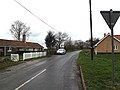
 School Road sign - geograph.org.uk - 3877966.jpg 2,989 × 2,240; 961 KB
-
 School Road, Bergh Apton - geograph.org.uk - 3877917.jpg 3,072 × 2,304; 1.87 MB
-
 School Road, Bergh Apton - geograph.org.uk - 3877963.jpg 3,072 × 2,304; 1.47 MB
-
 School Road, Bergh Apton - geograph.org.uk - 3878028.jpg 3,072 × 2,304; 700 KB
-
 School Road, Bergh Apton - geograph.org.uk - 3878144.jpg 3,072 × 2,304; 847 KB
-

-

-
 Shaded farm track - geograph.org.uk - 5892579.jpg 800 × 600; 96 KB
-

-
 Sheds at Busseybridge Farm, Mundham - geograph.org.uk - 3374370.jpg 640 × 477; 154 KB
-
 Sheds on Hillside Farm - geograph.org.uk - 6074419.jpg 800 × 563; 106 KB
-
 Sheep in pasture by Bergh Apton Manor - geograph.org.uk - 4332126.jpg 640 × 480; 234 KB
-
 Sheep resting - geograph.org.uk - 4332129.jpg 640 × 634; 311 KB
-
-
 Simple seat beside tree - geograph.org.uk - 1536811.jpg 640 × 480; 118 KB
-

-
 Spring crop by Red Lion House, Thurton - geograph.org.uk - 3374409.jpg 640 × 480; 207 KB
-
 Spring crop east of Bergh Apton House - geograph.org.uk - 3374394.jpg 640 × 480; 160 KB
-

-
 Stubble field by Mere Farm - geograph.org.uk - 4237868.jpg 640 × 480; 181 KB
-
 Stubble field north of White Heath Road - geograph.org.uk - 4237874.jpg 640 × 480; 195 KB
-


_-_geograph.org.uk_-_6074420.jpg)
_-_geograph.org.uk_-_6074425.jpg)
_-_geograph.org.uk_-_6074427.jpg)


