Category:Betws-y-Coed
Jump to navigation
Jump to search
town and community in Conwy County Borough, Wales, UK    | |||||
| Upload media | |||||
| Pronunciation audio | |||||
|---|---|---|---|---|---|
| Instance of | |||||
| Located in protected area | |||||
| Location | Conwy County Borough, Wales | ||||
| Population |
| ||||
| Area |
| ||||
| official website | |||||
 | |||||
Subcategories
This category has the following 14 subcategories, out of 14 total.
- Aerial images of Betws-y-Coed (32 F)
F
- Ffos Noddyn, Betws-y-Coed (17 F)
M
P
- Pont-y-Pair Inn (5 F)
R
- Betws-y-Coed railway station (135 F)
- Royal Oak Hotel, Betws-y-Coed (11 F)
S
- Shops in Betws-y-Coed (42 F)
Media in category "Betws-y-Coed"
The following 200 files are in this category, out of 541 total.
(previous page) (next page)-
 "Clerical errors" - geograph.org.uk - 4676318.jpg 640 × 480; 101 KB
-
-
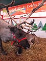
 "My Dad has a red nose" - geograph.org.uk - 3245902.jpg 640 × 480; 108 KB
-
 'Captain Hook' needs water - geograph.org.uk - 4111519.jpg 480 × 640; 90 KB
-

-
-
 1913 Fiat Tipo Zip - geograph.org.uk - 3594016.jpg 640 × 480; 108 KB
-
 1924 Vauxhall Kington 23-60 - geograph.org.uk - 3595706.jpg 640 × 480; 125 KB
-
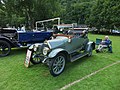
 1930 Sunbeam 20.9 Tourer - geograph.org.uk - 3595770.jpg 640 × 480; 124 KB
-
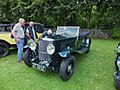 1935 Railton sports car - geograph.org.uk - 3595681.jpg 640 × 480; 108 KB
-
 1935 Wolseley Hornet car - geograph.org.uk - 3595686.jpg 640 × 480; 115 KB
-
 1954 Leyland PS2 coach - geograph.org.uk - 3593992.jpg 640 × 480; 103 KB
-
 1956 Ford Popular Utility pickup - geograph.org.uk - 3593962.jpg 640 × 480; 95 KB
-
 1963 Wolseley 1500 car - geograph.org.uk - 3595183.jpg 640 × 480; 100 KB
-
 A collection of Clerical Errors - geograph.org.uk - 4676854.jpg 640 × 480; 109 KB
-
 A crane at the Stables - geograph.org.uk - 5262972.jpg 640 × 360; 76 KB
-
 A disused reservoir near Coedmawr - geograph.org.uk - 1597553.jpg 640 × 426; 153 KB
-
 A Dunwood coach visits Betws-y-Coed - geograph.org.uk - 5873644.jpg 800 × 607; 89 KB
-
 A game of soldiers - geograph.org.uk - 4631914.jpg 1,000 × 750; 662 KB
-
 A Hider delivery in Betws-y-Coed - geograph.org.uk - 5482468.jpg 640 × 464; 71 KB
-

-
-
 A plantation of young trees - geograph.org.uk - 760314.jpg 640 × 480; 69 KB
-

-

-
 A Seat With A View - geograph.org.uk - 4776043.jpg 1,024 × 768; 147 KB
-

-

-
 A slate welcome to Betws-y-Coed - geograph.org.uk - 3260164.jpg 640 × 492; 111 KB
-
 A small llyn by Llyn Sarnau - geograph.org.uk - 1589503.jpg 640 × 426; 94 KB
-

-
 A track with a view - geograph.org.uk - 1597562.jpg 640 × 426; 96 KB
-
 A winters morning Afon Conwy - geograph.org.uk - 2764306.jpg 3,296 × 2,472; 1.99 MB
-
 A.A. Sign - geograph.org.uk - 2150230.jpg 1,200 × 1,600; 247 KB
-
 A470 near Craig Lledr - geograph.org.uk - 2640828.jpg 640 × 432; 75 KB
-
 A470 northbound - geograph.org.uk - 3267015.jpg 640 × 515; 78 KB
-
 A470 passing Allt y Coed - geograph.org.uk - 4720559.jpg 640 × 429; 93 KB
-
-
 A5 - geograph.org.uk - 3180113.jpg 640 × 430; 83 KB
-
 A5 - geograph.org.uk - 3468499.jpg 2,560 × 1,920; 1.99 MB
-
 A5 approaching Betws-y-coed - geograph.org.uk - 3180061.jpg 640 × 430; 77 KB
-
 A5 at Pentre-Du - geograph.org.uk - 4720798.jpg 640 × 467; 77 KB
-
 A5 in the Llugwy valley - geograph.org.uk - 3180117.jpg 640 × 430; 96 KB
-
 A5 north of Pentre Du - geograph.org.uk - 3180107.jpg 640 × 430; 77 KB
-
 A5 northbound - geograph.org.uk - 3248660.jpg 640 × 427; 91 KB
-
 A5 West of Betws-y-Coed - geograph.org.uk - 6035108.jpg 1,024 × 683; 1.03 MB
-
 A5, Pentre Du - geograph.org.uk - 3180094.jpg 640 × 430; 73 KB
-
 A5, westward - geograph.org.uk - 3180121.jpg 640 × 469; 77 KB
-
 Above Betws y Coed - geograph.org.uk - 181414.jpg 640 × 480; 145 KB
-
 Access cutting to Bwlch Gwyn Quarry - geograph.org.uk - 405565.jpg 480 × 640; 162 KB
-
 Adfael â tho coch - A red-roofed ruin - geograph.org.uk - 2500528.jpg 640 × 480; 135 KB
-
 Afon Conwy - geograph.org.uk - 2942247.jpg 640 × 480; 79 KB
-
 Afon Conwy - geograph.org.uk - 2949450.jpg 640 × 480; 60 KB
-
 Afon Conwy - geograph.org.uk - 3161709.jpg 640 × 348; 70 KB
-
 Afon Conwy - geograph.org.uk - 3180051.jpg 640 × 308; 60 KB
-
 Afon Conwy - geograph.org.uk - 4286979.jpg 640 × 480; 84 KB
-
 Afon Conwy - geograph.org.uk - 4287281.jpg 640 × 480; 88 KB
-
 Afon Conwy - geograph.org.uk - 4427122.jpg 358 × 640; 52 KB
-
 Afon Conwy - geograph.org.uk - 6160610.jpg 1,280 × 960; 1,006 KB
-
 Afon Conwy - geograph.org.uk - 6160613.jpg 1,280 × 960; 1.05 MB
-
 Afon Conwy - geograph.org.uk - 6184917.jpg 1,536 × 2,048; 1.42 MB
-
 Afon Conwy at Coed Y Celin - geograph.org.uk - 5351784.jpg 1,600 × 1,200; 1,006 KB
-
 Afon Conwy downstream from Waterloo Bridge - geograph.org.uk - 4631921.jpg 1,000 × 750; 606 KB
-
 Afon Conwy from the A470 Bridge - geograph.org.uk - 5351790.jpg 1,600 × 1,202; 1.1 MB
-
 Afon Conwy from the riverbank - geograph.org.uk - 2765998.jpg 3,296 × 2,472; 1.98 MB
-
 Afon Conwy from the Waterloo Bridge - geograph.org.uk - 5726156.jpg 640 × 480; 99 KB
-
 Afon Conwy in flood (2) - geograph.org.uk - 6091663.jpg 1,024 × 683; 227 KB
-
 Afon Conwy in flood - geograph.org.uk - 6091662.jpg 1,024 × 683; 232 KB
-
 Afon Conwy north of Waterloo Bridge - geograph.org.uk - 6196218.jpg 5,184 × 3,888; 6.03 MB
-
 Afon Llugwy at Betws y Coed - geograph.org.uk - 5351661.jpg 1,600 × 1,203; 1.07 MB
-
 Afon Llugwy at Betws y Coed - geograph.org.uk - 5351671.jpg 1,600 × 1,201; 1.13 MB
-
 Afon Llugwy at Betws-y-coed (3) - geograph.org.uk - 2479930.jpg 480 × 640; 142 KB
-
 Afon Llugwy at Betws-y-coed - geograph.org.uk - 1916018.jpg 4,592 × 3,056; 4.35 MB
-
 After Dinner Guests - geograph.org.uk - 2688736.jpg 778 × 519; 239 KB
-
 All ability path, Betws-y-Coed - geograph.org.uk - 3835309.jpg 1,200 × 798; 417 KB
-
 All stones and little water - geograph.org.uk - 409445.jpg 480 × 640; 167 KB
-

-

-

-
 An MG Midge - geograph.org.uk - 3594031.jpg 640 × 480; 107 KB
-

-
 Ancient tractor - geograph.org.uk - 4270799.jpg 640 × 480; 145 KB
-
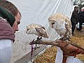
 Angel the owl - geograph.org.uk - 3246277.jpg 480 × 640; 79 KB
-
 Anna Davies, Betws-y-Coed - geograph.org.uk - 3283070.jpg 640 × 532; 101 KB
-
 Anna Davies, Betws-y-Coed - geograph.org.uk - 3835097.jpg 1,200 × 798; 387 KB
-
 Approaching Pant-yr-hyddod farm - geograph.org.uk - 2299096.jpg 640 × 480; 63 KB
-
 Austin A35 van - geograph.org.uk - 3595051.jpg 640 × 480; 99 KB
-
 Barn at Pentre Du, Betws-y-Coed - geograph.org.uk - 3835689.jpg 1,200 × 798; 496 KB
-
 Barrier across a forest track - geograph.org.uk - 1372694.jpg 640 × 480; 104 KB
-

-
-
 Benches beside Ty'n-y-Cae Pool - geograph.org.uk - 1373150.jpg 640 × 480; 126 KB
-
 Bends and railway bridge ahead on the A470 - geograph.org.uk - 4800458.jpg 1,024 × 587; 113 KB
-
 Bends on the A5 - geograph.org.uk - 3180130.jpg 640 × 420; 66 KB
-
 Gorsaf Dân Betws y Coed Fire Station - geograph.org.uk - 402428.jpg 640 × 442; 69 KB
-
 Betws y Coed - geograph.org.uk - 2492738.jpg 800 × 600; 205 KB
-
 Betws y Coed - panoramio.jpg 3,968 × 2,976; 5.03 MB
-
 Betws y Coed fire station - geograph.org.uk - 181425.jpg 640 × 480; 100 KB
-
 Betws y Coed Information Sign.jpg 1,536 × 2,048; 938 KB
-
 Betws y coed.jpg 480 × 197; 41 KB
-
 Betws-y-Coed (27880172024).jpg 3,648 × 5,472; 8.39 MB
-
 Betws-y-Coed (27881039713).jpg 5,472 × 3,648; 6.95 MB
-
 Betws-y-Coed - geograph.org.uk - 1847468.jpg 800 × 533; 201 KB
-
 Betws-y-Coed - geograph.org.uk - 1917328.jpg 4,727 × 3,263; 3.64 MB
-
 Betws-y-Coed - geograph.org.uk - 44286.jpg 640 × 480; 177 KB
-
 Betws-Y-Coed - geograph.org.uk - 51647.jpg 640 × 480; 135 KB
-
 Betws-y-Coed - geograph.org.uk - 851465.jpg 640 × 406; 149 KB
-
 Betws-y-coed - panoramio.jpg 2,448 × 1,399; 339 KB
-
 Betws-y-Coed - scan02.jpg 2,024 × 1,440; 2.02 MB
-
 Betws-y-Coed - scan03.jpg 2,024 × 1,440; 2.06 MB
-
 Betws-y-Coed - scan04.jpg 2,016 × 1,424; 2.02 MB
-
 Betws-y-Coed - scan05.jpg 2,016 × 1,424; 1.97 MB
-
 Betws-y-Coed banner.jpg 4,020 × 575; 578 KB
-
 Betws-y-coed bridge - geograph.org.uk - 992064.jpg 640 × 446; 222 KB
-
 Betws-y-Coed conifers.JPG 3,264 × 2,448; 1.83 MB
-
 Betws-y-coed falls - panoramio.jpg 3,011 × 1,712; 397 KB
-
 Betws-y-Coed Golf Course - geograph.org.uk - 1138472.jpg 640 × 480; 65 KB
-
 Betws-y-Coed Guest Houses - geograph.org.uk - 1834100.jpg 640 × 480; 100 KB
-
 Betws-y-Coed Memorial Hall - geograph.org.uk - 3283209.jpg 626 × 640; 109 KB
-
 Betws-y-Coed playing fields - geograph.org.uk - 4631287.jpg 1,000 × 750; 631 KB
-
 Betws-y-Coed playing fields - geograph.org.uk - 4631291.jpg 1,000 × 750; 594 KB
-
 Betws-y-Coed playing fields - geograph.org.uk - 4631293.jpg 1,000 × 750; 665 KB
-
 Betws-y-Coed Surgery - geograph.org.uk - 4749009.jpg 640 × 480; 47 KB
-
 Betws-y-Coed village green - scan01.jpg 2,008 × 1,424; 1.9 MB
-
 Betws-y-coed waterfall - geograph.org.uk - 992065.jpg 640 × 429; 204 KB
-
 Betws-y-coed waterfall - geograph.org.uk - 992066.jpg 429 × 640; 192 KB
-
 Betws-y-Coed Waterfalls (8083506318).jpg 2,848 × 4,288; 6.12 MB
-
 Betws-y-coed, boardwalk into the woods - geograph.org.uk - 3606388.jpg 480 × 640; 110 KB
-

-

-
-
 Betws-y-coed, postbox № LL24 139 - geograph.org.uk - 3663773.jpg 480 × 640; 94 KB
-
 Betws-y-coed, postbox № LL24 26 - geograph.org.uk - 3663781.jpg 640 × 480; 112 KB
-
 Betws-y-coed, the River - geograph.org.uk - 1334542.jpg 600 × 450; 271 KB
-
 Betws-y-coed, the River - geograph.org.uk - 1334554.jpg 600 × 450; 213 KB
-
 Betws-y-Coed, UK - panoramio.jpg 4,032 × 2,272; 2.72 MB
-
 Betws-y-coed, vintage car rally - geograph.org.uk - 3663777.jpg 640 × 481; 80 KB
-
 Betws-y-coed.jpeg 900 × 805; 378 KB
-
BetwsYCoedPronunciation.wav 1.5 s; 48 KB
-
 Bikers' paradise - geograph.org.uk - 5850951.jpg 640 × 427; 84 KB
-
 Bird life on Llyn Elsi - geograph.org.uk - 2410900.jpg 3,968 × 2,976; 3.21 MB
-
 Bird sculptures, Betws-y-Coed - geograph.org.uk - 3363042.jpg 640 × 480; 116 KB
-
-
-
 Bod Gwynedd B^B, Betws-y-Coed - geograph.org.uk - 3836110.jpg 1,200 × 798; 403 KB
-
 Bod Hyfryd and Talking Point, guest houses - geograph.org.uk - 3836220.jpg 1,200 × 798; 488 KB
-
 Bont Newydd, Afon Conwy, nr. Betws-y-Coed - geograph.org.uk - 34404.jpg 640 × 480; 217 KB
-
 Bottle Christmas Tree 2014 - geograph.org.uk - 4266456.jpg 640 × 480; 96 KB
-
 Bridge at Bettws y Coed, north Wales.jpeg 900 × 907; 543 KB
-
 Bridge at Betws Y Coed - geograph.org.uk - 1869277.jpg 488 × 577; 170 KB
-
 Bridge Going Down - geograph.org.uk - 2153124.jpg 1,200 × 1,600; 785 KB
-
 Bridge over Afon Rhiwddolion - geograph.org.uk - 3349194.jpg 1,280 × 853; 382 KB
-
 Bridge over the River Lledr - geograph.org.uk - 1138221.jpg 640 × 480; 136 KB
-
 Britannia locomotive - geograph.org.uk - 3075097.jpg 4,608 × 3,456; 5.55 MB
-
 Bryn Afon Guest House, Betws-y-Coed - geograph.org.uk - 3835211.jpg 1,200 × 798; 335 KB
-
 Bryn Derw, Rhiwddolion - geograph.org.uk - 1184628.jpg 640 × 480; 48 KB
-
 Brynmawr chapel, Betws-y-Coed - geograph.org.uk - 3286442.jpg 630 × 640; 103 KB
-
 Brynmawr Chapel, Betws-y-Coed - geograph.org.uk - 3836223.jpg 1,200 × 798; 438 KB
-

-
 Bubbles on the green - geograph.org.uk - 3698892.jpg 640 × 480; 106 KB
-
 Buffet Coach Cafe, Betws-y-Coed.jpg 2,048 × 1,152; 387 KB
-
 Bus stops, A5 - geograph.org.uk - 3180066.jpg 640 × 430; 94 KB
-
 Cae Llan, Station Road Public Conveniences.jpg 4,592 × 3,064; 5.55 MB
-
 Cae'n y Coed - geograph.org.uk - 1976722.jpg 4,592 × 3,056; 5.03 MB
-
 Canoe ^ Car Park at Nant Bwlch yr Haiarn OEC - geograph.org.uk - 4458971.jpg 1,600 × 1,200; 399 KB
-
 Capel Bryn Mawr - geograph.org.uk - 5928981.jpg 640 × 457; 87 KB
-
 Capped mineshaft in Gwydyr Forest Park - geograph.org.uk - 5066686.jpg 640 × 427; 117 KB
-
 Car park trail is closed - geograph.org.uk - 4797880.jpg 1,024 × 768; 261 KB
-
 Cascade in the Aberllyn Gorge - geograph.org.uk - 1373154.jpg 427 × 640; 133 KB
-
 Cautionary signs - geograph.org.uk - 4642924.jpg 640 × 480; 127 KB
-
 Chapel at Betws-y-coed - geograph.org.uk - 1432395.jpg 640 × 480; 82 KB
-
 Children love bubbles - geograph.org.uk - 4066117.jpg 640 × 480; 107 KB
-
 Christmas candy sticks - geograph.org.uk - 4266466.jpg 640 × 480; 116 KB
-
 Church in trees - geograph.org.uk - 2759068.jpg 1,024 × 769; 303 KB
-
 Cleared forestry near Llyn Elsi - geograph.org.uk - 1983837.jpg 640 × 480; 108 KB
-
 Clogwyn Cyrau, Betws-y-coed. - geograph.org.uk - 104732.jpg 440 × 640; 81 KB
-
 Coed Mawr Cottage - geograph.org.uk - 2165857.jpg 3,167 × 2,448; 1.6 MB
-
 Coed Mawr in 1981 - geograph.org.uk - 3931469.jpg 800 × 667; 160 KB
-
 Coedwig Gwydyr - Gwydyr Forest - geograph.org.uk - 5959199.jpg 640 × 445; 115 KB
-
 Conwy County Borough UK electoral wards - Betws-y-Coed locator.png 800 × 740; 92 KB
-
 Conwy Valley Rotary Club Well.jpg 1,152 × 2,048; 606 KB
-

-
 Cottage on Rhes Gethin, Betws-y-Coed - geograph.org.uk - 3836055.jpg 1,200 × 798; 352 KB
-
 Cottages at Betws y Coed - geograph.org.uk - 6184945.jpg 2,048 × 1,536; 1.37 MB
-
 Crossing no gates - geograph.org.uk - 4080263.jpg 640 × 480; 76 KB
-
-
 Cwmlanerch. - geograph.org.uk - 143269.jpg 640 × 480; 285 KB
-
-
 Damage at The Towers - geograph.org.uk - 1437112.jpg 428 × 640; 205 KB
-

-
 Denver ^ Rio Grande - geograph.org.uk - 4631140.jpg 1,000 × 587; 558 KB
-
 Dinas Mawr, Betws-y-Coed - geograph.org.uk - 34408.jpg 640 × 480; 157 KB
-
 Diosgydd-uchaf - geograph.org.uk - 3349274.jpg 1,280 × 853; 238 KB
-
 Distinctive distance sign, Betws-y-Coed - geograph.org.uk - 3283284.jpg 640 × 401; 103 KB
-
 Disused Reservoir near Llyn Y Parc - geograph.org.uk - 197108.jpg 640 × 427; 99 KB
-
 Do Todays Work Today - geograph.org.uk - 554801.jpg 640 × 480; 170 KB
-
 Doctor Zigs bubbles - geograph.org.uk - 4065803.jpg 640 × 480; 106 KB
-
 Dol-gam Campsite - geograph.org.uk - 157084.jpg 640 × 485; 58 KB
-
 Dolgethin Guest House, Betws-y-Coed - geograph.org.uk - 3836200.jpg 1,200 × 798; 397 KB
-
 Dolgethin guesthouse, Betws-y-Coed - geograph.org.uk - 3286669.jpg 640 × 501; 87 KB


_-_geograph.org.uk_-_6091663.jpg)


_-_geograph.org.uk_-_2479930.jpg)


.jpg)
.jpg)


.jpg)


