Category:Beukenhorst, Wassenaar
Jump to navigation
Jump to search
| Object location | | View all coordinates using: OpenStreetMap |
|---|
| Upload media | |||||
| Instance of |
| ||||
|---|---|---|---|---|---|
| Part of | |||||
| Location | Wassenaar, South Holland, Netherlands | ||||
| Street address |
| ||||
| Heritage designation |
| ||||
 | |||||
|
This is a category about rijksmonument number 511039
|
|
This is a category about rijksmonument number 511041
|
|
This is a category about rijksmonument number 511046
|
|
This is a category about rijksmonument number 511047
|
|
This is a category about rijksmonument number 511052
|
|
This is a category about rijksmonument number 511053
|
| Address |
|
Media in category "Beukenhorst, Wassenaar"
This category contains only the following file.
-
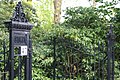 Beukenhorst, toegangshek.JPG 3,072 × 2,048; 2.35 MB
