Category:Biddulph
Jump to navigation
Jump to search
town and civil parish in Staffordshire, England, UK  | |||||
| Upload media | |||||
| Instance of | |||||
|---|---|---|---|---|---|
| Location | Staffordshire Moorlands, Staffordshire, West Midlands, England | ||||
| Different from | |||||
| Said to be the same as | Biddulph (Wikimedia duplicated page, civil parish) | ||||
 | |||||
English: Biddulph is a town in Staffordshire, England, north of Stoke-on-Trent and south east of Congleton, Cheshire.
Italiano: Biddulph è una cittadina di 20.045 abitanti, situata nella contea dello Staffordshire in Inghilterra.
Nederlands: Biddulph is een plaats in het bestuurlijke gebied Staffordshire Moorlands, in het Engelse graafschap Staffordshire. De plaats telt 17.819 inwoners.
Polski: Biddulph - miasto w Wielkiej Brytanii, w Anglii, w regionie West Midlands, w hrabstwie Staffordshire. W 2001 r. miasto to zamieszkiwało 17 241 osób.
Română: Biddulph este un oraş în comitatul Staffordshire, regiunea West Midlands, Anglia. Oraşul se află în districtul Staffordshire Moorlands.
Subcategories
This category has the following 21 subcategories, out of 21 total.
B
- Bailey's Wood ringwork castle (17 F)
- Biddulph Leisure Centre (4 F)
- Biddulph Millennium Garden (8 F)
- Biddulph Old Hall (148 F)
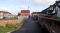
- Biddulph railway station (19 F)
- Biddulph Valley Park (16 F)
- Biddulph War Memorial (16 F)
- Biddulph WWI Memorial Cross (2 F)
- Black Bull railway station (1 F)
C
E
- Environs of Biddulph (2 F)
F
H
- Hollinsheads (bus company) (5 F)
K
- Knypersley Reservoir (88 F)
L
N
O
- Oxhey First School (4 F)
S
Media in category "Biddulph"
The following 200 files are in this category, out of 1,340 total.
(previous page) (next page)-
 "Landowners welcome caring walkers" - geograph.org.uk - 2146144.jpg 2,555 × 3,262; 1.24 MB
-
 A boggy bit - geograph.org.uk - 2162905.jpg 4,000 × 3,000; 3.6 MB
-
 A boggy bit^ - geograph.org.uk - 2219583.jpg 2,048 × 1,536; 1,006 KB
-
 A boundary stone perhaps^ - geograph.org.uk - 2160457.jpg 3,993 × 2,618; 3.2 MB
-
 A closer look at one of the Wickenstones - geograph.org.uk - 2515529.jpg 800 × 721; 138 KB
-
 A footpath no more - geograph.org.uk - 2144589.jpg 4,000 × 2,457; 1.29 MB
-
 A glimpse of the field behind Chamberlain Way - geograph.org.uk - 1937100.jpg 2,048 × 1,536; 1.03 MB
-
 A horse friendly gate - geograph.org.uk - 2174696.jpg 1,899 × 1,402; 683 KB
-
 A murder of crows - geograph.org.uk - 6080433.jpg 1,024 × 768; 193 KB
-
 A pair of dry troughs - geograph.org.uk - 231750.jpg 640 × 480; 143 KB
-
 A piece of history - geograph.org.uk - 2174380.jpg 1,899 × 1,230; 789 KB
-
 A scene of tranquillity - geograph.org.uk - 2521709.jpg 800 × 590; 201 KB
-
 A seat in the snow - geograph.org.uk - 2185380.jpg 1,944 × 1,438; 563 KB
-
 A seat in the sun - geograph.org.uk - 2103198.jpg 2,816 × 1,584; 1.65 MB
-
 A snowy valley - geograph.org.uk - 2197127.jpg 2,048 × 1,391; 525 KB
-
 A splash of colour - geograph.org.uk - 2126198.jpg 4,000 × 3,000; 3.62 MB
-
 A tree free section - geograph.org.uk - 2160151.jpg 4,000 × 2,751; 1.74 MB
-
 A wintry Albert Street - geograph.org.uk - 2197025.jpg 2,048 × 1,536; 563 KB
-
 A yellow Seven-spot Ladybird - geograph.org.uk - 2008100.jpg 1,481 × 1,730; 348 KB
-
 A yellow Silver Birch - geograph.org.uk - 2144280.jpg 4,000 × 3,000; 2.25 MB
-
 A527 approaching Biddulph - geograph.org.uk - 4902322.jpg 1,280 × 857; 1.19 MB
-
 Access to the Biddulph Valley Way - geograph.org.uk - 1932084.jpg 2,048 × 1,536; 1.15 MB
-
 Across Cheshire to Beeston Castle - geograph.org.uk - 2261441.jpg 1,200 × 803; 252 KB
-
 Across the fields - geograph.org.uk - 2166110.jpg 3,697 × 2,803; 2.02 MB
-
 Across the fields - geograph.org.uk - 2519132.jpg 800 × 600; 120 KB
-
 Across the meadow - geograph.org.uk - 2295217.jpg 2,045 × 1,352; 632 KB
-
 Across the old bridge - geograph.org.uk - 2094236.jpg 2,758 × 1,773; 1.13 MB
-
 Across to Higher Whitemoor Farm from Whitemore Wood - geograph.org.uk - 2221719.jpg 1,972 × 1,288; 535 KB
-
 Across to the Wickenstones - geograph.org.uk - 2487210.jpg 800 × 507; 84 KB
-
 Air Training Corps hut - geograph.org.uk - 2061090.jpg 2,048 × 1,536; 972 KB
-
 Akemore Lane - geograph.org.uk - 6080441.jpg 1,024 × 768; 312 KB
-
 Albert Street - geograph.org.uk - 2048190.jpg 1,662 × 1,496; 353 KB
-
 Albert Street to John Street - geograph.org.uk - 2059721.jpg 2,048 × 1,536; 523 KB
-
 Albert Street to Kingsfield Road - geograph.org.uk - 2059726.jpg 2,048 × 1,536; 467 KB
-
 Alleyway behind Albert Street - geograph.org.uk - 2061107.jpg 2,048 × 1,536; 1.16 MB
-
 Alleyway off the High Street - geograph.org.uk - 2061016.jpg 1,536 × 2,048; 641 KB
-
 Alleyway off Walley Street - geograph.org.uk - 2055818.jpg 2,048 × 1,536; 688 KB
-
 Along Smithy Lane - geograph.org.uk - 2041526.jpg 2,048 × 1,536; 542 KB
-
 Along the Biddulph Valley Way - geograph.org.uk - 1932062.jpg 2,048 × 1,536; 778 KB
-
 Along the lane - geograph.org.uk - 2485712.jpg 800 × 600; 209 KB
-
 Alpacas below Mow Cop - geograph.org.uk - 6080473.jpg 1,024 × 768; 120 KB
-
 Amenity grassland - geograph.org.uk - 1879704.jpg 2,048 × 1,536; 464 KB
-
 Amenity grassland - geograph.org.uk - 2042883.jpg 2,048 × 1,536; 862 KB
-
 Amenity grassland off Asquith Close - geograph.org.uk - 1933533.jpg 2,048 × 1,536; 1.04 MB
-
 An intermittent waterfall - geograph.org.uk - 2144054.jpg 4,000 × 3,000; 3.28 MB
-
 An old hedge-line - geograph.org.uk - 2174691.jpg 2,048 × 1,536; 1.35 MB
-
 An old well perhaps^ - geograph.org.uk - 2146034.jpg 3,642 × 2,697; 2.32 MB
-
 Another view of Gawton's Rock - geograph.org.uk - 2452952.jpg 800 × 600; 236 KB
-
 Apple trees - geograph.org.uk - 2104416.jpg 2,593 × 1,398; 1.29 MB
-
 Area of wasteland - geograph.org.uk - 2052704.jpg 2,048 × 1,536; 1.04 MB
-
 Artists view of the new store - geograph.org.uk - 2052744.jpg 1,657 × 858; 276 KB
-
 Aspens behind the car-park - geograph.org.uk - 2042374.jpg 1,422 × 1,849; 591 KB
-
 Asquith Close on Christmas Day - geograph.org.uk - 2207992.jpg 2,048 × 1,303; 421 KB
-
 Asquith Close-middle section - geograph.org.uk - 1996797.jpg 2,048 × 1,536; 505 KB
-
 Astbury church in the fog - geograph.org.uk - 2225222.jpg 640 × 480; 57 KB
-
 At Biddulph 2022 01.jpg 3,543 × 2,555; 4.57 MB
-
 At Biddulph 2022 02.jpg 3,327 × 2,345; 4.29 MB
-
 At rest - geograph.org.uk - 2174436.jpg 1,899 × 1,302; 875 KB
-
 At the bottom - geograph.org.uk - 2147220.jpg 3,878 × 2,897; 2.22 MB
-
 At the junction - geograph.org.uk - 2174819.jpg 1,407 × 1,879; 874 KB
-
 Autumn and Winter - geograph.org.uk - 2193411.jpg 2,048 × 1,536; 858 KB
-
 Autumn colours - geograph.org.uk - 2115021.jpg 3,843 × 2,183; 1.78 MB
-
 Autumn colours on the Biddulph Valley Way - geograph.org.uk - 2136218.jpg 3,696 × 2,637; 2.51 MB
-
 Autumn has arrived - geograph.org.uk - 2134603.jpg 4,000 × 3,000; 2.34 MB
-
 Autumn is coming - geograph.org.uk - 2042937.jpg 1,536 × 1,512; 686 KB
-
 Back alley - geograph.org.uk - 1997094.jpg 2,048 × 1,536; 756 KB
-
 Back alley to Wells Close - geograph.org.uk - 2053720.jpg 2,048 × 1,490; 783 KB
-
 Back alleyway - geograph.org.uk - 2125149.jpg 3,781 × 2,124; 1.08 MB
-
 Back corner of Wharf Road car-park - geograph.org.uk - 2052531.jpg 2,048 × 1,466; 602 KB
-
 Back entrance to Wharf Road car-park - geograph.org.uk - 2015361.jpg 2,048 × 1,536; 533 KB
-
 Back to Thames Drive - geograph.org.uk - 1937026.jpg 2,048 × 1,536; 790 KB
-
 Back towards Crossing Cottage - geograph.org.uk - 2222886.jpg 2,048 × 1,536; 1,014 KB
-
 Backswimmer or Water Boatman - geograph.org.uk - 1918833.jpg 1,292 × 968; 156 KB
-
 Bailey's Bank - geograph.org.uk - 1822256.jpg 2,048 × 1,536; 978 KB
-
 Bailey's Bank - geograph.org.uk - 2224724.jpg 640 × 480; 102 KB
-
 Bailey's Wood - geograph.org.uk - 1836187.jpg 2,048 × 1,536; 1.18 MB
-
 Bailey's Wood - geograph.org.uk - 219189.jpg 640 × 480; 143 KB
-
 Balfour Grove - geograph.org.uk - 2126173.jpg 4,000 × 2,861; 2.49 MB
-
 Bare trees and brown Bracken - geograph.org.uk - 2159627.jpg 4,000 × 3,000; 3.5 MB
-
 Bearded Iris - geograph.org.uk - 2410037.jpg 600 × 800; 178 KB
-
 Bearded Iris flower - geograph.org.uk - 2410052.jpg 800 × 623; 114 KB
-
 Bee on a thistle - geograph.org.uk - 2522002.jpg 800 × 720; 165 KB
-
 Beech roots - geograph.org.uk - 2104553.jpg 2,461 × 1,325; 610 KB
-
 Beech roots - geograph.org.uk - 2374349.jpg 800 × 600; 321 KB
-
 Beginning of the trees - geograph.org.uk - 2162974.jpg 3,980 × 2,815; 2.54 MB
-
 Behind Long Valley Road - geograph.org.uk - 1822286.jpg 2,048 × 1,536; 1.15 MB
-
 Behind Ruthin Grove - geograph.org.uk - 2515016.jpg 800 × 600; 164 KB
-
 Behind the houses - geograph.org.uk - 2487261.jpg 800 × 600; 166 KB
-
 Behind Troughstone Farm - geograph.org.uk - 2145385.jpg 4,000 × 3,000; 3.62 MB
-
 Below the garden wall - geograph.org.uk - 2126213.jpg 4,000 × 3,000; 2.4 MB
-
 Below the hill - geograph.org.uk - 2144737.jpg 4,000 × 3,000; 2.53 MB
-
 Below the Oak tree - geograph.org.uk - 1937016.jpg 2,048 × 1,536; 1.12 MB
-
 Bench mark on the bridleway - geograph.org.uk - 2162978.jpg 3,644 × 2,710; 3.39 MB
-
 Bench mark on the church - geograph.org.uk - 2356851.jpg 800 × 763; 248 KB
-
 Bench mark on the old mill - geograph.org.uk - 2175395.jpg 1,797 × 1,276; 777 KB
-
 Bench mark on the stone - geograph.org.uk - 2160440.jpg 3,802 × 3,000; 2.67 MB
-
 Benchmark by Congleton Road - geograph.org.uk - 2058177.jpg 2,048 × 1,536; 1,004 KB
-
 Benchmark by Smithy Lane - geograph.org.uk - 2057326.jpg 2,048 × 1,536; 736 KB
-
 Benchmark near Bailey's Wood - geograph.org.uk - 2114912.jpg 3,710 × 2,244; 2.54 MB
-
 Benchmark near Grange Road and Congleton Road Junction - geograph.org.uk - 2070990.jpg 1,232 × 1,730; 795 KB
-
 Benchmark near the Blue House - geograph.org.uk - 2058190.jpg 1,796 × 1,229; 909 KB
-
 Benchmark on Bailey's Bank - geograph.org.uk - 2166618.jpg 2,048 × 1,536; 1.11 MB
-
 Benchmark on Congleton Road - geograph.org.uk - 2055775.jpg 1,376 × 2,037; 867 KB
-
 Benchmark on Mow Lane - geograph.org.uk - 2092649.jpg 2,816 × 2,112; 1.76 MB
-
 Benchmark on the bridge - geograph.org.uk - 2071141.jpg 1,643 × 1,438; 1.14 MB
-
 Benchmark on the bridge - geograph.org.uk - 2144115.jpg 4,000 × 3,000; 3.54 MB
-
 Benchmark on the bridge - geograph.org.uk - 2156312.jpg 4,000 × 3,000; 3.68 MB
-
 Benchmark on the letterbox pillar - geograph.org.uk - 2515339.jpg 800 × 600; 207 KB
-
 Bends on Carriage Drive - geograph.org.uk - 2039259.jpg 2,048 × 1,536; 567 KB
-
 Between the Birches - geograph.org.uk - 2221302.jpg 2,048 × 1,536; 1.01 MB
-
 Between the corners on Mow Lane - geograph.org.uk - 2094295.jpg 2,546 × 2,112; 1.21 MB
-
 Between the hedges - geograph.org.uk - 2174723.jpg 1,536 × 2,048; 1.3 MB
-
 Between the roundabouts - geograph.org.uk - 2042516.jpg 2,048 × 1,332; 594 KB
-
 Biddulph - St Lawrence Church - Crusader grave slabs - geograph.org.uk - 5279138.jpg 2,920 × 5,184; 4.96 MB
-
 Biddulph 2018 01.jpg 4,032 × 3,024; 5.34 MB
-
 Biddulph 2023 008.jpg 6,960 × 4,640; 13.02 MB
-
 Biddulph 2023 009.jpg 6,960 × 4,640; 9.35 MB
-
 Biddulph 2023 010.jpg 6,960 × 4,640; 9.21 MB
-
 Biddulph 2023 014.jpg 6,960 × 4,640; 10.64 MB
-
 Biddulph 2023 021.jpg 6,960 × 4,640; 11.74 MB
-
 Biddulph 2023 022.jpg 6,960 × 4,640; 9.68 MB
-
 Biddulph 2023 023.jpg 6,960 × 4,640; 8.95 MB
-
 Biddulph 2023 055.jpg 4,640 × 6,960; 8.54 MB
-
 Biddulph 2023 056.jpg 6,960 × 4,640; 11.59 MB
-
 Biddulph 2023 057.jpg 6,960 × 4,640; 9.8 MB
-
 Biddulph 2023 058.jpg 6,960 × 4,640; 10.18 MB
-
 Biddulph 2023 059.jpg 4,640 × 6,960; 9.3 MB
-
 Biddulph 2023 060.jpg 6,960 × 4,640; 9.25 MB
-
 Biddulph and Tunstall Chiropody Clinic - geograph.org.uk - 2014717.jpg 2,048 × 1,536; 628 KB
-
 Biddulph Brook - geograph.org.uk - 2094306.jpg 4,000 × 3,000; 2.79 MB
-
 Biddulph brook - geograph.org.uk - 2114906.jpg 4,000 × 2,248; 2.49 MB
-
 Biddulph Brook - geograph.org.uk - 2156257.jpg 4,000 × 3,000; 3.03 MB
-
 Biddulph Common Road - geograph.org.uk - 4423518.jpg 1,600 × 1,200; 519 KB
-
 Biddulph Country Park, ferns and beech leaves - geograph.org.uk - 4866683.jpg 1,024 × 768; 366 KB
-
 Biddulph Country Park, fishing lake - geograph.org.uk - 4866664.jpg 1,024 × 768; 306 KB
-
 Biddulph Country Park, fishing lake with ducks - geograph.org.uk - 4866669.jpg 1,024 × 768; 348 KB
-
 Biddulph Country Park, fishing lake with geese - geograph.org.uk - 4866667.jpg 1,024 × 768; 256 KB
-
 Biddulph Country Park, leat from the weir - geograph.org.uk - 4866688.jpg 1,024 × 768; 420 KB
-
 Biddulph Country Park, new orchard - geograph.org.uk - 4866605.jpg 1,024 × 768; 439 KB
-

-

-
 Biddulph Country Park, picnic bench - geograph.org.uk - 4866693.jpg 1,024 × 768; 467 KB
-
 Biddulph Country Park, silted pond - geograph.org.uk - 4866661.jpg 1,024 × 768; 438 KB
-
 Biddulph Country Park, small pond - geograph.org.uk - 4866672.jpg 1,024 × 768; 395 KB
-

-
 Biddulph Country Park, stone bridge - geograph.org.uk - 4866651.jpg 1,024 × 768; 414 KB
-
 Biddulph Country Park, top weir - geograph.org.uk - 4866685.jpg 1,024 × 768; 398 KB
-
 Biddulph Country Park, visitor centre - geograph.org.uk - 4866612.jpg 1,024 × 768; 271 KB
-
 Biddulph Country Park, weir with dog - geograph.org.uk - 4866648.jpg 1,024 × 768; 408 KB
-
 Biddulph Country Park, woodland - geograph.org.uk - 4866691.jpg 1,024 × 768; 424 KB
-
 Biddulph Country Park, woodland path - geograph.org.uk - 4866656.jpg 768 × 1,024; 368 KB
-
 Biddulph Grange (detail) - geograph.org.uk - 5435098.jpg 640 × 480; 490 KB
-
 Biddulph Grange - geograph.org.uk - 5040737.jpg 1,600 × 1,067; 486 KB
-
 Biddulph Grange - geograph.org.uk - 5319432.jpg 2,000 × 1,500; 2.94 MB
-
 Biddulph Grange - geograph.org.uk - 5319449.jpg 2,000 × 1,500; 3.18 MB
-
 Biddulph Grange - geograph.org.uk - 5422958.jpg 4,032 × 3,024; 3.11 MB
-
 Biddulph Grange - geograph.org.uk - 5435094.jpg 640 × 480; 566 KB
-
 Biddulph Grange - geograph.org.uk - 6157478.jpg 4,608 × 3,072; 4.84 MB
-
 Biddulph Grange - replica skulls - geograph.org.uk - 5767172.jpg 640 × 480; 56 KB
-
 Biddulph Grange and Gardens - geograph.org.uk - 5760554.jpg 640 × 480; 104 KB
-
 Biddulph Grange Gardens - - geograph.org.uk - 5767199.jpg 640 × 482; 88 KB
-
 Biddulph Grange Gardens - China - geograph.org.uk - 5767228.jpg 640 × 480; 131 KB
-
 Biddulph Grange Gardens - Egypt - geograph.org.uk - 5767176.jpg 640 × 480; 119 KB
-
 Biddulph Grange Gardens - geograph.org.uk - 5767158.jpg 473 × 640; 116 KB
-
 Biddulph Grange Gardens - geograph.org.uk - 5767214.jpg 640 × 480; 151 KB
-
 Biddulph Grange Gardens - geograph.org.uk - 6157470.jpg 2,487 × 4,301; 3.58 MB
-
 Biddulph Grange Gardens - geograph.org.uk - 6157472.jpg 2,998 × 4,608; 4.23 MB
-
 Biddulph Grange, Biddulph - geograph.org.uk - 6156277.jpg 783 × 800; 242 KB
-
 Biddulph memorial 2021 01.jpg 4,032 × 3,024; 11.93 MB
-
 Biddulph memorial 2021 02.jpg 4,032 × 3,024; 13.99 MB
-
 Biddulph Moor - geograph.org.uk - 3122308.jpg 640 × 427; 98 KB
-
 Biddulph Moor Takeaway - geograph.org.uk - 2225365.jpg 1,679 × 1,172; 292 KB
-
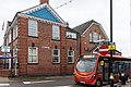
 Biddulph Pentecostal Church - geograph.org.uk - 4901862.jpg 1,280 × 857; 1.09 MB
-
 Biddulph Pentecostal Church - geograph.org.uk - 4901872.jpg 1,280 × 857; 828 KB
-
 Biddulph Primary Care Centre - geograph.org.uk - 4901958.jpg 1,024 × 686; 134 KB
-
 Biddulph Sainsbury's - geograph.org.uk - 4901976.jpg 1,280 × 857; 734 KB
-
 Biddulph Timber Ltd - geograph.org.uk - 2046442.jpg 2,048 × 1,295; 522 KB
-
 Biddulph Town Cemetery - geograph.org.uk - 1903753.jpg 3,072 × 1,728; 1.2 MB
-
 Biddulph Valley - geograph.org.uk - 1997171.jpg 2,048 × 1,536; 674 KB
-
 Biddulph Valley Way - geograph.org.uk - 1342722.jpg 640 × 480; 86 KB
-
 Biddulph Valley Way - geograph.org.uk - 1396457.jpg 640 × 480; 156 KB
-
 Biddulph Valley Way - geograph.org.uk - 1932065.jpg 2,048 × 1,536; 784 KB
-
 Biddulph Valley Way at Marsh Green - geograph.org.uk - 1396440.jpg 640 × 480; 147 KB
-
 Biddulph Valley Way near Gillow Heath - geograph.org.uk - 1879724.jpg 2,048 × 1,536; 725 KB
-
 Biddulph Valley Way towards the old station - geograph.org.uk - 1932032.jpg 2,048 × 1,536; 692 KB
-
 Biddulph Voluntary Action - geograph.org.uk - 2060042.jpg 1,991 × 1,426; 466 KB
-
 Biddulph, Congleton Road - geograph.org.uk - 5445264.jpg 640 × 427; 348 KB
-

-
 Birch wood - geograph.org.uk - 2157638.jpg 4,000 × 3,000; 3.43 MB
-
 Bird Cherry - geograph.org.uk - 2374221.jpg 600 × 800; 275 KB
-
 Bird Cherry flowers - geograph.org.uk - 2374246.jpg 723 × 800; 175 KB
-
 Blackbird Way - geograph.org.uk - 2076657.jpg 1,907 × 1,332; 756 KB
-
 Blackthorn blossom - geograph.org.uk - 2371369.jpg 800 × 549; 228 KB
-
 Blackwood House Lane Junction - geograph.org.uk - 5910277.jpg 800 × 600; 64 KB
-
 Boardwalk on the pasture - geograph.org.uk - 2193182.jpg 2,048 × 1,455; 576 KB
-
 Boggy land - geograph.org.uk - 2371260.jpg 800 × 600; 205 KB
-
 Booths Garage - geograph.org.uk - 2515508.jpg 800 × 440; 68 KB
-
 Bordered by embankments - geograph.org.uk - 2157608.jpg 4,000 × 3,000; 3.35 MB
-
 Bordering Woodside Farm - geograph.org.uk - 2219572.jpg 2,048 × 1,536; 874 KB
-
 Bottom end of Thames Drive - geograph.org.uk - 2042514.jpg 2,048 × 1,332; 513 KB


_-_geograph.org.uk_-_5435098.jpg)


