Category:Bielby
Jump to navigation
Jump to search
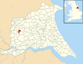
English: Bielby is a village and civil parish in the East Riding of Yorkshire, England. The village is situated about 4 miles (6.4 km) south of Pocklington.
village in the East Riding of Yorkshire, England, United Kingdom  | |||||
| Upload media | |||||
| Instance of | |||||
|---|---|---|---|---|---|
| Location | East Riding of Yorkshire, Yorkshire and the Humber, England | ||||
 | |||||
Subcategories
This category has the following 4 subcategories, out of 4 total.
Media in category "Bielby"
The following 163 files are in this category, out of 163 total.
-
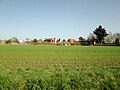
 A glimpse of Bielby - geograph.org.uk - 5637444.jpg 1,024 × 768; 376 KB
-
 Access road from Petersfield Farm - geograph.org.uk - 5315284.jpg 2,304 × 1,728; 1.03 MB
-

-
 Alongside the Pocklington Canal - geograph.org.uk - 5637163.jpg 1,024 × 768; 275 KB
-
 Approaching Coates Bridge - geograph.org.uk - 1412858.jpg 640 × 480; 118 KB
-
 Beilby Beck - geograph.org.uk - 6179697.jpg 1,600 × 1,084; 684 KB
-
 Bielbly Field Farm, East Yorkshire - geograph.org.uk - 4075077.jpg 1,600 × 1,064; 798 KB
-
 Bielbly Field Farm, East Yorkshire - geograph.org.uk - 4075097.jpg 1,600 × 1,064; 901 KB
-
 Bielby Arm, Pocklington Canal - geograph.org.uk - 871917.jpg 640 × 480; 281 KB
-
 Bielby Beck - geograph.org.uk - 132995.jpg 640 × 425; 124 KB
-
 Bielby Beck - geograph.org.uk - 1569529.jpg 426 × 640; 206 KB
-
 Bielby Beck - geograph.org.uk - 3935348.jpg 1,600 × 1,200; 911 KB
-
 Bielby Beck and the Mill House Bielby - geograph.org.uk - 5315188.jpg 2,298 × 1,718; 2.02 MB
-
 Bielby Beck at Crudhall Bridge - geograph.org.uk - 3279907.jpg 1,024 × 768; 197 KB
-
 Bielby farm track - geograph.org.uk - 1367953.jpg 449 × 640; 170 KB
-
 Bielby Field - geograph.org.uk - 3676422.jpg 640 × 427; 113 KB
-
 Bielby Mill - geograph.org.uk - 5637110.jpg 1,024 × 768; 243 KB
-
 Bielby Mill and weir - geograph.org.uk - 5637118.jpg 1,024 × 739; 195 KB
-
 Bielby UK parish locator map.svg 1,425 × 1,107; 1.68 MB
-
 Boxes of Suspension Insulators near Hayton Field Farm - geograph.org.uk - 4075048.jpg 1,600 × 1,064; 765 KB
-
 Bridge over Galecarr Drain - geograph.org.uk - 5315276.jpg 2,264 × 1,674; 1.48 MB
-
 Bridge over the Pocklington Canal - geograph.org.uk - 2035246.jpg 640 × 480; 72 KB
-
 Bridleway near Hayton Field Farm - geograph.org.uk - 4075050.jpg 1,600 × 1,064; 815 KB
-
 Bridleway to Everingham - geograph.org.uk - 4075090.jpg 1,600 × 1,064; 701 KB
-
 Bridleway towards Hayton Field Farm - geograph.org.uk - 4075020.jpg 1,600 × 1,064; 614 KB
-
 Bridleway towards Hayton Field Farm - geograph.org.uk - 4075024.jpg 1,600 × 1,064; 925 KB
-
 Bridleway towards Hayton Field Farm - geograph.org.uk - 4075025.jpg 1,600 × 1,064; 817 KB
-
 Bridleway towards Hayton Field Farm - geograph.org.uk - 4075027.jpg 1,600 × 1,064; 788 KB
-
 Buildings at Hayton Field Farm - geograph.org.uk - 4075066.jpg 1,600 × 1,064; 754 KB
-
 Bursar Farm, Bielby - geograph.org.uk - 2035290.jpg 640 × 480; 74 KB
-
 Canal at Bielby - geograph.org.uk - 6333704.jpg 1,024 × 683; 709 KB
-
 Canal cut - geograph.org.uk - 6333702.jpg 1,024 × 683; 769 KB
-
 Canal towpath at Sandhill Lock - geograph.org.uk - 1415095.jpg 640 × 480; 137 KB
-
 Canalside Willow Tree - geograph.org.uk - 573912.jpg 640 × 480; 109 KB
-
 Closed road - geograph.org.uk - 3564938.jpg 640 × 427; 120 KB
-
 Coat's Bridge - geograph.org.uk - 5637156.jpg 1,024 × 768; 380 KB
-
 Coat's Bridge Pocklington Canal - geograph.org.uk - 5315099.jpg 2,302 × 1,724; 1.73 MB
-
 Coat's Flat - geograph.org.uk - 132991.jpg 640 × 425; 56 KB
-
 Coat's Flat - geograph.org.uk - 5636817.jpg 1,024 × 768; 211 KB
-
 Coat's Lock - geograph.org.uk - 3564934.jpg 640 × 427; 112 KB
-
 Coat's Lock and Bridge, Pocklington Canal - geograph.org.uk - 3935353.jpg 1,600 × 1,200; 458 KB
-
 Coat's Lock from Coat's Bridge - geograph.org.uk - 6179687.jpg 1,600 × 1,456; 872 KB
-
 Coat's Lock on the Pocklington Canal - geograph.org.uk - 5315125.jpg 2,246 × 1,648; 1.75 MB
-
 Coat's Lock, Pocklington Canal - geograph.org.uk - 2517550.jpg 800 × 600; 278 KB
-
 Coats Lock - geograph.org.uk - 6333687.jpg 1,024 × 683; 504 KB
-
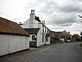
 College Arms - geograph.org.uk - 5102274.jpg 640 × 427; 103 KB
-
 College Arms Bielby.jpg 640 × 480; 68 KB
-
 Country lane passing Merton House Farm - geograph.org.uk - 5315277.jpg 2,304 × 1,728; 1.68 MB
-
 Crossfields Farm and the Pocklington Canal - geograph.org.uk - 5637151.jpg 1,024 × 768; 169 KB
-
 Crudhall Lane near Routh Lodge - geograph.org.uk - 4075113.jpg 1,600 × 1,064; 465 KB
-
 Crudhall Lane towards Routh Lodge - geograph.org.uk - 4075094.jpg 1,600 × 1,064; 600 KB
-
 Crudhall Lane towards Routh Lodge - geograph.org.uk - 4075101.jpg 1,600 × 1,064; 944 KB
-
 Crudhall Lane towards the A1079 - geograph.org.uk - 4075115.jpg 1,600 × 1,064; 701 KB
-
 Drain and flat fields north of Bielby - geograph.org.uk - 5637139.jpg 1,024 × 768; 281 KB
-
 Drain at Petersfield Plantation - geograph.org.uk - 4134343.jpg 1,600 × 1,064; 793 KB
-
 Drain beside Bielby Cut - geograph.org.uk - 6333721.jpg 1,024 × 683; 470 KB
-
 Entering Bielby - geograph.org.uk - 1416545.jpg 640 × 480; 61 KB
-
 Entering Bielby, East Yorkshire - geograph.org.uk - 2517570.jpg 800 × 600; 223 KB
-
 Everingham Lane near Bielbly Field Farm - geograph.org.uk - 4075081.jpg 1,600 × 1,064; 692 KB
-
 Everingham Lane near Hayton Field Farm - geograph.org.uk - 4075055.jpg 1,600 × 1,064; 707 KB
-
 Everingham Lane near Hayton Field Farm - geograph.org.uk - 4075056.jpg 1,600 × 1,064; 724 KB
-
 Everingham Lane towards Bielbly Field Farm - geograph.org.uk - 4075072.jpg 1,600 × 1,064; 508 KB
-
 Everingham Lane towards Bielbly Field Farm - geograph.org.uk - 4075075.jpg 1,600 × 1,064; 652 KB
-
 Farm track off Crudhall Lane - geograph.org.uk - 4075093.jpg 1,600 × 1,064; 1.29 MB
-
 Farm track off Marketbridge Lane - geograph.org.uk - 5102283.jpg 640 × 427; 113 KB
-
 Farmland near Petersfield Farm - geograph.org.uk - 2035327.jpg 640 × 480; 69 KB
-
 Farmland off Marketbridge Lane - geograph.org.uk - 2035268.jpg 640 × 480; 70 KB
-
 Farmland off Marketbridge Lane - geograph.org.uk - 3676404.jpg 640 × 427; 98 KB
-
 Field and Wood, Bielby - geograph.org.uk - 133002.jpg 640 × 425; 80 KB
-
 Field House Farm - geograph.org.uk - 2035254.jpg 640 × 480; 59 KB
-
 Field House Farm on Makerbridge Lane - geograph.org.uk - 2517562.jpg 800 × 600; 211 KB
-
 Field House Farm, Marketbridge lane - geograph.org.uk - 1414935.jpg 640 × 480; 54 KB
-
 Field on White Carr - geograph.org.uk - 5637167.jpg 1,024 × 768; 274 KB
-
 Fingerpost near Petersfield Farm - geograph.org.uk - 4459195.jpg 2,448 × 1,624; 1.66 MB
-
 Footbridge near Petersfield Plantation - geograph.org.uk - 4134338.jpg 1,600 × 1,064; 859 KB
-
 Footbridge over Baulker Drain - geograph.org.uk - 3969052.jpg 1,024 × 768; 300 KB
-
 Footbridge over Baulker Drain - geograph.org.uk - 4459180.jpg 2,448 × 1,624; 2.09 MB
-
 Footbridge over Galecarr Drain near Seaton Ross - geograph.org.uk - 4459323.jpg 2,448 × 1,624; 1.97 MB
-
 Footpath and Petersfield Farm - geograph.org.uk - 3973721.jpg 1,024 × 768; 181 KB
-
 Footpath and Petersfield Plantation - geograph.org.uk - 3973729.jpg 1,024 × 768; 147 KB
-
 Footpath to Bielby - geograph.org.uk - 1367952.jpg 640 × 426; 197 KB
-
 Footpath to Everingham - geograph.org.uk - 3973747.jpg 1,024 × 768; 140 KB
-
 Footpath towards Everingham - geograph.org.uk - 4134346.jpg 1,600 × 1,064; 686 KB
-
 Former Wesleyan Chapel, Bielby - geograph.org.uk - 3279915.jpg 1,024 × 768; 145 KB
-
 Gale Carr Farm - geograph.org.uk - 5315199.jpg 2,294 × 1,714; 1.85 MB
-
 Galecarr Lane - geograph.org.uk - 5640447.jpg 1,024 × 768; 134 KB
-
 Galecarr Lane, Bielby - geograph.org.uk - 2035284.jpg 640 × 480; 82 KB
-
 Grass field on the edge of Bielby - geograph.org.uk - 5640446.jpg 1,024 × 768; 149 KB
-
 Hayton Field - geograph.org.uk - 1569466.jpg 426 × 640; 191 KB
-
 Hayton Field Farmhouse - geograph.org.uk - 4075068.jpg 1,600 × 1,064; 672 KB
-
 Junction for Bielby - geograph.org.uk - 3565296.jpg 640 × 427; 81 KB
-
 Junction with Galecarr Lane - geograph.org.uk - 5102275.jpg 640 × 427; 101 KB
-
 Kissing gate on public footpath - geograph.org.uk - 6179692.jpg 1,600 × 1,200; 1.05 MB
-
 Lock at Coat's Bridge - geograph.org.uk - 5870109.jpg 1,024 × 768; 223 KB
-
 Lock on the Pocklington Canal - geograph.org.uk - 2035239.jpg 640 × 480; 89 KB
-

-
 Market Bridge, near Bielby - geograph.org.uk - 1569522.jpg 640 × 474; 187 KB
-
 Marketbridge Lane - geograph.org.uk - 5102280.jpg 640 × 427; 113 KB
-
 Marketbridge Lane - geograph.org.uk - 6413639.jpg 1,024 × 768; 167 KB
-
 Marketbridge Lane junction - geograph.org.uk - 1414927.jpg 640 × 480; 81 KB
-
 Marketbridge Lane towards Bielby - geograph.org.uk - 2035257.jpg 640 × 480; 97 KB
-
 Merton House Farm - geograph.org.uk - 2035304.jpg 640 × 368; 40 KB
-
 Merton House Farm - geograph.org.uk - 5637737.jpg 1,024 × 768; 147 KB
-
 Mill Bridge and Mill Lane, Bielby - geograph.org.uk - 3935346.jpg 1,600 × 1,200; 810 KB
-
 Mill Bridge over Bielby Beck - geograph.org.uk - 5637100.jpg 1,024 × 768; 358 KB
-
 Mill House - geograph.org.uk - 6333707.jpg 683 × 1,024; 599 KB
-
 Minor road junction - geograph.org.uk - 5315281.jpg 2,304 × 1,728; 1.01 MB
-

-
 Minor road near Triangle Wood - geograph.org.uk - 4075135.jpg 1,600 × 1,064; 831 KB
-
 Minor Road to Hayton - geograph.org.uk - 4075123.jpg 1,600 × 1,064; 575 KB
-
 Minor Road to Hayton - geograph.org.uk - 4075134.jpg 1,600 × 1,064; 773 KB
-
 Minor road towards Everingham - geograph.org.uk - 2035295.jpg 640 × 480; 61 KB
-
 Minor road towards Seaton Ross - geograph.org.uk - 2035314.jpg 640 × 480; 88 KB
-
 Missick Beck at Crudhall Bridge - geograph.org.uk - 6413635.jpg 1,024 × 768; 373 KB
-
 Mount Pleasant - geograph.org.uk - 3935360.jpg 1,600 × 1,200; 929 KB
-
 Mount Pleasant a derelict building - geograph.org.uk - 5314943.jpg 2,304 × 1,728; 2 MB
-
 New Plantation - geograph.org.uk - 3973738.jpg 1,024 × 768; 98 KB
-
 Over field toward Bielby village - geograph.org.uk - 5315195.jpg 2,300 × 1,724; 1.86 MB
-
 Passing Field House Farm - geograph.org.uk - 5102284.jpg 640 × 427; 111 KB
-
 Path leading to Carr Lane, Seaton Ross - geograph.org.uk - 4459312.jpg 2,448 × 1,624; 1.44 MB
-
 Path leading to Seaton Ross at Petersfield Plantation - geograph.org.uk - 4459219.jpg 2,448 × 1,624; 1.91 MB
-
 Pig Farm - geograph.org.uk - 133008.jpg 640 × 426; 97 KB
-
 Pocklington Canal - geograph.org.uk - 1414924.jpg 640 × 480; 163 KB
-
 Pocklington Canal at Coates Bridge Lock - geograph.org.uk - 180057.jpg 640 × 480; 123 KB
-
 Pocklington Canal at Coates Lock - geograph.org.uk - 180055.jpg 640 × 480; 95 KB
-
 Pocklington Canal near Coat's Bridge - geograph.org.uk - 5609143.jpg 5,184 × 2,920; 5.34 MB
-
 Pocklington Canal south of Coates Bridge - geograph.org.uk - 1414952.jpg 640 × 480; 190 KB
-
 Pocklington Canal, at Coat's Bridge - geograph.org.uk - 2517553.jpg 800 × 600; 329 KB
-
 Powerline Work - geograph.org.uk - 3676414.jpg 640 × 427; 95 KB
-
 Pylons near Bielby - geograph.org.uk - 1569479.jpg 518 × 640; 210 KB
-
 Road entering Beilby - geograph.org.uk - 6179699.jpg 1,600 × 938; 583 KB
-
 Road to Bielby - geograph.org.uk - 5102271.jpg 640 × 427; 102 KB
-
 Road to Hayton - geograph.org.uk - 3676408.jpg 640 × 427; 147 KB
-
 Routh Lodge - geograph.org.uk - 236848.jpg 640 × 426; 117 KB
-
 Routh Lodge - geograph.org.uk - 3676424.jpg 640 × 427; 96 KB
-
 Routh Lodge Farm - geograph.org.uk - 1569472.jpg 640 × 471; 216 KB
-
 Routh Lodge on Crudhall Lane - geograph.org.uk - 4075103.jpg 1,600 × 1,064; 672 KB
-
 Routh Lodge on Crudhall Lane - geograph.org.uk - 4075107.jpg 1,600 × 1,064; 893 KB
-
 Routh Lodge on Crudhall Lane - geograph.org.uk - 4075108.jpg 1,064 × 1,600; 625 KB
-
 Routh Lodge on Crudhall Lane - geograph.org.uk - 4075109.jpg 1,600 × 1,064; 461 KB
-
 Routh Lodge on Crudhall Lane - geograph.org.uk - 4075119.jpg 1,600 × 1,064; 669 KB
-
 Sandhill Lock - geograph.org.uk - 5637173.jpg 1,024 × 768; 209 KB
-
 Sandpit Road - geograph.org.uk - 5640449.jpg 1,024 × 768; 208 KB
-
 Silt from the Pocklington Canal being spread over field - geograph.org.uk - 5315133.jpg 2,276 × 1,690; 2.05 MB
-
 St Giles' church, Bielby - geograph.org.uk - 5637745.jpg 1,024 × 768; 132 KB
-
 Stable Cottage - geograph.org.uk - 5637747.jpg 1,024 × 768; 170 KB
-
 StGiles int.jpg 300 × 244; 109 KB
-
 Stone Bridge - geograph.org.uk - 21375.jpg 640 × 480; 91 KB
-
 Suspension Insulators near Hayton Field Farm - geograph.org.uk - 4075042.jpg 1,600 × 1,064; 938 KB
-
 Suspension Insulators near Hayton Field Farm - geograph.org.uk - 4075044.jpg 1,600 × 1,064; 885 KB
-
 The College Arms, Bielby - geograph.org.uk - 2517586.jpg 800 × 600; 196 KB
-

-
 The Pocklington Canal above Coat's Lock - geograph.org.uk - 5636797.jpg 1,024 × 768; 173 KB
-
 The Pocklington Canal above Sandhill Lock - geograph.org.uk - 5637178.jpg 1,024 × 768; 245 KB
-
 The Pocklington Canal Towpath - geograph.org.uk - 573877.jpg 640 × 480; 108 KB
-
 Towpath along the Pocklington Canal - geograph.org.uk - 1415006.jpg 640 × 480; 163 KB
-
 Track to Petersfield Farm - geograph.org.uk - 2035325.jpg 640 × 480; 105 KB
-
 Track towards Hayton Field Farm - geograph.org.uk - 6413632.jpg 1,024 × 768; 218 KB
-
 Unnamed Drain flowing into Baulker Drain - geograph.org.uk - 4074994.jpg 1,600 × 1,064; 875 KB
-
 View across the Pocklington Canal - geograph.org.uk - 5637146.jpg 1,024 × 768; 268 KB
-
 Village of Bielby - geograph.org.uk - 5102273.jpg 640 × 427; 103 KB
-
 Village of Bielby - geograph.org.uk - 5102277.jpg 427 × 640; 107 KB
-
 Whitecarr Lane to Marketbridge Farm - geograph.org.uk - 1414939.jpg 640 × 480; 82 KB


