Category:Biggar Water
Jump to navigation
Jump to search

river in South Lanarkshire, Scotland, UK, tributary of the River Tweed  | |||||
| Upload media | |||||
| Instance of | |||||
|---|---|---|---|---|---|
| Location | South Lanarkshire, Scotland | ||||
| Elevation above sea level |
| ||||
| Mouth of the watercourse |
| ||||
 | |||||
Media in category "Biggar Water"
The following 20 files are in this category, out of 20 total.
-
 Biggar Water - geograph.org.uk - 1181355.jpg 640 × 359; 70 KB
-
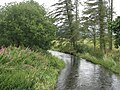
 Biggar Water by Broughton Brewery (geograph 2774319).jpg 800 × 530; 136 KB
-
 Biggar Water joins the Tweed - geograph.org.uk - 1714766.jpg 1,600 × 1,061; 646 KB
-
 Burnetland Farm - geograph.org.uk - 724373.jpg 640 × 360; 56 KB
-

-

-
 Davie's Burn, Biggar - geograph.org.uk - 2070137.jpg 640 × 480; 112 KB
-
 Marsh, Dreva - geograph.org.uk - 1031139.jpg 640 × 480; 58 KB
-
 Mucky field - geograph.org.uk - 1181363.jpg 640 × 480; 82 KB
-
 River Tweed - geograph.org.uk - 1031165.jpg 640 × 480; 88 KB
-
 Sheep troughs above the Biggar Water - geograph.org.uk - 1182140.jpg 640 × 359; 63 KB
-

-

-
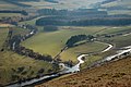
 The Biggar gap - geograph.org.uk - 1714619.jpg 1,024 × 679; 143 KB
-
 The Biggar Water and flooded farmland - geograph.org.uk - 655993.jpg 640 × 480; 62 KB
-
 The Biggar Water at Rathan - geograph.org.uk - 937670.jpg 640 × 480; 113 KB
-
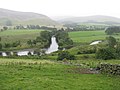 The Biggar Water joins the Tweed - geograph.org.uk - 937755.jpg 640 × 480; 64 KB
-
 The Biggar Water, near Broughton - geograph.org.uk - 655987.jpg 640 × 480; 70 KB
-
 Peeblesshire farmland - geograph.org.uk - 170511.jpg 640 × 480; 67 KB
-
 Rachan Home Farm - geograph.org.uk - 16675.jpg 640 × 480; 56 KB

.jpg)


