Category:Billericay
Jump to navigation
Jump to search
town in the Borough of Basildon, Essex, England   | |||||
| Upload media | |||||
| Instance of | |||||
|---|---|---|---|---|---|
| Location | Basildon, Essex, East of England, England | ||||
| Population |
| ||||
| Said to be the same as | Billericay (Wikimedia duplicated page, civil parish) | ||||
| official website | |||||
 | |||||
Subcategories
This category has the following 14 subcategories, out of 14 total.
B
- Billericay railway station (9 F)
- Billericay War Memorial (2 F)
- Billericay Brewing Company (3 F)
C
- The Chequers, Billericay (2 F)
- Billericay cricket ground (2 F)
E
- Emmanuel Church, Billericay (1 F)
H
M
- Mill Meadows, Billericay (11 F)
N
- Norsey Wood (3 F)
O
- Old Town Hall, Billericay (1 F)
R
- The Railway, Billericay (3 F)
- The Red Lion, Billericay (3 F)
Media in category "Billericay"
The following 200 files are in this category, out of 301 total.
(previous page) (next page)-
 1-5 norsey rd billericay.jpg 3,264 × 2,448; 3.88 MB
-
 11-13 chapel st billericay.jpg 3,264 × 2,448; 3.65 MB
-
 135, High Street, Billericay - geograph.org.uk - 4686658.jpg 3,072 × 2,304; 1.82 MB
-
 3 chapel st billericay.jpg 2,448 × 3,264; 3.79 MB
-
 4.30 am Granites Chase , Barleylands Farm , Billericay , Essex , June 2012 - panoramio.jpg 2,227 × 1,960; 1.39 MB
-
 40 high st billericay.jpg 2,448 × 3,264; 3.58 MB
-
 5 chapel st billericay.jpg 3,264 × 2,448; 3.74 MB
-
 7-9 chapel st billericay.jpg 3,264 × 2,448; 3.99 MB
-
 A Great Burstead Board School - geograph.org.uk - 3894884.jpg 640 × 182; 30 KB
-
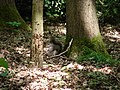
 A Newly Coppiced Area in Norsey Wood - geograph.org.uk - 4937445.jpg 424 × 640; 69 KB
-

-
 A Rose in my garden , June 2012 - panoramio.jpg 3,448 × 2,505; 2.04 MB
-
 A Solo non-scripta - geograph.org.uk - 4937482.jpg 424 × 640; 62 KB
-
 A129 London Road - geograph.org.uk - 1841980.jpg 3,072 × 2,304; 1.42 MB
-
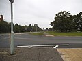
 A129 London Road and Billericay Town Sign - geograph.org.uk - 1841986.jpg 3,072 × 2,304; 1.37 MB
-
 A129 London Road and London Road Postbox - geograph.org.uk - 1841973.jpg 3,072 × 2,304; 1.41 MB
-
 A176 near Billericay - geograph.org.uk - 4816647.jpg 1,600 × 1,064; 441 KB
-

-
 Agricultural supplier - entrance - geograph.org.uk - 4816656.jpg 1,600 × 1,064; 430 KB
-
 Alma Link, Billericay - geograph.org.uk - 4686877.jpg 3,072 × 2,304; 1.78 MB
-
 Alma Link, Billericay - geograph.org.uk - 4686895.jpg 2,304 × 3,072; 2.27 MB
-
 Apple Blossom ^ Little Critter - geograph.org.uk - 4458577.jpg 424 × 640; 51 KB
-
 Approaching London Road - geograph.org.uk - 3634146.jpg 424 × 640; 81 KB
-
 Autumn sunlight in Norsey Wood - geograph.org.uk - 4193731.jpg 1,024 × 768; 472 KB
-
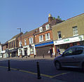
 B1007 High Street, Billericay - geograph.org.uk - 4686675.jpg 3,072 × 2,304; 2.28 MB
-
 B1007 High Street, Billericay - geograph.org.uk - 4686908.jpg 3,072 × 2,304; 1.79 MB
-
 B1007 High Street, Billericay - geograph.org.uk - 4687291.jpg 3,072 × 2,304; 1.87 MB
-
 Bee , In my garden , June 2012 - panoramio.jpg 1,515 × 1,486; 628 KB
-
 Beetle Food in Norsey Wood - geograph.org.uk - 4937428.jpg 640 × 424; 117 KB
-
 Bill or Ricky - geograph.org.uk - 2406230.jpg 2,592 × 1,944; 2.21 MB
-
 Billericay , The Railway Footbridge , June 2012 - panoramio.jpg 3,647 × 2,661; 2.56 MB
-
 Billericay 10k 2008 approaching finish - geograph.org.uk - 3197807.jpg 1,600 × 1,200; 233 KB
-
 Billericay Cricket Club - geograph.org.uk - 6162777.jpg 3,585 × 2,216; 2.64 MB
-
 Billericay Delivery Office - geograph.org.uk - 4686620.jpg 3,072 × 2,304; 1.81 MB
-
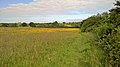
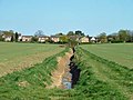
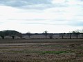 Billericay Farmland - geograph.org.uk - 3251786.jpg 1,000 × 750; 125 KB
-
 Billericay fire station - geograph.org.uk - 1284209.jpg 640 × 427; 180 KB
-
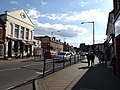
 Billericay High Street (163259394).jpg 1,200 × 1,174; 1.08 MB
-
 Billericay MSPO Postbox - geograph.org.uk - 4687248.jpg 3,072 × 2,304; 1.83 MB
-
 Billericay MSPO Postbox - geograph.org.uk - 4687255.jpg 3,072 × 2,304; 1.86 MB
-
 Billericay MSPO Postbox - geograph.org.uk - 4687261.jpg 2,253 × 2,995; 3.39 MB
-
 Billericay Post Office (built 1938) - geograph.org.uk - 3683678.jpg 1,541 × 1,562; 2.85 MB
-
 Billericay Post Office - geograph.org.uk - 909502.jpg 640 × 425; 65 KB
-
 Billericay Reading Rooms - geograph.org.uk - 3675125.jpg 594 × 793; 500 KB
-
Billericay rural area during snowy weather, near Mill Meadows, in 2010.webm 20 s, 640 × 480; 719 KB
-
 Billericay Telephone Exchange - geograph.org.uk - 4686591.jpg 2,946 × 2,207; 1.75 MB
-
 Billericay Town Colts Saturday practice session - geograph.org.uk - 3748057.jpg 4,000 × 2,248; 4.25 MB
-
 Billericay Town Notice Board - geograph.org.uk - 4687540.jpg 3,072 × 2,304; 1.83 MB
-
 Billericay Town Sign - geograph.org.uk - 924444.jpg 3,072 × 2,304; 1.29 MB
-
 Billericay United Reformed Church - geograph.org.uk - 4686547.jpg 3,072 × 2,304; 1.82 MB
-
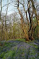
 Bluebell in Norsey Wood, Billericay - geograph.org.uk - 5748371.jpg 2,495 × 2,495; 1.06 MB
-
 Bluebells in Barrenleys Wood - geograph.org.uk - 4458605.jpg 430 × 640; 130 KB
-
 Bluntswall Woods near Billericay, Essex - geograph.org.uk - 67872.jpg 640 × 480; 146 KB
-
 Bridleway nr Queens Park Country Park, Billericay - geograph.org.uk - 6165064.jpg 2,736 × 3,648; 5.41 MB
-
 Bridleway to Buckwyns Farm - geograph.org.uk - 2481193.jpg 640 × 428; 135 KB
-
 Bridleway ^1 - geograph.org.uk - 3943474.jpg 424 × 640; 86 KB
-
 Bungalows on Stock Road, Billericay - geograph.org.uk - 5524261.jpg 2,304 × 1,728; 834 KB
-
 Burial Mound, Norsey Wood - geograph.org.uk - 4193729.jpg 1,024 × 768; 493 KB
-
 Burstead Farmland - geograph.org.uk - 3251788.jpg 1,000 × 750; 168 KB
-
 Bus shelter and playing field - geograph.org.uk - 3440603.jpg 640 × 480; 104 KB
-
 Bus stop on Rayleigh Road, Billericay - geograph.org.uk - 5526685.jpg 2,304 × 1,728; 1 MB
-
 Carpet of Bluebells, Norsey Wood, Billericay - geograph.org.uk - 5748374.jpg 3,648 × 2,255; 4.88 MB
-
 Cater Museum Billericay.jpg 1,125 × 1,500; 968 KB
-
 Chantry Centre.jpg 4,080 × 3,060; 4 MB
-
 Chapel Street, Billericay - geograph.org.uk - 4686552.jpg 3,072 × 2,304; 1.77 MB
-
 Chapel Street, Billericay - geograph.org.uk - 4686602.jpg 3,072 × 2,304; 2.12 MB
-
 Coppice Stool - geograph.org.uk - 2966630.jpg 2,736 × 2,736; 3.37 MB
-
 Coppice with standards, Norsey Wood - geograph.org.uk - 3440634.jpg 640 × 480; 160 KB
-
 Coppiced area - geograph.org.uk - 2966648.jpg 3,648 × 2,255; 5.12 MB
-
 Coppiced area with standards - geograph.org.uk - 2964777.jpg 3,648 × 2,736; 4.47 MB
-
 Coppiced tree at path junction - geograph.org.uk - 2966660.jpg 3,648 × 2,736; 4.37 MB
-

-
 Cottages in Norsey Road, Billericay - geograph.org.uk - 659833.jpg 640 × 423; 72 KB
-
 DanRuss 01.jpg 3,049 × 2,156; 742 KB
-
 Dated keystone, Billericay Post Office - geograph.org.uk - 3683756.jpg 1,001 × 1,406; 640 KB
-
 Derelict looking glasshouse near Elmshaw's Farm - geograph.org.uk - 5537066.jpg 5,202 × 3,465; 4.16 MB
-
 Derelict telephone box in Tye Common Road, Billericay - geograph.org.uk - 5537086.jpg 5,202 × 3,465; 3.27 MB
-
 Elizabeth Cottage, Norsey Road, Billericay - geograph.org.uk - 5537570.jpg 5,202 × 3,465; 3.55 MB
-
 Elizabeth II postbox on Potash Road, Billericay - geograph.org.uk - 6152220.jpg 3,096 × 3,914; 1.97 MB
-
 Emmanuel Church from Sun Corner - geograph.org.uk - 1880657.jpg 640 × 480; 71 KB
-
En-uk-Billericay.ogg 1.5 s; 31 KB
-
 Entrance to Queen's Park - geograph.org.uk - 4521164.jpg 3,072 × 1,728; 1.49 MB
-
 Entrance to the car park - geograph.org.uk - 4687544.jpg 3,072 × 2,304; 1.87 MB
-
 Fields Towards London Rd - geograph.org.uk - 3672938.jpg 640 × 424; 53 KB
-
 Fireworks (227178397).jpeg 2,048 × 2,048; 1.38 MB
-
 Fireworks Over Water at Billericay 2.jpg 3,648 × 2,736; 3.96 MB
-
 Fireworks Over Water at Billericay.jpg 2,736 × 2,736; 5.32 MB
-
 Flats on Stock Road, Billericay - geograph.org.uk - 5524276.jpg 2,195 × 1,646; 975 KB
-
 Footbridge in Mill Meadows - geograph.org.uk - 2406257.jpg 2,048 × 1,536; 1.41 MB
-
 Footbridge ^ Stile on FP 11 - geograph.org.uk - 3672923.jpg 424 × 640; 70 KB
-
 Footbridge, Queens Park - geograph.org.uk - 3440792.jpg 640 × 480; 189 KB
-
 Footpath 11 - geograph.org.uk - 3634139.jpg 640 × 424; 59 KB
-
 Footpath and Marsh Woundwort - geograph.org.uk - 2481146.jpg 428 × 640; 126 KB
-
 Footpath From Tye Common - geograph.org.uk - 3894889.jpg 640 × 430; 98 KB
-
 Footpath near Little Blunts, Billericay - geograph.org.uk - 6165077.jpg 2,736 × 2,736; 3.1 MB
-
 Footpath near Little Blunts, Billericay - geograph.org.uk - 6165078.jpg 2,736 × 3,648; 3.77 MB
-
 Footpath nr Queens Park Country Park, Billericay - geograph.org.uk - 6165069.jpg 3,648 × 2,736; 4.79 MB
-
 Footpath through Mill Meadows, Billericay - geograph.org.uk - 6162780.jpg 3,648 × 2,255; 2.61 MB
-
 Footpath to Little Farm - geograph.org.uk - 2481217.jpg 640 × 428; 82 KB
-
 Footpath to Outwood Farm Road - geograph.org.uk - 4458482.jpg 640 × 424; 76 KB
-
 Footpath ^ Forget-me-nots - geograph.org.uk - 4458455.jpg 424 × 640; 118 KB
-
 Footpath ^ Stream - geograph.org.uk - 4458467.jpg 424 × 640; 126 KB
-
 Gilmore Rise and Gilmore Rise Postbox - geograph.org.uk - 1842012.jpg 3,072 × 2,304; 1.53 MB
-
 Gooseberry Green - geograph.org.uk - 3672919.jpg 640 × 424; 60 KB
-
 Great Cowbridge Grange - geograph.org.uk - 4518931.jpg 3,072 × 1,728; 1.76 MB
-
 Harvest Home - geograph.org.uk - 3672944.jpg 640 × 424; 51 KB
-
 Hill house billericay.jpg 2,448 × 3,264; 4.03 MB
-
 House on Outwood Farm Road - geograph.org.uk - 6151875.jpg 800 × 600; 99 KB
-
 House on Potash Road, Billericay - geograph.org.uk - 6151886.jpg 800 × 600; 110 KB
-
 Houses on Mountnessing Road, Billericay - geograph.org.uk - 5524228.jpg 2,304 × 1,728; 1.01 MB
-
 Houses on Outwood Common Road - geograph.org.uk - 6151878.jpg 800 × 476; 83 KB
-
 Houses on Potash Road, Billericay - geograph.org.uk - 6151891.jpg 800 × 462; 83 KB
-
 Houses on Potash Road, Billericay - geograph.org.uk - 6152221.jpg 4,681 × 3,415; 3.65 MB
-
 Houses on Rayleigh Road, Billericay - geograph.org.uk - 5526684.jpg 2,222 × 1,667; 929 KB
-
 Houses on Stock Road, Billericay - geograph.org.uk - 5524280.jpg 2,304 × 1,728; 835 KB
-
 Junction of Norsey Road and Potash Road - geograph.org.uk - 3440646.jpg 640 × 480; 144 KB
-
 L32 Green Farm Lane Memorial Great Burstead.jpg 1,080 × 1,248; 363 KB
-
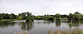
 Lake Meadows - geograph.org.uk - 4172818.jpg 4,320 × 3,240; 5.73 MB
-
 Lake Meadows Lake - geograph.org.uk - 3672909.jpg 424 × 640; 77 KB
-
 Lake Meadows Panorama - geograph.org.uk - 3634132.jpg 640 × 265; 36 KB
-
 Lake Meadows Park - geograph.org.uk - 3274959.jpg 3,936 × 2,128; 1.49 MB
-
 Lake Meadows Park - geograph.org.uk - 3672904.jpg 640 × 424; 93 KB
-
 Lion Lane sign - geograph.org.uk - 4686917.jpg 3,072 × 2,304; 1.82 MB
-
 Lion Lane, Billericay - geograph.org.uk - 4686709.jpg 2,253 × 2,995; 2.23 MB
-
 Little Crowbridge Grange - geograph.org.uk - 3634157.jpg 640 × 424; 48 KB
-
 Lockers hall billericay.jpg 3,264 × 2,448; 3.64 MB
-
 London Road Postbox - geograph.org.uk - 1841978.jpg 2,304 × 3,072; 1.47 MB
-
 Looking over Arable Land to Billericay - geograph.org.uk - 6135457.jpg 3,648 × 2,255; 1.7 MB
-

-
 Marsh Woundwort - geograph.org.uk - 2481167.jpg 428 × 640; 58 KB
-
 Mayflower High School - geograph.org.uk - 2125856.jpg 1,024 × 682; 316 KB
-
 Meadow by path from Billericay to Mount Nessing church - geograph.org.uk - 4518403.jpg 3,072 × 1,728; 1.73 MB
-
 Mountnessing Road at the junction of Rayleigh Road - geograph.org.uk - 5524232.jpg 2,304 × 1,728; 1.03 MB
-
 Muddy Path ^ Apple Blossom - geograph.org.uk - 4458547.jpg 424 × 640; 128 KB
-
 New Route Through Little Blunts - geograph.org.uk - 3943518.jpg 424 × 640; 74 KB
-
 Norsey Road, Billericay - geograph.org.uk - 5537567.jpg 5,202 × 3,465; 2.76 MB
-
 Norsey Wood boundary - geograph.org.uk - 2964774.jpg 3,445 × 2,129; 4.27 MB
-
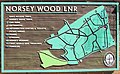 Norsey Wood map - geograph.org.uk - 2966638.jpg 2,804 × 1,733; 1.82 MB
-
 Norsey Wood ranger base - geograph.org.uk - 4616934.jpg 3,072 × 1,728; 1.68 MB
-
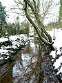
 Norsey Wood stream - geograph.org.uk - 4592289.jpg 2,171 × 3,256; 1.68 MB
-
 Norsey Woods Entrance in the snow^ - geograph.org.uk - 1074914.jpg 640 × 480; 112 KB
-
 Not the Footpath to North Nook - geograph.org.uk - 3943509.jpg 424 × 640; 107 KB
-
 Old School on Laindon Rd - geograph.org.uk - 3894877.jpg 640 × 424; 82 KB
-
 Old vicarage billericay.jpg 3,264 × 2,448; 4.18 MB
-
 Onestop Shop ^ Billericay Post Office - geograph.org.uk - 4687185.jpg 3,072 × 2,304; 1.86 MB
-
 Ordnance Survey One-Inch Sheet 161 London N.E. Published 1970.jpg 11,141 × 13,255; 65.6 MB
-
 Ordnance Survey One-Inch Sheet 161 London NE, Published 1940.jpg 11,021 × 12,814; 17.22 MB
-
 Ordnance Survey One-Inch Sheet 161 London NE, Published 1958.jpg 8,337 × 9,958; 11.5 MB
-
 Ornamental Signpost, Billericay - geograph.org.uk - 416075.jpg 640 × 480; 149 KB
-
 Outwood Common Road - geograph.org.uk - 6151883.jpg 800 × 600; 106 KB
-
 Outwood Farm Road - geograph.org.uk - 6151876.jpg 640 × 480; 107 KB
-
 Paddock ^ Buckwyns Farm - geograph.org.uk - 2481201.jpg 640 × 428; 66 KB
-
 Pasha billericay.jpg 3,264 × 2,448; 3.94 MB
-
 Path in Lake Meadows, Billericay - geograph.org.uk - 6165042.jpg 3,648 × 2,736; 3.73 MB
-
 Path out of Norsey Woods - geograph.org.uk - 4616868.jpg 3,072 × 1,728; 1.83 MB
-
 Path Through Queens Park - geograph.org.uk - 2481120.jpg 428 × 640; 114 KB
-
 Path to Gooseberry Green - geograph.org.uk - 3634137.jpg 640 × 424; 87 KB
-
 Path to Perry St - geograph.org.uk - 3943493.jpg 424 × 640; 77 KB
-
 Paul Robinson Solicitors, Billericay - geograph.org.uk - 5524282.jpg 2,304 × 1,728; 817 KB
-
 Pavilion at Hannikins Recreation Ground - geograph.org.uk - 3596433.jpg 4,000 × 2,248; 1.61 MB
-
 Pedestrian entrance to Norsey Wood - geograph.org.uk - 2964771.jpg 3,225 × 1,993; 3.84 MB
-
 Perry Street at the junction of Wick Green - geograph.org.uk - 5534079.jpg 2,238 × 1,636; 901 KB
-
 Perry Street, Billericay - geograph.org.uk - 5524218.jpg 2,304 × 1,728; 868 KB
-
 Perry Street, Billericay - geograph.org.uk - 5534081.jpg 2,304 × 1,728; 856 KB
-
 Phone boxes near post office billericay.jpg 3,264 × 2,448; 3.79 MB
-
 Plantation from Goatsmore Lane - geograph.org.uk - 1871675.jpg 640 × 428; 121 KB
-
 Play area Lake Meadows Park - geograph.org.uk - 3274964.jpg 3,966 × 2,188; 1.78 MB
-
 Poetry in the park - geograph.org.uk - 2088253.jpg 1,600 × 1,540; 592 KB
-
 Pond by Great Cowbridge Grange - geograph.org.uk - 3440771.jpg 640 × 480; 201 KB
-
 Post box in Tye Common Road, Billericay - geograph.org.uk - 5537091.jpg 5,202 × 3,465; 2.89 MB
-
 Potash Road, Billericay - geograph.org.uk - 6151887.jpg 800 × 600; 182 KB
-
 Potash Road, Billericay - geograph.org.uk - 6151892.jpg 800 × 600; 110 KB
-
-
 Queens Park - geograph.org.uk - 2481104.jpg 640 × 428; 71 KB
-
 Queens Park Avenue, Billericay - geograph.org.uk - 5524196.jpg 2,304 × 1,728; 807 KB
-
 Queens Park Boundary - geograph.org.uk - 3943455.jpg 424 × 640; 77 KB
-
 Queens Park Country Park - geograph.org.uk - 3440798.jpg 640 × 480; 111 KB
-
 Railway east of Billericay - geograph.org.uk - 3440621.jpg 640 × 480; 166 KB
-
 Rayleigh Road, Havering's Grove - geograph.org.uk - 5534083.jpg 2,304 × 1,728; 929 KB
-
 Recently cleaned ditch - geograph.org.uk - 3440785.jpg 640 × 480; 97 KB
-
 Recently diverted footpath - geograph.org.uk - 3440802.jpg 640 × 480; 123 KB
-
 Remains of a bivouac - geograph.org.uk - 4937433.jpg 640 × 424; 116 KB
-
 River Wid - geograph.org.uk - 3634171.jpg 424 × 640; 114 KB
-
 River Wid, Boundary between Mountnessing ^ Billericay - geograph.org.uk - 6143140.jpg 2,736 × 2,736; 2.93 MB
-
 River Wid^ - geograph.org.uk - 2796753.jpg 1,200 × 1,600; 864 KB
-
 River Wid^ - geograph.org.uk - 2796755.jpg 1,200 × 1,600; 854 KB
-
 River Wid^ - geograph.org.uk - 2796756.jpg 1,200 × 1,600; 659 KB
-
 Road entrance to Norsey Wood - geograph.org.uk - 2964768.jpg 3,344 × 2,067; 3.73 MB
-
 Rosebay Avenue at the junction of Queens Park Avenue - geograph.org.uk - 5524205.jpg 2,304 × 1,728; 1.11 MB
-
 Roundabout on Laindon Road, Billericay - geograph.org.uk - 5524184.jpg 2,304 × 1,728; 848 KB
-
 Rural Resistance - geograph.org.uk - 2229164.jpg 640 × 480; 84 KB
-
 Seat in Queens Park - geograph.org.uk - 2481115.jpg 640 × 428; 57 KB
-
 Shops on Stock Road, Billericay - geograph.org.uk - 5524281.jpg 2,304 × 1,728; 867 KB
-
 Shops on Western Road, Billericay - geograph.org.uk - 5537555.jpg 5,202 × 3,465; 3.03 MB
-
 South lodge billericay.jpg 3,264 × 2,448; 3.76 MB
-
 Spa cottage billericay.jpg 3,264 × 2,448; 3.62 MB
-
 Spring in Norsey Wood - geograph.org.uk - 4937418.jpg 424 × 640; 122 KB
-
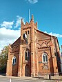 St Mary Magdalen's Church, Billericay.jpg 2,811 × 3,748; 1.91 MB
-
 St. John's church at Sunnymede - geograph.org.uk - 681320.jpg 640 × 480; 70 KB
-
 St.Ediths Lane sign - geograph.org.uk - 4686681.jpg 2,995 × 2,244; 2.85 MB
-
 Stachys palustris - geograph.org.uk - 2481176.jpg 428 × 640; 43 KB


.jpg)


_-_geograph.org.uk_-_3683678.jpg)


.jpeg)


