Category:Binnen Bantammerstraat 6, Amsterdam
Jump to navigation
Jump to search
| Object location | | View all coordinates using: OpenStreetMap |
|---|
 | |||||
| Upload media | |||||
| Instance of |
| ||||
|---|---|---|---|---|---|
| Location | Amsterdam, North Holland, Netherlands | ||||
| Street address |
| ||||
| Located on street | |||||
| Heritage designation |
| ||||
 | |||||
|
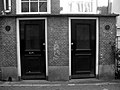
This is a category about rijksmonument number 306
|
| Address |
|
Media in category "Binnen Bantammerstraat 6, Amsterdam"
The following 4 files are in this category, out of 4 total.
-
 Amsterdam - Binnen Bantammerstraat 2-4-6.jpg 1,936 × 2,592; 2 MB
-
 Binnen - Amsterdam - 20015919 - RCE.jpg 1,200 × 1,188; 404 KB
-
 WLM - andrevanb - amsterdam, binnen bantammerstraat 4 - achterzijde.jpg 901 × 1,200; 358 KB
-
 WLM - andrevanb - amsterdam, binnen bantammerstraat 6 - achterzijde.jpg 1,200 × 900; 362 KB


