Category:Biotopes at cemetery Ruhland
Jump to navigation
Jump to search
| Object location | | View all coordinates using: OpenStreetMap |
|---|
Friedhof Ruhland als Lebensraum[edit]
Deutsch: Diese Kategorie erfasst Biotobpe / Lebensräume auf dem Friedhof in Ruhland.
English: This category contains urban biotopes at cemetery Ruhland.
Media in category "Biotopes at cemetery Ruhland"
The following 106 files are in this category, out of 106 total.
-
 Friedhof Ruhland, 5. Querweg ostwärts, Vorwinter, 01.jpg 3,648 × 2,736; 6.68 MB
-
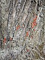
 Friedhof Ruhland, Amberbaum, Rinde, 01.jpg 1,704 × 2,272; 675 KB
-
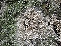
 Friedhof Ruhland, Blattflechte an Winterlinde, Vorwinter, 01.jpg 2,736 × 3,648; 5.75 MB
-
 Friedhof Ruhland, Blattflechte an Winterlinde, Vorwinter, 02.jpg 2,736 × 3,648; 1.79 MB
-
 Friedhof Ruhland, Blattflechte an Winterlinde, Vorwinter, 03.jpg 2,736 × 3,648; 1.17 MB
-
 Friedhof Ruhland, Blattflechte an Winterlinde, Vorwinter, 04.jpg 2,736 × 3,648; 1.1 MB
-
 Friedhof Ruhland, Blattflechte an Winterlinde, Vorwinter, 05.jpg 2,736 × 3,648; 1.69 MB
-
 Friedhof Ruhland, Blattflechte an Winterlinde, Vorwinter, 06.jpg 2,736 × 3,648; 1.31 MB
-
 Friedhof Ruhland, Blattflechte an Winterlinde, Vorwinter, 07.jpg 2,736 × 3,648; 1.25 MB
-
 Friedhof Ruhland, Blattflechte an Winterlinde, Vorwinter, 08.jpg 2,736 × 3,648; 2 MB
-
 Friedhof Ruhland, Blattflechte an Winterlinde, Vorwinter, 09.jpg 2,736 × 3,648; 1.93 MB
-
 Friedhof Ruhland, Blattflechte an Winterlinde, Vorwinter, 10.jpg 3,648 × 2,736; 1.42 MB
-
 Friedhof Ruhland, Blattflechte an Winterlinde, Vorwinter, 11.jpg 3,648 × 2,736; 1.49 MB
-
 Friedhof Ruhland, Blattflechte an Winterlinde, Vorwinter, 12.jpg 2,736 × 3,648; 1.42 MB
-
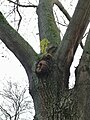
 Friedhof Ruhland, Feldahorn in Spitzahorn-Gabel, Herbst, 01.jpg 3,000 × 4,000; 2.96 MB
-
 Friedhof Ruhland, Feldahorn in Spitzahorn-Gabel, Herbst, 02.jpg 3,000 × 4,000; 2.06 MB
-
 Friedhof Ruhland, Gewöhnliche Gelbflechte an Winterlinde, Vorwinter, 01.jpg 2,736 × 3,648; 1.83 MB
-
 Friedhof Ruhland, Gewöhnliche Gelbflechte an Winterlinde, Vorwinter, 02.jpg 2,736 × 3,648; 1.48 MB
-
 Friedhof Ruhland, Gewöhnliche Gelbflechte an Winterlinde, Vorwinter, 03.jpg 2,736 × 3,648; 4.8 MB
-
 Friedhof Ruhland, Gewöhnliche Gelbflechte an Winterlinde, Vorwinter, 04.jpg 2,736 × 3,648; 1.56 MB
-
 Friedhof Ruhland, Gewöhnliche Gelbflechte an Winterlinde, Vorwinter, 05.jpg 3,648 × 2,736; 1.8 MB
-
 Friedhof Ruhland, Gewöhnliche Gelbflechte an Winterlinde, Vorwinter, 06.jpg 3,648 × 2,736; 1.58 MB
-
 Friedhof Ruhland, Gewöhnliche Gelbflechte an Winterlinde, Vorwinter, 07.jpg 3,648 × 2,736; 1.8 MB
-
 Friedhof Ruhland, Gewöhnliche Gelbflechte an Winterlinde, Vorwinter, 08.jpg 3,648 × 2,736; 2.09 MB
-
 Friedhof Ruhland, Gewöhnliche Gelbflechte an Winterlinde, Vorwinter, 09.jpg 3,648 × 2,736; 1.17 MB
-
 Friedhof Ruhland, Gewöhnliche Gelbflechte an Winterlinde, Vorwinter, 10.jpg 3,648 × 2,736; 1.22 MB
-
 Friedhof Ruhland, Gewöhnliche Gelbflechte an Winterlinde, Vorwinter, 11.jpg 3,648 × 2,736; 1.74 MB
-
 Friedhof Ruhland, Laubflechte mit Schimmelbefall an Winterlinde, Vorwinter, 01.jpg 2,736 × 3,648; 1.77 MB
-
 Friedhof Ruhland, Laubflechte mit Schimmelbefall an Winterlinde, Vorwinter, 02.jpg 2,736 × 3,648; 1.22 MB
-
 Friedhof Ruhland, Laubflechte mit Schimmelbefall an Winterlinde, Vorwinter, 03.jpg 2,736 × 3,648; 1.6 MB
-
 Friedhof Ruhland, Laubflechte mit Schimmelbefall an Winterlinde, Vorwinter, 04.jpg 3,648 × 2,736; 1.49 MB
-
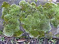
 Friedhof Ruhland, Moos-Flechten-Gesellschaft auf Bergahorn am Hauptweg, Vorwinter, 01.jpg 2,736 × 3,648; 6.46 MB
-
 Friedhof Ruhland, Moos-Flechten-Gesellschaft auf Bergahorn am Hauptweg, Vorwinter, 02.jpg 2,736 × 3,648; 5.57 MB
-
 Friedhof Ruhland, Moos-Flechten-Gesellschaft auf Bergahorn am Hauptweg, Vorwinter, 03.jpg 2,736 × 3,648; 5.96 MB
-

-

-

-

-
-

-

-

-
 Friedhof Ruhland, Moosgesellschaft auf Betonstein am 5. Querweg, Vorwinter, 01.jpg 3,648 × 2,736; 6.85 MB
-
 Friedhof Ruhland, Moosgesellschaft auf Betonstein am 5. Querweg, Vorwinter, 02.jpg 3,648 × 2,736; 5.99 MB
-
 Friedhof Ruhland, Moosgesellschaft auf Betonstein am 5. Querweg, Vorwinter, 03.jpg 3,648 × 2,736; 5.48 MB
-
 Friedhof Ruhland, Moosgesellschaft auf Betonstein am 5. Querweg, Vorwinter, 04.jpg 3,648 × 2,736; 5.37 MB
-
 Friedhof Ruhland, Moosgesellschaft auf Betonstein am 5. Querweg, Vorwinter, 05.jpg 3,648 × 2,736; 5.89 MB
-
 Friedhof Ruhland, Moosgesellschaft auf Betonstein am 5. Querweg, Vorwinter, 06.jpg 3,648 × 2,736; 6.22 MB
-
 Friedhof Ruhland, Moosgesellschaft auf Betonstein am 5. Querweg, Vorwinter, 07.jpg 3,648 × 2,736; 6.02 MB
-
 Friedhof Ruhland, Moosgesellschaft auf Betonstein am 5. Querweg, Vorwinter, 08.jpg 3,648 × 2,736; 6.05 MB
-

-

-

-
 Friedhof Ruhland, Rotbraune Fadenalge und Flechte an Winterlinde, Vorwinter, 01.jpg 2,736 × 3,648; 2.38 MB
-
 Friedhof Ruhland, Rotbraune Fadenalge und Flechte an Winterlinde, Vorwinter, 02.jpg 2,736 × 3,648; 1.75 MB
-
 Friedhof Ruhland, Rotbraune Fadenalge und Flechte an Winterlinde, Vorwinter, 03.jpg 2,736 × 3,648; 1.77 MB
-
 Friedhof Ruhland, Rote Taubnessel blühend am Hauptweg, Frühling, 01.jpg 2,736 × 3,648; 5.77 MB
-
 Friedhof Ruhland, Rote Taubnessel blühend am Hauptweg, Frühling, 02.jpg 3,648 × 2,736; 5.42 MB
-
 Friedhof Ruhland, Rote Taubnessel blühend am Hauptweg, Frühling, 03.jpg 3,648 × 2,736; 4.32 MB
-
 Friedhof Ruhland, Rote Taubnessel blühend auf Fläche, Frühling, 01.jpg 3,648 × 2,736; 6.11 MB
-
 Friedhof Ruhland, Rote Taubnessel blühend auf Fläche, Frühling, 02.jpg 3,648 × 2,736; 4.72 MB
-
 Friedhof Ruhland, Rote Taubnessel blühend auf Fläche, Frühling, 03.jpg 3,648 × 2,736; 5.92 MB
-

-

-

-

-
 Friedhof Ruhland, unbekannte Flechte und Gewöhnliche Gelbflechte an Berg-Ahorn, 01.jpg 1,200 × 1,600; 1.27 MB
-
 Friedhof Ruhland, verzweigte Laubflechte an Winterlinde, Vorwinter, 01.jpg 2,736 × 3,648; 1.1 MB
-
 Friedhof Ruhland, verzweigte Laubflechte an Winterlinde, Vorwinter, 02.jpg 2,736 × 3,648; 1.2 MB
-
 Friedhof Ruhland, verzweigte Laubflechte an Winterlinde, Vorwinter, 03.jpg 2,736 × 3,648; 5.69 MB
-
 Friedhof Ruhland, verzweigte Laubflechte an Winterlinde, Vorwinter, 04.jpg 2,736 × 3,648; 1.35 MB
-
 Friedhof Ruhland, verzweigte Laubflechte an Winterlinde, Vorwinter, 05.jpg 3,648 × 2,736; 1.3 MB
-
 Friedhof Ruhland, verzweigte Laubflechte an Winterlinde, Vorwinter, 06.jpg 3,648 × 2,736; 1.1 MB
-
 Friedhof Ruhland, verzweigte Laubflechte an Winterlinde, Vorwinter, 07.jpg 2,736 × 3,648; 1.42 MB
-
 Friedhof Ruhland, verzweigte Laubflechte an Winterlinde, Vorwinter, 08.jpg 3,648 × 2,736; 3.65 MB
-
 Friedhof Ruhland, verzweigte Laubflechte an Winterlinde, Vorwinter, 09.jpg 2,736 × 3,648; 1.33 MB
-
 Friedhof Ruhland, verzweigte Laubflechte an Winterlinde, Vorwinter, 10.jpg 2,736 × 3,648; 1.65 MB
-
 Friedhof Ruhland, verzweigte Laubflechte an Winterlinde, Vorwinter, 11.jpg 2,736 × 3,648; 1.15 MB
-
 Friedhof Ruhland, Winterlinde in Spitzahorn-Gabel, Frühling, 01.jpg 2,736 × 3,648; 6.62 MB
-
 Friedhof Ruhland, Winterlinde in Spitzahorn-Gabel, Frühling, 02.jpg 1,166 × 1,898; 1.43 MB
-
 Friedhof Ruhland, Winterlinde in Spitzahorn-Gabel, Frühsommer, 01.jpg 2,405 × 2,573; 1.35 MB
-
 Friedhof Ruhland, Winterlinde in Spitzahorn-Gabel, Frühsommer, 02.jpg 3,000 × 4,000; 6.11 MB
-
 Friedhof Ruhland, Winterlinde in Spitzahorn-Gabel, Sommer, 01.jpg 2,736 × 3,648; 6.57 MB
-
 Friedhof Ruhland, Winterlinde in Spitzahorn-Gabel, Sommer, 02.jpg 2,736 × 3,648; 2.34 MB
-
 Friedhof Ruhland, Winterlinde in Spitzahorn-Gabel, Sommer, 03.jpg 2,736 × 3,648; 1.84 MB
-
 Friedhof Ruhland, zierliche Laubflechte an Winterlinde, Vorwinter, 01.jpg 2,736 × 3,648; 2.26 MB
-
 Friedhof Ruhland, zierliche Laubflechte an Winterlinde, Vorwinter, 02.jpg 3,648 × 2,736; 1.49 MB
-
 Ruhland, Friedhof, Feuerwanzen an Spitzahorn, Frühling, 01.jpg 3,648 × 2,736; 2.68 MB
-
 Ruhland, Friedhof, Feuerwanzen an Spitzahorn, Frühling, 02.jpg 3,648 × 2,736; 2.96 MB
-
 Ruhland, Friedhof, Feuerwanzen an Spitzahorn, Frühling, 03.jpg 2,736 × 3,648; 2.86 MB
-
 Ruhland, Friedhof, Feuerwanzen an Spitzahorn, Frühling, 04.jpg 3,648 × 2,736; 2.87 MB
-
 Ruhland, Friedhof, Feuerwanzen an Wegkante bei Spitzahorn, Frühsommer, 01.jpg 2,323 × 2,913; 1.49 MB
-
 Ruhland, Friedhof, Feuerwanzen an Wegkante bei Spitzahorn, Frühsommer, 02.jpg 1,995 × 2,450; 887 KB
-
 Ruhland, Friedhof, Feuerwanzen an westlicher Mauer, Frühling, 01.jpg 3,648 × 2,736; 1.84 MB
-
 Ruhland, Friedhof, Feuerwanzen an Winterlinde, Frühsommer, 01.jpg 3,000 × 4,000; 5.98 MB
-
 Ruhland, Friedhof, Feuerwanzen an Winterlinde, Frühsommer, 02.jpg 3,000 × 4,000; 5.37 MB
-
 Ruhland, Friedhof, Feuerwanzen an Winterlinde, Frühsommer, 03.jpg 3,000 × 4,000; 4.95 MB
-
 Ruhland, Friedhof, Feuerwanzen an Winterlinde, Frühsommer, 04.jpg 3,000 × 4,000; 5.19 MB
-
 Ruhland, Friedhof, Feuerwanzen an Winterlinde, Frühsommer, 05.jpg 3,000 × 4,000; 5.11 MB
-
 Ruhland, Friedhof, Feuerwanzen an Winterlinde, Frühsommer, 06.jpg 3,000 × 4,000; 4.72 MB
-
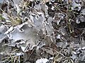
 Ruhland, Friedhof, Wiese westlich des Hauptwegs, Hundsflechte, 01.jpg 1,200 × 1,600; 1.58 MB
-
 Ruhland, Friedhof, Wiese westlich des Hauptwegs, Hundsflechte, 02.jpg 1,200 × 1,600; 1.59 MB
-
 Ruhland, Friedhof, Wiese westlich des Hauptwegs, Hundsflechte, 03.jpg 1,600 × 1,200; 1.1 MB
-
 Ruhland, Friedhof, Wiese westlich des Hauptwegs, Hundsflechte, 04.jpg 1,600 × 1,200; 1.44 MB
-
 Ruhland, Friedhof, Wiese westlich des Hauptwegs, Hundsflechte, 05.jpg 1,600 × 1,200; 1.22 MB
-
 Ruhland, Friedhof, Wiese westlich des Hauptwegs, Hundsflechte, 06.jpg 1,600 × 1,200; 1.42 MB


