Category:Birse (civil parish)
Jump to navigation
Jump to search
Scottish parish in Aberdeenshire, Scotland, UK | |||||
| Upload media | |||||
| Instance of | |||||
|---|---|---|---|---|---|
| Named after | |||||
| Location |
| ||||
| Population |
| ||||
| Area |
| ||||
 | |||||
Subcategories
This category has the following 6 subcategories, out of 6 total.
Media in category "Birse (civil parish)"
The following 200 files are in this category, out of 721 total.
(previous page) (next page)-
 'The Dinnie Stones' at Potarch - geograph.org.uk - 5528704.jpg 4,896 × 3,672; 6.59 MB
-
 A bed of shingle in the River Dee - geograph.org.uk - 3078263.jpg 1,824 × 1,368; 1.1 MB
-
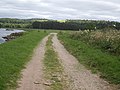
 A bend in the public road - geograph.org.uk - 3884104.jpg 1,883 × 1,547; 975 KB
-
 A bend in the River Dee - geograph.org.uk - 3120111.jpg 3,648 × 2,736; 2.49 MB
-
 A burnside green track - geograph.org.uk - 3588902.jpg 1,824 × 1,368; 731 KB
-
 A clearing in the wood - geograph.org.uk - 3569898.jpg 1,000 × 667; 482 KB
-
 A comfy seat on Peter Hill - geograph.org.uk - 3963222.jpg 1,000 × 667; 324 KB
-
 A dry stane wall at Potarch - geograph.org.uk - 5435916.jpg 4,896 × 3,672; 6.53 MB
-
 A family mausoleum in Birse Churchyard - geograph.org.uk - 3588687.jpg 1,335 × 1,642; 989 KB
-
 A field boundary fence - geograph.org.uk - 3078698.jpg 1,824 × 1,368; 714 KB
-
 A field east of Birse Hall - geograph.org.uk - 3885304.jpg 2,304 × 1,728; 1.51 MB
-
 A field of barley at Birse - geograph.org.uk - 3588895.jpg 1,824 × 1,368; 908 KB
-
 A fishing bothy on the River Dee - geograph.org.uk - 3078004.jpg 1,368 × 1,824; 1.01 MB
-
 A fishing bothy on the south bank of the Dee - geograph.org.uk - 3085811.jpg 3,648 × 2,736; 2.28 MB
-
 A freshly cut field at Finzean - geograph.org.uk - 3540499.jpg 1,000 × 664; 370 KB
-
 A Grey Heron patrolling the Redbrae Pool beat - geograph.org.uk - 3078038.jpg 1,824 × 1,368; 761 KB
-
 A photo collage inside Forest of Birse kirk - geograph.org.uk - 5528495.jpg 4,078 × 3,288; 2.44 MB
-
 A place of rest - geograph.org.uk - 3588671.jpg 1,824 × 1,368; 771 KB
-
 A possible standing stone - geograph.org.uk - 4013224.jpg 800 × 640; 295 KB
-
 A quiet corner of God's Little Acre - geograph.org.uk - 3588700.jpg 1,824 × 1,368; 1.2 MB
-
 A rain pool in the forest - geograph.org.uk - 965227.jpg 640 × 480; 144 KB
-
 A rashy field, Potarch - geograph.org.uk - 5633081.jpg 1,024 × 683; 319 KB
-
 A ring-nosed ton of beef - geograph.org.uk - 869409.jpg 640 × 480; 94 KB
-
 A rocky knoll - geograph.org.uk - 3885908.jpg 2,239 × 1,543; 969 KB
-
 A rural postbox at Birsemore - geograph.org.uk - 3605071.jpg 1,769 × 1,210; 963 KB
-
 A seat above Balnahard - geograph.org.uk - 4068841.jpg 1,000 × 667; 364 KB
-
 A shingle beach on an island in the River Dee - geograph.org.uk - 3098238.jpg 3,648 × 2,736; 2.87 MB
-
 A small copse by the Auldfrushoch Burn - geograph.org.uk - 3078415.jpg 480 × 640; 107 KB
-
 A small pool - geograph.org.uk - 869454.jpg 480 × 640; 133 KB
-
 A stand of trees near Oldyleiper - geograph.org.uk - 2433505.jpg 1,824 × 1,368; 991 KB
-
 A steel frame barn - geograph.org.uk - 869496.jpg 640 × 480; 66 KB
-
 A T-junction of minor roads in Birse hamlet - geograph.org.uk - 3588912.jpg 1,719 × 1,055; 700 KB
-
-
 A track to Arntilly - geograph.org.uk - 5924620.jpg 1,024 × 683; 506 KB
-
 A track to Deerhillock - geograph.org.uk - 3587486.jpg 1,824 × 1,368; 621 KB
-
 A tree on a mound - geograph.org.uk - 966412.jpg 640 × 480; 68 KB
-
 A view of the Market Stance, Potarch - geograph.org.uk - 5435902.jpg 4,356 × 3,309; 2.99 MB
-
 A view of Woodside - geograph.org.uk - 3886911.jpg 2,187 × 1,383; 1 MB
-
 A view to Haugh Farm - geograph.org.uk - 3078716.jpg 640 × 480; 90 KB
-
 A view towards Birse church - geograph.org.uk - 3587487.jpg 1,353 × 955; 438 KB
-
 A wicket gate entrance to Birse graveyard - geograph.org.uk - 3587517.jpg 1,824 × 1,368; 857 KB
-
 A wooded island in the Dee - geograph.org.uk - 3098233.jpg 1,368 × 1,824; 1.05 MB
-
 Above Balnahard Wood - geograph.org.uk - 1305735.jpg 640 × 428; 205 KB
-
 Aboyne - Birsemore - geograph.org.uk - 5269529.jpg 2,560 × 1,920; 1.67 MB
-
 Aboyne - River Dee - geograph.org.uk - 5269537.jpg 2,560 × 1,920; 1.89 MB
-
 Access junction to Birse Community Hall - geograph.org.uk - 3587505.jpg 1,755 × 1,225; 992 KB
-
 Access lane to Deerhillock - geograph.org.uk - 2433489.jpg 2,736 × 3,648; 1.26 MB
-
 Access path to Forest of Birse kirk - geograph.org.uk - 5528509.jpg 2,912 × 2,172; 1.37 MB
-
 Access to a new cycle path at Balnaboth - geograph.org.uk - 3130768.jpg 1,824 × 1,368; 779 KB
-
 Access to Balnahard farm - geograph.org.uk - 3886811.jpg 2,009 × 1,447; 1.11 MB
-
 Access to East Tillygarmond - geograph.org.uk - 2328237.jpg 1,824 × 1,368; 701 KB
-
 Access to Finzean House - geograph.org.uk - 3886819.jpg 2,304 × 1,728; 1.41 MB
-
 Access to Hawthorn Cottage - geograph.org.uk - 4162330.jpg 4,608 × 3,456; 3.04 MB
-
 Access to new cycle path at Inchbrae - geograph.org.uk - 2553808.jpg 1,296 × 972; 683 KB
-
 Access to new cycle path at Inchbrae - geograph.org.uk - 2553824.jpg 1,944 × 2,592; 1.17 MB
-
 Access to new villas in village of Birse - geograph.org.uk - 3884773.jpg 2,304 × 1,728; 1.08 MB
-
 Access to Old Hall, Birse - geograph.org.uk - 966390.jpg 640 × 480; 145 KB
-
 Access to Oldyleiper - geograph.org.uk - 3885860.jpg 2,209 × 1,431; 1.33 MB
-
 Access to the moor from Glencat - geograph.org.uk - 869557.jpg 640 × 480; 83 KB
-
 Access to Tillycroy farm - geograph.org.uk - 4162332.jpg 1,892 × 1,376; 760 KB
-
 Access to Woodside - geograph.org.uk - 3886905.jpg 2,249 × 1,443; 1.2 MB
-
 An access to Middle Belwade Pool - geograph.org.uk - 3078632.jpg 3,648 × 2,736; 2.62 MB
-
 An entrance to Balfour Wood - geograph.org.uk - 3884308.jpg 2,304 × 1,728; 1.51 MB
-
 An entrance to Kittling Wood - geograph.org.uk - 3884371.jpg 2,304 × 1,728; 2.03 MB
-
 An old barn structure - geograph.org.uk - 3078759.jpg 1,824 × 1,368; 618 KB
-
 An old outbuilding at Balnaboth - geograph.org.uk - 3130798.jpg 3,648 × 2,736; 1.45 MB
-
 An old road above Kinminity - geograph.org.uk - 5923698.jpg 1,024 × 683; 475 KB
-
 An outcrop in the River Dee - geograph.org.uk - 2551211.jpg 2,592 × 1,944; 1.06 MB
-
 Another access to Middle Belwade Pool - geograph.org.uk - 3078639.jpg 1,368 × 1,824; 986 KB
-
 Approach to Big Jetty Pool - geograph.org.uk - 3082175.jpg 1,824 × 1,368; 910 KB
-
 Approach to Big Jetty Pool - geograph.org.uk - 3082180.jpg 1,824 × 1,368; 1.13 MB
-
 Approach to Burn of Cattie crossings - geograph.org.uk - 2553852.jpg 1,296 × 972; 665 KB
-
 Approach to Drumneachie - geograph.org.uk - 965309.jpg 640 × 480; 91 KB
-

-
 Approach to Middle Belwade beat - geograph.org.uk - 3078155.jpg 1,824 × 1,368; 1.12 MB
-
 Approach to Redbrae Pool - geograph.org.uk - 3078015.jpg 1,824 × 1,368; 1.08 MB
-
 Approach to the Middle Milwade beat - geograph.org.uk - 3078122.jpg 1,824 × 1,368; 750 KB
-
 Approach to the old Birse School - geograph.org.uk - 3884785.jpg 1,715 × 1,383; 866 KB
-
 Arable land, Mains of Potarch - geograph.org.uk - 5633095.jpg 1,024 × 683; 360 KB
-
 Arms of Farquharson of Finzean - geograph.org.uk - 6119691.jpg 3,944 × 3,497; 2.69 MB
-
 Auchaballa - geograph.org.uk - 5923589.jpg 1,024 × 683; 341 KB
-
 Auchaballa - geograph.org.uk - 869459.jpg 640 × 480; 55 KB
-
 Auchaballa sign - geograph.org.uk - 5923590.jpg 1,024 × 683; 546 KB
-
 Auchaballa Wood - geograph.org.uk - 5923585.jpg 1,024 × 683; 612 KB
-
 Auchnafoy - geograph.org.uk - 3078741.jpg 1,824 × 1,368; 515 KB
-
 Auchnashinn - geograph.org.uk - 3574628.jpg 640 × 427; 304 KB
-
 Auldenachie Pinewoods - geograph.org.uk - 1263887.jpg 640 × 458; 131 KB
-
 Autumn colours at Myreside - geograph.org.uk - 1607899.jpg 640 × 428; 91 KB
-
 Autumn fields - geograph.org.uk - 966334.jpg 640 × 480; 69 KB
-
 Balfiddy farmhouse (2014) - geograph.org.uk - 4162258.jpg 4,608 × 3,456; 3.31 MB
-
 Balfiddy steadings (2014) - geograph.org.uk - 4162252.jpg 4,608 × 3,456; 3.31 MB
-
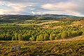
 Balfour Forest - geograph.org.uk - 5920150.jpg 1,024 × 769; 562 KB
-
 Balfour Forest - geograph.org.uk - 5920159.jpg 1,024 × 1,024; 754 KB
-
 Balfour Forest - geograph.org.uk - 5921169.jpg 1,024 × 683; 433 KB
-
 Balfour Forest - geograph.org.uk - 5921188.jpg 1,024 × 683; 459 KB
-
 Balfour Forest - geograph.org.uk - 5921237.jpg 1,024 × 683; 342 KB
-
 Balfour Forest - geograph.org.uk - 5921249.jpg 1,024 × 683; 462 KB
-
 Balfour Forest - geograph.org.uk - 5921256.jpg 1,024 × 683; 566 KB
-
 Balfour to The Fungle path - geograph.org.uk - 5921261.jpg 1,024 × 1,024; 570 KB
-
 Balfour to The Fungle path - geograph.org.uk - 5921267.jpg 1,024 × 683; 422 KB
-
 Ballogie nursery, Marywell - geograph.org.uk - 6118962.jpg 5,325 × 4,000; 5.24 MB
-
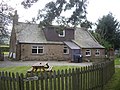
 Balnaboth cafe-shop - geograph.org.uk - 869875.jpg 640 × 480; 70 KB
-
 Balnaboth Cottage - geograph.org.uk - 3130808.jpg 3,648 × 2,736; 2.31 MB
-
 Balnaboth garden - geograph.org.uk - 869854.jpg 640 × 480; 109 KB
-
 Balnahard - geograph.org.uk - 4068847.jpg 800 × 640; 235 KB
-
 Balnahard Wood - geograph.org.uk - 1305966.jpg 640 × 428; 196 KB
-
 Barbed-wire fence and hedgerow flora - geograph.org.uk - 3078249.jpg 3,648 × 2,736; 1.51 MB
-
 Barn at Drumneachie - geograph.org.uk - 966322.jpg 640 × 442; 86 KB
-
 Belhangie cottage - geograph.org.uk - 1382917.jpg 640 × 461; 60 KB
-
 Belhangie cottage - geograph.org.uk - 5566903.jpg 4,526 × 2,434; 1.49 MB
-

-
 Bend in track in Haugh Plantation - geograph.org.uk - 3077975.jpg 1,824 × 1,368; 968 KB
-
 Bike path, Slewdrum Forest - geograph.org.uk - 5633064.jpg 1,024 × 683; 380 KB
-
 Bikepacking rig, Shooting Greens - geograph.org.uk - 5633047.jpg 1,024 × 683; 400 KB
-

-
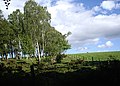 Birchwood by B993 - geograph.org.uk - 2432335.jpg 1,747 × 1,247; 644 KB
-
 Birse Church - geograph.org.uk - 3588678.jpg 1,368 × 1,824; 795 KB
-
 Birse Community Hall and Church - geograph.org.uk - 3587511.jpg 1,765 × 1,169; 564 KB
-

-
 Birse parish kirk - geograph.org.uk - 6119495.jpg 3,992 × 3,249; 3.87 MB
-
 Birse war memorial - geograph.org.uk - 6119648.jpg 3,969 × 4,499; 3.62 MB
-
 Birse ^ Feughside Parish Church - geograph.org.uk - 3588704.jpg 1,824 × 1,368; 891 KB
-
 Birsemore Loch 1 - geograph.org.uk - 4009088.jpg 1,000 × 667; 357 KB
-
 Birsemore Loch 2 - geograph.org.uk - 4009093.jpg 1,000 × 667; 372 KB
-
 Birsemore Loch 3 - geograph.org.uk - 4009100.jpg 1,000 × 666; 392 KB
-
 Birsemore Loch 4 - geograph.org.uk - 4009105.jpg 1,000 × 667; 430 KB
-
 Birsemore Loch 5 - geograph.org.uk - 4009111.jpg 1,000 × 667; 401 KB
-
 Birsemore Loch 6 - geograph.org.uk - 4009117.jpg 1,000 × 667; 408 KB
-
 Birsemore Loch 7 - geograph.org.uk - 4009120.jpg 1,000 × 664; 370 KB
-
 Birsemore Loch 8 - geograph.org.uk - 4017536.jpg 1,000 × 664; 346 KB
-

-
 Blanket Bog on Craigmahandle - geograph.org.uk - 1043795.jpg 640 × 480; 123 KB
-
 Blizzard - geograph.org.uk - 1153504.jpg 640 × 479; 34 KB
-
 Bogandacher - geograph.org.uk - 3963278.jpg 800 × 640; 264 KB
-
 Bogieshiel Lodge - geograph.org.uk - 2558535.jpg 3,648 × 2,736; 4.78 MB
-
 Bogieshiel Lodge - geograph.org.uk - 2558546.jpg 3,648 × 2,736; 4.84 MB
-
 Bogturk 'bowl' - geograph.org.uk - 1149984.jpg 640 × 458; 106 KB
-
 Boundary wall - geograph.org.uk - 965132.jpg 640 × 480; 159 KB
-
 Brass Plaque on the seat - geograph.org.uk - 4068844.jpg 1,000 × 667; 389 KB
-
 Bridge of Oldyleiper mill lade, North Balfour - geograph.org.uk - 3885857.jpg 1,788 × 1,447; 954 KB
-
 Bridge of Potarch - geograph.org.uk - 4294648.jpg 4,608 × 3,456; 3.03 MB
-
 Bridge of Potarch - geograph.org.uk - 5489456.jpg 1,024 × 682; 194 KB
-
 Bridge of Potarch, 31 Dec 2015 - geograph.org.uk - 4792631.jpg 3,456 × 4,608; 3.96 MB
-
 Bridge over Burn of Cattie (July) - geograph.org.uk - 1382905.jpg 640 × 466; 91 KB
-
 Bridge over Burn of Cattie - geograph.org.uk - 869413.jpg 640 × 480; 76 KB
-
 Bridge over the Burn of Birse - geograph.org.uk - 3588858.jpg 1,824 × 1,368; 730 KB
-
 Bridgend cottage - geograph.org.uk - 2551310.jpg 1,029 × 660; 212 KB
-
 Buildings in Oldyleiper - geograph.org.uk - 3588917.jpg 1,824 × 1,368; 758 KB
-
 Burn across Fungle - geograph.org.uk - 1232778.jpg 640 × 426; 118 KB
-
 Burn of Allanstank - geograph.org.uk - 1272894.jpg 640 × 480; 108 KB
-
 Burn of Auldmad - geograph.org.uk - 1142535.jpg 640 × 480; 122 KB
-
 Burn of Auldmad - geograph.org.uk - 1272884.jpg 640 × 480; 159 KB
-
 Burn of Auldmad and Burn of Corn - geograph.org.uk - 1165744.jpg 640 × 480; 93 KB
-
 Burn of Balfour - geograph.org.uk - 3884687.jpg 2,304 × 1,728; 1.94 MB
-
 Burn of Birse - geograph.org.uk - 2433525.jpg 1,824 × 1,368; 1.05 MB
-
 Bus stop shelter for Birse - geograph.org.uk - 2433510.jpg 1,563 × 1,095; 800 KB
-
 Butterworth Gallery, Marywell - geograph.org.uk - 2551283.jpg 1,159 × 813; 247 KB
-
 Cairn - geograph.org.uk - 869610.jpg 480 × 640; 78 KB
-
 Cairn on Cock Hill - geograph.org.uk - 1018805.jpg 545 × 640; 106 KB
-

-
 Canadian Road - geograph.org.uk - 5923607.jpg 1,024 × 683; 490 KB
-
 Carn Ferg trig pillar and monument. - geograph.org.uk - 1184017.jpg 640 × 480; 58 KB
-
 Cattle grid - geograph.org.uk - 965334.jpg 640 × 480; 122 KB
-
 Cattle grid by Glencat farm - geograph.org.uk - 869468.jpg 640 × 480; 76 KB
-
 Cattle grid on riverside track - geograph.org.uk - 3082170.jpg 1,824 × 1,368; 1.06 MB
-
 Cattle grid on track to River Dee - geograph.org.uk - 2433494.jpg 1,824 × 1,368; 714 KB
-
 Cattle on track down from Lamawhillis - geograph.org.uk - 1184719.jpg 640 × 480; 104 KB
-
 Cattle resting - geograph.org.uk - 966327.jpg 640 × 480; 106 KB
-
 Children's playground - geograph.org.uk - 5528641.jpg 4,896 × 3,672; 6.87 MB
-
 Churchyard path to Birse Church - geograph.org.uk - 3588715.jpg 1,824 × 1,368; 629 KB
-

-

-
 Commonty Wood and Tom's Cairn - geograph.org.uk - 1215600.jpg 640 × 480; 65 KB
-
 Community Footpath in Finzean - geograph.org.uk - 2729210.jpg 3,648 × 2,736; 1.35 MB
-
 Converted steading, Baulds - geograph.org.uk - 3886854.jpg 1,704 × 1,447; 778 KB
-
 Corsedardar Wood - geograph.org.uk - 3758190.jpg 1,000 × 666; 221 KB
-
 Cottages in Marywell - geograph.org.uk - 2551258.jpg 1,141 × 878; 381 KB
-
 Cottages near Birse Sawmill - geograph.org.uk - 966387.jpg 640 × 480; 102 KB
-
 Cottages, North Balfour - geograph.org.uk - 3885863.jpg 2,221 × 1,443; 888 KB
-
 Coupit seat - geograph.org.uk - 5921205.jpg 1,024 × 683; 359 KB
-
 Course of the Rough Burn - geograph.org.uk - 1494599.jpg 640 × 480; 89 KB
-
 Cowdray Pool beat - geograph.org.uk - 3078660.jpg 1,824 × 1,368; 1.14 MB
-
 Cowdray Pool, River Dee - geograph.org.uk - 3078203.jpg 1,824 × 1,368; 1.08 MB
-
 Craigbeg - geograph.org.uk - 5633076.jpg 1,024 × 683; 473 KB
-
 Craigmore Croft - geograph.org.uk - 1215667.jpg 640 × 480; 83 KB
-
 Craigmore Wood - geograph.org.uk - 1326528.jpg 640 × 480; 102 KB
-
 Cults Cottage, Feughside - geograph.org.uk - 5885707.jpg 4,640 × 2,841; 2.53 MB
-
 Cycle path bridge - geograph.org.uk - 5556805.jpg 4,616 × 3,463; 4.08 MB
-
 Cycle path crossing, Burn of Cattie - geograph.org.uk - 2553854.jpg 1,944 × 2,592; 1.36 MB
-
 Cycle path downhill towards Potarch - geograph.org.uk - 5556838.jpg 4,462 × 3,347; 3.68 MB
-
 Cycle path through forest on Muckle Ord - geograph.org.uk - 2557004.jpg 1,944 × 2,592; 1.34 MB
-
 Cycle path uphill towards Shooting Greens pass - geograph.org.uk - 5556845.jpg 4,896 × 3,672; 6.48 MB
-
 Cycle path, Potarch - geograph.org.uk - 5633086.jpg 1,024 × 683; 379 KB
-
 Cycle path, Potarch - geograph.org.uk - 5633092.jpg 1,024 × 683; 397 KB
-

-
 Daffodils, Slewdrum Forest - geograph.org.uk - 5633072.jpg 1,024 × 683; 405 KB
-
 Daisy Cottage, Finzean - geograph.org.uk - 3886813.jpg 2,304 × 1,728; 1.05 MB
-
 Dante's Inferno^ - geograph.org.uk - 965249.jpg 640 × 480; 50 KB
-
 Dardarius stone, the B976 and the Birse War Memorial - geograph.org.uk - 4270043.jpg 1,083 × 1,600; 248 KB
-
 Dee by Potarch - geograph.org.uk - 2314950.jpg 3,456 × 2,304; 2.28 MB


_-_geograph.org.uk_-_4162258.jpg)
_-_geograph.org.uk_-_4162252.jpg)


_-_geograph.org.uk_-_1382905.jpg)


&filefrom=Dee+in+spate%2C+31+Dec+2015+-+geograph.org.uk+-+4792597.jpg#mw-category-media)