Category:Blank SVG maps of individual states of the United States
Jump to navigation
Jump to search
English: This category is used as a subset of the intersection of two different categories: Category:Blank maps of the United States and Category:SVG maps of the United States, further filtered to include only maps showing one individual state in whole or part, or showing a group of states while highlighting one of them. It will provide a list of blank SVG maps that depict all or part of one of the United States (except multiple states without distinction; see below). The maps may may have jurisdictional lines, e.g. state boundary, county lines, census districts, etc., may have jurisdiction names or abbreviations (state name, county names, etc.), but generally should have no distinguishing features between districts, locations, places or jurisdictions, in order to allow the map to be used as a base map as a starting point for something else. In effect,it serves as a "one stop shopping mart" for those looking for certain types of blank maps of one of the U.S. states in SVG format.
Note: This category should not include maps of multiple states which do not highlight a specific state. There is a specific category for those files, Category:Blank SVG maps of the United States.
Color is OK if consistent, e.g. all gray, all white, all black, all green, etc. Lines should be a contrasting color. The use if the "4-color rule" in which each jurisdiction, like a county, is given a color and only changes so it is different from its immediate neighbors, is also okay.Media in category "Blank SVG maps of individual states of the United States"
The following 109 files are in this category, out of 109 total.
-
 All Washington Counties.svg 986 × 624; 1.44 MB
-
 Blank Map of Long Island.svg 798 × 318; 56 KB
-
 Blank map subdivisions 2019 Albers Alabama.svg 255 × 400; 50 KB
-
 Blank map subdivisions 2019 Albers Alaska.svg 400 × 227; 136 KB
-
 Blank map subdivisions 2019 Albers Arizona.svg 345 × 400; 20 KB
-
 Blank map subdivisions 2019 Albers Arkansas.svg 400 × 349; 52 KB
-
 Blank map subdivisions 2019 Albers California.svg 338 × 400; 73 KB
-
 Blank map subdivisions 2019 Albers Colorado.svg 400 × 289; 40 KB
-
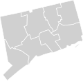
 Blank map subdivisions 2019 Albers Connecticut.svg 400 × 291; 10 KB
-
 Blank map subdivisions 2019 Albers Delaware.svg 166 × 400; 3 KB
-
 Blank map subdivisions 2019 Albers District of Columbia.svg 322 × 400; 694 bytes
-
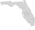
 Blank map subdivisions 2019 Albers Florida.svg 400 × 399; 55 KB
-
 Blank map subdivisions 2019 Albers Georgia.svg 347 × 400; 93 KB
-
 Blank map subdivisions 2019 Albers Hawaii.svg 400 × 261; 10 KB
-
 Blank map subdivisions 2019 Albers Idaho.svg 252 × 400; 43 KB
-
 Blank map subdivisions 2019 Albers Illinois.svg 226 × 400; 56 KB
-
 Blank map subdivisions 2019 Albers Indiana.svg 260 × 400; 44 KB
-
 Blank map subdivisions 2019 Albers Iowa.svg 400 × 261; 37 KB
-
 Blank map subdivisions 2019 Albers Kansas.svg 400 × 205; 39 KB
-
 Blank map subdivisions 2019 Albers Kentucky.svg 400 × 169; 74 KB
-
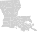
 Blank map subdivisions 2019 Albers Louisiana.svg 400 × 377; 55 KB
-
 Blank map subdivisions 2019 Albers Maine.svg 267 × 400; 27 KB
-
 Blank map subdivisions 2019 Albers Maryland.svg 400 × 210; 22 KB
-
 Blank map subdivisions 2019 Albers Massachusetts.svg 400 × 247; 22 KB
-
 Blank map subdivisions 2019 Albers Michigan.svg 340 × 400; 45 KB
-
 Blank map subdivisions 2019 Albers Minnesota.svg 350 × 400; 48 KB
-
 Blank map subdivisions 2019 Albers Mississippi.svg 246 × 400; 50 KB
-
 Blank map subdivisions 2019 Albers Missouri.svg 400 × 356; 60 KB
-
 Blank map subdivisions 2019 Albers Montana.svg 400 × 230; 66 KB
-
 Blank map subdivisions 2019 Albers Nebraska.svg 400 × 184; 38 KB
-
 Blank map subdivisions 2019 Albers Nevada.svg 265 × 400; 16 KB
-
 Blank map subdivisions 2019 Albers New Hampshire.svg 208 × 400; 13 KB
-
 Blank map subdivisions 2019 Albers New Jersey.svg 211 × 400; 20 KB
-
 Blank map subdivisions 2019 Albers New Mexico.svg 359 × 400; 25 KB
-
 Blank map subdivisions 2019 Albers New York.svg 400 × 305; 55 KB
-
 Blank map subdivisions 2019 Albers North Carolina.svg 400 × 152; 62 KB
-
 Blank map subdivisions 2019 Albers North Dakota.svg 400 × 238; 30 KB
-
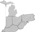
 Blank map subdivisions 2019 Albers Ohio.svg 370 × 400; 50 KB
-
 Blank map subdivisions 2019 Albers Oklahoma.svg 400 × 197; 46 KB
-
 Blank map subdivisions 2019 Albers Oregon.svg 400 × 297; 39 KB
-
 Blank map subdivisions 2019 Albers Pennsylvania.svg 400 × 230; 44 KB
-
 Blank map subdivisions 2019 Albers Puerto Rico.svg 400 × 191; 34 KB
-
 Blank map subdivisions 2019 Albers Rhode Island.svg 256 × 400; 4 KB
-
 Blank map subdivisions 2019 Albers South Carolina.svg 400 × 318; 38 KB
-
 Blank map subdivisions 2019 Albers South Dakota.svg 400 × 248; 33 KB
-
 Blank map subdivisions 2019 Albers Tennessee.svg 400 × 97; 60 KB
-
 Blank map subdivisions 2019 Albers Texas.svg 400 × 380; 157 KB
-
 Blank map subdivisions 2019 Albers Utah.svg 320 × 400; 27 KB
-
 Blank map subdivisions 2019 Albers Vermont.svg 243 × 400; 15 KB
-
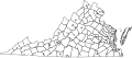
 Blank map subdivisions 2019 Albers Virginia.svg 400 × 173; 85 KB
-
 Blank map subdivisions 2019 Albers Washington.svg 400 × 263; 39 KB
-
 Blank map subdivisions 2019 Albers West Virginia.svg 400 × 355; 35 KB
-
 Blank map subdivisions 2019 Albers Wisconsin.svg 375 × 400; 41 KB
-
 Blank map subdivisions 2019 Albers Wyoming.svg 400 × 314; 19 KB
-
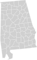 Blank map subdivisions Alabama.svg 70 × 114; 32 KB
-
 Blank map subdivisions Alaska.svg 257 × 168; 32 KB
-
 Blank map subdivisions Arizona.svg 124 × 145; 12 KB
-
 Blank map subdivisions Arkansas.svg 92 × 83; 34 KB
-
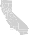
 Blank map subdivisions California.svg 147 × 250; 42 KB
-
 Blank map subdivisions Colorado.svg 133 × 105; 29 KB
-
 Blank map subdivisions Connecticut.svg 32 × 31; 8 KB
-
 Blank map subdivisions Delaware.svg 19 × 32; 6 KB
-
 Blank map subdivisions District of Columbia.svg 4 × 5; 4 KB
-
 Blank map subdivisions Florida.svg 166 × 142; 36 KB
-
 Blank map subdivisions Georgia.svg 99 × 103; 60 KB
-
 Blank map subdivisions Hawaii.svg 121 × 71; 6 KB
-
 Blank map subdivisions Idaho.svg 109 × 176; 29 KB
-
 Blank map subdivisions Illinois.svg 73 × 129; 36 KB
-
 Blank map subdivisions Indiana.svg 56 × 97; 31 KB
-
 Blank map subdivisions Iowa.svg 110 × 72; 30 KB
-
 Blank map subdivisions Kansas.svg 135 × 73; 30 KB
-
 Blank map subdivisions Kentucky.svg 135 × 68; 45 KB
-
 Blank map subdivisions Louisiana.svg 103 × 91; 35 KB
-
 Blank map subdivisions Maine.svg 67 × 106; 19 KB
-
 Blank map subdivisions Maryland.svg 83 × 41; 17 KB
-
 Blank map subdivisions Massachusetts.svg 64 × 34; 15 KB
-
 Blank map subdivisions Michigan.svg 138 × 145; 35 KB
-
 Blank map subdivisions Minnesota.svg 120 × 134; 33 KB
-
 Blank map subdivisions Mississippi.svg 65 × 113; 30 KB
-
 Blank map subdivisions Missouri.svg 122 × 105; 40 KB
-
 Blank map subdivisions Montana.svg 187 × 118; 41 KB
-
 Blank map subdivisions Nebraska.svg 151 × 75; 29 KB
-
 Blank map subdivisions Nevada.svg 116 × 179; 12 KB
-
 Blank map subdivisions New Hampshire.svg 30 × 63; 10 KB
-
 Blank map subdivisions New Jersey.svg 24 × 56; 15 KB
-
 Blank map subdivisions New Mexico.svg 128 × 132; 19 KB
-
 Blank map subdivisions New York.svg 138 × 105; 36 KB
-
 Blank map subdivisions North Carolina.svg 161 × 71; 44 KB
-
 Blank map subdivisions North Dakota.svg 120 × 75; 23 KB
-
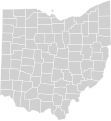
 Blank map subdivisions Ohio.svg 76 × 87; 36 KB
-
 Blank map subdivisions Oklahoma.svg 158 × 82; 34 KB
-
 Blank map subdivisions Oregon.svg 147 × 123; 27 KB
-
 Blank map subdivisions Pennsylvania.svg 106 × 69; 35 KB
-
 Blank map subdivisions Rhode Island.svg 14 × 20; 10 KB
-
 Blank map subdivisions South Carolina.svg 93 × 71; 29 KB
-
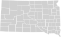
 Blank map subdivisions South Dakota.svg 128 × 85; 28 KB
-
 Blank map subdivisions Tennessee.svg 156 × 54; 49 KB
-
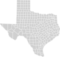
 Blank map subdivisions Texas.svg 255 × 249; 90 KB
-
 Blank map subdivisions Utah.svg 103 × 128; 24 KB
-
 Blank map subdivisions Vermont.svg 31 × 58; 13 KB
-
 Blank map subdivisions Virginia.svg 145 × 80; 95 KB
-
 Blank map subdivisions Washington.svg 122 × 91; 47 KB
-
 Blank map subdivisions West Virginia.svg 82 × 82; 48 KB
-
 Blank map subdivisions Wisconsin.svg 98 × 105; 34 KB
-
 Blank map subdivisions Wyoming.svg 128 × 106; 21 KB
-
 Map of Virginia highlighting no county.svg 748 × 324; 237 KB
-
 Ohio and adjacent States and counties with FIPS and names.svg 151 × 140; 264 KB
-
 US-McD.Terr.(1961).svg 26 × 22; 18 KB
-
 USA Counties with FIPS and names.svg 555 × 352; 750 KB


.svg)
