Category:Bloemgracht 106, Amsterdam
Jump to navigation
Jump to search
| Object location | | View all coordinates using: OpenStreetMap |
|---|
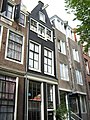
house in Amsterdam, Netherlands  | |||||
| Upload media | |||||
| Instance of | |||||
|---|---|---|---|---|---|
| Location | Amsterdam, North Holland, Netherlands | ||||
| Street address |
| ||||
| Located on street | |||||
| Heritage designation |
| ||||
 | |||||
Huis met gevel onder punttop:
|
This is a category about rijksmonument number 566
|
| Address |
|
Media in category "Bloemgracht 106, Amsterdam"
The following 3 files are in this category, out of 3 total.
-
 Amsterdam - Bloemgracht 106.jpg 2,304 × 3,072; 2.27 MB
-
 Amsterdam Bloemgracht 106 and 108 across.jpg 1,728 × 2,304; 1.17 MB
-
 Exterieur VOORGEVELS, OVERZICHT - Amsterdam - 20298465 - RCE.jpg 962 × 1,200; 293 KB

