Category:Bloemgracht 55, Amsterdam
Jump to navigation
Jump to search
| Object location | | View all coordinates using: OpenStreetMap |
|---|
 | |||||
| Upload media | |||||
| Instance of |
| ||||
|---|---|---|---|---|---|
| Location | Amsterdam, North Holland, Netherlands | ||||
| Street address |
| ||||
| Located on street | |||||
| Heritage designation |
| ||||
 | |||||
|
This is a category about rijksmonument number 521
|
| Address |
|
Media in category "Bloemgracht 55, Amsterdam"
The following 4 files are in this category, out of 4 total.
-
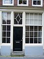 Amsterdam Bloemgracht 55 door.jpg 1,728 × 2,304; 672 KB
-
 Amsterdam Bloemgracht 55 top.jpg 1,728 × 2,304; 1.01 MB
-
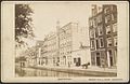 Gevelwand aan gracht - Amsterdam - 20329000 - RCE.jpg 1,200 × 777; 172 KB
-
 Voorgevel - Amsterdam - 20016086 - RCE.jpg 817 × 1,200; 238 KB


